| Previous :: Next Topic |
| Author |
Message |
GeoTom
Member


Joined: 19 May 2005
Posts: 3215 | TRs | Pics
Location: Earth |
|
GeoTom
Member
|
 Mon Mar 03, 2008 2:48 pm |
|
|
| wolfs wrote: | | Is this the little spot immediately past the concrete trestle where the RR crosses US2? I saw a little spur road there that looked plowed wide enough to park on last time thru. |
That would likely be the other space I referred to in a previous post. It was maybe another half mile or so west of where we eventually parked. Coming from Stevens Pass, it is on your right.
|
| Back to top |
  
|
|
Sabahsboy
Member

Joined: 18 Jul 2006
Posts: 2484 | TRs | Pics
Location: SW Sno County |
|
Sabahsboy
Member
|
Mon Mar 03, 2008 6:57 pm Arrowhead summit
|
|
|
I am "blown away!" All the photos are terrific! The block of Big Chiwaukum is impressive. I like this angle view of the Chiwaukums...they look like true, rugged mountains. View of Bulls Tooth is most interesting as well.
You fellows have great endurance and achieve summits with ease...or so it appears! Jasper must get so "R and R" for a spell, though! He is "mighty dog"!
What? No avys?! Thank goodness.
|
| Back to top |
|
|
rush
Member

Joined: 03 Mar 2008
Posts: 7 | TRs | Pics
|
|
rush
Member
|
Mon Mar 03, 2008 11:19 pm |
|
|
I was one of the skiers coming from the West.. Not the best snow conditions I've had for skiing Arrowhead, but it wasn't bad after a couple hundred feet off the summit.
To Dicey's question on Jim Hill, GeoTom wrote "We did see a couple ski tracks descending from a ridge lower down on Jim Hill. Not sure if anyone actually got any good pictures of them though." I think those tracks where on the 5909' subpeak between Arrowhead and Jim Hill. After descending the west side of Arrowhead we skinned up the north ridge of that subpeak toward those same tracks and did a run down. Fun exploring, but no better snow than the Arrowhead side.
Dicey - parking for Jim Hill isn't the best right now. You can park at the Stevens Pass Nordic center and go in via Lanham Lake or walk the highway for 0.37 miles and go in via Henry Creek. We parked just east of where the rr tracks bridge crosses hwy 2 - it would be 0.7 miles back to Henry Creek from there. I don't think there are any options in between.
|
| Back to top |
|
|
cartman
Member
Joined: 20 Feb 2007
Posts: 2800 | TRs | Pics
Location: Fremont |
|
cartman
Member
|
Tue Mar 04, 2008 4:16 pm |
|
|
| rush wrote: | | Dicey - parking for Jim Hill isn't the best right now. You can park at the Stevens Pass Nordic center and go in via Lanham Lake |
This is what we did when we attempted it a few years ago. Trail all the way to Lanham Lake.
|
| Back to top |
|
|
nuclear_eggset
Member

Joined: 02 Jul 2006
Posts: 2206 | TRs | Pics
Location: Eastside |
|
| Back to top |
|
|
Justus S.
Member
Joined: 17 Nov 2004
Posts: 1298 | TRs | Pics
Location: WA |
Had a great trip guys. Thanks for organizing W. Nice to meet you GeoTom and Jasper.
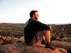
Some pics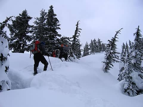 Up and up with a camera 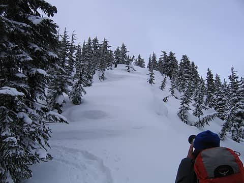 Picture times 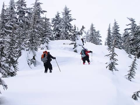 Trudging upwards  Steve heading up 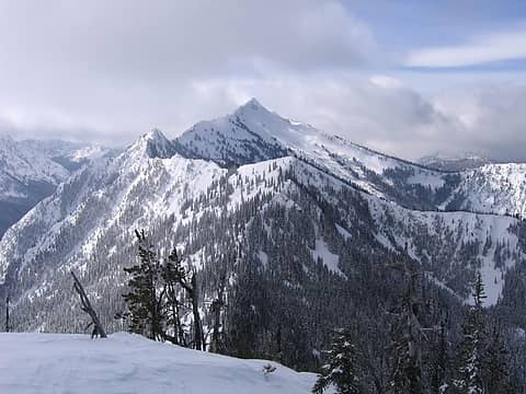 Hill 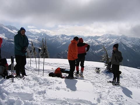 Group on Top 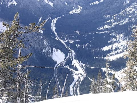 Highway 2  Hmmm....What should I take a picture of next? 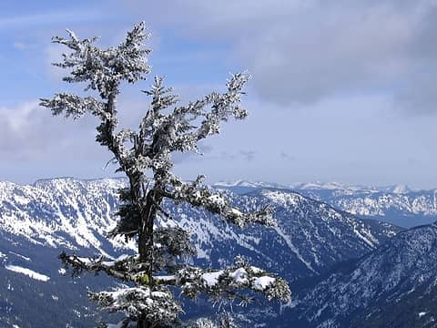 Tree 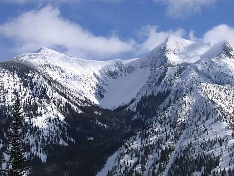 North Chiwaukum 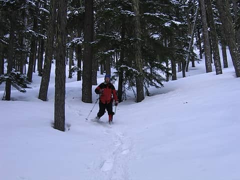 Matt descending in the forest
|
| Back to top |
|
|
Sabahsboy
Member
Joined: 18 Jul 2006
Posts: 2484 | TRs | Pics
Location: SW Sno County |
Justus S., some very nice photos. Love the close up of North Chewaukum! Among my earliest backpack ventures were the Chewaukums in mid-1970's. Ascent and afternoon snooze on Big Chewaukum...the silence and freshness of the air is instilled in my memory.
For all that went to Arrowhead....a great bunch of photos and the views...super "wow!"
|
| Back to top |
|
|
Gabigabs
Trail Breaker

Joined: 07 Nov 2007
Posts: 841 | TRs | Pics
Location: Seattle |
|
Gabigabs
Trail Breaker
|
Wed Mar 05, 2008 5:32 pm |
|
|
Gret report and awesome pictures. Thanks for sharing.
Life is simple... Eat, Sleep, Hike!
Life is simple... Eat, Sleep, Hike!
|
| Back to top |
|
|
wildernessed
viewbagger

Joined: 31 Oct 2004
Posts: 9275 | TRs | Pics
Location: Wenatchee |
| Justus S. wrote: | Had a great trip guys. Thanks for organizing W. Nice to meet you GeoTom and Jasper.
Some picsUp and up with a camera Picture times Trudging upwards Steve heading up Hill Group on Top Highway 2 Hmmm....What should I take a picture of next? Tree North Chiwaukum Matt descending in the forest |
 Again soon ! Again soon !
Living in the Anthropocene
Living in the Anthropocene
|
| Back to top |
|
|
wildernessed
viewbagger
Joined: 31 Oct 2004
Posts: 9275 | TRs | Pics
Location: Wenatchee |

Living in the Anthropocene
Living in the Anthropocene
|
| Back to top |
|
|
Matt
Tea, Earl Grey, Hot

Joined: 30 Jan 2007
Posts: 4308 | TRs | Pics
Location: Shoreline |
|
Matt
Tea, Earl Grey, Hot
|
Sun Mar 09, 2008 1:56 am |
|
|
Here are a couple stitched photos from the summit.
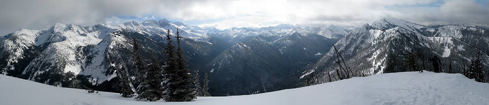 180 degree pano looking south from Arrowhead 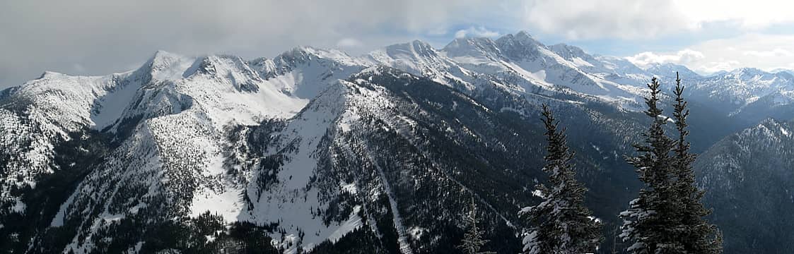 Chiwaukum
As beacons mountains burned at evening. J.R.R. Tolkien
As beacons mountains burned at evening. J.R.R. Tolkien
|
| Back to top |
|
|
Mark Griffith
(Embrace yourself)
Joined: 14 Mar 2005
Posts: 853 | TRs | Pics
Location: Issaquah |
Looks like a fantastic day to be out, great photos.
|
| Back to top |
|
|
wildernessed
viewbagger
Joined: 31 Oct 2004
Posts: 9275 | TRs | Pics
Location: Wenatchee |
Awesome Matt !
Living in the Anthropocene
Living in the Anthropocene
|
| Back to top |
|
|
|
|


