| Previous :: Next Topic |
| Author |
Message |
Mark Griffith
(Embrace yourself)

Joined: 14 Mar 2005
Posts: 853 | TRs | Pics
Location: Issaquah |
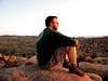
| Opus wrote: |  Summit |
Nice shot of the summit approach!
mbg
|
| Back to top |
  
|
|
wamtngal
Member

Joined: 13 Jun 2004
Posts: 2382 | TRs | Pics
Location: somewhere |
|
wamtngal
Member
|
 Mon Mar 24, 2008 8:25 am |
|
|
Nice! Looks like spring in the Teanaways...so different than when we were there in mid-January. Great photos all! 
Opinions expressed here are my own.
Opinions expressed here are my own.
|
| Back to top |
|
|
Middle E
no more moustache

Joined: 10 Feb 2008
Posts: 432 | TRs | Pics
Location: Seattle, WA |
|
Middle E
no more moustache
|
Mon Mar 24, 2008 8:35 am |
|
|
| Opus wrote: | Great trip! I was really dragging on this one though. Must have been all that Easter bunny chasing.
 GPS tracks |
...which explains all of the zigs and zags in our return route, to those who were wondering. The Easter Bunny is well-known for it's cunning and elusiveness, and cannot be found by walking in a straight line!
pithy yet insightful signature
pithy yet insightful signature
|
| Back to top |
|
|
Sadie's Driver
Sadie's Driver

Joined: 24 Apr 2006
Posts: 1763 | TRs | Pics
Location: Welcome Pass |
Four-paw buddy lets me tag along!
|
| Back to top |
|
|
don b
Member

Joined: 22 Feb 2006
Posts: 369 | TRs | Pics
|
|
don b
Member
|
Mon Mar 24, 2008 9:29 am |
|
|
A group of us were skiing on Earl yesterday and I can assure you it wasn't spring!
|
| Back to top |
|
|
dicey
custom title

Joined: 11 May 2004
Posts: 2870 | TRs | Pics
Location: giving cornices a wider berth |
|
dicey
custom title
|
Tue Mar 25, 2008 1:03 am |
|
|
| Sadie's Driver wrote: | | seawallrunner wrote: | | wonderful photos you guys! what a crowd, and what a great place to be!
about the sun halo - there was one in vancouver too - and I've seen them every year at this time of year.
Are halos at all related to the equinox or is this late March sighting just a coincidence (spring clouds, uncertain weather, northwest being the northwest) and these occur at other times of the year? Seem more pronounced in March for some reason. |
SWR - here is what I found about a Sun (or moon) halo:
This fairly common sight occurs when high thin clouds containing millions of tiny ice crystals cover much of the sky. Each ice crystal acts like a miniature lens. Because most of the crystals have a similar elongated hexagonal shape, light entering one crystal face and exiting through the opposing face refracts 22 degrees, which corresponds to the radius of the Sun Halo. A similar Moon Halo may be visible during the night.
There doesn't seem to be a direct correlation to the equinox - but the reports I saw either were at or around the Vernal or Winter equinox. Others might have more scientific explanations. s.d. |
I call it a sundog.
It means the weather is going to crap out on you in 24 hours. I saw the same sundog on saturday. Sunday was a crapfest blizzard. 
|
| Back to top |
|
|
Sadie's Driver
Sadie's Driver
Joined: 24 Apr 2006
Posts: 1763 | TRs | Pics
Location: Welcome Pass |
Four-paw buddy lets me tag along!
|
| Back to top |
|
|
JimK
Member

Joined: 07 Feb 2002
Posts: 5606 | TRs | Pics
Location: Ballard |
|
JimK
Member
|
Tue Mar 25, 2008 1:41 pm |
|
|
It's time for my take on the trip:
In just over 20 years of hiking throughout the Teanaway River Valleys I have made it to the top of just about every named peak and most unnamed ones. One that I had never visited was Teanaway Butte. In the summer it's a road walk and a short one at that. In the winter it's a good ski trip via the Middle Fork Teanaway Road. Until the last half dozen years or so the North Fork Road was only plowed as as far as Lick Creek. That left a long snowmobile used road to the top. Now that the NF Road is plowed to 29 Pines it is a very reasonable snowshoe or ski trip. Matt did an interesting trip last year up Teanaway Butte and along the ridge to Tarzan Butte before dropping back down to 29 Pines. I was interested in giving it a try.
The last two weeks we had been following trips Matt had trip reported to lookouts or lookout sites. First was Red Top then Evergreen and now Teanaway Butte. After this trip we'll have to go back to planning our own trips. It was just going to be Suzanne, Barry, and I on this trip. The night before, Joe expressed interest then David and lastly Bob and Kolleen felt Silver Peak had too much avalanche danger and they asked about our trip. Three morphed into seven of us.
We all met at the end of plowing on the NF Teanaway Road at 29 Pines campgrounds at 8:45 AM. It was a brisk 25 degrees as we got ready to begin. The blue sky promised great views and warmer weather coming. We immediately went left on the Jungle Creek Road and crossed the Teanaway River. Almost immediately we came to another junction. Left on the Rye Creek Road were many snowmobile tracks. Right on the Jungle Creek Road there were none. This road is a skier and snowshoer only road. The road was not icy but the snow was firm. We kept our snowshoes on our backs. In fact, all the way around our loop we did not use our snowshoes.
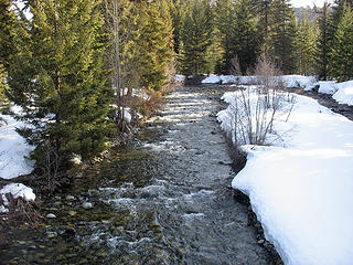 NF Teanaway River 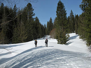 Jungle Creek Road 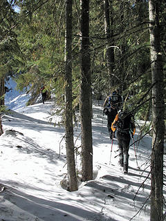 Off Road 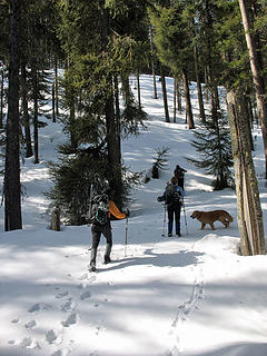 Starting Up 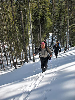 Steeper 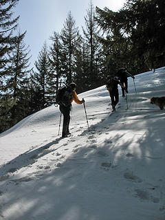 More Up 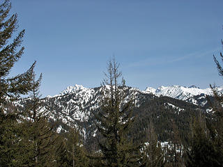 First View Of Stuart 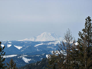 Mt. Rainier 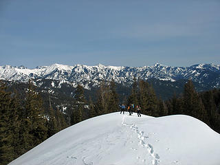 Summit Ridge 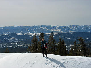 Barry 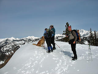 Group On Summit 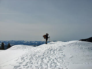 David 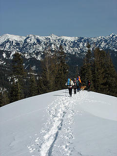 Heading Down 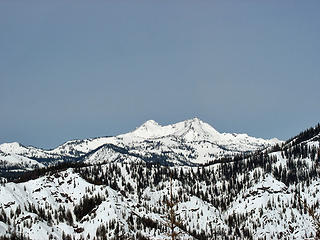 Hawkins Mountain  Old Snag 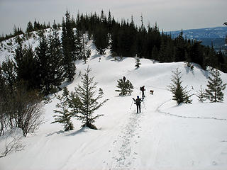 On A Road 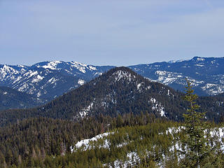 Tarzan Butte 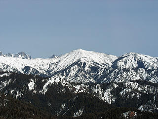 Earl Peak 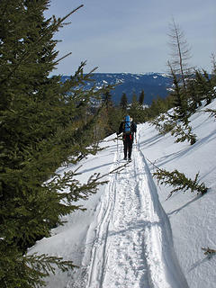 Snowmobile Track 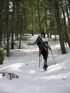 Heading Up Tarzan 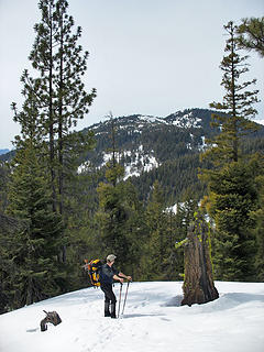 Teanaway Butte 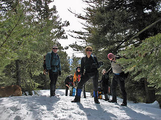 Tarzan Summit 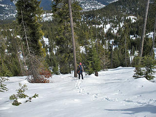 Tarzan Descent 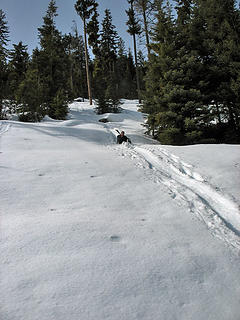 Glissade! 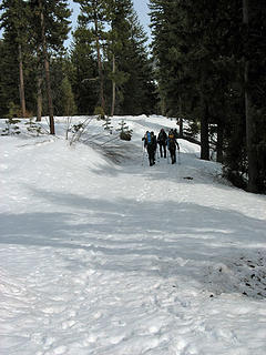 On Old Road
|
| Back to top |
|
|
don b
Member
Joined: 22 Feb 2006
Posts: 369 | TRs | Pics
|
|
don b
Member
|
Tue Mar 25, 2008 4:43 pm |
|
|
Thanks for the report Jim. Now all that is left is for you to put all the peaks on a map so some of us don't have to (get to?) spend 20 years figuring it all out!
|
| Back to top |
|
|
Randy
Cube Rat

Joined: 18 Dec 2001
Posts: 2910 | TRs | Pics
Location: Near the Siamangs |
|
Randy
Cube Rat
|
Tue Mar 25, 2008 4:53 pm |
|
|
Jim - Good to see you on Saturday!
Have you done the two high points along the ridge dividing Bear and Jack Creeks? If not, they are calling you. They are noted on the Backcourt list.
Also, thanks for the picture of Navaho. I've been up there in summer, but have been obsessing over skiing it here in the next few weeks.
|
| Back to top |
|
|
goats gone wild
Mr. Goat

Joined: 19 Aug 2007
Posts: 2524 | TRs | Pics
Location: Vampireville |
| JimK wrote: | | [
In just over 20 years of hiking throughout the Teanaway River Valleys I have made it to the top of just about every named peak and most unnamed ones. |
Jim, is this something you set out to do or did it just evolve over time?
Congratulations on your accomplishment, Jim. May the memories of all the trips stay with you for a long, long time.
.....leaving me wanting to return over and over in what ever capacity that may be, even if one day my knees are too old and I can only see the mountains from my porch.
Jason Hummel
.....leaving me wanting to return over and over in what ever capacity that may be, even if one day my knees are too old and I can only see the mountains from my porch.
Jason Hummel
|
| Back to top |
|
|
goats gone wild
Mr. Goat
Joined: 19 Aug 2007
Posts: 2524 | TRs | Pics
Location: Vampireville |
| Opus wrote: |  Give me your sandwich. |
 Looks like a hold-up. What a bad ass.
.....leaving me wanting to return over and over in what ever capacity that may be, even if one day my knees are too old and I can only see the mountains from my porch.
Jason Hummel
.....leaving me wanting to return over and over in what ever capacity that may be, even if one day my knees are too old and I can only see the mountains from my porch.
Jason Hummel
|
| Back to top |
|
|
JimK
Member
Joined: 07 Feb 2002
Posts: 5606 | TRs | Pics
Location: Ballard |
|
JimK
Member
|
Tue Mar 25, 2008 6:49 pm |
|
|
Randy, unexpected and nice to see you and Mike and Justus at the trailhead. I might be more likely to head over to BearJack if you folks were to post a trip report (hint, hint). Navaho is a great place to ski though I've only been there on foot. If you camp in Stafford Basin you can do a lot of skiing on Earl and Navaho.
ggw, It was not a burning need to hit all the Teanaway peaks as Teanaway Butte has been the last one for about 4 years. I finally got around to it. Still my favorite place to be in the spring. I'll leave the area to the rest of you during the hot days of summer.
Overall it was a fun day with a great group.
|
| Back to top |
|
|
Sadie's Driver
Sadie's Driver
Joined: 24 Apr 2006
Posts: 1763 | TRs | Pics
Location: Welcome Pass |
Four-paw buddy lets me tag along!
|
| Back to top |
|
|
John Morrow
Member

Joined: 03 Apr 2007
Posts: 1526 | TRs | Pics
Location: Roslyn |
| dicey wrote: | | Sadie's Driver wrote: | | seawallrunner wrote: | | wonderful photos you guys! what a crowd, and what a great place to be!
about the sun halo - there was one in vancouver too - and I've seen them every year at this time of year.
Are halos at all related to the equinox or is this late March sighting just a coincidence (spring clouds, uncertain weather, northwest being the northwest) and these occur at other times of the year? Seem more pronounced in March for some reason. |
SWR - here is what I found about a Sun (or moon) halo:
This fairly common sight occurs when high thin clouds containing millions of tiny ice crystals cover much of the sky. Each ice crystal acts like a miniature lens. Because most of the crystals have a similar elongated hexagonal shape, light entering one crystal face and exiting through the opposing face refracts 22 degrees, which corresponds to the radius of the Sun Halo. A similar Moon Halo may be visible during the night.
There doesn't seem to be a direct correlation to the equinox - but the reports I saw either were at or around the Vernal or Winter equinox. Others might have more scientific explanations. s.d. |
I call it a sundog.
It means the weather is going to crap out on you in 24 hours. I saw the same sundog on saturday. Sunday was a crapfest blizzard. :huh: |
We saw the sundog (full 360 circle) too on Kendall Ridge Sat. mid-late morning, as did some other folks up there. Pretty cool!
Tell me, what is it you plan to do with your one wild and precious life?-Mary Oliver
A nation that continues year after year to spend more money on military defense than on programs of social uplift is approaching spiritual doom.
― MLK Jr.
Tell me, what is it you plan to do with your one wild and precious life?-Mary Oliver
A nation that continues year after year to spend more money on military defense than on programs of social uplift is approaching spiritual doom.
― MLK Jr.
|
| Back to top |
|
|
|
|


 Weren't YOU leading this merry band of hikers?

 . You must have been on Earl with the other crazies Sunday! And they call that fun.


 s.d.
s.d.