| Previous :: Next Topic |
| Author |
Message |
mntsun
Wunderer

Joined: 08 Jul 2007
Posts: 206 | TRs | Pics
Location: Squaresville |
|
mntsun
Wunderer
|
 Mon May 05, 2008 10:37 am |
|
|
Having completed OT work and not having to buy a house over the weekend, I was raring for a challenging second conditioner snowshoe this week but didn't have much time to put it together. Puzlrs Green Mnt report sounded good, and if it didnt work out I could visit Mooloch and/or South Bessemer. Being my first time on the CCC all of these options seemed feasible or at least entertaining  I made decent time up the recently used roads (the smell of transmission oil in the morning evoking memories) until I reached my (probably arbitrary) waypoint for leaving the road to gain Green's east flank. Note to self: get better beta than a trip report. I bashed through a very decayed forest (can you bash if nothing is solid?). "duff is easy on the knees" indeed; I was up to my knees in duff and was eventually outflanked by an unending wall of slide alder surrounded by waterfalls. Decision time: was the day to be about navigation or conditioning? Would the cloud cover lift and could one be impaled on sticks if they could not support your weight? I made the executive decision to bail, a decision made easier because I was solo (it would have been easy to talk me up the next 400 to the snow line but I ignored the voices in my head). The descent was as enjoyable as the ascent and it was apparent why this is more enjoyed as a winter climb.
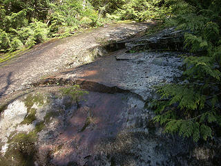 Part of the bushwahck 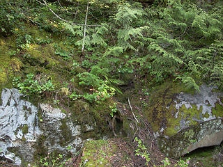 Hmm...probably not "the trail" 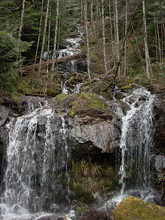 Another waterfall 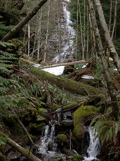 A waterfall 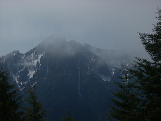 morning clouds on Russain Butte 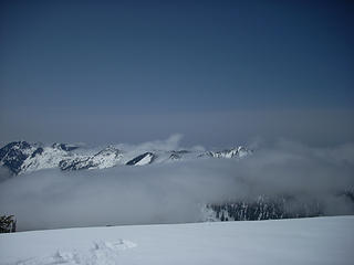 Last of clouds smothering Green before my batteries ran out 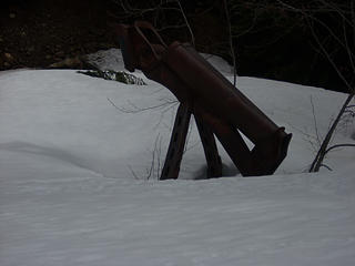 Mining for snow 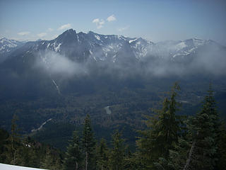 Buttes, clouds, river  . It was sure working for me and the pounds were simply sweated away.
I noticed some recent avalanche activity and then that the CCC started crossing said activity. Two of the four were only sketchy. The third was not fun. The fourth went into space around the final turn and it was time to leave to the CCC and head up through the trees and their even-steeper-and-deeper-but-not-off-a-cliff snow. The false summits and slushy snow walls inspired some creative curses, but their flat reaches on top made it a really nice summit in the snow.
As the clouds lifted, my camera batteries died . It was sure working for me and the pounds were simply sweated away.
I noticed some recent avalanche activity and then that the CCC started crossing said activity. Two of the four were only sketchy. The third was not fun. The fourth went into space around the final turn and it was time to leave to the CCC and head up through the trees and their even-steeper-and-deeper-but-not-off-a-cliff snow. The false summits and slushy snow walls inspired some creative curses, but their flat reaches on top made it a really nice summit in the snow.
As the clouds lifted, my camera batteries died  I tried swapping them out with any other electronic device to no avail; this stunk as I had not seen a similar view into the mountains and with the clarity, visibility and cliffs, it was like being in a different section of the Cascades. The ridge up to Mooloch was obvious; I looked and rationalized, but with melty slush conditions and a couple sketchy areas near the top awash in recent avalanches there was only one safe choice. There was also that issue of avalanches to cross on the return (cutting up/down/across trees around them was not preferable). I tried swapping them out with any other electronic device to no avail; this stunk as I had not seen a similar view into the mountains and with the clarity, visibility and cliffs, it was like being in a different section of the Cascades. The ridge up to Mooloch was obvious; I looked and rationalized, but with melty slush conditions and a couple sketchy areas near the top awash in recent avalanches there was only one safe choice. There was also that issue of avalanches to cross on the return (cutting up/down/across trees around them was not preferable).
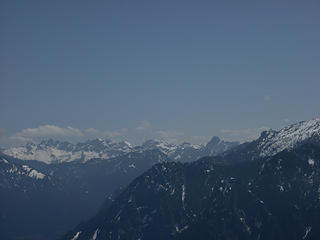 What is that, the Pickets of Alpine Lakes? 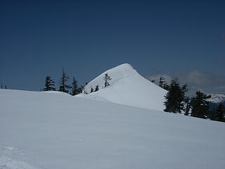 South Bessemer summit area 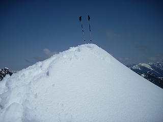 What is this, Eldorado? 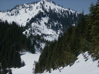 The ridge up Mooloch. Having bright sun and sunglasses, I cut off the critical section at the top
|
| Back to top |
  
|
|
puzzlr
Mid Fork Rocks

Joined: 13 Feb 2007
Posts: 7220 | TRs | Pics
Location: Stuck in the middle |
|
puzzlr
Mid Fork Rocks
|
Mon May 05, 2008 6:20 pm |
|
|
 That's definitely the long way to S Bessemer! Great that you got your excercise and at least a couple pictures. Very entertaining TR, too That's definitely the long way to S Bessemer! Great that you got your excercise and at least a couple pictures. Very entertaining TR, too  , I look forward to more.
It's hard to believe you were on the same ridge we were on Green. Did you see this marker (as well as other nearby pink flagging) along the CCC road when you started up? We had no problems with rocks or alder.
You refer to the CCC road several times, but the maintained one that goes up to the ridge (and beyond) is the Bessemer Road. The CCC road is less developed and mostly level as it traverses low on the valley wall from Teneriffe to the Tayler River CG. , I look forward to more.
It's hard to believe you were on the same ridge we were on Green. Did you see this marker (as well as other nearby pink flagging) along the CCC road when you started up? We had no problems with rocks or alder.
You refer to the CCC road several times, but the maintained one that goes up to the ridge (and beyond) is the Bessemer Road. The CCC road is less developed and mostly level as it traverses low on the valley wall from Teneriffe to the Tayler River CG.
|
| Back to top |
|
|
mntsun
Wunderer
Joined: 08 Jul 2007
Posts: 206 | TRs | Pics
Location: Squaresville |
|
mntsun
Wunderer
|
Mon May 05, 2008 7:42 pm |
|
|
Yup, I looked at my map (without sunglasses) and noticed it was not the CCC but the Bessemer-Road-Trail  Your picture looks a lot drier and less duffier than my route. I was able to find the turnoff from the Connector Trail, but missed visualizing the pink flag and probably went up the ridge too soon (3.5 on the Bushwhack Scale). Pink flagging not blue, darn!
|
| Back to top |
|
|
puzzlr
Mid Fork Rocks
Joined: 13 Feb 2007
Posts: 7220 | TRs | Pics
Location: Stuck in the middle |
|
puzzlr
Mid Fork Rocks
|
Mon May 05, 2008 8:27 pm |
|
|
We also saw the blue flagging at several spots and concluded that they marked locations that needed water drainage work.
|
| Back to top |
|
|
|
|
You cannot post new topics in this forum
You cannot reply to topics in this forum
You cannot edit your posts in this forum
You cannot delete your posts in this forum
You cannot vote in polls in this forum
|
Disclosure: As an Amazon Associate NWHikers.net earns from qualifying purchases when you use our link(s). |


