| Previous :: Next Topic |
| Author |
Message |
Justus S.
Member


Joined: 17 Nov 2004
Posts: 1298 | TRs | Pics
Location: WA |
May 8, 2008
Guye Peak
My buddy Ryan wanted to get out for a late evening hike. We decided to do Guye Peak after work. We arrived at Snoqualmie Pass around 6:00pm and made our way up toward Commonwealth Basin. Not having been there before we had a more interesting approach than necessary. Once in the basin we picked up an established boot path and continued up valley. We followed the path up and then continued up an established boot path to the saddle between Guye and Snoqualmie. The we managed to do this in boots, but we still had to put forth some effort as the snow is still not completely consolidated. On the way up the high clouds dropped a few snowflakes. There was just a light dusting of new snow. Anyway, we easily booted up to a summit.
Well here it was, another one of those peaks that has multiple high points. Well of course it wasnt obvious which one was higher. Unfortunately, this is not one of those peaks you can just walk over to the other high points either. Well, I would have to see if it would go. It appeared some other eager person had made their way over. I dropped around on the west side of the north summit and carefully traversed around then went up and over a bump. It was a good twenty feet down to the snow below and after some careful class 3+ downclimbing I was down. It was then a quick boot up to the middle peak. On top I was still a bit uncertain as to the highest point. Well, I would try and continue on to the south point. I dropping down then up another little bump. This peak is bumpy. I dropped off the bump by carefully scooting down some steep snow (glad it was below freezing out) and finally kicked steps up to the final, south, high point. Well after all this it still was pretty hard to tell the highest point, but Im going to say that the north one seems to be the highest. All this work perhaps for nothing, oh well. It was getting pretty late by now, so I scurried back. We got pretty much to the basin before really needing our lights. On the way back we took the easy way by staying on the west side of the creek and dropping down the little ski area (there was a bootpath). All in all it was a nice evening trip.
Notes: trip time 4hrs. Used boots for the entire trip but there was still some postholing to be had. Friday is looking nice go out and have some fun.
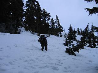 working up 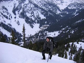 Ryan and ski area 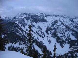 Ski area, Denny Mtn 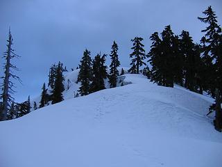 ridge up to guye 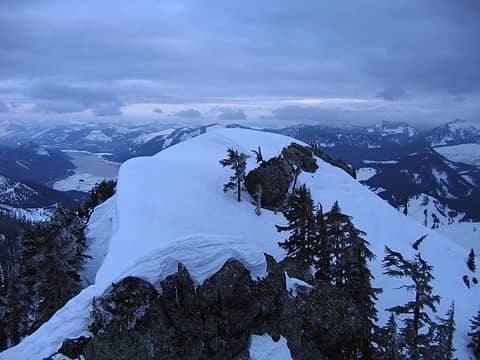 on middle point looking at south point 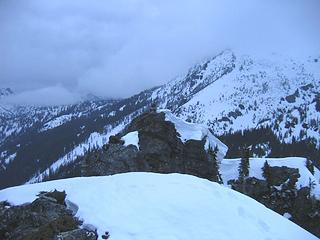 Ryan(on North point) from middle point 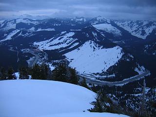 pass area from south point 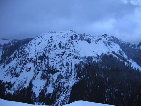 Kendall 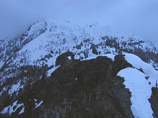 R on the North summit from south point
|
| Back to top |
  
|
|
wildernessed
viewbagger

Joined: 31 Oct 2004
Posts: 9275 | TRs | Pics
Location: Wenatchee |
Nice Justus. I can't wait for more consolidation and more than a small weather window.
Living in the Anthropocene
Living in the Anthropocene
|
| Back to top |
|
|
puzzlr
Mid Fork Rocks

Joined: 13 Feb 2007
Posts: 7220 | TRs | Pics
Location: Stuck in the middle |
|
puzzlr
Mid Fork Rocks
|
 Fri May 09, 2008 10:18 pm |
|
|
Nice climb. It's hard to get between those peaks even in summer. I don't remember which is supposed to be the highest either. I've also found that the snow is gradually settling enough to support boots in most places now.
|
| Back to top |
|
|
Malachai Constant
Member

Joined: 13 Jan 2002
Posts: 16092 | TRs | Pics
Location: Back Again Like A Bad Penny |
According to Beckey South Peak is highest.
"You do not laugh when you look at the mountains, or when you look at the sea." Lafcadio Hearn
"You do not laugh when you look at the mountains, or when you look at the sea." Lafcadio Hearn
|
| Back to top |
|
|
cartman
Member
Joined: 20 Feb 2007
Posts: 2800 | TRs | Pics
Location: Fremont |
|
cartman
Member
|
Mon May 12, 2008 5:16 pm |
|
|
After you phoned from the north summit, I remembered hearing somewhere that the S Peak was the highest, but can't confirm that.
|
| Back to top |
|
|
Justus S.
Member
Joined: 17 Nov 2004
Posts: 1298 | TRs | Pics
Location: WA |
Well, seems the consensus is the south peak is higher then. One thing to point out is if you take a look at the picture taken from the middle peak looking south you can clearly see Roaring Ridge, across the hwy, over the top of the south peak. Since Roaring ridge is only 4988 it would seem based on the line of sight that the south peak is lower. Anyway, guess it doesn't much matter.
|
| Back to top |
|
|
|
|


