| Previous :: Next Topic |
| Author |
Message |
yew
non-technical

Joined: 12 Dec 2005
Posts: 1173 | TRs | Pics
Location: Bellingham |
|
yew
non-technical
|
 Tue May 20, 2008 9:28 pm |
|
|
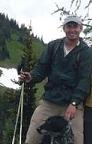
Yesterday, I parked at the end/top of the Cleator Rd in the Chuckanuts and hiked down the steep trail to the service road that runs near Fragrance Lake then over to near Lost Lake. The trail down from Cleator Road is pretty steep and sees a lot of use by mountain bikers on burly, full suspension downhill bikes judging by the trail's condition. It was breezy, cloudy with a few sprinkles up high. There are views through the forest of the lush, green, forested hills and the Bay; beautiful! There's a rockwall here that you can bushwhack over to for better views west over the water. But, be careful. Rocks and vegetation can be wet and slick. If you slip and fall, you're dead meat. And the process could be slow!
Once I hit the service road, I turned left/south on a rolling trail on the west side of the hill that ties into the Lost Lake Trail. Since this area was blocked from wind, flies and gnats were out en masse. A long winter has weakened my tolerance of harrassing insects. They dive bombed and buzzed my ears, eyes and nose. It was a big mistake not not bring bug dope.
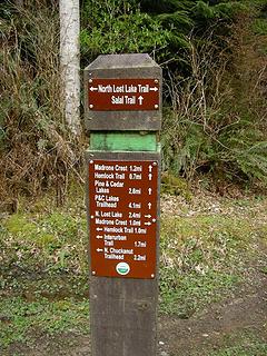
I stayed straight at the junction with the Lost Lake Trail figuring the trail would loop back to the east side of the lake like the route I took last year. At the junction, Lost Lake is to the left. There were dirtbike tracks on this trail and the trail to Lost Lake within Larrabee State Park. The trail leaves the state park, descends steeply in spots, passes near a nice swamp, a cool sandstone wall,
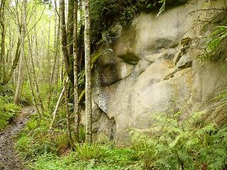 Chuckanut sandstone near Lost Lake, Washington 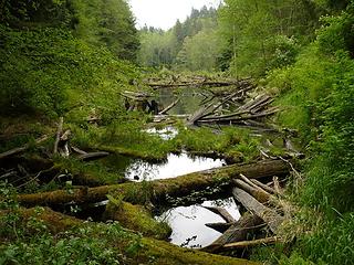 old lake in the Chuckanuts near Lost Lake 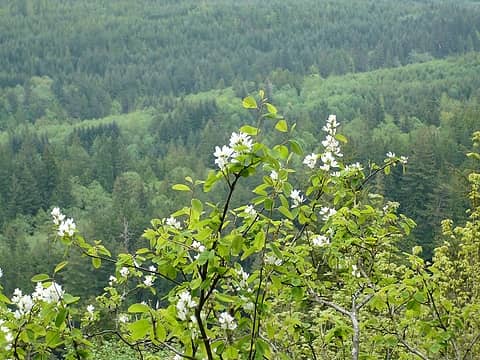 near rock outcrop near Cleator Rd, Chuckanut Mtns, Washington 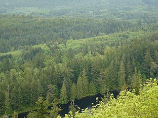 Lost Lake (?) from trail off Cleator Rd, Chuckanut Mtns, Washington 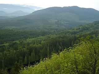 Lost Lake and Blanchard Mtn from a trail off Cleator Rd in the Chuckanut Mtns, Washington
"I aint jokin woman, I got to ramble...We gonna go walkin through the park every day." - Led Zeppelin
"I aint jokin woman, I got to ramble...We gonna go walkin through the park every day." - Led Zeppelin
|
| Back to top |
  
|
|
aywolfpac
Member

Joined: 27 Jan 2008
Posts: 1286 | TRs | Pics
Location: Burlington, WA |
I basically took those same two pictures on my trip in.  If I understand correctly you took the straight trail where the sign pointing to Lost Lake or Fragrance Lake Road, yes? If I understand correctly you took the straight trail where the sign pointing to Lost Lake or Fragrance Lake Road, yes?
 Left or right? Actually I went straight ahead on my way to Oyster Creek Falls. You can see how cloudy the day was though. Yuck!
|
| Back to top |
|
|
captain jack
Serving suggestion

Joined: 25 May 2004
Posts: 3389 | TRs | Pics
Location: Upper Fidalgo |
That trail from Cleator Ridge to Fragrance Lake is the only trail in the whole Chuckanut / Blanchard complex I dont like. Its rutted from all the bikes, and steep, and you never know when you might get run over.  Oh well, the cyclists need somewhere to play up there.
| Quote: | | The trail continues on but I don't know where it goes. |
The trail starting from the last hairpin turn before the summit parking area is called the Chuckanut Ridge trail, and its a wonderful walk. It follows the spine of the ridge, with views east to Lost Lake, and also has views of Baker from some of the rock outcroppings along the way. About 2 miles from the top end , you will find a junction on your left. This takes you back to Cleator road, ending just below the gate, and junction with the Fragrance Lake connector. You can follow the road back up to the top of the ridge from here to make a loop.
Following the trail 4 miles down to its end puts you here.
 choices choices
|
| Back to top |
|
|
yew
non-technical
Joined: 12 Dec 2005
Posts: 1173 | TRs | Pics
Location: Bellingham |
|
yew
non-technical
|
Fri May 23, 2008 2:27 am |
|
|
| aywolfpac wrote: | | If I understand correctly you took the straight trail where the sign pointing to Lost Lake or Fragrance Lake Road, yes? |
Yes, I stayed straight at the sign and hiked down to the road you mentioned. I walked down that logging road a little way but didn't want to go too far not knowing where it went. Thanks for the directions.
| Captain Jack wrote: | | The trail starting from the last hairpin turn... |
Thanks for the directions too. I walked about 1/3 mile down that Chuckanut Ridge trail. Nice views from the rock outcrop (pics above) Can't wait to get back up there and hike the loop you mention!
"I aint jokin woman, I got to ramble...We gonna go walkin through the park every day." - Led Zeppelin
"I aint jokin woman, I got to ramble...We gonna go walkin through the park every day." - Led Zeppelin
|
| Back to top |
|
|
|
|
You cannot post new topics in this forum
You cannot reply to topics in this forum
You cannot edit your posts in this forum
You cannot delete your posts in this forum
You cannot vote in polls in this forum
|
Disclosure: As an Amazon Associate NWHikers.net earns from qualifying purchases when you use our link(s). |


