| Previous :: Next Topic |
| Author |
Message |
Ancient Ambler
Member


Joined: 15 May 2007
Posts: 1092 | TRs | Pics
Location: Bainbridge Island |
Inspired by Schmidt Alti-dude and babe, took off from the office and reached the Dungeness TH at 7PM, hoping to beat both the incoming nasty weather and the darkness. No other cars at the TH lot, and the last sign-in on the trail register was a couple days before.
Goal was to check out the collapsed log bridge across the Dungeness a half mile downstream from Camp Handy, scout out an alternative crossing, and get some cardio in before another onslaught of winter shut down the mountains.
At the TH, there's a sign that pretty much promises replacement of the collapsed bridge during 2008:
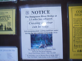 Notice at TH signboard  Thus the scouting for alternatives.
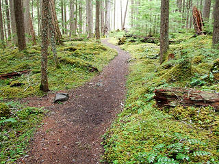
Had hoped the usual Sequim magic would kick in and provide rainshadow blue skies for my evening jaunt, but while there was sunshine near the SR 104/101 junction, the skies were gray by the time I turned off 101 onto Louella, and heavy rain was falling as I picked my way through the potholes on FR 2870. At the TH, though, the rain subsided, and I got a very pleasant walk through the moss-covered terrain between the TH and the bridge across Royal Creek. Thus the scouting for alternatives.
Had hoped the usual Sequim magic would kick in and provide rainshadow blue skies for my evening jaunt, but while there was sunshine near the SR 104/101 junction, the skies were gray by the time I turned off 101 onto Louella, and heavy rain was falling as I picked my way through the potholes on FR 2870. At the TH, though, the rain subsided, and I got a very pleasant walk through the moss-covered terrain between the TH and the bridge across Royal Creek.
 ~3/4 mile from TH 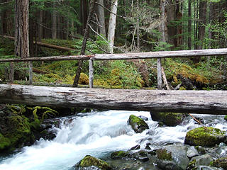 Log bridge across Royal Creek 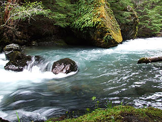 Dungeness at Fern Rock 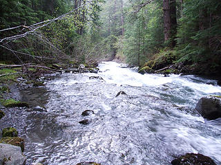 Down river 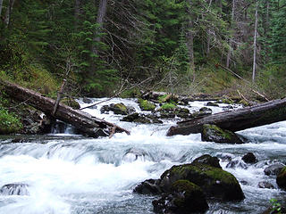 collapsed bridge 1/2 mile below Camp Handy 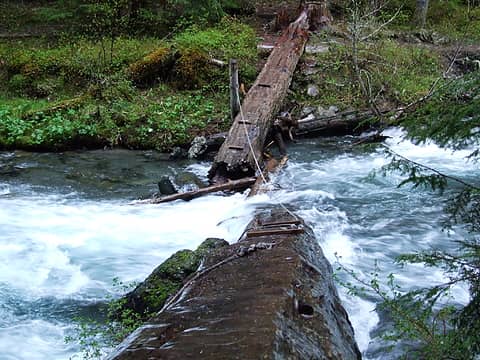 zero bridge deck traction 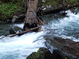 From west bank 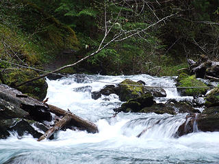 Whitewater over remains of log bridge 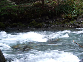 Dungeness near horse crossing 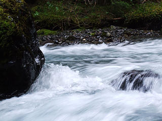 Dungeness just upstream from horse crossing 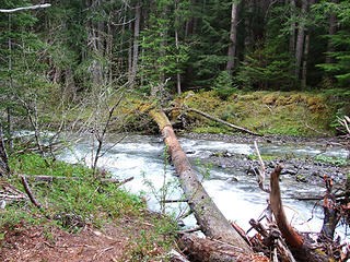 Log across Dungeness ~1/4 downstream of collapsed bridge 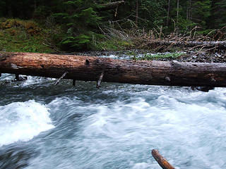 Don't fall here 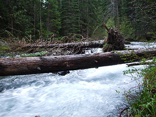 Dicey crossing
|
| Back to top |
  
|
|
sequimjack
Member

Joined: 11 Aug 2007
Posts: 35 | TRs | Pics
Location: Sequim |
Great report . . . looks bad for awhile
|
| Back to top |
|
|
mtngrl
Member

Joined: 22 Mar 2004
Posts: 248 | TRs | Pics
|
|
mtngrl
Member
|
 Fri Jun 06, 2008 8:11 am |
|
|
Bummer! But, thanks for the info and pictures. That log a quarter mile below the bridge looks somewhat hopeful though, at least once the water levels decrease.
|
| Back to top |
|
|
reststep
Member

Joined: 17 Dec 2001
Posts: 4757 | TRs | Pics
|
|
reststep
Member
|
Fri Jun 06, 2008 3:07 pm |
|
|
Thanks for checking that out Ancient Ambler.
I hope to check out your route to Deception Basin sometime.
"The mountains are calling and I must go." - John Muir
"The mountains are calling and I must go." - John Muir
|
| Back to top |
|
|
Schmidt Alti-Dude
4th class poster
Joined: 06 Jul 2007
Posts: 1361 | TRs | Pics
Location: Looking for Adventure 201! |
Great RTD (Race the Darkness) AA.
| Ancient Ambler wrote: | | Had hoped the usual Sequim magic would kick in and provide rainshadow blue skies for my evening jaunt |
We've had many a sunny day in Sequim only to see the plops of rain hit our windshield as we drove up Palo Alto Road to the Don Schmith Valley. I guess the rain shadow doesn't extend that far.
Anything stated by me in no way reflects the attitudes or opinions of my wife
Anything stated by me in no way reflects the attitudes or opinions of my wife
|
| Back to top |
|
|
goats gone wild
Mr. Goat

Joined: 19 Aug 2007
Posts: 2524 | TRs | Pics
Location: Vampireville |
Thanks for the info, AA. Glad you made it out safe albeit late. 
.....leaving me wanting to return over and over in what ever capacity that may be, even if one day my knees are too old and I can only see the mountains from my porch.
Jason Hummel
.....leaving me wanting to return over and over in what ever capacity that may be, even if one day my knees are too old and I can only see the mountains from my porch.
Jason Hummel
|
| Back to top |
|
|
|
|
You cannot post new topics in this forum
You cannot reply to topics in this forum
You cannot edit your posts in this forum
You cannot delete your posts in this forum
You cannot vote in polls in this forum
|
Disclosure: As an Amazon Associate NWHikers.net earns from qualifying purchases when you use our link(s). |


