| Previous :: Next Topic |
| Author |
Message |
Sadie's Driver
Sadie's Driver


Joined: 24 Apr 2006
Posts: 1763 | TRs | Pics
Location: Welcome Pass |
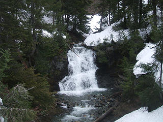
The weather was deteriorating rapidly for today. What to do? I recommended the "east side" of the mountains for probable better weather. I had it in my mind that Esmerelda Peak would be a good destination. Middle E (Barry), Jim K and Opus (David) were in - Trail Pair wasn't convinced! Bryan's trip report earlier this week on his Gallagher Head Lake trip convinced us this would be a good destination. The road beyond 29 Pines was open all the way to the DeRoux campground  . It would be a bittersweet journey. Almost a year ago to the day, Sadie made her last backpacking trip to Gallagher Head Lake with a jaunt up Hawkins for a fun glissade - but we wouldn't reach the summit of Esmerelda on that trip. Today, we got a reasonable start at about 7:15 a.m. from the 65th Park and Pool - weather was ugly in Seattle. We even passed Two Dog Dad going across Snoqualmie Pass - . It would be a bittersweet journey. Almost a year ago to the day, Sadie made her last backpacking trip to Gallagher Head Lake with a jaunt up Hawkins for a fun glissade - but we wouldn't reach the summit of Esmerelda on that trip. Today, we got a reasonable start at about 7:15 a.m. from the 65th Park and Pool - weather was ugly in Seattle. We even passed Two Dog Dad going across Snoqualmie Pass -      Don't know where he ended up - we fully expected to see his Element at the Red Mountain Trailhead! Don't know where he ended up - we fully expected to see his Element at the Red Mountain Trailhead!  (inside joke - he missed joining us on that trip a few months ago!) (inside joke - he missed joining us on that trip a few months ago!)  In any case, we are ready for the day . . In any case, we are ready for the day . .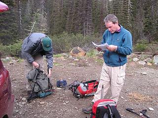 We're heading to Navajo, right? 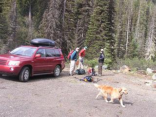 Let's go already . . . (note, new cargo carrier on top! Yay!) 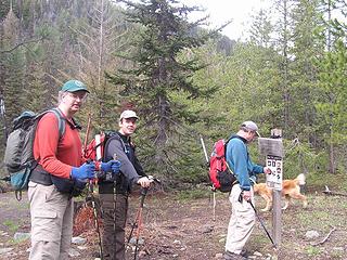 The crew @ 9:30 a.m. start 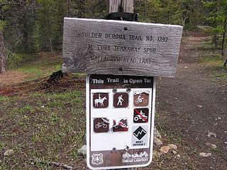 . . . and in the beginning . . . our route today 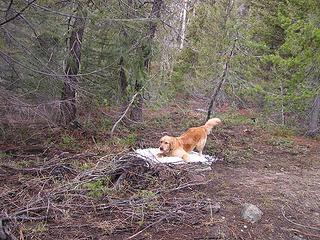 Someone can't wait for the snow! 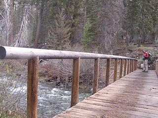 Crossing Teanaway River - not that raging 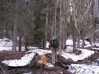 Jim and Gusto crossing DeRoux Creek 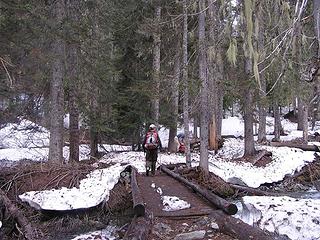 David crossing DeRoux Creek 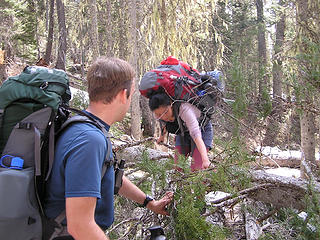 David and Yumi crossing DeRoux Creek in 2007 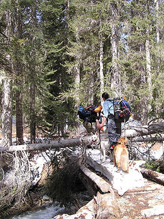 Crossing DeRoux Creek in May 2007 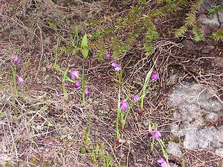 Looks like Blue-eyed Grass 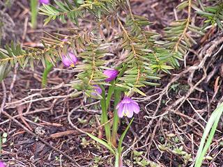 Close up 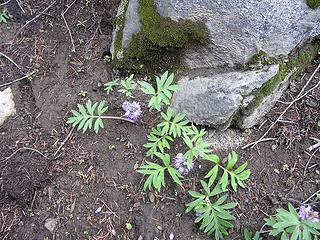 Ballhead Waterleaf 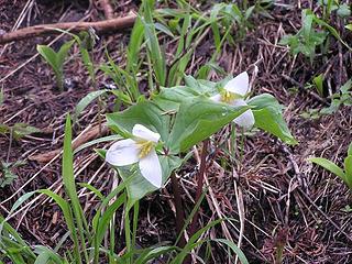 Trillium 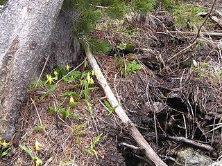 Glacier Lilies 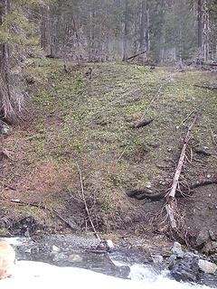 Hillside of Glacier Lilies 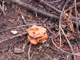 Fungus among us! 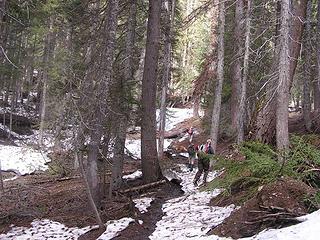 Intermittent snow on the lower elevations  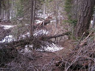 Bryan - you forgot to move this for us! 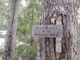 Our route today - for a while 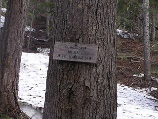 Junction of route to Koppen and Gallagher Head Lake 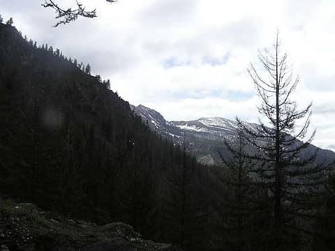 View of Iron Peak early in the day 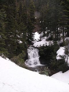 Waterfall on DeRoux Creek below creek crossing 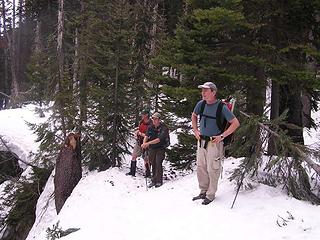 Professionals sizing up the waterfall   It isn't a long distance - maybe 100' - but be wary. It isn't a long distance - maybe 100' - but be wary.  (Bryan - we didn't see your tracks here!) We managed to negotiate this section well (hopefully, the others have some photos - I was holding onto my ice ax too tightly!) We got down to the creek and it was a relatively easy crossing - the creek wasn't very deep today. (Bryan - we didn't see your tracks here!) We managed to negotiate this section well (hopefully, the others have some photos - I was holding onto my ice ax too tightly!) We got down to the creek and it was a relatively easy crossing - the creek wasn't very deep today.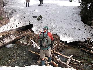 Jim crossing DeRoux Creek 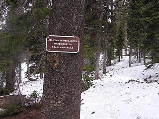 Thank goodness - vehicles are limited to designated roads and trails!  We cut off from the Gallagher Head Lake route and headed almost due north to head towards a couple of benches and then up to the ridge that would take us to the Esmerelda summit. We cut off from the Gallagher Head Lake route and headed almost due north to head towards a couple of benches and then up to the ridge that would take us to the Esmerelda summit.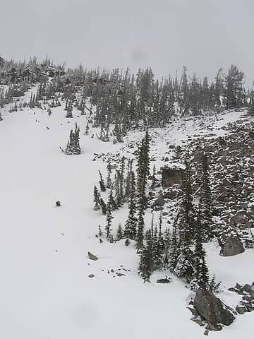 The steep section up to the upper bench 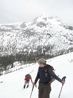 Jim and David up the steep part - with Hawkins East in the background 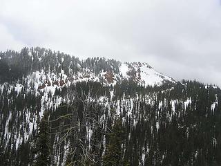 DeRoux from across the creek 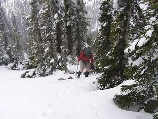 Jim making his way up through the trees 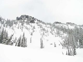 Our destination (on the left) 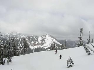 Jim and David heading up towards summit saddle 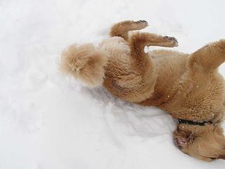 Gus practicing his back glissade! 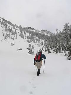 Barry heading towards ridge 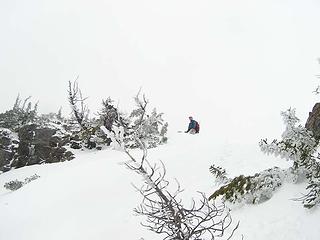 Barry on ridge and heading to Esmerelda-2 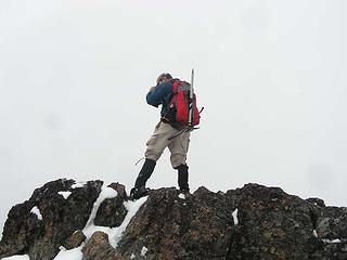 Barry on Esmerelda-2 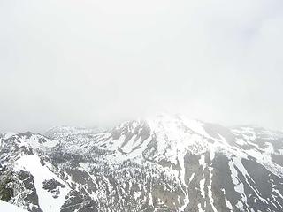 Fortune Peak in the clouds! 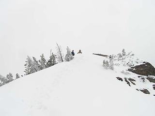 Gus and Barry waiting for Driver to come up to Esmerelda West 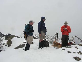 Snowing on the summit - David checking the summit register - How many days until summer? 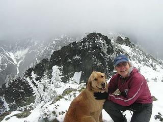 Gus and the Driver on the summit 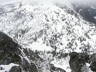 Gallagher Head Lake below 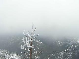 Frost/ice on trees at summit 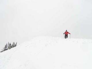 David coming down off of summit 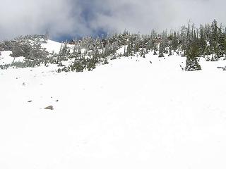 Looking back up to the ridge (can't seek our glissade track) 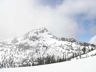 East Hawkins on our way out 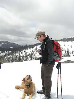 "David, you're my best friend, really!" 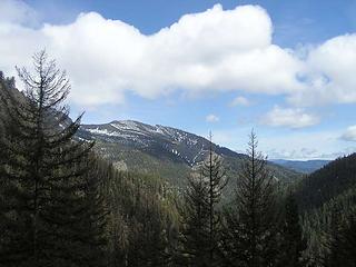 Iron Peak in the afternoon 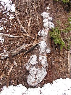 Gnarly 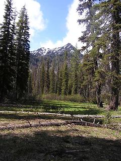 At end of trip - looking north towards E. Esmerelda across lovely meadow of Shooting Stars (note - blue sky!!!) 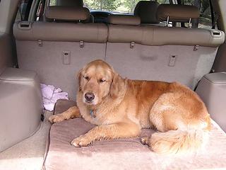 Yawn! 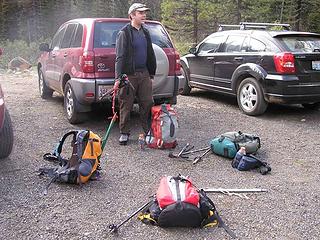 "Hey, you guys! Pick up your stuff!"  It looks like those snowshoes are gone until next "winter"! (probably in about 6 weeks, eh?) It looks like those snowshoes are gone until next "winter"! (probably in about 6 weeks, eh?)   [P.S. on the way to the trailhead, we saw some Elk - within a half-mile of where the pavement turns to dirt. Then, on the way out, we stirred up some vultures who began circling our car All sorts of critters out today!]
Four-paw buddy lets me tag along!
Four-paw buddy lets me tag along!
|
| Back to top |
  
|
|
TrailPair
Member

Joined: 17 Apr 2005
Posts: 1699 | TRs | Pics
|
Did you see us waving at you from our vantage on Davis? I think Joe was going to send smoke signals from the look-out while K, Niko and I went to the summit.
This thing called work is interfering with my play
This thing called work is interfering with my play
|
| Back to top |
|
|
Quark
Niece of Alvy Moore

Joined: 15 May 2003
Posts: 14152 | TRs | Pics
|
|
Quark
Niece of Alvy Moore
|
 Sat Jun 07, 2008 9:54 pm |
|
|
I tell you, that pooch is one lucky pooch. Yes, a luck-ee pooch. Whatalife you're giving him!
"...Other than that, the post was more or less accurate."
Bernardo, NW Hikers' Bureau Chief of Reporting
"...Other than that, the post was more or less accurate."
Bernardo, NW Hikers' Bureau Chief of Reporting
|
| Back to top |
|
|
twodogdad
Member

Joined: 21 Nov 2006
Posts: 846 | TRs | Pics
Location: seattle |
|
twodogdad
Member
|
Sat Jun 07, 2008 9:54 pm esmeralda
|
|
|
|
| Back to top |
|
|
Opus
Wannabe

Joined: 04 Mar 2006
Posts: 3700 | TRs | Pics
Location: The big rock candy mountain |
|
Opus
Wannabe
|
Sat Jun 07, 2008 9:55 pm |
|
|
Great trip! Good to make the summit after our aborted attempt last year. Comparing my GPS tracks between the two trips we started uphill way too far north. We were closer to that east-running ridge, which cliffed out on us and was ridiculously steep. Much better travel this time! Oddly too my TOPO software lists the true summit as the eastern block. Of course we found the register on the western one. At least you and Barry have it covered, tagging both!
Click here for full photo set.
 GPS tracks  It cant melt yet!  Purple flower  Flowers  Final bit 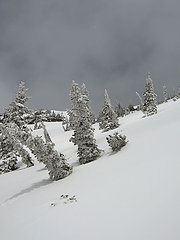 This is June?  Summit  Heading up  Register  Cloudy summit  Heading down  Blue sky  Snow bowling  Helpful Gusto  Steep snow crossing  Glowing glacier Lily  Trilium and lily
|
| Back to top |
|
|
Sadie's Driver
Sadie's Driver
Joined: 24 Apr 2006
Posts: 1763 | TRs | Pics
Location: Welcome Pass |
Four-paw buddy lets me tag along!
|
| Back to top |
|
|
Matt
Tea, Earl Grey, Hot

Joined: 30 Jan 2007
Posts: 4307 | TRs | Pics
Location: Shoreline |
|
Matt
Tea, Earl Grey, Hot
|
Sat Jun 07, 2008 10:21 pm |
|
|
Does Gusto really like so much that he seeks out the first patches of it?
Nice to see a few flowers appearing in the higher country.
I especially liked Opus's photo of the glacier lily and purple flower together. Anyone know what the purple flower is?
As beacons mountains burned at evening. J.R.R. Tolkien
As beacons mountains burned at evening. J.R.R. Tolkien
|
| Back to top |
|
|
GeoTom
Member
Joined: 19 May 2005
Posts: 3215 | TRs | Pics
Location: Earth |
|
GeoTom
Member
|
Sat Jun 07, 2008 10:22 pm |
|
|
| Quote: | | Does Gusto really like so much that he seeks out the first patches of it? |
I can't answer for Gusto, but Jasper does the same thing.
Nice job guys Jasper was at home today while Uncle Scott and I ventured into no-dogs land. He got to go to the beach with his mom though 
|
| Back to top |
|
|
Yet
Member

Joined: 23 Apr 2005
Posts: 2634 | TRs | Pics
Location: Happily Ever After |
|
Yet
Member
|
Sat Jun 07, 2008 10:57 pm |
|
|
Gus is soooo adorable!
SD, I love reading your TRs. So much life in them.
And hurray for tagging the summit for Sadie!
|
| Back to top |
|
|
wildernessed
viewbagger

Joined: 31 Oct 2004
Posts: 9275 | TRs | Pics
Location: Wenatchee |
I think JimK could climb Esmerelda blindfolded !, as well as many others over there. 
Living in the Anthropocene
Living in the Anthropocene
|
| Back to top |
|
|
Sadie's Driver
Sadie's Driver
Joined: 24 Apr 2006
Posts: 1763 | TRs | Pics
Location: Welcome Pass |
Four-paw buddy lets me tag along!
|
| Back to top |
|
|
Middle E
no more moustache

Joined: 10 Feb 2008
Posts: 432 | TRs | Pics
Location: Seattle, WA |
|
Middle E
no more moustache
|
Sun Jun 08, 2008 8:33 am |
|
|
| Opus wrote: | | Oddly too my TOPO software lists the true summit as the eastern block. Of course we found the register on the western one. At least you and Barry have it covered, tagging both! |
Glad to hear Suzanne and I won't have to go back to get the true summit!
No, it didn't seem like June with the thick clouds and plumes of snow blowing off the summit cornices - but the nice sunburn on my face when I got home proved otherwise.
 waterfall on Deroux Cr. 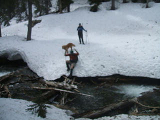 JimK crossing the creek 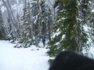 Suzanne coming out of the woods 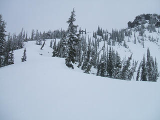 upper ridge to Esmerelda 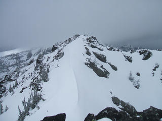 Is that one higher? 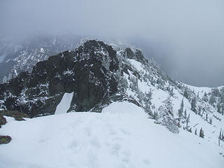 Was that one higher 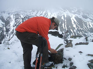 David signed the register 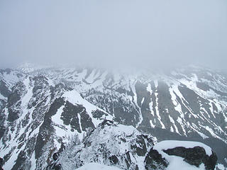 Fortune, somewhere 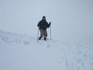 Jim coming down the summit ridge 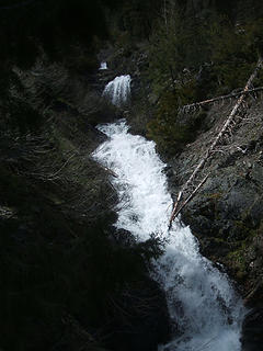 cascade on Deroux creek 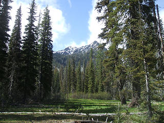 Now it's sunny
pithy yet insightful signature
pithy yet insightful signature
|
| Back to top |
|
|
the Zachster
Member

Joined: 17 Jan 2007
Posts: 4776 | TRs | Pics
Location: dog training |
Another fun and interesting trip report from you guys...thanks! Sweet thoughts of Sadie and some great times with Gusto! 
"May I always be the kind of person my dog thinks I am"
"May I always be the kind of person my dog thinks I am"
|
| Back to top |
|
|
mtnrider
Member
Joined: 29 Jan 2002
Posts: 122 | TRs | Pics
Location: Arlington |
|
mtnrider
Member
|
Sun Jun 08, 2008 4:23 pm Esmeralda
|
|
|
I always enjoy reports of the Teanaway Peaks. It brings back lots of wonderful memories. I have a suggestion for Jim K and all the others that enjoy exploring the Teanaway. Do Esmeralda from the Esmeralda Basin side. It has a whole different flavor. Best to do on snow! I got bored with the usual route and started doing the peak from the north.
Fun.
|
| Back to top |
|
|
Jack's Mom
Member
Joined: 26 Nov 2007
Posts: 178 | TRs | Pics
|
Hey - Great trip report, one of our favorite spots. Be SURE to check Gusto for ticks (and yourselves too)- there was a story in the paper this morning about a young man who picked up a tick in the Teanaway area last weekend. He's fine now, but was temporarily paralized!
|
| Back to top |
|
|
|
|


 2dd
2dd


 s.d.
s.d. 28, right?
s.d.
28, right?
s.d.


