| Previous :: Next Topic |
| Author |
Message |
Joey
verrry senior member


Joined: 05 Jun 2005
Posts: 2797 | TRs | Pics
Location: Redmond |
|
Joey
verrry senior member
|
 Fri Jun 13, 2008 8:48 pm |
|
|
Today I went exploring for a snow-free scramble route up the south end of Kachess Ridge to the old beacon site. To my great surprise I found an existing scramble/game trail that is 95% snow free to the beacon site at 4,615' (TH is at 2,360'). Or maybe it should be game/scramble trail since for every partial boot track I saw there were many more game tracks.
Over the years I have hiked to the former beacon site many times. I know from past experience that after a heavy snow season the trail in the hanging valley along Silver Creek will not melt out until the middle of July and maybe later. Yes, you can sorta follow the trail from blaze to saw cut up that hanging valley to the trail junction where you either turn left to go the beacon site or stay right and cross Silver Creek. Been there done that on snow a bunch. So finding a mostly snow free trail (although fainter and steeper) was a most welcome discovery.
Now for all I know this trail is common knowledge and I simply have missed all the TRs and great pics. But just in case you dont already know about this trail and are still pondering where you will beat yer feet this weekend, here is something new to consider. The route description is below. This trail is easy to find and easy to follow. There is one route issue to watch out for on the way down. Ill work on processing pics and post them a bit later.
Oh BTW, unless there already is a more-or-less established name for this trail, I propose we call it the Kachess Ridge scramble trail. And by all means leave the ice axe and gaiters at home unless you intend to run the ridge north past the beacon site.
Head up the Kachess Ridge trail to 3,350' where there is a sharp switchback to the right. If you do this fairly soon you will encounter a small amount of avalanche snow on the trail a bit lower down. I recommend you hike up the left side of the snow. You will soon get back on the trail. At the 3,350' switchback there is a small pile of sticks across the prominent side trail heading westerly. Take this side trail till it comes to a cliff top at 3,380'. Head up hill. Since there is a wide variety in line-of-travel options for this next section, there is not much in the way of visible tread. Climbing to the right is fine but by the time you get to about 3,700' you want to have worked back to your left so you are once again on top of this same ascending ridge that has a cliff/steep face on the west side.
I have a hard time calling this a scramble. Yes, it is steeper than most trails. But most of the footing is soft ground which makes for technically easy hiking albeit pulse elevating.
Once you are back on the ridge top at around 3,700' continue up. Soon you will see tread. From here on most of the way has visible tread.
At 3,950' this ascending ridge sorta runs into higher ground. This is a terrain junction and you need to take careful note so you recognize this spot on the way down. As you descend you need to turn right here. It would be painfully easy to space out and miss this right turn on the way down and keep following yer nose on a descending traverse with high ground to your left. Doing so is guaranteed to put you somewhere on the sorry side of unhappy. Youve been warned.
Also, at 3,950' as you look uphill you will see two trails heading sorta left. You want the higher one. From here you simply do indeed follow your nose. The trail never strays far from the steep face to your left. In due course you will arrive at the beacon site.
OK- disclaimer - on the last few hundred feet of gain to the beacon site there was some well-consolidated snow. Even if there is no tread here the going would be easy and obvious.
|
| Back to top |
  
|
|
Joey
verrry senior member
Joined: 05 Jun 2005
Posts: 2797 | TRs | Pics
Location: Redmond |
|
Joey
verrry senior member
|
Sat Jun 14, 2008 9:07 am |
|
|
Roll the pics. Here are some flower shots:
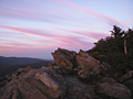
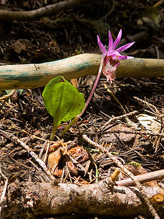 Calypso orchid 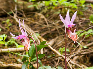 Calypso Orchid 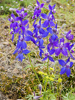 Larkspur 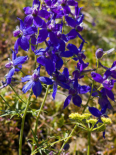 Larkspur 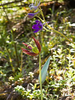 Chocolate Lily and Larkspur 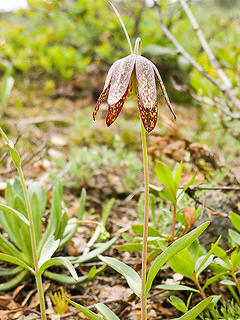 Chocolate Lily 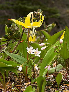 Glacier Lily and Spring Beauty 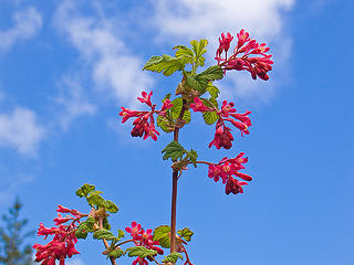 Red Currant 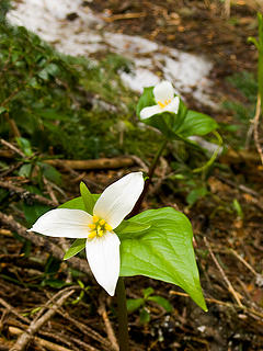 Trillium 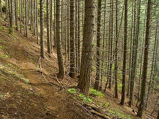 Main Kachess Ridge/Silver Creek trail 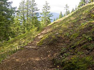 Switchback and trail junction. The scramble trail is heading off into the distance 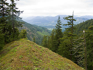 Along the scramble trail ridge 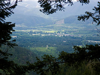 Easton area 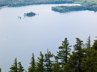 Lake Kachess 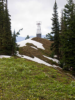 Beacon remains 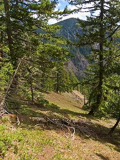 See the trail in the shade? 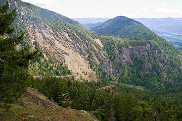 Easton Ridge on the right 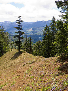 Along the scramble trail ridge 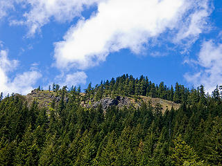 Scramble trail runs along the edge of the forest above the rocks 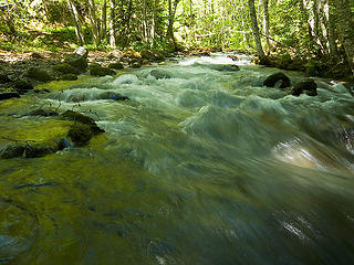 Silver Creek near the trailhead 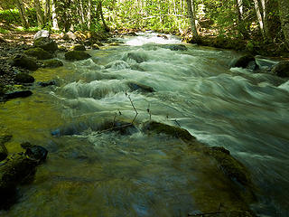 Silver Creek near the trailhead 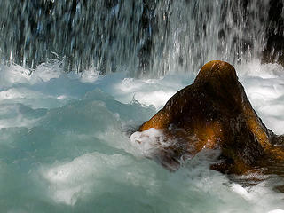 Silver Creek near the trailhead
|
| Back to top |
|
|
kleet
meat tornado

Joined: 06 Feb 2002
Posts: 5303 | TRs | Pics
Location: O no they dih ent |
|
kleet
meat tornado
|
Sat Jun 14, 2008 9:27 am |
|
|
Nice TR and flower shots, Joey. The weather looks immeasurably better there than here (big surprise). 
A fuxk, why do I not give one?
A fuxk, why do I not give one?
|
| Back to top |
|
|
Tom
Admin
Joined: 15 Dec 2001
Posts: 17854 | TRs | Pics
|
|
Tom
Admin
|
Sat Jun 14, 2008 9:33 am |
|
|
| Joey wrote: | Silver Creek near the trailhead |
Great shot!
|
| Back to top |
|
|
Joey
verrry senior member
Joined: 05 Jun 2005
Posts: 2797 | TRs | Pics
Location: Redmond |
|
Joey
verrry senior member
|
Mon Jun 16, 2008 7:19 am |
|
|
Finally had a chance to do the GPS map. This map shows both the real trail to the beacon site and the scramble trail. Round trip was 4.7 miles to the beacon site via the scramble trail. When the snow in the Silver Creek valley melts, one could do a lollipop hike.
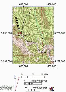 Kachess Ridge. The 'real' trail to the Beacon site is the one to the north. The scramble trail is the one to the south. The map includes a UTM grid based on the NAD27 datum.
|
| Back to top |
|
|
Mark Griffith
(Embrace yourself)

Joined: 14 Mar 2005
Posts: 853 | TRs | Pics
Location: Issaquah |
Man Kachees is full isn't it?
|
| Back to top |
|
|
|
|


