| Previous :: Next Topic |
| Author |
Message |
huron
Member


Joined: 13 Sep 2004
Posts: 1037 | TRs | Pics
|
|
huron
Member
|
 Mon Aug 24, 2009 9:44 pm |
|
|
According to Beckey, the early summit attempts on Mt. Stuart go back to third hand information about a guy who found a stick on the summit inscribed with "Angus McPherson - 1873." The ghost of old Angus has haunted me since reading Beckey's description so I looked for an opportunity to exorcise him once and for all.
Coach's trip report on Stuart in a day showed that a one day hike was quite achievable. Conditions were right, and Seattlehikertoo would join me for good company, so this was a perfect opportunity.
Start time was somewhere around 6am at the Esmeralda trail head where the parking lot was full. We proceeded up and over Ingalls Pass, snapped some photos and headed down to the creek where we found two other hikers with similar plans.
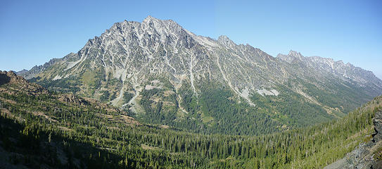 Stuart Range from Ingalls Pass 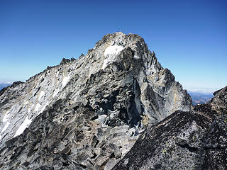 Stuart Summit Route 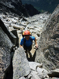 Gaining Stuart Summit 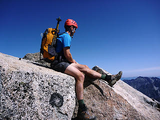 Topped out 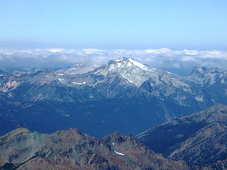 Mt. Daniel from Mt. Stuart Summit 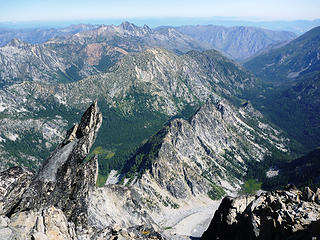 Gargoyle
|
| Back to top |
  
|
|
Magellan
Brutally Handsome

Joined: 26 Jul 2006
Posts: 13116 | TRs | Pics
Location: Inexorable descent |
|
Magellan
Brutally Handsome
|
Mon Aug 24, 2009 9:49 pm |
|
|
Stuart is getting hiked a lot!  Thanks for the beta, including the trailhead melee'. Thanks for the beta, including the trailhead melee'.
|
| Back to top |
|
|
seattlehikertoo
Member

Joined: 26 Jun 2008
Posts: 582 | TRs | Pics
Location: Finding an alternative to Mailbox Pk |
This was an excellent trip. Here's some route details as well as a few remarks on the route and weird tourist encounters.
To clear a few things up from the get-go. First, the idea that the couloir is not that bad is giving out false info. Period. True, the upper portion (above 7600 feet) is a fun scramble, but the lower portion (5400 - 7600 feet), well...Put it this way, if you took a sandy beach, added loose basketball-sized boulders and other scree, then pitched the entire thing on a 45 degree slope, you'd be describing the couloir perfectly. You'll be creating your own dust storm, especially on the way down, and are guaranteed to dislodge a few large rocks as well. We were so tired of yelling "ROCK!" that we wished we had it pre-recorded so that we could just hit a button on our packs whenever we needed.
We began hiking from the crowded parking lot (elev 4240). For those that are navigationally challenged, we went right at the first sign,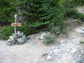 Go to the right 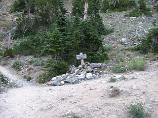 Go to the right 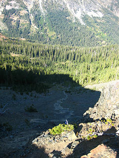 Looking down into the Ingalls Creek Basin from Longs Pass 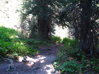 The way to the climbers paths 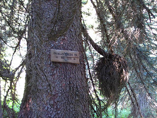 Go right to the climbers paths 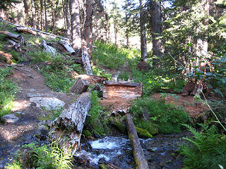 Another 100 feet or 100 yds to the climbers path on the left 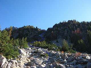 Our route 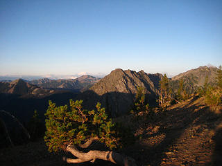 Rainier in the morning light from Longs Pass 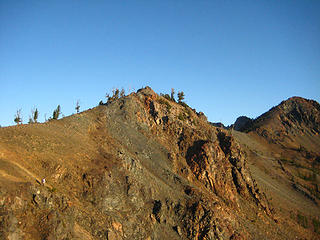 Magnum getting a final look from Longs Pass 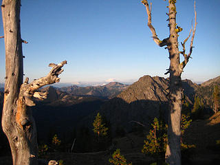 View from Longs Pass 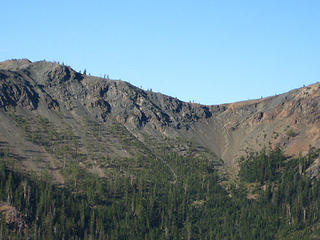 Looking back on the zigzag path up to Longs Pass 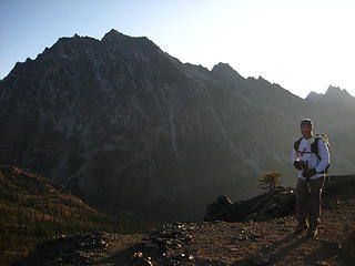 Magnum in front of our destination 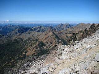 Views SW from near top of couloir 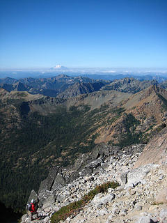 Magnum admiring the views near the top of the couloir 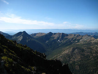 Views from top of couloir 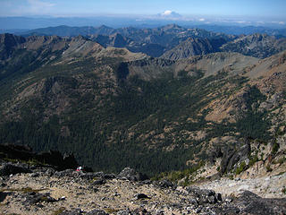 Magnum approaching the top of the couloir 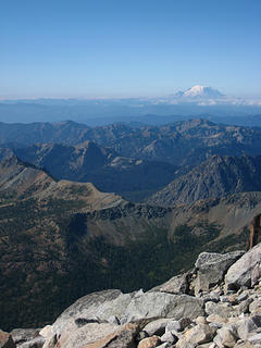 Rainier emerges above the clouds 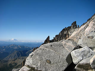 Views near the beginning of the ridge traverse 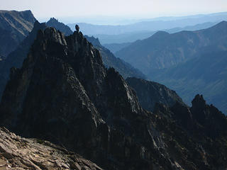 Sherpa Balanced Rock 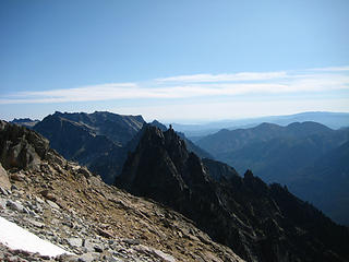 Sherpa Balanced Rock 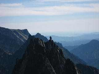 Sherpa Balanced Rock 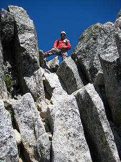 Magnum atop the high class 3 near the summit 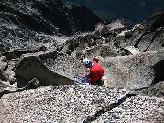 Magnum signs the register 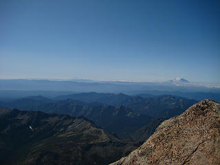 Summit views 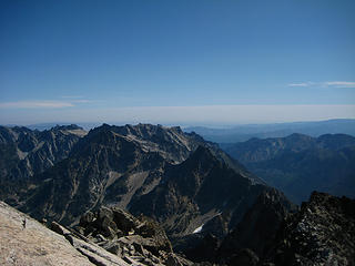 Summit views 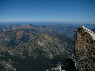 Near summit 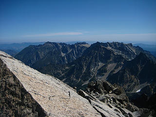 Summit views 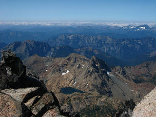 Summit views 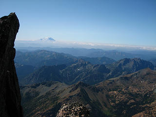 Views from the ridge traverse 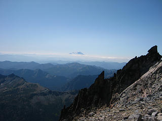 Views from 8500 feet up the couloir 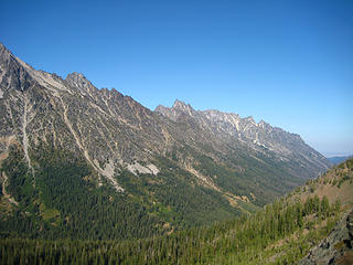 SE flank of Stuart and peaks surrounding the Enchantments 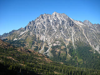 Stuart 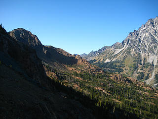 West ridge of Stuart 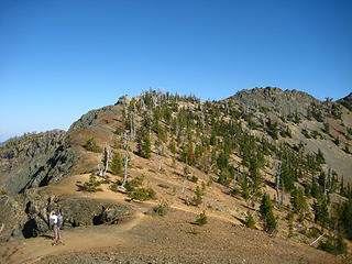 Magnum capturing the scene at Longs Pass
|
| Back to top |
|
|
Stefan-K
Member

Joined: 10 Aug 2009
Posts: 522 | TRs | Pics
Location: seattle |
|
Stefan-K
Member
|
Mon Aug 24, 2009 11:19 pm |
|
|
oh good, you made it out of the toilet, pics intact, to grace us with this lovely dual kick-ass account. nice!
|
| Back to top |
|
|
Go Jo
of the lykkens

Joined: 08 Jun 2003
Posts: 2248 | TRs | Pics
Location: Around The Bend |
|
Go Jo
of the lykkens
|
Mon Aug 24, 2009 11:55 pm |
|
|
Apparently we need to make the TNAB schedule more challenging for you two yahoos!
Think we'll make you hike this week's destination barefoot and blindfolded...  Seriously though, it's amazing to see what you have been experiencing and accomplishing on your trips this season.
I'm thrilled that your conditioning and drive is allowing for these type of mountain experiences, well done ~Jo
Seriously though, it's amazing to see what you have been experiencing and accomplishing on your trips this season.
I'm thrilled that your conditioning and drive is allowing for these type of mountain experiences, well done ~Jo
|
| Back to top |
|
|
seattlehikertoo
Member
Joined: 26 Jun 2008
Posts: 582 | TRs | Pics
Location: Finding an alternative to Mailbox Pk |
Yes, I am out of the toilet and at the computer...
Stuart finished off a week that included Mailbox, Del Campo, Lakebagging at Pratt and Tuscohatchie, and Stuart.
I think that's 46.7 miles, 20,800 feet of gain, or thereabouts  Now, I'm going to bed...
|
| Back to top |
|
|
rbuzby
Attention Surplus

Joined: 24 Feb 2009
Posts: 1011 | TRs | Pics
|
|
rbuzby
Attention Surplus
|
Tue Aug 25, 2009 7:28 am |
|
|
Cool trip! Stuart rules. I was up on Earl Sunday scoping Stuart. I must have taken 1100 pictures.
I wonder why nobody seems to go the easy way on Stuart anymore? You can day hike through Beverly pass down to Ingalls, then over to the big giant obvious main gully that comes down and to the east from the false summit. Then up that gully and over to the main summit from the false one. It's just a long slog in snow(early season) or scree (now).
Maybe its too tedious, or is longer by a mile or 2. But its "class nothing" and theres no route finding challenge. I did it in a 16 hour day trip in May. Falling asleep on the summit made it take longer than it had to.
Cascadian Colour (sp?) or one of those other gullies must be more fun, more scrambling or shorter distance or whatever. I'm guessing thats why people go that way mostly.
But the easy way is awful easy. The guy who used to cut my hair in Ellensburg went up that way with his young grandaughter. Anyone who just wants to get up there without scrambling much, or at all, may want to consider that way instead of CC, or other gullies west of the easy one.
|
| Back to top |
|
|
coach
Member

Joined: 22 Feb 2009
Posts: 127 | TRs | Pics
Location: Lost in the mountains |
|
coach
Member
|
Wed Aug 26, 2009 7:11 am |
|
|
Looks like I started a recent trend with Stuart dayhikes. Were you successful in exorcising Angus?
|
| Back to top |
|
|
ragman and rodman
Member

Joined: 28 Apr 2005
Posts: 1219 | TRs | Pics
Location: http://rgervin.com/ |
| seattlehikertoo wrote: | | You'll be creating your own dust storm, especially on the way down, and are guaranteed to dislodge a few large rocks as well. We were so tired of yelling "ROCK!" that we wished we had it pre-recorded so that we could just hit a button on our packs whenever we needed. |
Your comment above about descending the Cascadian Couloir is another endorsement for using the "Variation No. 1" route down... there were 5 in our party and no incidents of dislodging rocks... however, there were a few dust storms.
|
| Back to top |
|
|
seattlehikertoo
Member
Joined: 26 Jun 2008
Posts: 582 | TRs | Pics
Location: Finding an alternative to Mailbox Pk |
R and R,
Yes, the variation would have been better in retrospect for both up and down. Your report is awesome by the way.
|
| Back to top |
|
|
tigermn
Member

Joined: 10 Jul 2007
Posts: 9242 | TRs | Pics
Location: There... |
|
tigermn
Member
|
Wed Aug 26, 2009 9:33 am |
|
|
| rbuzby wrote: | | But the easy way is awful easy. The guy who used to cut my hair in Ellensburg went up that way with his young grandaughter. Anyone who just wants to get up there without scrambling much, or at all, may want to consider that way instead of CC, or other gullies west of the easy one. |
Hmmm.. something to think about for the future..... class nothing  I wouldn't mind "hiking" up there someday. Probably want maximum daylight though.
|
| Back to top |
|
|
|
|
You cannot post new topics in this forum
You cannot reply to topics in this forum
You cannot edit your posts in this forum
You cannot delete your posts in this forum
You cannot vote in polls in this forum
|
Disclosure: As an Amazon Associate NWHikers.net earns from qualifying purchases when you use our link(s). |


