| Previous :: Next Topic |
| Author |
Message |
Schmidt Altitude
Whippet Entourage


Joined: 28 Mar 2007
Posts: 803 | TRs | Pics
Location: The Quah |
June 21, 2008
Being the highest summit between the Middle Fork Snoqualmie and the Taylor Rivers, we're surprised Treen Peak doesn't get more attention. Maybe it's the hour long drive up the potholed Middle Fork Road. Maybe it's the miner's trail up Green Ridge that gains 3000 feet in the first few miles. Maybe it's the over 5000 feet needed to gain the summit. Maybe it's the 1000 plus feet of counter elevation encountered on the return trip. Maybe it's the 10 to 12 hours of hiking time needed. Or perhaps it is all of these things.  We've been intrigued with Treen Peak ever since we first visited the Garfield Mountain/Charlie Brown lakes back in 2005. Seeing it in the foreground of the spectacular sunset we observed during the Big Snow Mountain climb earlier this year furthered our fascination. We were surprised when we found out that yukon222, dicey, and yana all shared our fixation for Treen Peak and yet had all never climbed it.
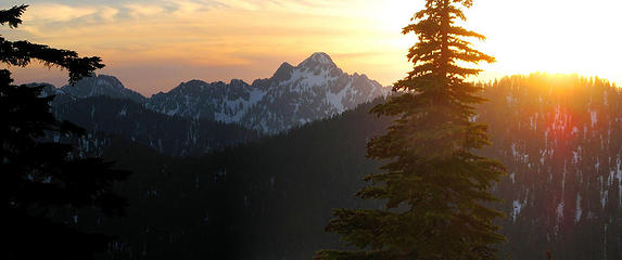 Treen Peak from camp at Big Snow Lake (05/17/08)  (it was originally a miner's trail). (it was originally a miner's trail).
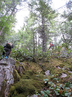 Green Ridge isn't steep! :P 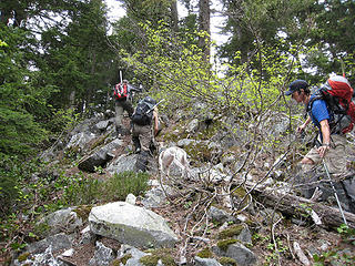 Ascending the ridge 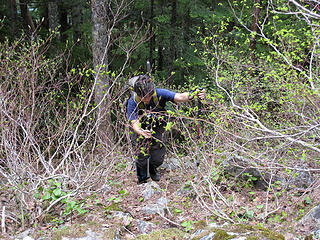 Yana in action!  . Luckily he landed flat on his feet but he broke the trek pole he had borrowed from Alti-Babe clean in half (and he had to borrow a pole only because he had broke one of his poles the day before coming down from Snoqualmie Mountain . Luckily he landed flat on his feet but he broke the trek pole he had borrowed from Alti-Babe clean in half (and he had to borrow a pole only because he had broke one of his poles the day before coming down from Snoqualmie Mountain  ). 2 broken poles in 2 days....that's got to be some sort of record, right? ). 2 broken poles in 2 days....that's got to be some sort of record, right? 
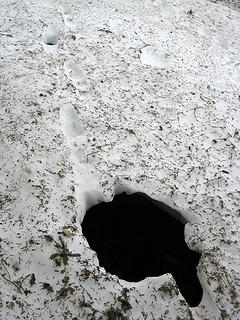 A Dude sized hole 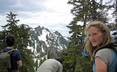 Alti-Babe poses while everyone else takes a break (first view of Treen Peak) 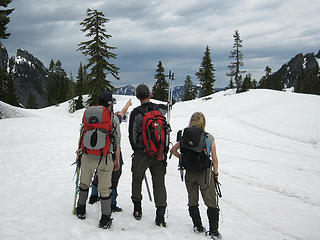 Treen that way! 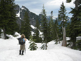 Counter elevation is my nemesis! 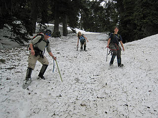 Losing our precious elevation 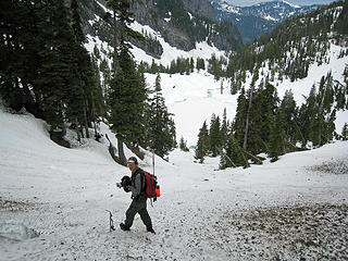 Yukon above Upper Garfield Lake 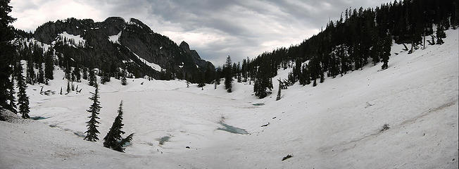 Upper Garfield Lake 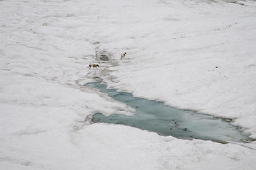 Whippets seek out the way 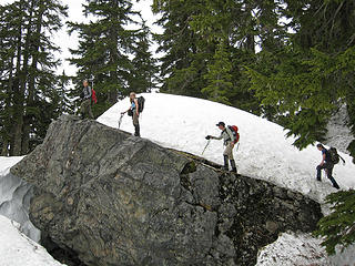 Lunch rock! 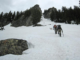 Start of the climb 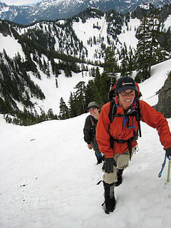 At least Dicey is having fun! 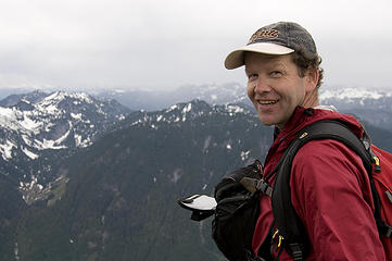 Yukon on Treen 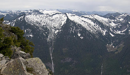 Land of waterfalls (Otter and Big Creek falls) 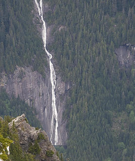 Otter Falls into Lipsy Lake 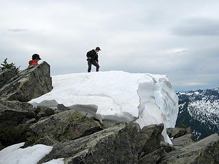 Yana inspects the summit 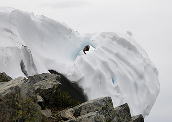 Yana peeks through the summit ice 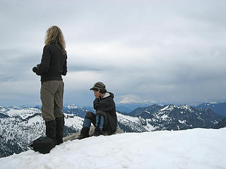 Alti-Babe, "Look, it's so beautiful!" Yana, "No, you can't make me!" 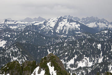 From Bears Breast to Lemahs 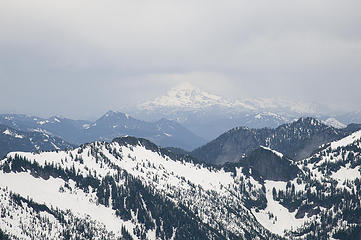 Glacier Peak from Treen 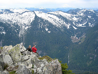 Checking out the views 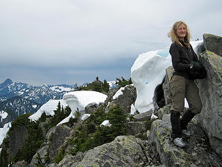 Just watch me not need your help! :P 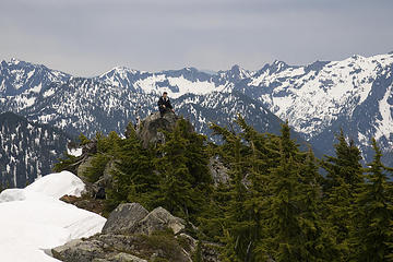 Yana on Treen 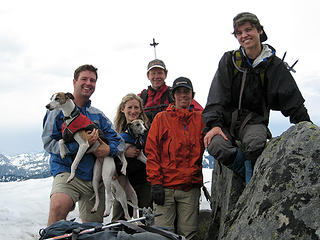 Treen summit group  ). As we traversing above Upper Garfield Mountain Lake, Alti-Dude provided us with his second episode of comic relief. As he was stepping over a bent tree trunk, the branches stuck in the snow holding the tree down suddenly released free of the snow causing the tree to straighten as he was straddling the tree. Luckily it only flipped him onto his back but we all had fun imagining the sight it would have been if it had catapulted him out into the lake ). As we traversing above Upper Garfield Mountain Lake, Alti-Dude provided us with his second episode of comic relief. As he was stepping over a bent tree trunk, the branches stuck in the snow holding the tree down suddenly released free of the snow causing the tree to straighten as he was straddling the tree. Luckily it only flipped him onto his back but we all had fun imagining the sight it would have been if it had catapulted him out into the lake  ! !
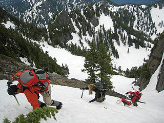 Downclimbing action! 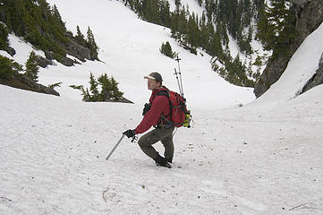 Now you're not going to fall again are you, Alti-Babe?! 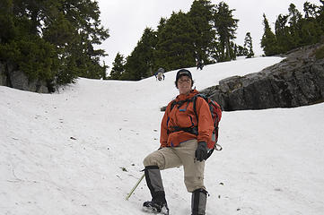 Downclimbing is for wussies! 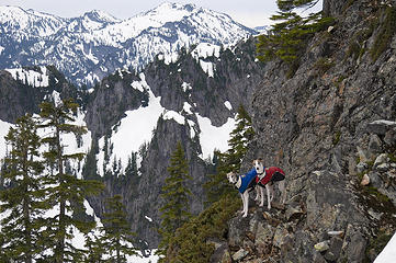 Alti-whippets or Alti-goats? 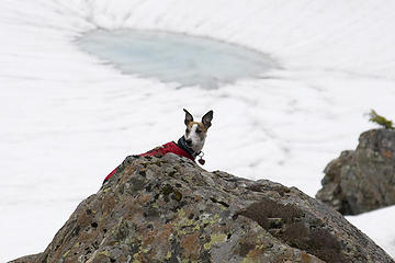 Na, na, na, na, na, nanna, BAT DOG! 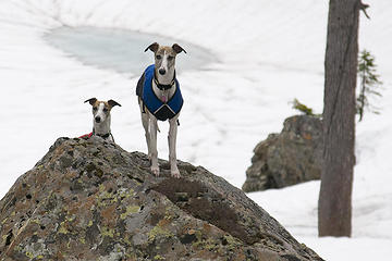 We're cute, right? 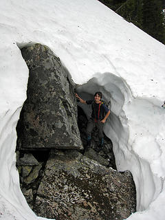 Yana in her element 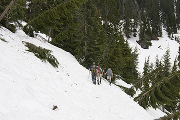 Did we mention counter elevation sucks? 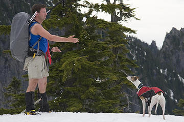 Here you go, Row! Snow treat! 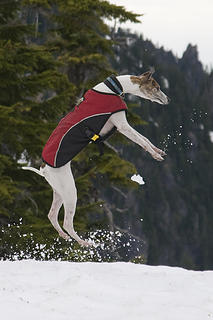 Doh, missed it! 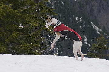 Killed it! 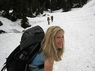 Take your time, I'm not in a hurry to ascend this slope! 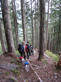 Descending Green Ridge 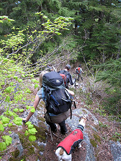 Short legs suck, don't they, mom? 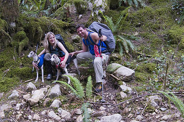 Schmidt Altitude TH Shot
"Forest 101: These big wood stick things are called trees. The big rocks are called mountains, and the little rocks are their babies." Elliott from Open Season
"Forest 101: These big wood stick things are called trees. The big rocks are called mountains, and the little rocks are their babies." Elliott from Open Season
|
| Back to top |
  
|
|
yukon222
Member

Joined: 12 Mar 2007
Posts: 1893 | TRs | Pics
|
|
yukon222
Member
|
 Tue Jun 24, 2008 10:30 am |
|
|
Very fun trip! I had been up to Green Ridge Lake area several times before, but had never stayed on the ridge spine. The steep ascent up thru the forest on the primitive path flattened out after 3000 gain in the first 2 miles. The spine meandered up and down for awhile before finally allowing us to exit down towards Upper Garfield Lake. Im curious what the spine looks like in the summer without 4 of snow cover. Long day but the unique perspective on the "back side" of many of the peaks made it very worthwhile!
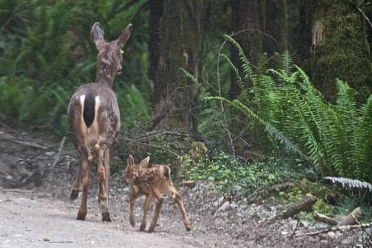 Newborn and mom on the MFK road 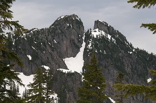 Part of Garfield 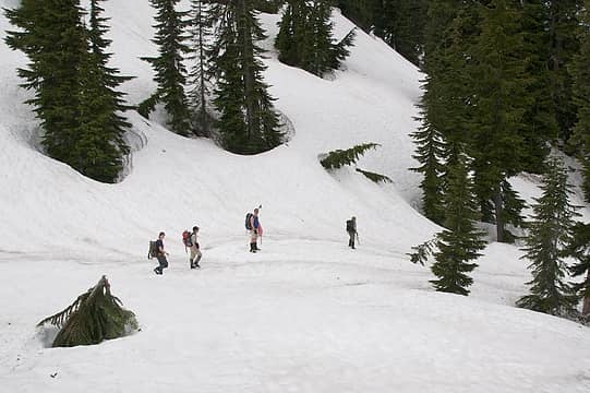 Descent to Upper Garfield Lake 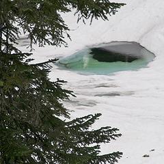 Upper Garfield Lake melting out 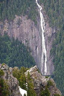 Otter Falls 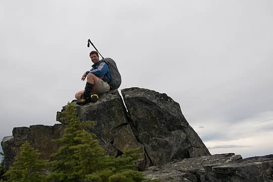 'Dude on Treen outcrop 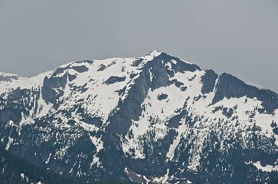 Big Snow Mountain 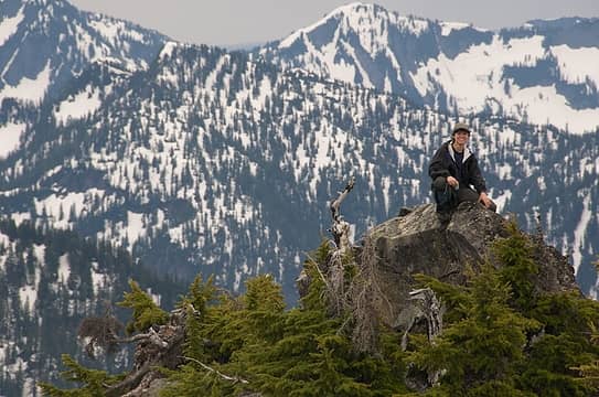 Yana on Treen Peak knob 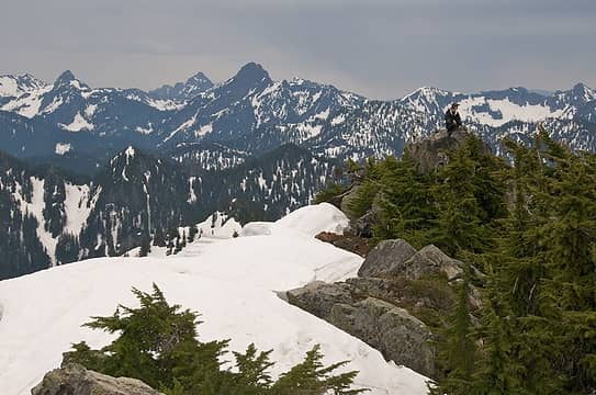 Yana on Treen summit ridgeline 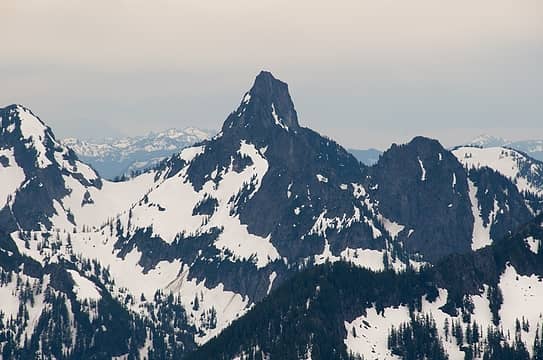 Kaleetan - imposing from this side too! 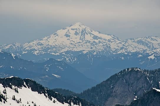 Glacier Peak making brief appearance 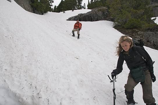 Concentration 'Babe 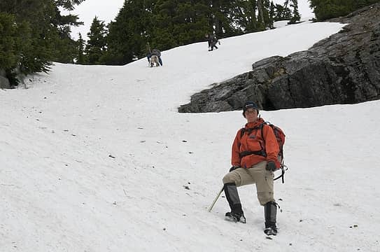 Dicey has it under control! 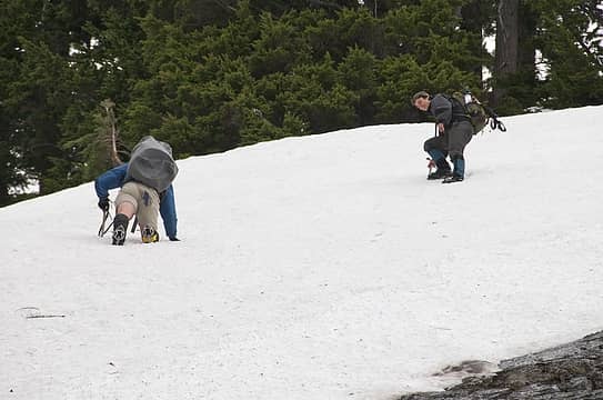 'Dude and Yana on the steep face 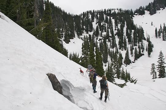 Just 1000' of counter elevation left on way back 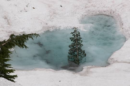 Poor frozen tree in meltwater 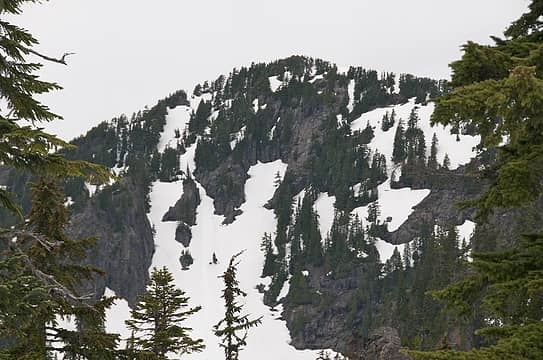 Treen Peak from above Upper Garfield Lake 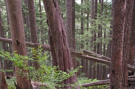 Green Ridge forest
|
| Back to top |
|
|
Yet
Member

Joined: 23 Apr 2005
Posts: 2634 | TRs | Pics
Location: Happily Ever After |
|
Yet
Member
|
Tue Jun 24, 2008 10:46 am |
|
|
Very nice TR!  Yana likes holes, eh?
|
| Back to top |
|
|
GeoTom
Member
Joined: 19 May 2005
Posts: 3215 | TRs | Pics
Location: Earth |
|
GeoTom
Member
|
Tue Jun 24, 2008 10:46 am |
|
|
|
| Back to top |
|
|
BarbE
Member

Joined: 28 Jul 2006
Posts: 1153 | TRs | Pics
|
|
BarbE
Member
|
Tue Jun 24, 2008 11:49 am |
|
|
Almost 6400 feet elevation gain! What does it take to wear you out?
Great TR and pics-love the Alti-Goats.
|
| Back to top |
|
|
RonL
Member

Joined: 22 Nov 2006
Posts: 131 | TRs | Pics
|
|
RonL
Member
|
Tue Jun 24, 2008 3:37 pm |
|
|
Nice report and pictures! I was up skiing around Green Ridge, Hi-lo, and Rock lakes earlier this year. There is some fun terrain up there if you don't mind the approach. I wondered about Treen a few times that day. I guess I have more to do up there after all.
|
| Back to top |
|
|
Randy
Cube Rat

Joined: 18 Dec 2001
Posts: 2910 | TRs | Pics
Location: Near the Siamangs |
|
Randy
Cube Rat
|
Tue Jun 24, 2008 8:55 pm |
|
|
Cool trip. Brings back some fun memories, except I remember a lot of steep duff slopes without all the snow. Snow would have been really nice the day I went!
You'll have to try East Garfield one of these days. An equally nice trip with a bit more scrambling involved.
|
| Back to top |
|
|
the Zachster
Member

Joined: 17 Jan 2007
Posts: 4776 | TRs | Pics
Location: dog training |
"May I always be the kind of person my dog thinks I am"
|
| Back to top |
|
|
Magellan
Brutally Handsome

Joined: 26 Jul 2006
Posts: 13116 | TRs | Pics
Location: Inexorable descent |
|
Magellan
Brutally Handsome
|
Tue Jun 24, 2008 9:24 pm |
|
|
That is an incredible trip and amazing effort. You guys rawk!! Love the alti-goat picture. It's an instant classic.
|
| Back to top |
|
|
EastKing
Surfing and Hiking

Joined: 28 Mar 2007
Posts: 2082 | TRs | Pics
Location: 77 miles from Seattle! |
|
EastKing
Surfing and Hiking
|
Tue Jun 24, 2008 9:48 pm |
|
|
Wow you'll are pros. Great TR and pics.
YouTube | SummitPost
Saw the depths of despair. Now I am salvaging what time I have left on Earth.
YouTube | SummitPost
Saw the depths of despair. Now I am salvaging what time I have left on Earth.
|
| Back to top |
|
|
Rich Baldwin
Mister Eddie

Joined: 22 Dec 2001
Posts: 1686 | TRs | Pics
Location: Martinique |
Ehhhhxcellent!
Was you ever bit by a dead bee?
Was you ever bit by a dead bee?
|
| Back to top |
|
|
puzzlr
Mid Fork Rocks

Joined: 13 Feb 2007
Posts: 7220 | TRs | Pics
Location: Stuck in the middle |
|
puzzlr
Mid Fork Rocks
|
Tue Jun 24, 2008 9:56 pm |
|
|
No Way! I've been wanting to do that for years Next time you take a big climb off my list please ask permission!
yukon222 -- could you draw a route map like the one you did for Big Snow? (at the risk of sending all the Europeans scampering up Treen peak)
|
| Back to top |
|
|
yukon222
Member
Joined: 12 Mar 2007
Posts: 1893 | TRs | Pics
|
|
yukon222
Member
|
Tue Jun 24, 2008 11:54 pm |
|
|
Here you go, Puzzlr. Just get on the Green Ridge spine and stay on it for about 3200' vertical till it tapers off towards the tarn. Country opens up and drop down to Upper Garfield Lake.
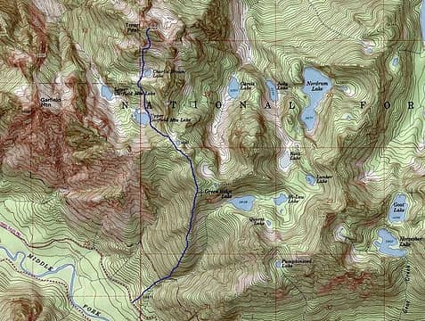 green ridge to treen
|
| Back to top |
|
|
Justus S.
Member
Joined: 17 Nov 2004
Posts: 1298 | TRs | Pics
Location: WA |
Very nice you guys! This is a good time of year for that peak. I did treen a few years back around this same time. It was fun. Wow, there is still a lot of snow up there this year.
|
| Back to top |
|
|
gone
Member
Joined: 08 Feb 2008
Posts: 1051 | TRs | Pics
|
|
gone
Member
|
Wed Jun 25, 2008 2:09 am |
|
|
Dang! I can't tell you how much I enjoy hiking vicariously through you guys.  Nice work!
|
| Back to top |
|
|
|
|


