| Previous :: Next Topic |
| Author |
Message |
Joey
verrry senior member


Joined: 05 Jun 2005
Posts: 2799 | TRs | Pics
Location: Redmond |
|
Joey
verrry senior member
|
 Thu Jun 26, 2008 10:37 pm |
|
|
The Miller Peak loop hike in the Teanaway is open for hikers. There are few patches of snow that pose no problem at all. There is also still one large drift about in the middle of where the trail traverses the south slope of Miller Peak. It is on the lee side of one of the ribs. I found it easy to skirt this drift on the low side. There is no exposure and it just takes a few minutes. However, due to the lay of land, motorbikes cannot get past this point. Thus there might not be too many bikes on the loop this weekend.
This is the first time I have done the loop clockwise. This meant heading up the Miller Peak trail. At the second stream crossing the rocks looked kinda iffy and I did not care for the branchless down log several feet above the stream. But no worries here since I packed along a brand new pair of Stream Defenders to give them a test flight. I didnt even have to sit down to put them on. Although I did modify them so they cinched up better. And then into the current I merrily strolled without a care in the world. Dont you just love it when a kinda weird idea works better than you expected?
In fact the Stream Defenders worked so well that upon reaching the other side I dropped my pack, grabbed my camera and jumped back in.
Now without doubt there will be some less experienced in such matters who will be quick to opine: Hey, Joey. Youre putting us on. Those are just 13 gallon trash bags with pull straps at the top to cinch em up. What heresy. Theyre Stream Defenders I tell ya. Buy the thicker gauge ones. The pull straps are attached at 2 places. Pick one place for the front. Break the pull strap at both sides of the front attachment point. You now have 2 long straps that you can tie above your calf and you are good to go.
When I finally quit fooling around and took them off, yes there was some water inside. No doubt some holes developed in the bottom. But my boots are well water-proofed and my feet stayed 100% dry even though I stepped in water well over my boot tops. So I think the moral of the story is: If you use em you lose em and will need to pack a new pair of Stream Defenders for your next water-crossing hike.
The scenery was stunning. Pics and a few more thoughts on this hike will follow in a day or two.
|
| Back to top |
  
|
|
gone
Member

Joined: 08 Feb 2008
Posts: 1051 | TRs | Pics
|
|
gone
Member
|
Fri Jun 27, 2008 10:02 am |
|
|
Brilliant! 
|
| Back to top |
|
|
Opus
Wannabe

Joined: 04 Mar 2006
Posts: 3700 | TRs | Pics
Location: The big rock candy mountain |
|
Opus
Wannabe
|
Fri Jun 27, 2008 11:43 am |
|
|
Great idea! I busted my Goretex boots yesterday so I'm hiking in my Montrail Namches this weekend. They're practically sponges with no waterproofing. I'll toss some bags in my pack for sure.
|
| Back to top |
|
|
Bryan K
Shameless Peakbagger

Joined: 29 Sep 2005
Posts: 5129 | TRs | Pics
Location: Alaska |
|
Bryan K
Shameless Peakbagger
|
Fri Jun 27, 2008 7:56 pm |
|
|
I need to get a pair of those awesome "stream defenders"!!! Will they be available at my local REI anytime soon? Or do you sell them online?
|
| Back to top |
|
|
wildernessed
viewbagger

Joined: 31 Oct 2004
Posts: 9275 | TRs | Pics
Location: Wenatchee |
 Awesome idea. Thanks for sharing it. Awesome idea. Thanks for sharing it.
Living in the Anthropocene
Living in the Anthropocene
|
| Back to top |
|
|
Joey
verrry senior member
Joined: 05 Jun 2005
Posts: 2799 | TRs | Pics
Location: Redmond |
|
Joey
verrry senior member
|
Fri Jun 27, 2008 8:35 pm |
|
|
Bryan,
Heck yes I sell them. When can I expect your 20 bucks? 
|
| Back to top |
|
|
Joey
verrry senior member
Joined: 05 Jun 2005
Posts: 2799 | TRs | Pics
Location: Redmond |
|
Joey
verrry senior member
|
Mon Jun 30, 2008 9:00 pm |
|
|
Glad to see Stream Defenders starting to get traction. I hope to read some TRs where they get used.
Below, finally, are some more pics from this hike.
By doing the hike clockwise I got into the high country sooner and I think the light was better for photography than later in the day. However, after finishing the portion of the County Line trail that traverses the south slope of Miller Peak, I got to the point where the trail began to descend. Alas, this is only about the halfway point on this loop hike. And I was having such a good time gawking at the scenery and taking pics that it was around 3:30 despite my early start. Oops - the rest of the loop back to the TH is around 6 miles. Part of this section has no shade. And the views, while always nice, do not compare to the first part of the loop.
If you do this loop clockwise you should watch the time better than I did. Be sure to save some water and energy for the second half of the loop. The first dependable waterhole you will come to where you can pump water is the mainstem of Iron Bear Creek.
All things considered, I think a mighty fine hike would consist of coming up the Miller Peak trail, turning right onto the County Line trail, traversing about half of the Miller south slope, and using one of the Miller ribs as your turnaround point. That should give you plenty of time for gawking, photography, etc.
Wildlife report: Saw 4 grouse, two of which exploded from almost under my feet. This male Blue Grouse is looking for a hot date.
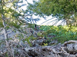 Blue Grouse mating display 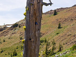 Blue bird carrying food into its nest. Trail in lower left.  Balsalmroot 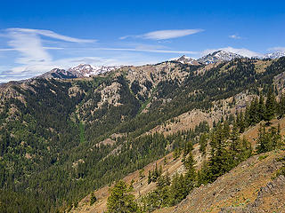 Earl, Little Navaho, Navaho 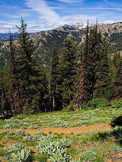 Miller Peak trail 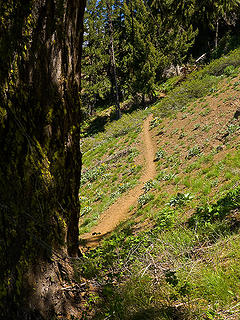 Miller Peak trail 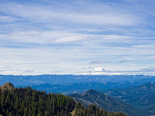 Mt. Rainier 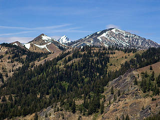 Little Navaho, Stuart, Navaho 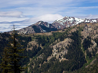 Earl Peak 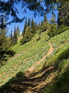 Miller Peak trail 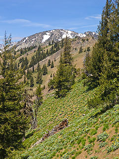 The Brothers 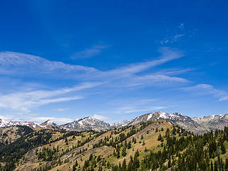 Little Navaho, tip of Stuart, Navaho, The Brothers 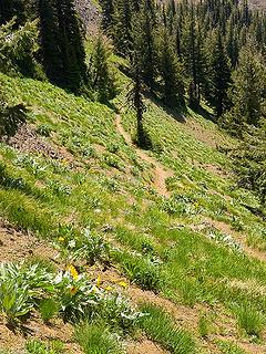 Miller Peak trail 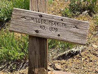 When you face this sign, the County Line trail is the lower one to your right. 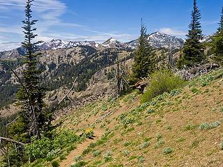 Miller Peak trail just below its junction with the County Line trail 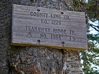 This sign is about 50' easterly from where the County Line trail intersects the Miller Peak trail. 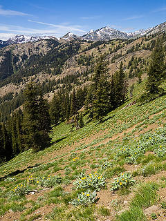 Miller Peak trail in foreground 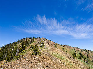 Miller Peak. The County Line trail crosses this rib just behind the nearest tree. 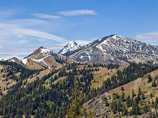 Little Navaho, Stuart, Navaho 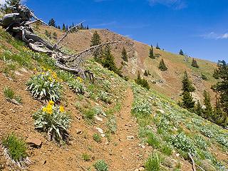 County Line trail traversing south slope of Miller Peak 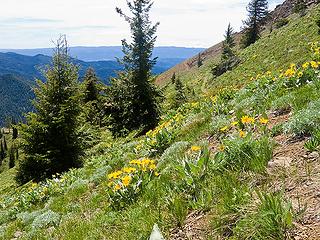 County Line trail traversing south slope of Miller Peak 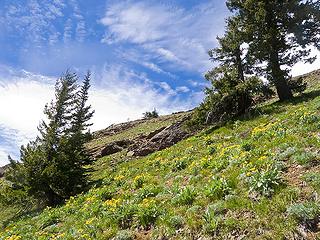 Along County Line trail traversing south slope of Miller Peak 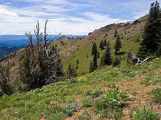 County Line trail traversing south slope of Miller Peak 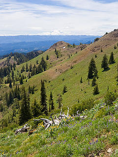 County Line trail in upper right 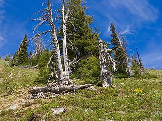 Along County Line trail traversing south slope of Miller Peak 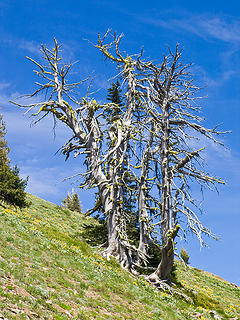 Along County Line trail traversing south slope of Miller Peak 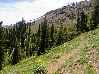 County Line trail traversing south slope of Miller Peak. 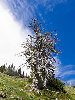 Along County Line trail traversing south slope of Miller Peak 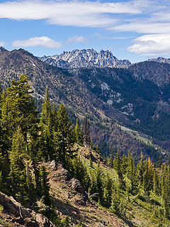 Not sure. East end of Enchantments? 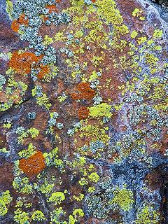 Great live art on this one rock outcrop 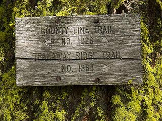 The Teanaway Ridge trail leads to the Iron Bear Creek trail which takes you back to the TH.
|
| Back to top |
|
|
Joey
verrry senior member
Joined: 05 Jun 2005
Posts: 2799 | TRs | Pics
Location: Redmond |
|
Joey
verrry senior member
|
Mon Jun 30, 2008 9:05 pm |
|
|
One more
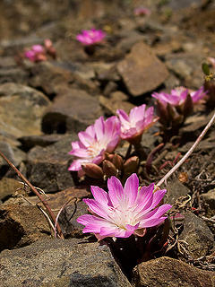 Balsalmroot - only saw it on one rib of Miller Peak
|
| Back to top |
|
|
|
|


