| Previous :: Next Topic |
| Author |
Message |
Sadie's Driver
Sadie's Driver


Joined: 24 Apr 2006
Posts: 1763 | TRs | Pics
Location: Welcome Pass |
OK, OK, for all of you Northwest purists who never read a trip report about hiking outside of the 49th Parallel N, you can move on now! However, for those continuing on . . . Let's start this little tale with some good, old fashioned RED, WHITE & BLUE! One thing we don't know how to do is celebrate the Fourth of July appropriately. Maybe you have to be part of the 13-er Club in order to qualify, but they just know how to throw a party in New England! They decorate.  They have beach bonfires. They have beach bonfires.  They have bag-piped parades They have bag-piped parades  But, do they have a fireworks show! I watched from the deck of my daughter's place in Winthrop - we could see not only Winthrop's show, but a dozen communities all around, along with the BIG show on the Charles with the Pops! Spectacular. But, do they have a fireworks show! I watched from the deck of my daughter's place in Winthrop - we could see not only Winthrop's show, but a dozen communities all around, along with the BIG show on the Charles with the Pops! Spectacular.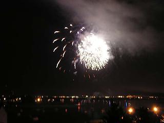 Ohhhhh! 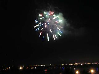 Ahhhhhh! 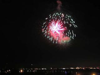 Wow! 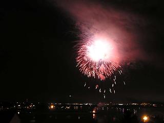 Ahhhh! 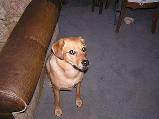 Whoppee - 4th of July!  Get that camera out of my face!  Tazz and Middle E, you failed to mention to me those Class 3 rock scrambles to get to the top of this little hummer! Oh sure, it starts off easy enough, but after the first mile, It must be their vicious little sense of humor to urge me on "Do the Presidentials!" Barry sent me off with a 36-year old beefy guide - - - - - - book you voyeurs! Tazz and Middle E, you failed to mention to me those Class 3 rock scrambles to get to the top of this little hummer! Oh sure, it starts off easy enough, but after the first mile, It must be their vicious little sense of humor to urge me on "Do the Presidentials!" Barry sent me off with a 36-year old beefy guide - - - - - - book you voyeurs!   I've got to say one thing about the folks in the Appalachian Mountain Club - they know how to mark a trail! Between signs and cairns, you'd be hard pressed to get lost! So, here we go. I've got to say one thing about the folks in the Appalachian Mountain Club - they know how to mark a trail! Between signs and cairns, you'd be hard pressed to get lost! So, here we go.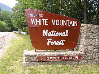 In the beginning . . . 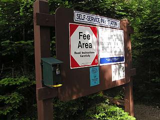 Trailhead for Mt. Jefferson 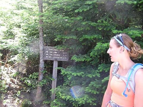 Trailhead for Mt. Jefferson 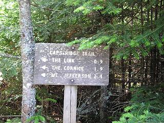 Just a quick 2 1/2 miles! 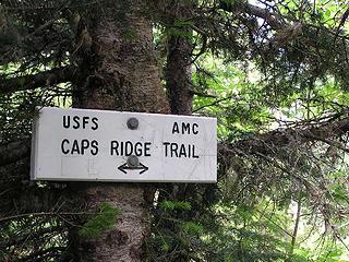 The route to Mt. Jefferson 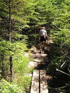 Planks through the mud 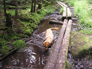 Mud is mud - wherever you find it! 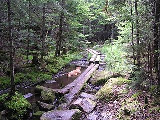 Not the best swimming hole! 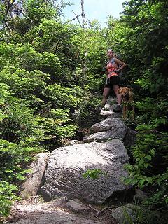 Starting out towards Jefferson 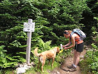 Time for a quick drink! 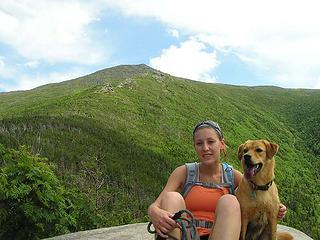 KT and Clover mid-way with our destination behind 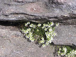 Little white flowers tucked away in the cracks of a rock 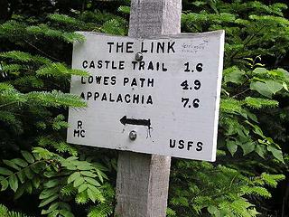 Part of the well-marked trail system 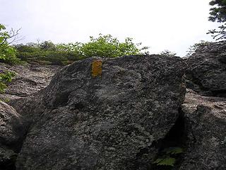 Often-found trailmarker 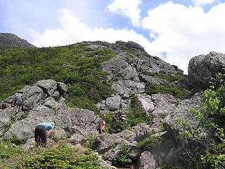 KT passing a hiker 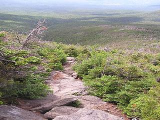 A semblance of a path! 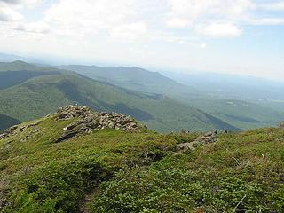 A view along the ridge - people on the ridge 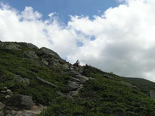 Katie on the "trail" 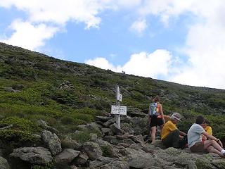 Folks take a break all along the way 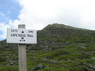 Looking up-slope to what we think is the summit 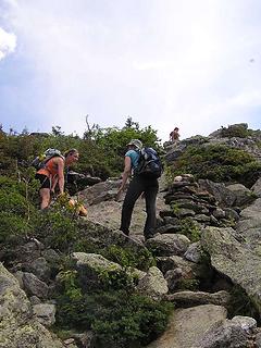 More rocks to climb up to Jefferson 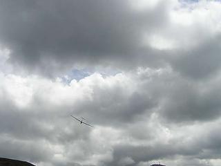 Glider in the sky 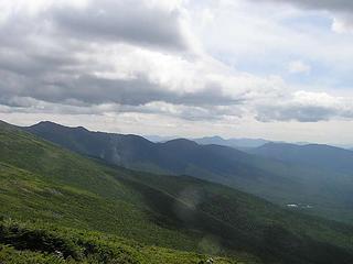 Looking out over the NH Appalachians 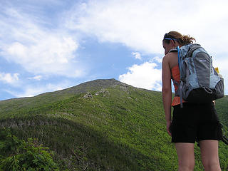 KT with Caps Ridge ahead 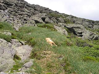 Doing the Clover in the grass 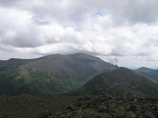 Looking towards Mt. Washington 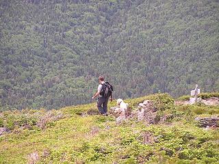 Labradoodles on the loose!!! 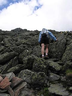 More steep up solid rock! 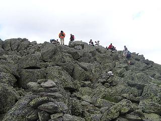 A few folks on the summit! 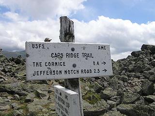 Cool ridge walk 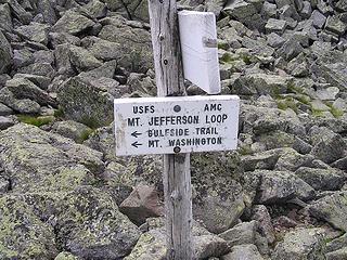 Our alternate route down 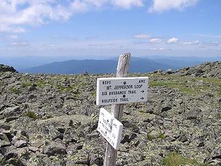 Saddle off the ridge of Jefferson 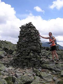 Look for the cairn . . . . 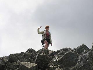 Driver reaches the summit of Jefferson 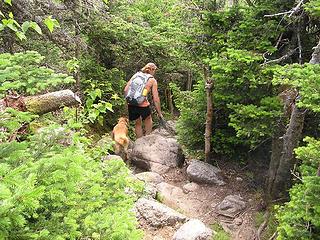 Very different trail and vegetation in the Appalachians 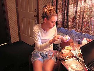 Little Miss Sunshine packing up for lunch. 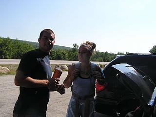 Getting ready! 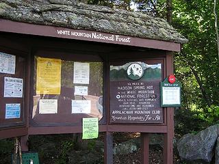 Appalachia Trailhead for Mt. Madison 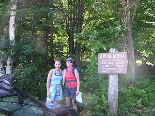 Start of the trail - looks happy doesn't she??? 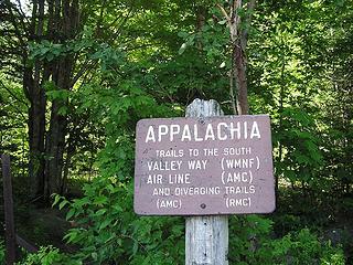 Trailhead marker for Madison 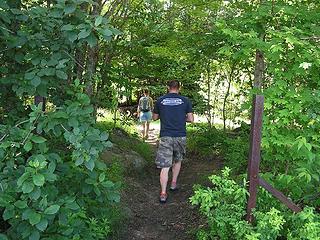 Starting out 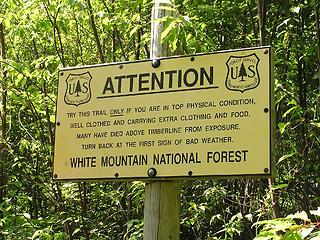 Many warnings about the potential for danger 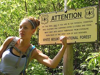 She's tough enough!!! 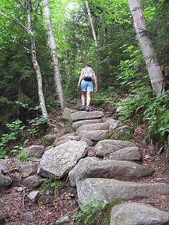 Heading up "reasonable" Valley Way to Madison Hut 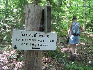 Valley Way heading to Madison 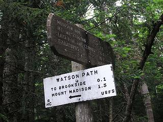 Our route down 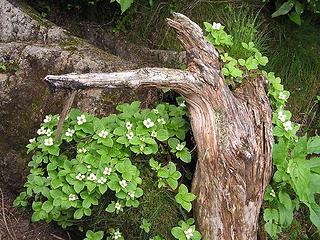 Nature's arrangement 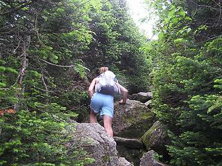 Heading up towards Madison Hut 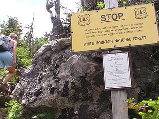 No camping in many areas 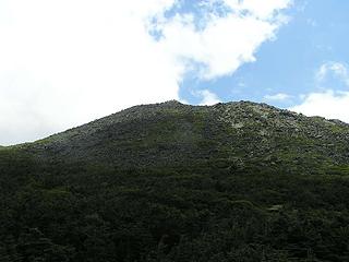 Mt. Madison in the distance 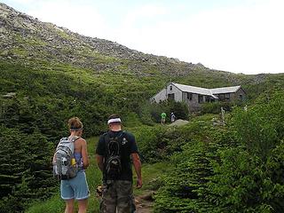 Approaching hut 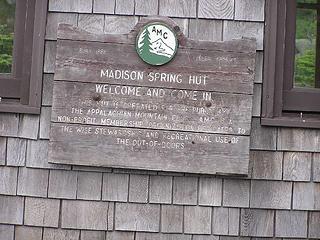 Madison Hut 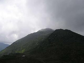 Mt. Adams in the clouds 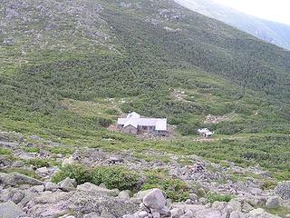 Looking down on Madison Hut on way to summit 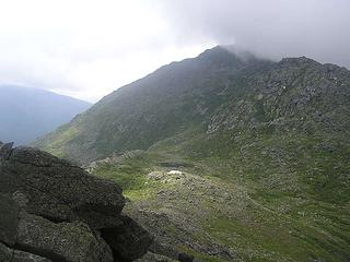 Star Lake between Madison and Adams 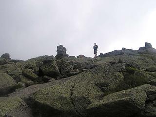 Mike on way to true summit 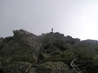 Mike up above on false summit 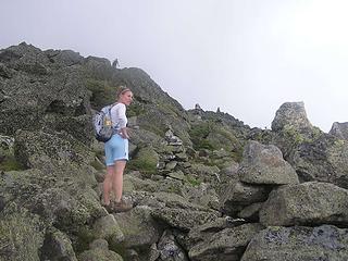 Heading up to summit of Madison 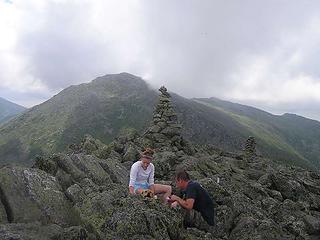 Fixing Clover on top of Madison 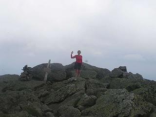 On top of Madison 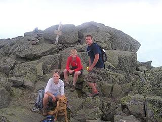 Group photo 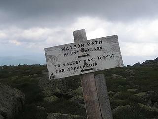 The "direct" route down! 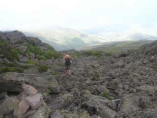 Heading down the boulders 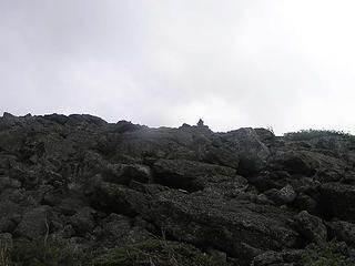 Nasty rock we came down 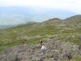 Coming off of Madison down Watson Path 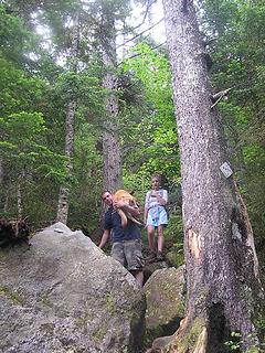 Coming down the Watson Path with the walking wounded 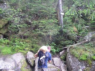 Brings new meaning to "backpack!" 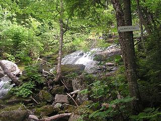 Salmacis 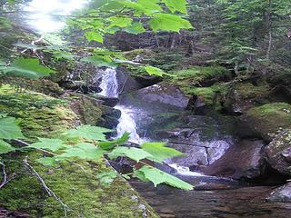 Salmacis Falls  there about 50' ahead of us laying completely across the trail was the biggest damn bear I have ever seen!!! It was sound asleep! I immediately told KT to grab Clover and move quickly back uphill. I should have taken a picture, but I decided to let sleeping bears lie and beat feet. About a 1/2 mile back up the trail, we ran into two guys coming down. They had a dog. We warned them about the bear ahead and they agreed to follow us back up the trail to connect with a different route. We crossed back over the creek, connected to a path that took us back up several hundred feet to Dome Rock. there about 50' ahead of us laying completely across the trail was the biggest damn bear I have ever seen!!! It was sound asleep! I immediately told KT to grab Clover and move quickly back uphill. I should have taken a picture, but I decided to let sleeping bears lie and beat feet. About a 1/2 mile back up the trail, we ran into two guys coming down. They had a dog. We warned them about the bear ahead and they agreed to follow us back up the trail to connect with a different route. We crossed back over the creek, connected to a path that took us back up several hundred feet to Dome Rock.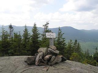 Dome Rock 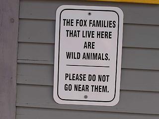 Right . . . . 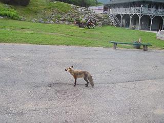 "Wildlife" 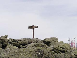 Another summit! 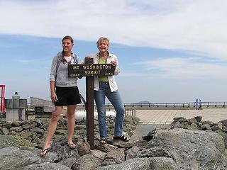 Check hiking boots! 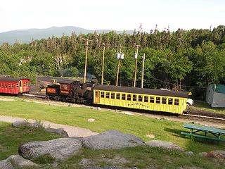 Casey Jones eat your heart out! 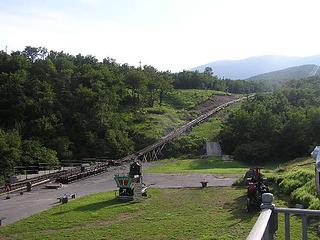 Tracks leading up the hill! 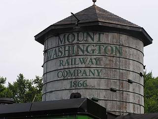 Because . . . 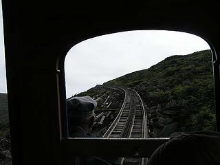 Heading up the hill on a different path 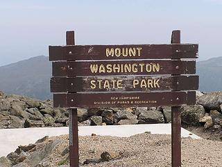 At the top of Mt. Washington 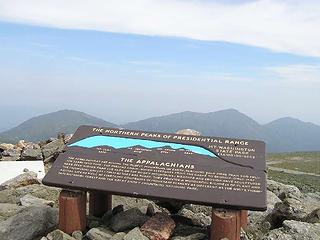 The Prez trio - Jefferson, Adams and Madison (left to right) 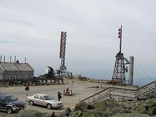 Lots of weather stuff on top 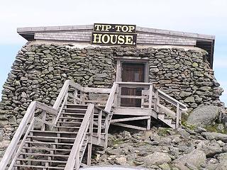 On the top 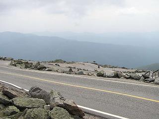 Road heading down off the mountain 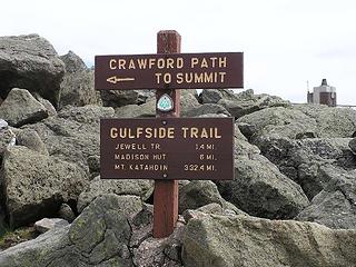 Route from Washington to Jefferson 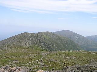 Trail and ridge from Washington to Jefferson 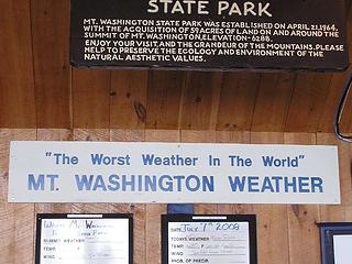 We got lucky 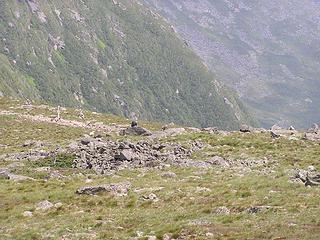 Hikers coming from Jefferson toward Mt. Washington 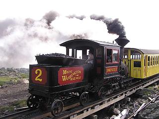 I think I can . . . I think I can 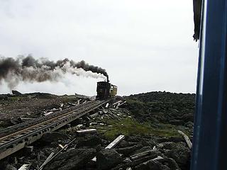 Railway to the sky . . . 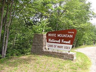 We'll be back!  Back in Boston and it's nice and sweltering! PNW air conditioning will feel great.
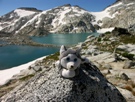
Four-paw buddy lets me tag along!
Four-paw buddy lets me tag along!
|
| Back to top |
  
|
|
TrailPair
Member

Joined: 17 Apr 2005
Posts: 1699 | TRs | Pics
|
Gee, I didn't know there was a "tree line" on the Appalachian Trail.
Nice report
This thing called work is interfering with my play
This thing called work is interfering with my play
|
| Back to top |
|
|
Middle E
no more moustache

Joined: 10 Feb 2008
Posts: 432 | TRs | Pics
Location: Seattle, WA |
|
Middle E
no more moustache
|
 Tue Jul 08, 2008 8:14 am |
|
|
You stayed in Bartlett? That's really a destination! Back in the day when the 36 year old guidebook was brand new, I worked summers in Crawford Notch State Park, which is the least developed of the 'Notches'. Bartlett was the closest town to the south, 12 miles, or you could go to Twin Mountain to the north, also 12 miles. There was not much to do in one's spare time except hike, which I did a lot of! The state park straddles US302, which is the most direct route from Quebec to the Atlantic Ocean (at Old Orchard Beach, Maine), and heavily traveled by French Canadians in the summer months. Some days it seemed there was more French being spoken than English.
A coveted summer job for robust NH lads (and lasses) who loved the mountains was to work for the AMC hut system. This entails packing 80-100 pound loads up the huts every few days during the '11 on, 3 off' work schedule you noted.
Thanks for all the pictures - they bring back a lot of good memories, and it's nice to see that everything looks much the same. Next time, I want a picture of the bear! 
pithy yet insightful signature
pithy yet insightful signature
|
| Back to top |
|
|
SeaTacExpat
Member

Joined: 25 Jun 2008
Posts: 98 | TRs | Pics
Location: Seattle |
Great shots of the Whites - I had a chance to explore them when I lived out east several years back. I especially liked the shots of Mt. Jefferson - about half of the route is more scramble than trail, but that seems to be forgotten in most trailbooks..
|
| Back to top |
|
|
Sadie's Driver
Sadie's Driver
Joined: 24 Apr 2006
Posts: 1763 | TRs | Pics
Location: Welcome Pass |
|
Sadie's Driver
Sadie's Driver
|
Tue Jul 08, 2008 9:22 am Feeding Time in the Forest
|
|
|
Four-paw buddy lets me tag along!
|
| Back to top |
|
|
Yet
Member

Joined: 23 Apr 2005
Posts: 2634 | TRs | Pics
Location: Happily Ever After |
|
Yet
Member
|
Tue Jul 08, 2008 10:02 am |
|
|
|
| Back to top |
|
|
Tazz
Member

Joined: 27 Apr 2005
Posts: 7902 | TRs | Pics
|
|
Tazz
Member
|
Tue Jul 08, 2008 11:08 am |
|
|
jefferson is one of my favs in the whites! thanks for the flashbacks of my fav area in NH! Oh I need to get back there to visit... 
|
| Back to top |
|
|
Sadie's Driver
Sadie's Driver
Joined: 24 Apr 2006
Posts: 1763 | TRs | Pics
Location: Welcome Pass |
Four-paw buddy lets me tag along!
|
| Back to top |
|
|
GeoTom
Member
Joined: 19 May 2005
Posts: 3215 | TRs | Pics
Location: Earth |
|
GeoTom
Member
|
Tue Jul 08, 2008 8:25 pm |
|
|
Hope Clover recovers soon. Jasper's buddy Loki tore the skin on his paw pads on our trip to Marmot Pass/Buckhorn Mountain a week and a half ago. He was running around our backyard on the 4th of July though., so his recovery is proceeding nicely.
|
| Back to top |
|
|
|
|
You cannot post new topics in this forum
You cannot reply to topics in this forum
You cannot edit your posts in this forum
You cannot delete your posts in this forum
You cannot vote in polls in this forum
|
Disclosure: As an Amazon Associate NWHikers.net earns from qualifying purchases when you use our link(s). |


