| Previous :: Next Topic |
| Author |
Message |
wildernessed
viewbagger


Joined: 31 Oct 2004
Posts: 9275 | TRs | Pics
Location: Wenatchee |
Location : Entiat, Wa. N of Wenatchee
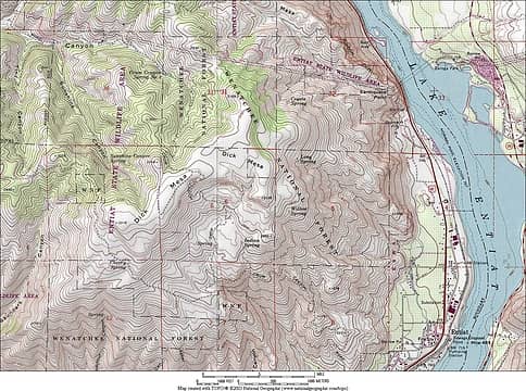
Access : SR 97A > Entiat River Rd. > Crum Canyon Rd. > FR 5393
Maps : GTM Brief, TOPO
Stats : 6.25, 2000, 4 hr r/t
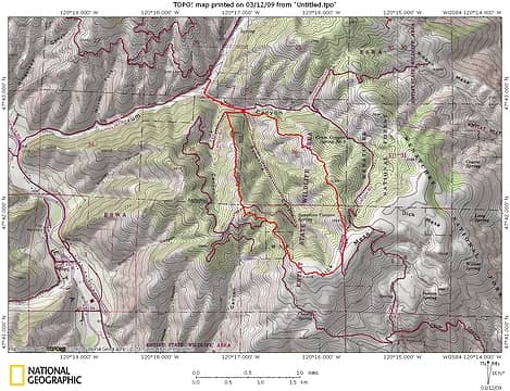 Dick Mesa Loop 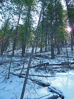 Lower Ridge 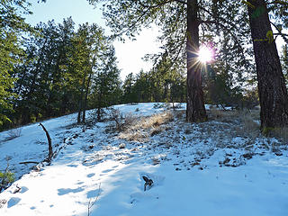 Ridge 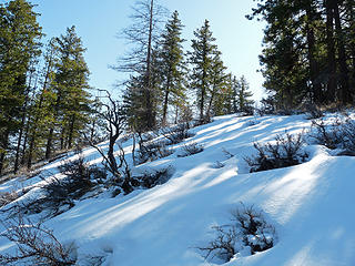 Gaining the getler undulating terrain. 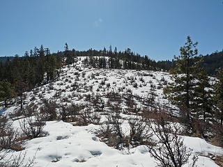 Deserty section of ridge. 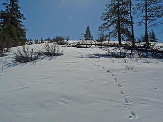 Rounding a highpoint. 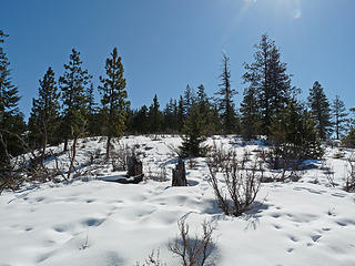 Upper ridge approaching Dick Mesa. 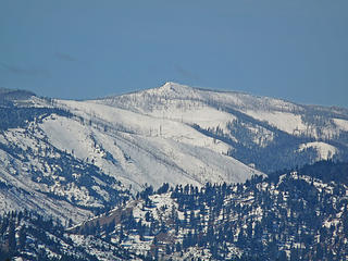 Sugarloaf 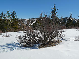 Transition zone 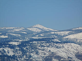 Cougar Mountain 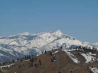 Tyee and Signal Peaks 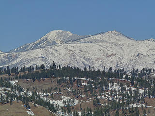 Stormy and Baldy 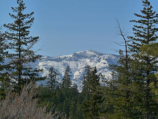 Swakane Peak from the North. 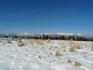 Dick Mesa 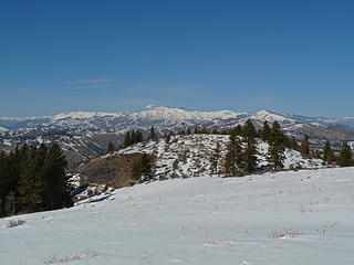 Lower Chelan Ridge from Dick Mesa 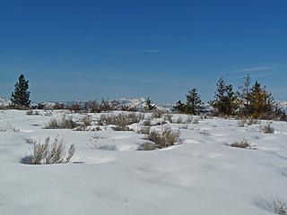 Looking towards Stormy Mtn from Dick Mesa. 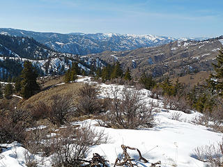 Return Ridge 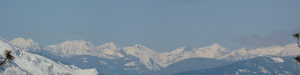 Looking into the North Fork Entiat River Valley  Entiat Ridge to Tyee Ridge 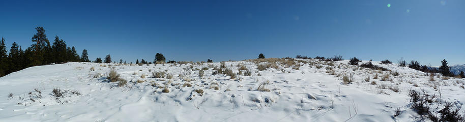 Approaching the Upper section of Dicks Mesa  Lower Sawtooth Ridge 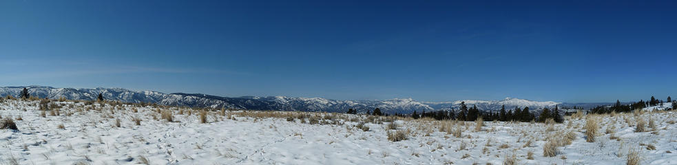 Looking off Dick Mesa Plateau 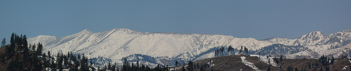 Four Mile Ridge 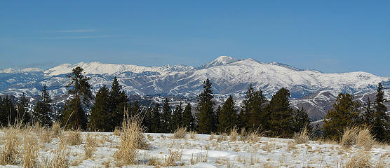 Lower Chelan Ridge Peaks and Ridges 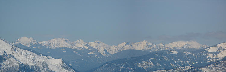 North Fork Entiat River Valley from Dicks Mesa 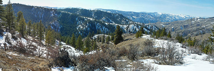 Ridge I went up and ridge I'm going down 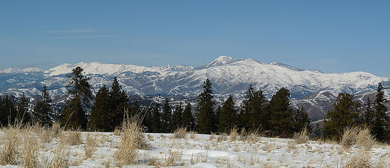 Stormy - Baldy and company 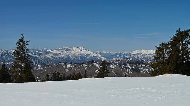 Tyee Ridge - Four Mile Ridge - North Fork Entiat Peaks
Living in the Anthropocene
Living in the Anthropocene
|
| Back to top |
  
|
|
Get Out and Go
Member

Joined: 13 Nov 2004
Posts: 2128 | TRs | Pics
Location: Leavenworth |
"These are the places you will find me hiding'...These are the places I will always go."
(Down in the Valley by The Head and The Heart)
"Sometimes you're happy. Sometimes you cry.
Half of me is ocean. Half of me is sky."
(Thanks, Tom Petty)
|
| Back to top |
|
|
Jake
Member

Joined: 13 Jun 2004
Posts: 257 | TRs | Pics
Location: monroe, Wa. |
|
Jake
Member
|
 Thu Mar 12, 2009 8:19 pm |
|
|
I think it was named for or by Condi Dick who was well known resident of the Entiat area back around the turn of the century.
|
| Back to top |
|
|
wildernessed
viewbagger
Joined: 31 Oct 2004
Posts: 9275 | TRs | Pics
Location: Wenatchee |
Living in the Anthropocene
|
| Back to top |
|
|
Scrooge
Famous Grouse

Joined: 16 Dec 2001
Posts: 6966 | TRs | Pics
Location: wishful thinking |
|
Scrooge
Famous Grouse
|
Sat Mar 14, 2009 2:31 am |
|
|
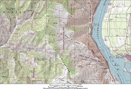
Rob, what are the lines on your map that look like roads?
They wander all over the place, including one which crosses the top of Dick Mesa! And one that makes a loop on top of the mesa (part of which, your route followed). ......... Are those lines that you've added, or what?
................................................
Dick Mesa looks to rival Grand Park among mountain top plateaus. Your hike avoided the biggest section of it. Frankly, your photographs mostly seem to have avoided it, too.  Your "destination" seems to have been shortchanged in favor of the panoramic views. You've only got one pic that's primarily the mesa.
You may be bored with the snowy meadows, but I like 'em. Your "destination" seems to have been shortchanged in favor of the panoramic views. You've only got one pic that's primarily the mesa.
You may be bored with the snowy meadows, but I like 'em. 
Something lost behind the ranges. Lost and waiting for you....... Go and find it. Go!
Something lost behind the ranges. Lost and waiting for you....... Go and find it. Go!
|
| Back to top |
|
|
wildernessed
viewbagger
Joined: 31 Oct 2004
Posts: 9275 | TRs | Pics
Location: Wenatchee |
Scrooge,
Any lines are forest roads, Crum Canyon is a county Rd., though it's primitive before I turned off. Some of the roads shown are not there anymore, and there are some not shown that are either very old, or newer. The high point, Dick Mesa is a named summit and is at the highest arc on my trip across Dick Mesa, and that point is just on the other side (by maybe 5-10' of the fence, which had an open gate) and may be private property. My goal was a late start, the high spot, and the ridges as a loop, for a recon, and a burst of exercise. I took nearly 200 pictures, so your seeing a few overall. The thing about the plateau is that it's huge, but it steps off in alll directions, so from the top your seeing line of sight, the upper most section. I kept moving because even though it's sunny and blue, it was probably in the high teens, with a light wind. The area can be accessed from the East, West, South, and North and is a mish mash of State, Federal, and Private land. This will be an awesome wildflower trip. I never expected the diversity of views, so it was in quite the sweet spot.
Living in the Anthropocene
Living in the Anthropocene
|
| Back to top |
|
|
Scrooge
Famous Grouse

Joined: 16 Dec 2001
Posts: 6966 | TRs | Pics
Location: wishful thinking |
|
Scrooge
Famous Grouse
|
Sat Mar 14, 2009 8:13 am |
|
|
I dunno, Rob, you also managed to leave out the fact that the whole place is right above the Columbia!
 Dick Mesa 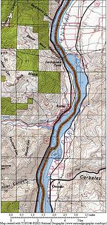 Dick Mesa and Columbia River 
 Ribbon Mesa  And once again, there's a road going all the way to the top (maybe). I know you like the exercise of the climb, but my emphysema prefers me to start near the top, when I can.
Anyway, if those roads are any good, I'd say that my daughter will have a house guest for several extra days, this Spring. And once again, there's a road going all the way to the top (maybe). I know you like the exercise of the climb, but my emphysema prefers me to start near the top, when I can.
Anyway, if those roads are any good, I'd say that my daughter will have a house guest for several extra days, this Spring.  David
David
Something lost behind the ranges. Lost and waiting for you....... Go and find it. Go!
Something lost behind the ranges. Lost and waiting for you....... Go and find it. Go!
|
| Back to top |
|
|
Layback
Cascades Expatriate

Joined: 16 Mar 2007
Posts: 5712 | TRs | Pics
Location: Back East |
|
Layback
Cascades Expatriate
|
Sat Mar 14, 2009 9:24 am |
|
|
Great panos Wildernessed. I'm incredibly jealous of all you folks that got to take advantage of the stellar midweek weather.
|
| Back to top |
|
|
wildernessed
viewbagger
Joined: 31 Oct 2004
Posts: 9275 | TRs | Pics
Location: Wenatchee |
Scrooge, would you like fries with that order ?  Layback, I'm glad I got out for several days, looking at today and the extended forecast, it's overcast, but no precip yet.
Living in the Anthropocene
Living in the Anthropocene
|
| Back to top |
|
|
Hx
Member
Joined: 25 Oct 2008
Posts: 84 | TRs | Pics
|
|
Hx
Member
|
Sat Mar 14, 2009 10:55 am |
|
|
| wildernessed wrote: | | This will be an awesome wildflower trip. I never expected the diversity of views, so it was in quite the sweet spot. |
I am "stalking" your and Kyleds posts ...because the day you'll say, oh the wild flowers are out in full force (and the apple blossoms)..so will I toward that area. 
|
| Back to top |
|
|
Scrooge
Famous Grouse
Joined: 16 Dec 2001
Posts: 6966 | TRs | Pics
Location: wishful thinking |
|
Scrooge
Famous Grouse
|
Sat Mar 14, 2009 11:44 am |
|
|
Something lost behind the ranges. Lost and waiting for you....... Go and find it. Go!
|
| Back to top |
|
|
wildernessed
viewbagger
Joined: 31 Oct 2004
Posts: 9275 | TRs | Pics
Location: Wenatchee |
Living in the Anthropocene
|
| Back to top |
|
|
Z
Erratic
Joined: 28 Jan 2008
Posts: 797 | TRs | Pics
Location: Greater Orondo area |
|
Z
Erratic
|
Mon Mar 16, 2009 5:40 pm |
|
|
| Scrooge wrote: | | This spring, when the roads dry out (mostly), see what condition that Crum Canyon Road is in, and how far it's drivable. ........ Also, see if you can tell if that larger, eastern section of the mesa is occupied by active, private farms. ........ It would be planted in wheat, if it gets enough water, but it may not.
David |
I haven't been up there for a few years, but the roads up Crum and from "downtown" Entiat were in good shape. Ernie Chandler, a dentist in Leavenworth at the time, used to farm the top until he fatally rolled his combine while travelling between the upper and lower fields. You'll see it when driving up from the Entiat side. I'm not sure who farms it now, but I think there's still wheat fields, but the roads were always open. I've never driven out from there past the power line that crosses at Ribbon Cliff/Daroga Park, but it was mostly good road at the time (extra points for the derivation of Daroga). Neat area worth exploring.
"Einstein stating that nothing can travel faster than the speed of light, is as a blind man stating that nothing can travel faster than the speed of sound" 1979
They don't make years like they used to.
"Einstein stating that nothing can travel faster than the speed of light, is as a blind man stating that nothing can travel faster than the speed of sound" 1979
They don't make years like they used to.
|
| Back to top |
|
|
wildernessed
viewbagger
Joined: 31 Oct 2004
Posts: 9275 | TRs | Pics
Location: Wenatchee |
| Z wrote: | | Scrooge wrote: | | This spring, when the roads dry out (mostly), see what condition that Crum Canyon Road is in, and how far it's drivable. ........ Also, see if you can tell if that larger, eastern section of the mesa is occupied by active, private farms. ........ It would be planted in wheat, if it gets enough water, but it may not.
David |
I haven't been up there for a few years, but the roads up Crum and from "downtown" Entiat were in good shape. Ernie Chandler, a dentist in Leavenworth at the time, used to farm the top until he fatally rolled his combine while travelling between the upper and lower fields. You'll see it when driving up from the Entiat side. I'm not sure who farms it now, but I think there's still wheat fields, but the roads were always open. I've never driven out from there past the power line that crosses at Ribbon Cliff/Daroga Park, but it was mostly good road at the time (extra points for the derivation of Daroga). Neat area worth exploring. |
Thanks for the info., I saw a combine up there, don't know that it's the same. What surprised me were the surrounding mountain views from up there, really a treat when you think of the Mesa itself. Right now access from the east is snowfree to the Mesa.
Living in the Anthropocene
Living in the Anthropocene
|
| Back to top |
|
|
|
|
You cannot post new topics in this forum
You cannot reply to topics in this forum
You cannot edit your posts in this forum
You cannot delete your posts in this forum
You cannot vote in polls in this forum
|
Disclosure: As an Amazon Associate NWHikers.net earns from qualifying purchases when you use our link(s). |


 Looks like another nice area you explored with crystal views. I resisted the urge to make any lame puns
  about the name of the place....family website, you know. However, I can't help but notice that as far as Topo Maps go, "Brief" covers this area.
 I didn't see anybody on the road, or on the trip, go figure ! First winter ascent, first trip report of this area.


 I hardly ever eat them, anyway. ....... Tell you what: I'll treat you to a beer and pizza, instead. ....... Or, if I time it right, maybe we can organize a Wenatchee social while I'm over there.