| Previous :: Next Topic |
| Author |
Message |
crabio
Member


Joined: 07 Nov 2007
Posts: 328 | TRs | Pics
Location: Bremerton, WA. |
|
crabio
Member
|
 Mon Jul 14, 2008 8:59 am |
|
|
Well, I finally made it to Mt Baldy. Been wanting to do this hike for a long time and now it's out of my system. Thanks to everyone who helped me get information regarding where to go and identifying mountain peaks that I got to see.
Got to the trail head about 8:15 and headed out about 8:30.
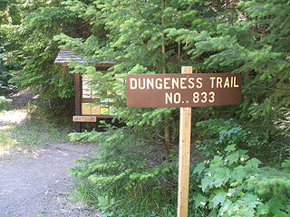 Start to a great hike 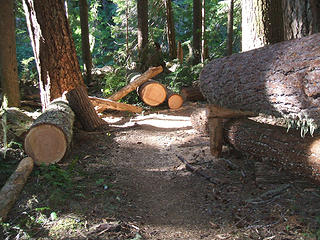 Recent trail work 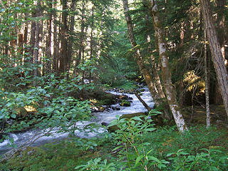 River shot 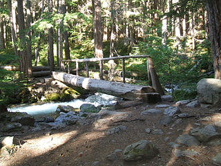 Bridge over the Dungeness River 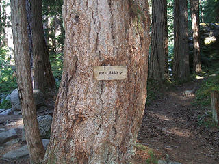 Royal Basin Sign 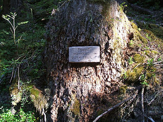 Trail Sign 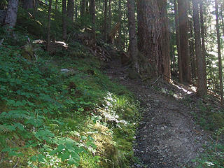 Starting Lower Maynard Burn Trail 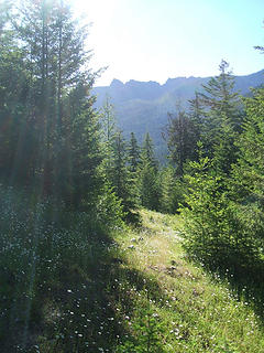 Hiking in flowers 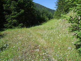 Hiking in the daisies 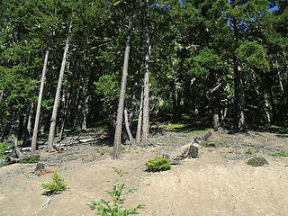 Starting the Upper Maynard Burn Trail (aka HELL) 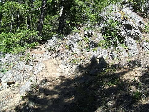 Good trail up to the left 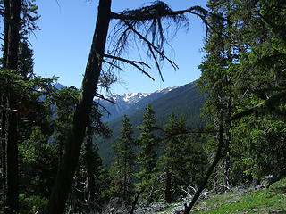 Mountains in the distance 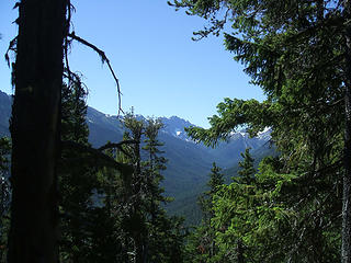 View heading up 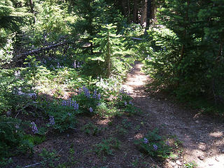 Hiking in blue flowers  It's about 85 degrees  Nervous 1 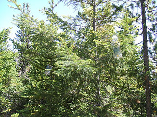 Nervous 2 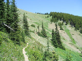 Getting ready to traverse the bowl 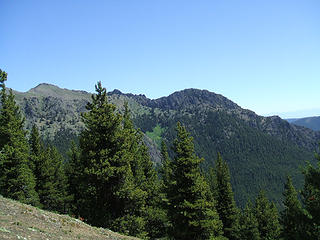 View on the way up 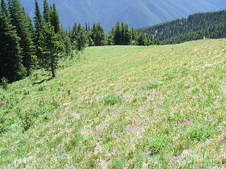 Looking back down the meadow 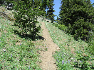 Still heading up 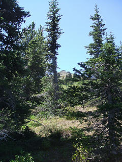 Goal in sight ! 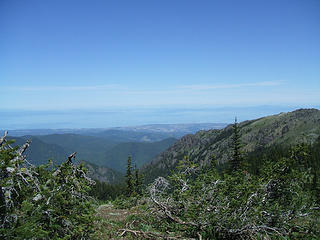 Sequim and Dungeness Spit 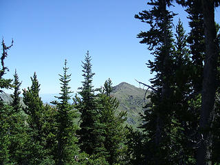 Tyler Peak 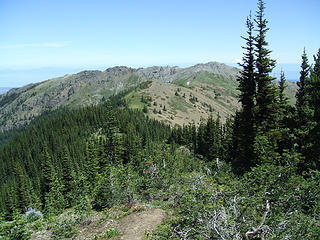 Mt Baker in the distance 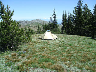 Hullo !!! Anyone home ??? 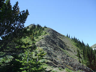 OMG! More Climbing ! 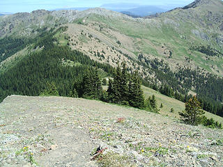 Up the ridge looking back on the little tent  Gray Wolf Peak 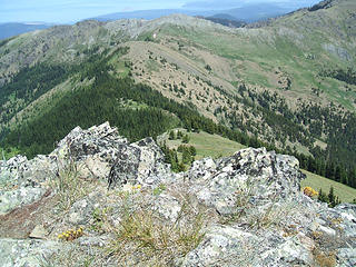 View from the top looking down on the little tent. 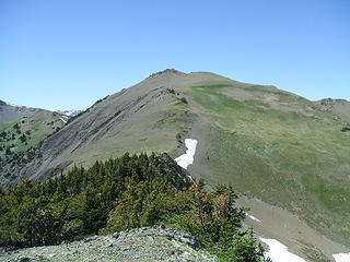 Mt Baldy 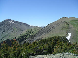 Mt Baldy - Right
Gray Wolf Peak - Left 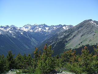 Looking SW 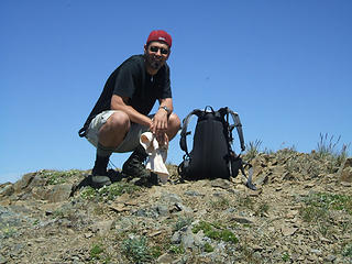 Made it to the top
|
| Back to top |
  
|
|
bobbi
stillaGUAMish

Joined: 13 Jul 2006
Posts: 8012 | TRs | Pics
Location: olympics! |
|
bobbi
stillaGUAMish
|
Mon Jul 14, 2008 9:14 am |
|
|
great job! i was having problems breathing just reading your TR. my hiking buddy has invited me a couple of times....scared  it will probably take me 6+ hours to get to the summit! next time.
btw: are you planning of heading to the lake of the angels soon? also, i'm a former bremertonian! it will probably take me 6+ hours to get to the summit! next time.
btw: are you planning of heading to the lake of the angels soon? also, i'm a former bremertonian!
bobbi ૐ
"Today is your day! Your mountain is waiting. So
get on your way!" - Oh, the Places Youll Go! By Dr. Seuss
bobbi ૐ
"Today is your day! Your mountain is waiting. So
get on your way!" - Oh, the Places Youll Go! By Dr. Seuss
|
| Back to top |
|
|
crabio
Member
Joined: 07 Nov 2007
Posts: 328 | TRs | Pics
Location: Bremerton, WA. |
|
crabio
Member
|
Mon Jul 14, 2008 9:31 am |
|
|
I am planning on getting back up to LOA ... my hiking buddy has never been up there and I want him to see it. I went last year in October. Cold and cloudy up top. I want to go this year later in August. Not sure what condition the Putvin trail is in though after all the storms we had last year.
If I had to rank these 2 hikes next to each other, I think I'd put LOA above this one. LOA is a steep one but not quite as long. There's some scrambling involved with LOA (which I LOVE) and the view of that lake up there nestled in amongst those high peaks is spectacular.
-fellow Bremertonian
|
| Back to top |
|
|
Ancient Ambler
Member

Joined: 15 May 2007
Posts: 1092 | TRs | Pics
Location: Bainbridge Island |
Way to go, crabio. That's a tough trail under any circumstances, but when it's hot out, that trail puts the hurt on, fast. Especially if you start from the lower Maynard Burn section off the Dungeness trail instead of from the spur road. I'm glad you got the payoff for your hard work in the form of perfectly clear skies and great views. You got some great photos, and thanks for sharing them with us. I still have to get up there this year; your report will spur me on.
|
| Back to top |
|
|
summithound
Climbing Connoisseur
Joined: 26 Jul 2004
Posts: 1766 | TRs | Pics
Location: Everett, WA |
|
summithound
Climbing Connoisseur
|
Mon Jul 14, 2008 4:47 pm |
|
|
Nice going crabio.  That's a pretty tough hike. Got one of the worst sunburns of my life up there. When my buddy and I did it, we cheated and shaved a little distance off the the hike by taking the rough access road to the upper Maynard Burn trailhead. That's a pretty tough hike. Got one of the worst sunburns of my life up there. When my buddy and I did it, we cheated and shaved a little distance off the the hike by taking the rough access road to the upper Maynard Burn trailhead.
Pain is just weakness leaving the body.
Pain is just weakness leaving the body.
|
| Back to top |
|
|
cweston
Member

Joined: 24 Jul 2008
Posts: 310 | TRs | Pics
Location: Manhattan, KS (There's no place like home.) |
|
cweston
Member
|
Tue Jul 29, 2008 3:01 pm |
|
|
Funny--my wife and I did that hike many, many years ago, and it was exactly as you describe: steep and hot and dry. When we got to the summit, it was eerily windless. Maybe it's a fluke, or maybe that's how it always is.
|
| Back to top |
|
|
Schmidt Alti-Dude
4th class poster

Joined: 06 Jul 2007
Posts: 1361 | TRs | Pics
Location: Looking for Adventure 201! |
Don't tell me you went all the way to the false summit and didn't do the true summit. Believe me, it takes less time than it looks when you're up there.
Anything stated by me in no way reflects the attitudes or opinions of my wife
Anything stated by me in no way reflects the attitudes or opinions of my wife
|
| Back to top |
|
|
crabio
Member
Joined: 07 Nov 2007
Posts: 328 | TRs | Pics
Location: Bremerton, WA. |
|
crabio
Member
|
Tue Jul 29, 2008 4:07 pm |
|
|
Oh no ... don't say that ! Do you realize that by that one comment I now am already planning to go again ?
I THOUGHT I WAS DONE WITH THAT ONE !!!!!!!!!!!!!!!!!
|
| Back to top |
|
|
|
|


