| Previous :: Next Topic |
| Author |
Message |
huron
Member


Joined: 13 Sep 2004
Posts: 1037 | TRs | Pics
|
|
huron
Member
|
 Mon Jul 14, 2008 12:26 pm |
|
|
For those who are not familiar with it, Russian Butte can be seen as the rugged looking set of crags to the left of Mailbox Peak as you drive East through North Bend on I-90. It was easy to decide to climb Russian Butte, but much harder to find a way to access it in a single day. A route following the Pratt River trail and ascending from the East would be the shortest, but Mesachie convinced Omega and I that the route up the Granite Lakes forest road documented in a single paragraph by Beckey had the advantage of crossing Revolution Peak and a few other points of interest. Taking the road route also provided some additional time margin for the trip since we could walk the road back after dark.
View Larger Map
 This map is interactive! Click, drag, zoom...
How to do this on your post
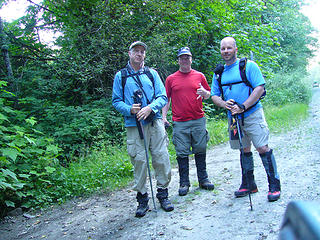
Start time was 6:30am at the trailhead which was a hundred yards West of the Middle Fork bridge. Hikers left to right: Omega, Mesahchie Mark, Magnum. This map is interactive! Click, drag, zoom...
How to do this on your post
Start time was 6:30am at the trailhead which was a hundred yards West of the Middle Fork bridge. Hikers left to right: Omega, Mesahchie Mark, Magnum.
 Before (too tired for an after) 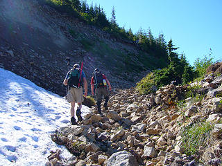 Upper Granite Lakes road 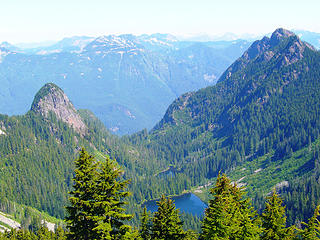 Russian Butte & Gifford Lakes from Southwest 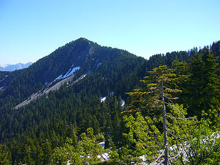 Revolution Peak from Southwest 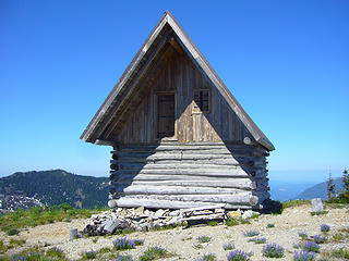 ???? ?????? 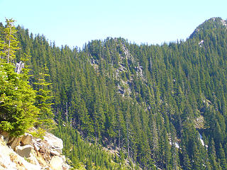 Mind the gap 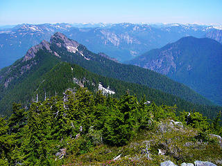 North from Revolution (5454) 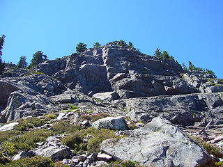 Russian Butte East wall 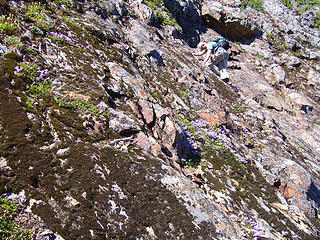 Climbing East wall of center butte 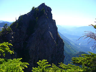 Fin South of summit 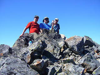 Russian Butte 5,123' 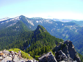 South from Russian Butte Summit 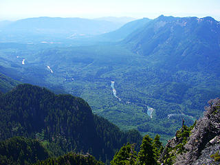 Middle Fork West from Russian Butte Summit 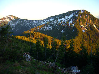 Definace & West Defiance from Northwest
|
| Back to top |
  
|
|
Busta-Hip
will there be bugs?

Joined: 07 Jul 2007
Posts: 9 | TRs | Pics
Location: Sammamish, WA |
|
Busta-Hip
will there be bugs?
|
Mon Jul 14, 2008 12:54 pm |
|
|
Nicely done boys. 
A dream is an answer to a question you havent figured out how to ask - Fox Mulder
A dream is an answer to a question you havent figured out how to ask - Fox Mulder
|
| Back to top |
|
|
Mesahchie Mark
A Lerxst

Joined: 10 May 2005
Posts: 700 | TRs | Pics
Location: In Wonderland |
Thanks for putting together the TR, Mr Magnum!
This was one of the longest day trips I've ever been on, right up there with Sloan and Mesahchie Peak. Omega's sekrit trail start had me thinking about the Steven King story "Mrs Todd's Shortcut".
Wrong way!
Right Way
I had never been up to Granite Lakes before, so it was interesting to see Mailbox, Dirty Harry's, West Defiance and Defiance from a north perspective. Throw Rainier into the mix, and it was almost forgiveable that we were on a logging road!
Rainier peaks out behind W Defiance and the Other Butte
From on the ridge, it was a privelege to spy the Gifford Lakes and Thompson Lake. The latter looked like it could be an awesome camping destination, provided you had a Curtis raft.
Thompson - check out the islands!
Giffords
More to come...
|
| Back to top |
|
|
Randy
Cube Rat

Joined: 18 Dec 2001
Posts: 2910 | TRs | Pics
Location: Near the Siamangs |
|
Randy
Cube Rat
|
Mon Jul 14, 2008 4:18 pm |
|
|
Awesome dudes. I've wanted to do Russian Butte for years. Thanks for the beta!
|
| Back to top |
|
|
Yet
Member

Joined: 23 Apr 2005
Posts: 2634 | TRs | Pics
Location: Happily Ever After |
|
Yet
Member
|
Mon Jul 14, 2008 4:29 pm |
|
|
| Magnum wrote: | | Mesahchie had stashed a few liquid things in a creek on the way up, so we took a break to toast to success. |
You mean like water, gatorade, or V8?
Whatever it takes to quench the thirst!
Busta-Hip, nice to see your post. When will I see you again at a TNAB?
|
| Back to top |
|
|
meandmyaussies
Member

Joined: 01 Nov 2007
Posts: 182 | TRs | Pics
Location: The Quah |
Wow - epic trip, guys! How was the ridge between Revolution and RB? That first section looks a little sketchy. Did you just go up the center section of the butte? The south fin looks pretty hairy.
Congrats on getting it done!
|
| Back to top |
|
|
huron
Member
Joined: 13 Sep 2004
Posts: 1037 | TRs | Pics
|
|
huron
Member
|
Mon Jul 14, 2008 9:31 pm |
|
|
From Thompson to Revolution, we crossed the ridge line which was narrow and steep to either side. It had just a few up and down climbs on rock with one larger climb in the center (shown in photo) that had some exposure on each side. From Revolution, we left the summit to the Northeast down a steep snow slope, then traversed below the ridge at 4500 feet to the base of RB.
|
| Back to top |
|
|
Schmidt Alti-Dude
4th class poster

Joined: 06 Jul 2007
Posts: 1361 | TRs | Pics
Location: Looking for Adventure 201! |
Sweeeeeeeeeeeeeeeeeeeeeeet!
Anything stated by me in no way reflects the attitudes or opinions of my wife
Anything stated by me in no way reflects the attitudes or opinions of my wife
|
| Back to top |
|
|
Magellan
Brutally Handsome

Joined: 26 Jul 2006
Posts: 13116 | TRs | Pics
Location: Inexorable descent |
|
Magellan
Brutally Handsome
|
Tue Jul 15, 2008 12:34 am |
|
|
18 hours!?!? I don't know of anything I can do for 18 hours. You guys  
|
| Back to top |
|
|
runningbird
Member
Joined: 11 Apr 2008
Posts: 31 | TRs | Pics
Location: Mt. Si / Middle Fork |
Hoooo Rah! SO WAY cool - You guys ROCK!!!!!
|
| Back to top |
|
|
wamtngal
Member

Joined: 13 Jun 2004
Posts: 2382 | TRs | Pics
Location: somewhere |
|
wamtngal
Member
|
Tue Jul 15, 2008 8:11 am |
|
|
Excellent guys!
Opinions expressed here are my own.
Opinions expressed here are my own.
|
| Back to top |
|
|
cmurph
Member

Joined: 18 Feb 2006
Posts: 102 | TRs | Pics
Location: Seattle, WA |
|
cmurph
Member
|
Tue Jul 15, 2008 8:39 am |
|
|
Nicely done guys...you are so badass!
|
| Back to top |
|
|
yukon222
Member

Joined: 12 Mar 2007
Posts: 1893 | TRs | Pics
|
|
yukon222
Member
|
Tue Jul 15, 2008 8:48 am |
|
|
18hrs? Whoa. Guess the proposed TNAB trip to Russian Butte from a month or two ago won't be happening.  7,000' of gain with that many miles is definitely a marathon day. Excellent.
  Was the rock climbing mostly Class 3 or a few Class 4 moves in there? How much of the road walking could be ridden on mountain bicycle?
|
| Back to top |
|
|
Yet
Member
Joined: 23 Apr 2005
Posts: 2634 | TRs | Pics
Location: Happily Ever After |
|
Yet
Member
|
Tue Jul 15, 2008 11:20 am |
|
|
| cmurph wrote: | | you are so badass! |
Hee! Colleen, that's what I told Mark, especially in the "gangsta" photo. 
|
| Back to top |
|
|
Mesahchie Mark
A Lerxst
Joined: 10 May 2005
Posts: 700 | TRs | Pics
Location: In Wonderland |
| yukon222 wrote: | | Was the rock climbing mostly Class 3 or a few Class 4 moves in there? How much of the road walking could be ridden on mountain bicycle? |
The scramble definitely felt like a good mix of 3/4, especially early on, 'cause Magnum and I were taking a different route than Omega. After that it mellowed considerably. The whole thing may have seemed harder than it should - I was completely gassed by this point!
I think one could pedal to Granite Lakes no problem. After that, you could use a bike to coast down sections of the road, but you'd have to dismount often for various obstacles and errorsion issues.
|
| Back to top |
|
|
|
|


