| Previous :: Next Topic |
| Author |
Message |
fettster
Member

Joined: 29 Apr 2007
Posts: 182 | TRs | Pics
Location: Hillsboro, OR |
|
fettster
Member
|
 Sun Jun 15, 2008 2:30 pm |
|
|
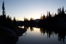
I got back about a week ago from a backpacking trip of the Grand Canyon Rim-to-Rim. I went with friends Rob, Maria, and DavidL. What an extraordinary place! I received some input from members of this site for the trip so thought I would share some of my experience here. It would take a long time to write down all the stories and details from such a trip so I jotted down some notes and highlights from each of the days to share.
June 1 Arrival at Grand Canyon South Rim, spend the night at Yavapai Lodge
I get to view the Canyon for the very first time in person. Daunting to see how deep it is, but am even more flabbergasted how wide it is given we have to get all the way across with our backpacks.
Thrilled and surprised to spot two endangered California Condors soaring nearby on the first time to the Grand Canyon. They glide off the cliff updrafts and end up perching on the South Side as we watch.
I hardly getting any sleep that night. Just too much expectation for the upcoming day I guess.
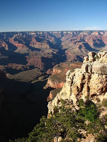 6/1 Daunting view across to Bright Angel Canyon and the North Rim. We have to cross all that, wow! 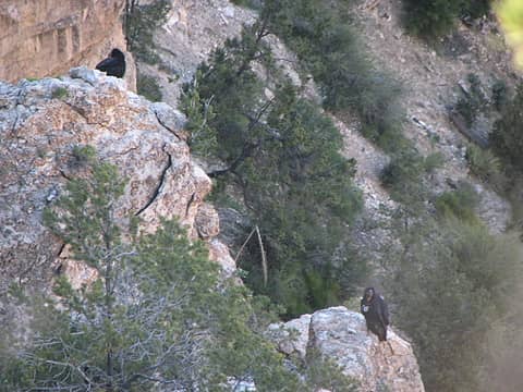 6/1 Perching California Condors 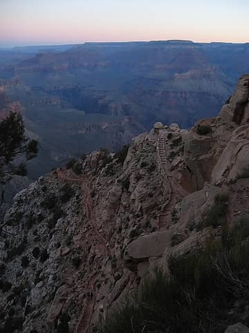 6/2 The Chimney - Photo by RobM 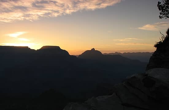 6/2 Sunrise from Ooh Aah Point 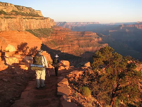 6/2 Bathed in orange 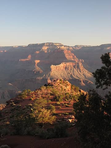 6/2 Cedar Ridge and Cheops Pyramid in background 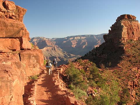 6/2 Approaching O'Neill Butte (right) 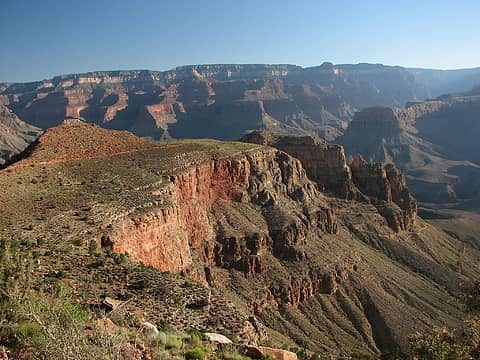 6/2 "The Red and Whites" switchbacks (lower right) 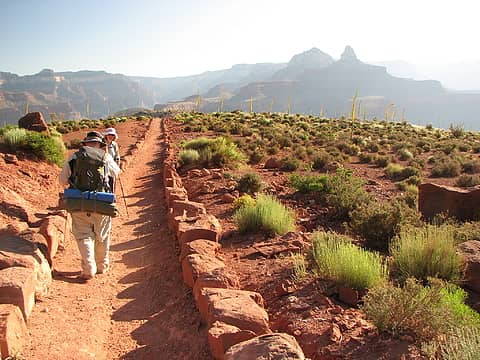 6/2 Utah Agave strike it up 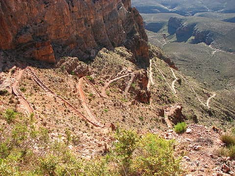 6/2 Oh yes, the switchbacks. 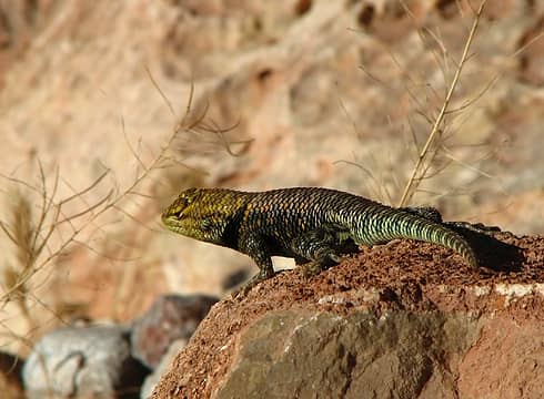 6/2 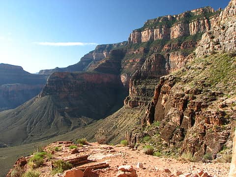 6/2 South Rim gaining height on us. 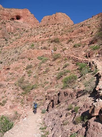 6/2 Maria (bottom), DavidL, and I - Photo by RobM 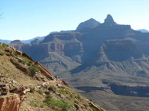 6/2 DavidL, Brahma and Zoroaster Temples 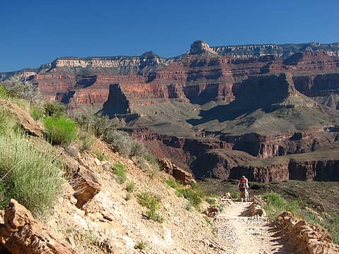 6/2 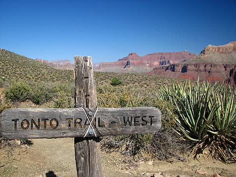 6/2 S. Kaibab Trail Intersection with Tonto Trail 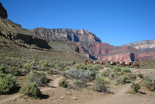 6/2 Mule parade 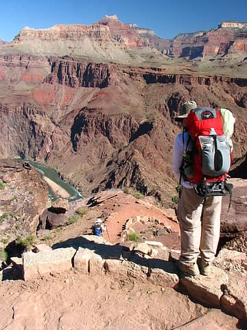 6/2 River edging closer 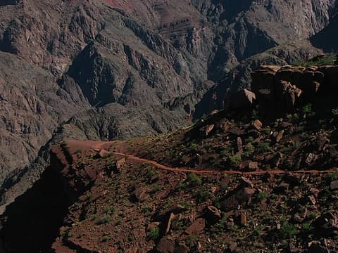 6/2 Traverse through Tapeats Sandstone 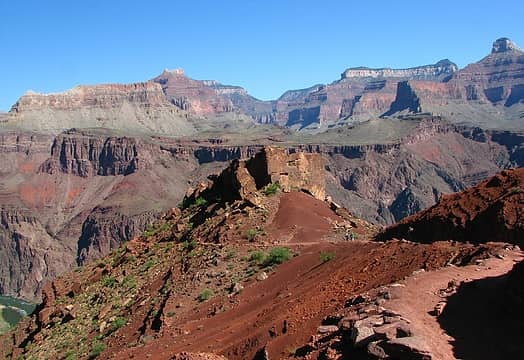 6/2 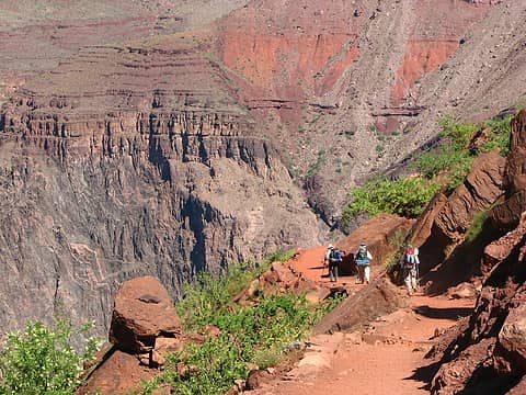 6/2 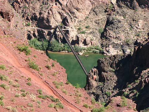 6/2 Kaibab Suspension Bridge 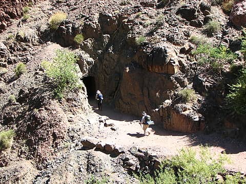 6/2 To the tunnel and bridge 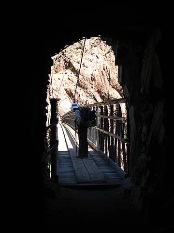 6/2 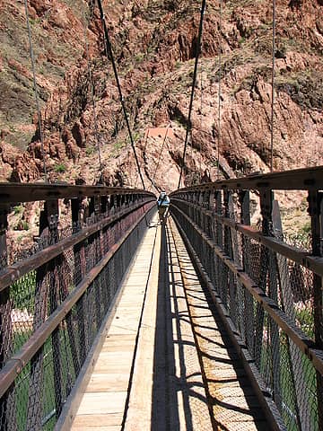 6/2 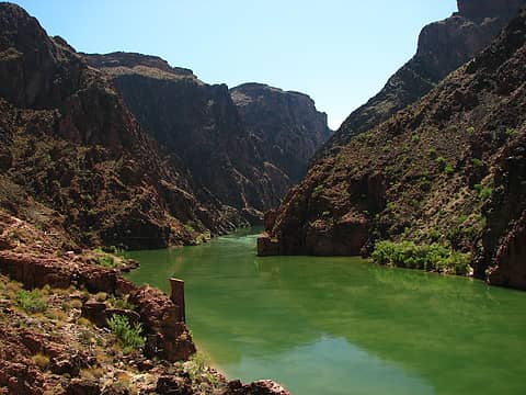 6/2 The green Colorado tanned with sediment flow 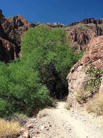 6/2 Cottonwoods and shade at Bright Angel Campground  6/2 Yep, and that's in the shade. 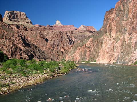 6/2 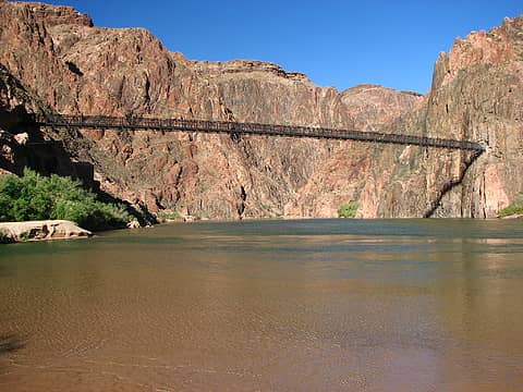 6/2 Kaibab Suspension Bridge from banks of the Colorado 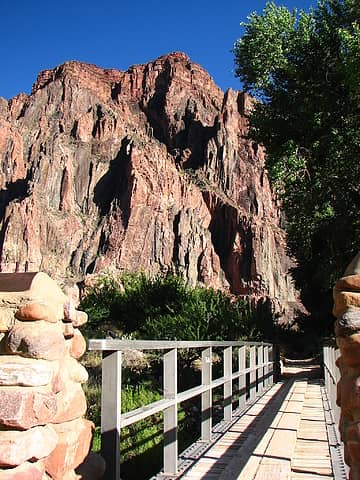 6/2 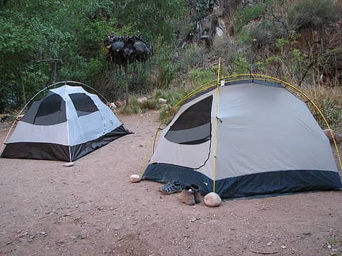 6/2 Camp night 1, Bright Angel Campground 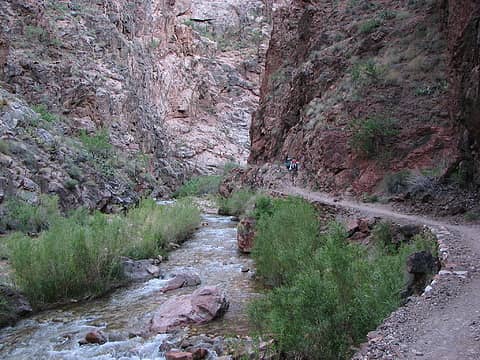 6/3 Tight lower portion Bright Angel Canyon 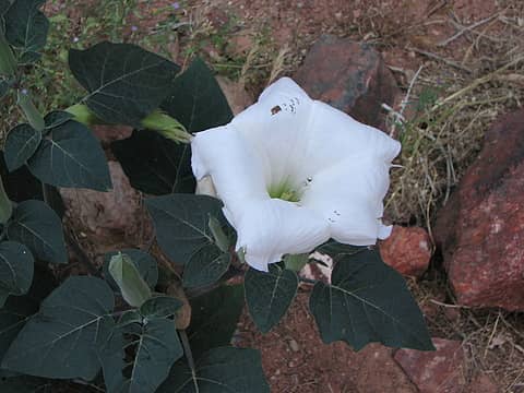 6/3 Datura 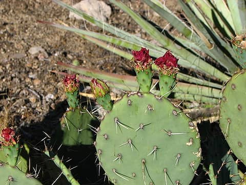 6/3 Prickly Pear 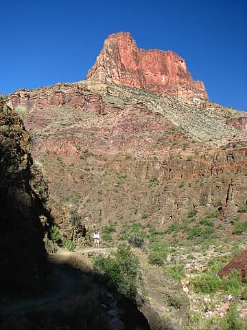 6/3 DavidL and Clement Powell Butte 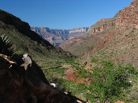 6/3 South Rim in the distance 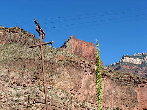 6/3 Historic Telegraph Line 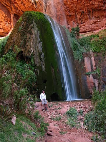 6/3 DavidL and Ribbon Falls 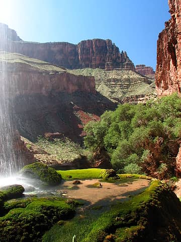 6/3 Mini-pool on top of fall's sedimentary base 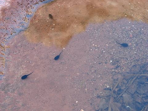 6/3 Tadpoles in desert puddle 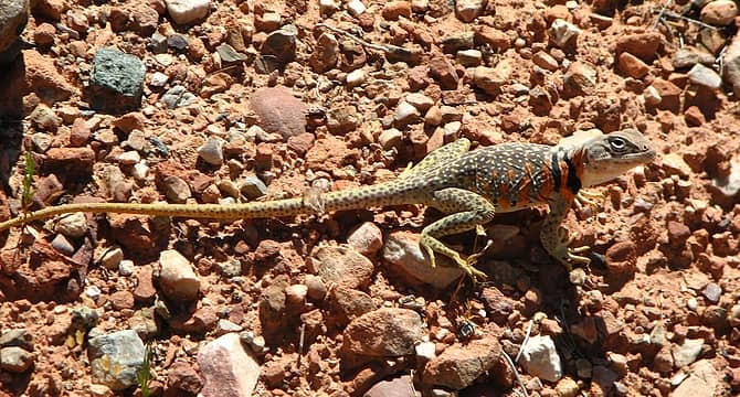 6/3 Great Basin Collared Lizard (a gravid female, i.e. carrying eggs) 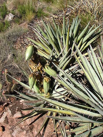 6/3 Banana Yucca 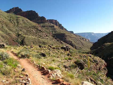 6/3 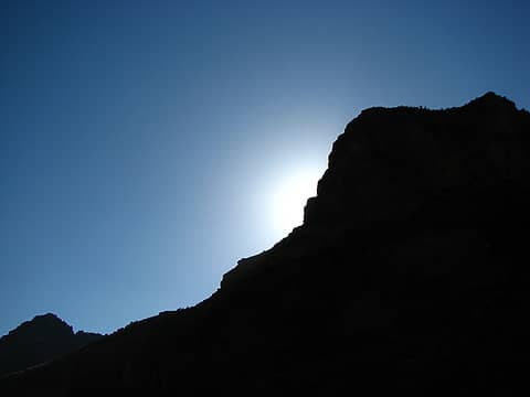 6/3 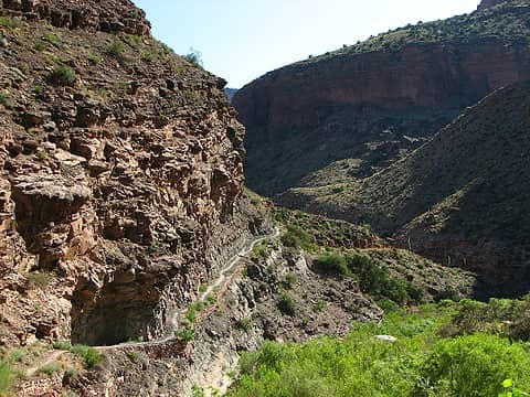 6/3 Trail leading into Cottonwood Camp 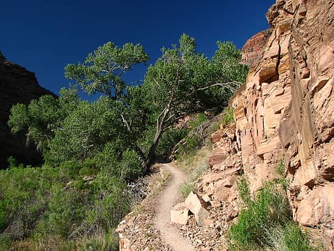 6/3 "Cottonwood", yep, good name for camp 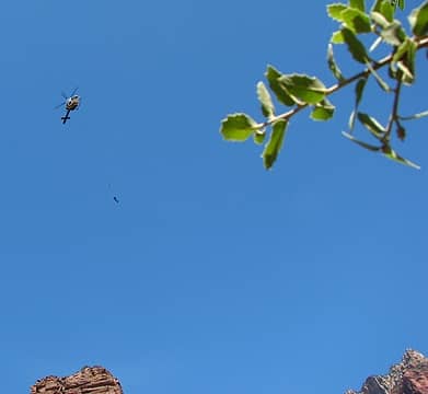 6/3 Park service helicopter at work 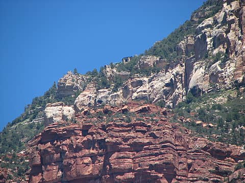 6/3 North Rim Lodge just visible from camp 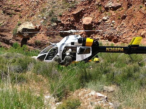 6/3 The easy way out 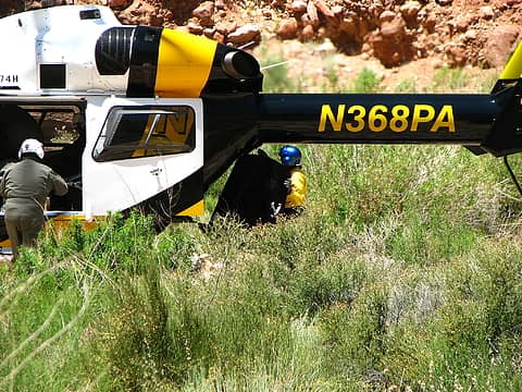 6/3 Load master at work 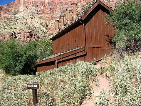 6/3 Spoiled backpackers 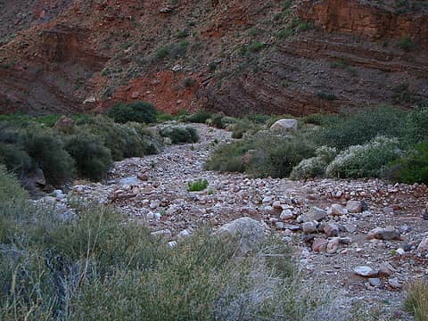 6/3 Evident wash zone 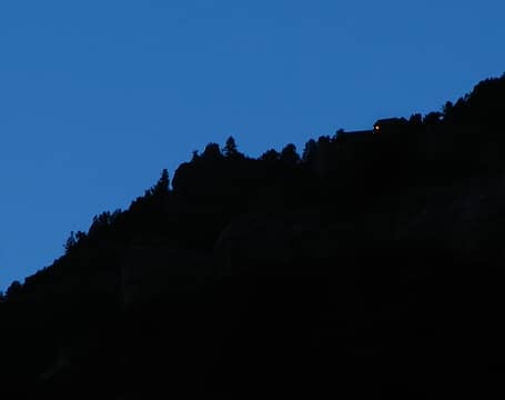 6/3 Taunting light before bedtime 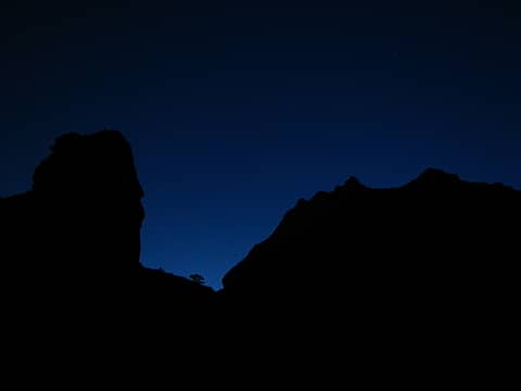 6/3 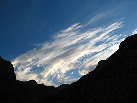 6/4 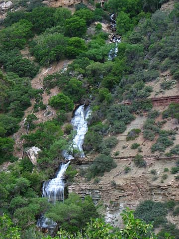 6/4 Roaring Springs 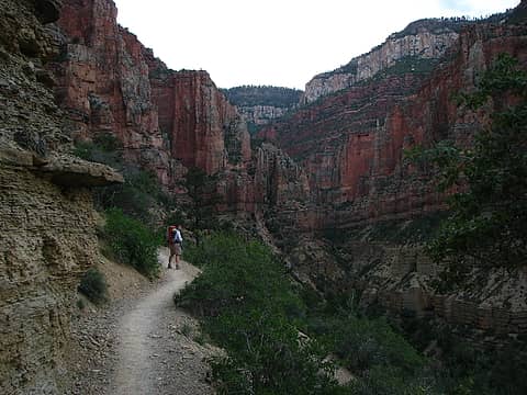 6/4 DavidL, Roaring Springs Canyon 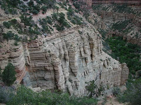 6/4 Watch your step! 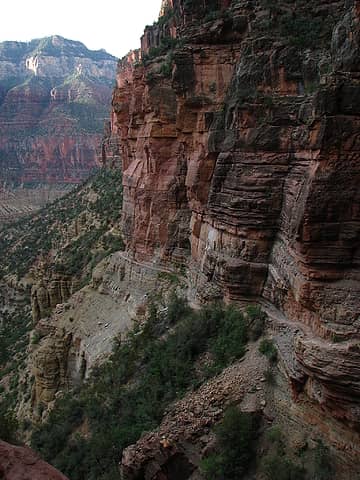 6/4 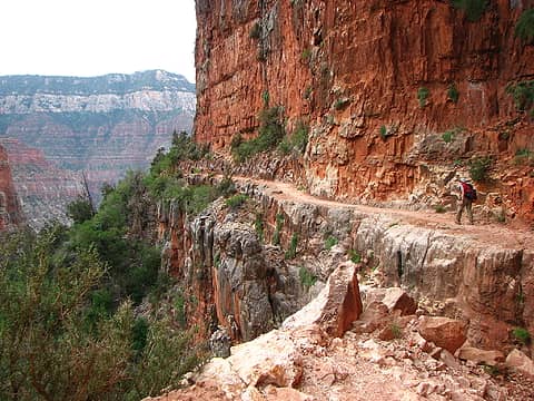 6/4 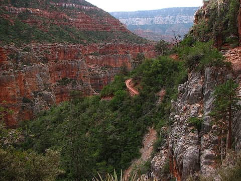 6/4 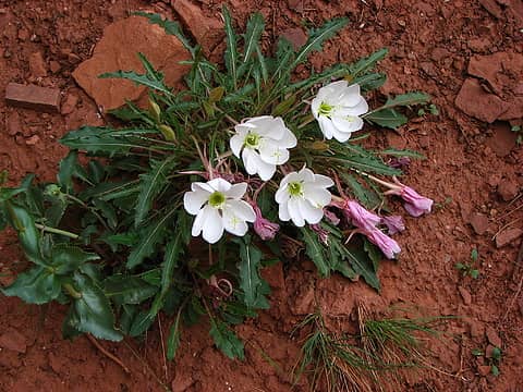 6/4 Primrose 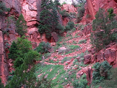 6/4 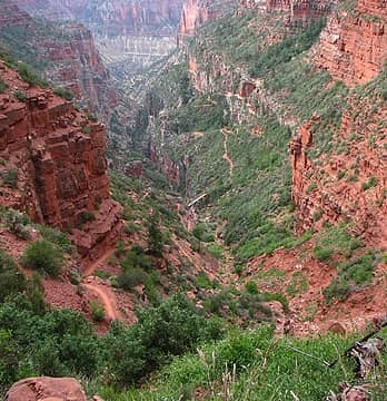 6/4 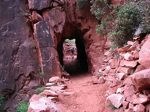 6/4 Supai Tunnel 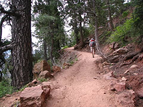 6/4 Noticeably larger vegetation near the top including Ponderosa  6/4 Flaming sunset 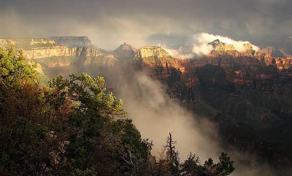 6/4 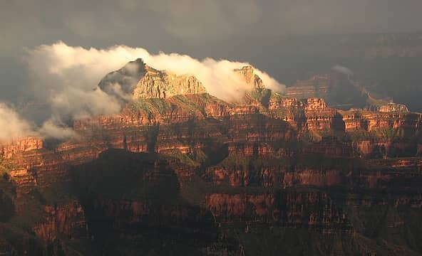 6/4 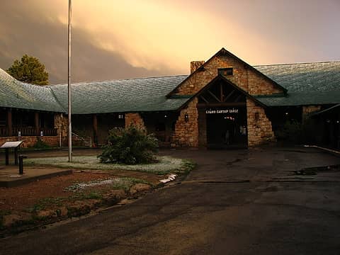 6/4 Da Lodge 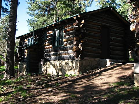 6/4 Da cabin 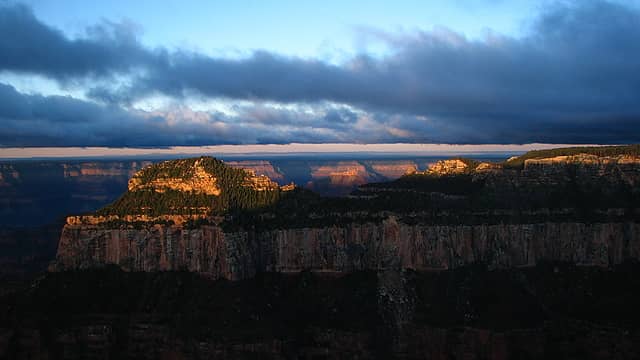 6/5 Beats sleeping in 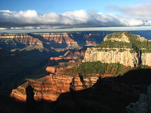 6/5 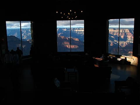 6/5 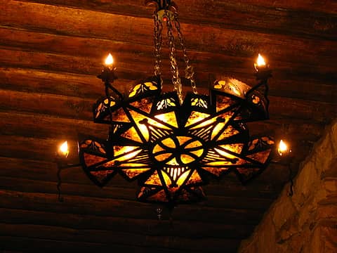 6/4 Lodge chandelier 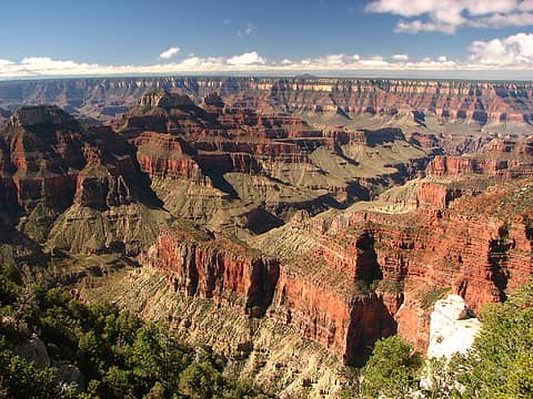 6/5 Bright Angel Canyon 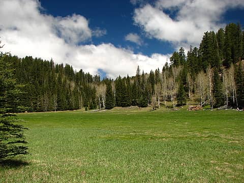 6/5 Harvey Meadow 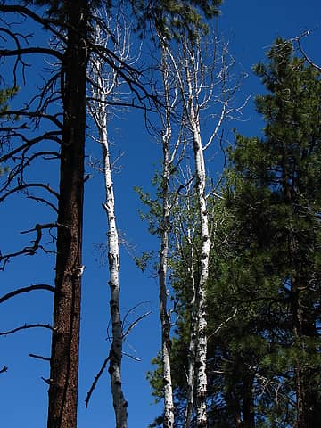 6/5 Aspen 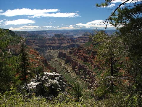 6/5 Transept Canyon 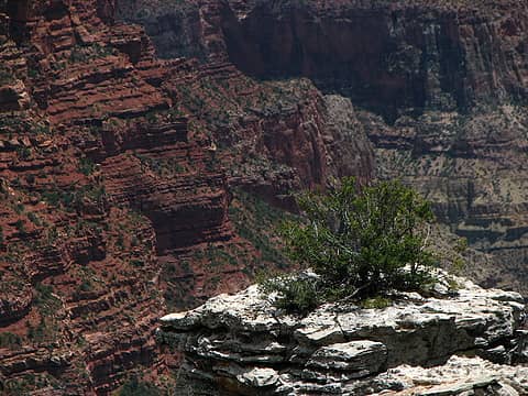 6/5 Pedestal 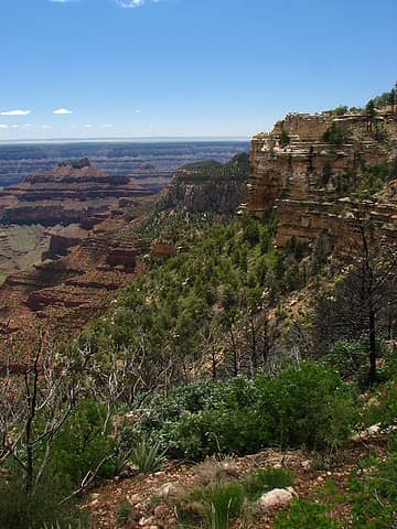 6/5 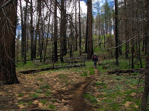 6/5 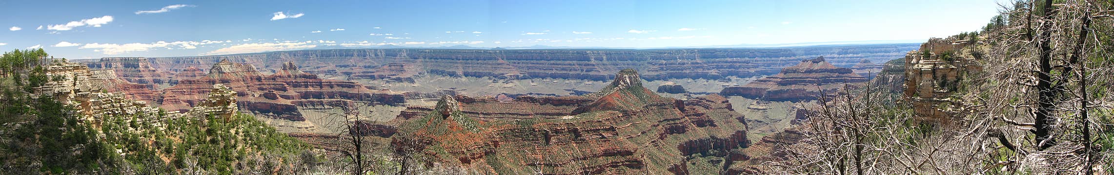 6/5 Widforss Point Overlook 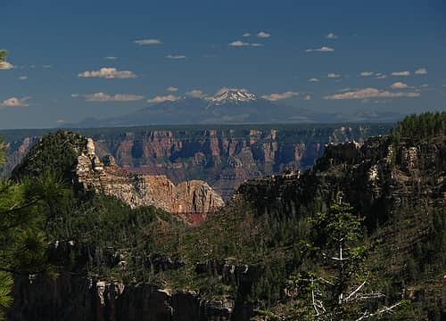 6/5 Mount Humphreys 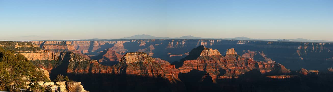 6/5 Last night sunset
|
| Back to top |
  
|
|
More Cowbell
Warrior Princess

Joined: 01 Jul 2006
Posts: 5657 | TRs | Pics
Location: Alive on Earth |
If you want to forget all your other troubles, wear too tight shoes. - Unknown
|
| Back to top |
|
|
raz2sea
Daddy RAZ

Joined: 04 Dec 2007
Posts: 1060 | TRs | Pics
Location: Seattle |
|
raz2sea
Daddy RAZ
|
Sun Jun 15, 2008 2:49 pm |
|
|
|
| Back to top |
|
|
Magellan
Brutally Handsome

Joined: 26 Jul 2006
Posts: 13116 | TRs | Pics
Location: Inexorable descent |
|
Magellan
Brutally Handsome
|
Sun Jun 15, 2008 2:55 pm |
|
|
Wow! What a great trip. I'm glad it was so satisfying for you. The are too many great pictures to single anything out. I am totally surprised at the flowers, meadows, big trees and raging water. From 100+ to blowing snow, sounds like you got it all. Thanks for sharing. 
|
| Back to top |
|
|
Tom_Sjolseth
Born Yesterday

Joined: 30 May 2007
Posts: 2651 | TRs | Pics
Location: Right here. |
Thanks for that treat of a TR!
|
| Back to top |
|
|
tinman
Member

Joined: 08 Oct 2004
Posts: 355 | TRs | Pics
Location: Where it rains, WA |
|
tinman
Member
|
Sun Jun 15, 2008 3:35 pm |
|
|
Wow, my son and I were just talking about doing that trip next spring. What a great trip and trail report. You've sealed it for me, I gotta make some reservations now. What a great variety of weather too.
Thanks
Wherever you go, there you are.......
Wherever you go, there you are.......
|
| Back to top |
|
|
Newt
Short Timer

Joined: 21 Dec 2001
Posts: 3175 | TRs | Pics
Location: Down the road and around the corner |
|
Newt
Short Timer
|
Sun Jun 15, 2008 3:38 pm |
|
|
Excellent TR and Photos. I've never been much impressed with GC photos and never had the desire to go there. You changed my mind. Some of the best I've seen. And a day by day blow to top it off.
Thank you very much.
It's pretty safe to say that if we take all of man kinds accumulated knowledge, we still don't know everything. So, I hope you understand why I don't believe you know everything. But then again, maybe you do.
It's pretty safe to say that if we take all of man kinds accumulated knowledge, we still don't know everything. So, I hope you understand why I don't believe you know everything. But then again, maybe you do.
|
| Back to top |
|
|
Bryan K
Shameless Peakbagger

Joined: 29 Sep 2005
Posts: 5129 | TRs | Pics
Location: Alaska |
|
Bryan K
Shameless Peakbagger
|
Sun Jun 15, 2008 3:44 pm |
|
|
What an amazing area!!! Your pictures are beautiful
|
| Back to top |
|
|
marta
wildflower maven

Joined: 07 May 2003
Posts: 1761 | TRs | Pics
|
|
marta
wildflower maven
|
Sun Jun 15, 2008 4:27 pm |
|
|
Gorgeous photos. I love the clouds over the canyon.
|
| Back to top |
|
|
fettster
Member
Joined: 29 Apr 2007
Posts: 182 | TRs | Pics
Location: Hillsboro, OR |
|
fettster
Member
|
Sun Jun 15, 2008 6:10 pm |
|
|
|
| Back to top |
|
|
goats gone wild
Mr. Goat

Joined: 19 Aug 2007
Posts: 2524 | TRs | Pics
Location: Vampireville |
| fettster wrote: |
6/4 |
WOW, gorgeous!!!
.....leaving me wanting to return over and over in what ever capacity that may be, even if one day my knees are too old and I can only see the mountains from my porch.
Jason Hummel
.....leaving me wanting to return over and over in what ever capacity that may be, even if one day my knees are too old and I can only see the mountains from my porch.
Jason Hummel
|
| Back to top |
|
|
fettster
Member
Joined: 29 Apr 2007
Posts: 182 | TRs | Pics
Location: Hillsboro, OR |
|
fettster
Member
|
Sun Jun 15, 2008 6:27 pm |
|
|
| Magellan wrote: | | From 100+ to blowing snow, sounds like you got it all. |
It was fun listening in on the many rim tourists reporting back to others on cellphone the next day.
"We got 5 inches of snow last night!"
"We had a blizzard here!"
Nowhere near that, probably a quarter or half inch of the stuff, but we still would've been in sorry shape had we been stuck in tents that night with no sleeping bags and no rain fly.
|
| Back to top |
|
|
Magellan
Brutally Handsome
Joined: 26 Jul 2006
Posts: 13116 | TRs | Pics
Location: Inexorable descent |
|
Magellan
Brutally Handsome
|
Sun Jun 15, 2008 11:18 pm |
|
|
Allright, I will agree with GWG. That picture is da bomb!
|
| Back to top |
|
|
fettster
Member
Joined: 29 Apr 2007
Posts: 182 | TRs | Pics
Location: Hillsboro, OR |
|
fettster
Member
|
Mon Jun 16, 2008 7:18 am |
|
|
| raz2sea wrote: | | Those pictures of the fog lifting off the canyon walls are just stunning and so unexpected. |
I don't recall who it was but I overheard someone that evening saying the heat of the inner Canyon was pushing the fog and clouds of the system up out of the Canyon, and the wind out of the west finished the effect creating the plumes off the rocky faces. Very amazing and thrilling to witness in person.
|
| Back to top |
|
|
Canuck
Member
Joined: 05 Jun 2006
Posts: 2137 | TRs | Pics
Location: Lacey WA |
|
Canuck
Member
|
Mon Jun 16, 2008 7:40 am |
|
|
|
| Back to top |
|
|
|
|
You cannot post new topics in this forum
You cannot reply to topics in this forum
You cannot edit your posts in this forum
You cannot delete your posts in this forum
You cannot vote in polls in this forum
|
Disclosure: As an Amazon Associate NWHikers.net earns from qualifying purchases when you use our link(s). |


