| Previous :: Next Topic |
| Author |
Message |
Bloated Chipmunk
Cock Rock Searcher


Joined: 29 Jan 2007
Posts: 2993 | TRs | Pics
Location: Margaritaville |
For several years I have wanted to bag this peak after first catching a glimpse from the nearby Meeks Table.  For whatever reason I never got around to tagging it until now. I searched high & low but found very little info on the route, usually only a mention of the peak as a reference from those who climbed a nearby peak like Mt. Aix. My Greentrails map shows trails along the west and south sides which would make for a long trek on foot, but nothing from the east which would clearly be the shortest distance from a forest road. For whatever reason I never got around to tagging it until now. I searched high & low but found very little info on the route, usually only a mention of the peak as a reference from those who climbed a nearby peak like Mt. Aix. My Greentrails map shows trails along the west and south sides which would make for a long trek on foot, but nothing from the east which would clearly be the shortest distance from a forest road.  So, I decided what I'd do was park at the gate @ the end of road 1502, start up trail 982, then continue west off-trail once 982 turned south & headed downhill, eventually attaining the SE ridge of the butte & taking it up to the summit. Evidently my idea didn't seem too hair-brained as Todd & MountainMan agreed to be adventurous with me. So, I decided what I'd do was park at the gate @ the end of road 1502, start up trail 982, then continue west off-trail once 982 turned south & headed downhill, eventually attaining the SE ridge of the butte & taking it up to the summit. Evidently my idea didn't seem too hair-brained as Todd & MountainMan agreed to be adventurous with me.  Due to the long drive just to reach this stretch of the William O. Douglas wilderness area in combination with an unknown route, we opted to make it an overnighter - make camp somewhere just below the SE ridge & then have a light hike from there to the summit. Thankfully, everything pretty much went as planned.
  Todd & I left Seattle @ the ass crack of dawn & met MountainMan in Kent, @ which point we piled into his big ass truck & headed out on hwy. 410 over Chinook Pass. Todd was happy to see more of the views from the pass, as our last trip had 10' snowbanks & thick fog.
  We stopped for a few pics & continued east. We counted giant roadside ant hills & before long we reached the turn that leads us through many miles of forest road before finally putting us @ the appropriate trailhead. We stopped for a few pics & continued east. We counted giant roadside ant hills & before long we reached the turn that leads us through many miles of forest road before finally putting us @ the appropriate trailhead.
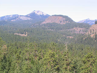 Nelson Butte beckons us. The lovely Meeks Table in the foreground. 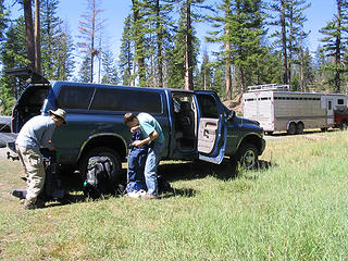 Preparing to depart 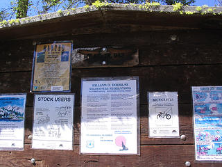 Trailhead sign, though we didn't follow this trail very long  Todd had a bit of an issue making it under one ill-placed fallen tree. Todd had a bit of an issue making it under one ill-placed fallen tree. 
 Todd @ the "Gateway Rocks" 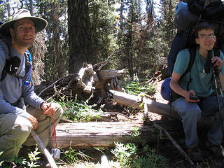 MountainMan & Todd take a quick break from the bushwhacking 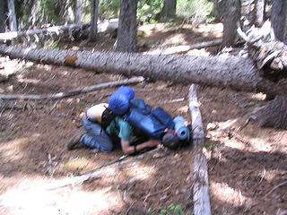 Todd has a mishap trying to get underneath this tree 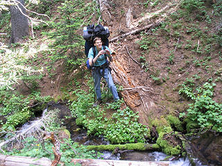 Todd @ creek crossing 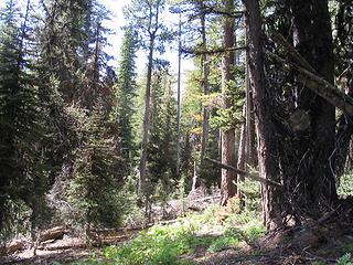 Nelson Butte is visible through the trees  We angled south a bit & eventually found a flattish spot a bit uphill from a creek crossing, just before the hillside steepened. We angled south a bit & eventually found a flattish spot a bit uphill from a creek crossing, just before the hillside steepened.
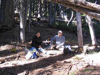
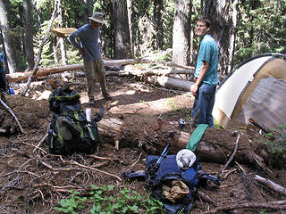 MountainMan & Todd @ camp 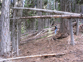 Todd hoists up the bear bags 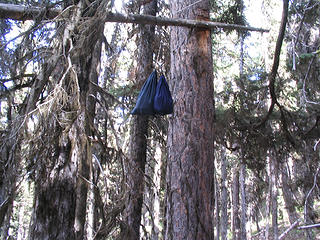 Bear bags 
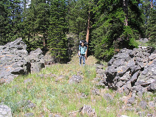
 Vague trail up SE ridge 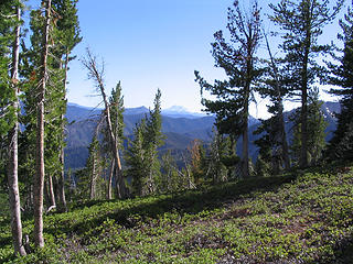 Mt. Adams is visible from SE ridge 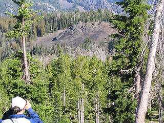 MountainMan photographs funky lava rock-like spikes below 
 Looks like a scramble! 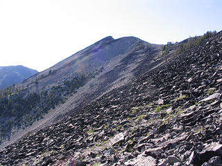 Partway up the first rock scramble 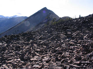 Nelson Butte 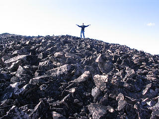 Todd atop false/east summit 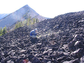 MountainMan photographs minty plants...Nelson Butte true summit behind 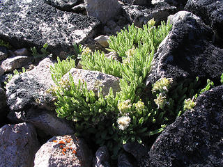 Minty smelling plans amongst the rocks 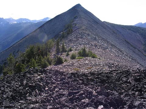 The home stretch  Other than that small detail, it was easy going. Other than that small detail, it was easy going. 
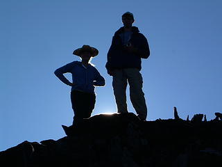
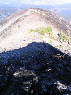 Looking back @ false/east summit, Todd in the shadows 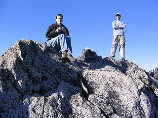 Todd & MountainMan atop summit of Nelson Butte 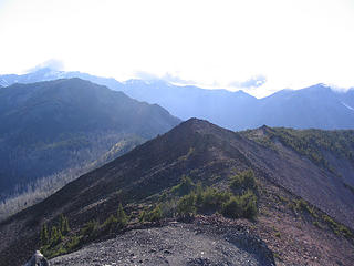 Mt. Rainier 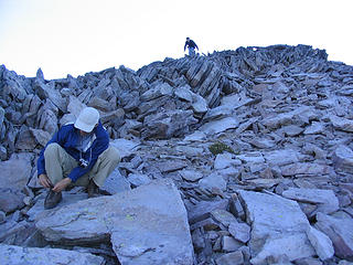 The loose rock near the summit 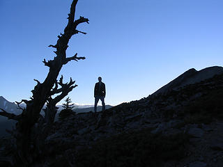 Todd's silhouette @ Nelson Butte @ right  The next morning Todd & MM took some shots of the sunrise filtering through the trees, then we all tried getting a few more winks. A couple hrs. later we were all up & eating b'fast. Todd decided to do something interesting to his egg.
 Todd & MountainMan having b'fast 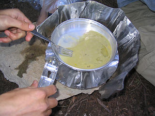 Todd tries mixing Merlot w/eggs 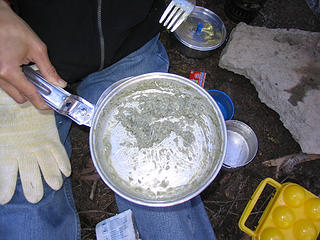 This is how it turned out 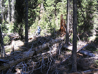 Bushwhacking 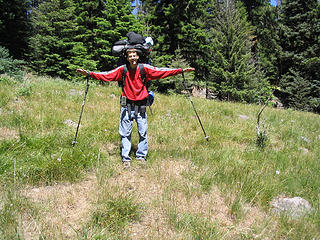 Todd in one of the meadow fields 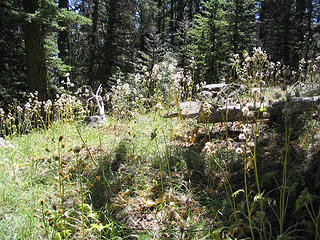 Fluffy buds in the sunlight 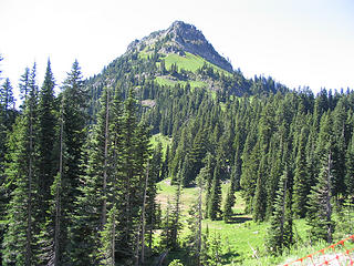 Yakima Pk. 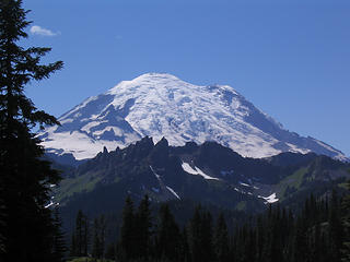 Mt. Rainier 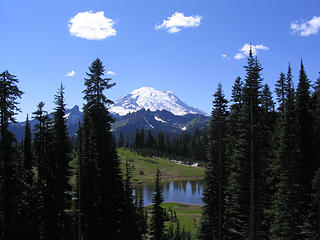 Mt. Rainier & Tipsoo Lk.
Home is where the hiking is.
"Peaks that have come and gone four times should halt a man in his steps." -- William O. Douglas
A balanced diet is a margarita in each hand.
Home is where the hiking is.
"Peaks that have come and gone four times should halt a man in his steps." -- William O. Douglas
A balanced diet is a margarita in each hand.
|
| Back to top |
  
|
|
David¹
Token Canadian

Joined: 25 Jul 2002
Posts: 3040 | TRs | Pics
Location: The Great White North |
|
David¹
Token Canadian
|
 Sun Aug 03, 2008 8:46 pm |
|
|
Someone needs to introduce Todd to ultralight backpacking. My knees & back ache just looking at those pics.
Looks like you had fun 
|
| Back to top |
|
|
bobbi
stillaGUAMish

Joined: 13 Jul 2006
Posts: 8012 | TRs | Pics
Location: olympics! |
|
bobbi
stillaGUAMish
|
Sun Aug 03, 2008 9:01 pm |
|
|
now how did todd go boom? great TR and photos.
it's amazing that i have no idea of the names of mtns/pks of the cascades or any of the eastern trails.
one day, i'll make it over there. still too many trails in the olympics to conquer!
bobbi ૐ
"Today is your day! Your mountain is waiting. So
get on your way!" - Oh, the Places Youll Go! By Dr. Seuss
bobbi ૐ
"Today is your day! Your mountain is waiting. So
get on your way!" - Oh, the Places Youll Go! By Dr. Seuss
|
| Back to top |
|
|
EastKing
Surfing and Hiking

Joined: 28 Mar 2007
Posts: 2082 | TRs | Pics
Location: 77 miles from Seattle! |
|
EastKing
Surfing and Hiking
|
Sun Aug 03, 2008 10:11 pm |
|
|
Looked like a fun trip. Good TR and photos. I headed up Rock Mountain which was a rockin good time. Nelson Butte looks like a must visit!! Glad everything went well!!
YouTube | SummitPost
Saw the depths of despair. Now I am salvaging what time I have left on Earth.
YouTube | SummitPost
Saw the depths of despair. Now I am salvaging what time I have left on Earth.
|
| Back to top |
|
|
Bloated Chipmunk
Cock Rock Searcher
Joined: 29 Jan 2007
Posts: 2993 | TRs | Pics
Location: Margaritaville |
Here are a few of Todd's photos:
 Glowing hikers 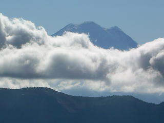 Rainier on top of clouds 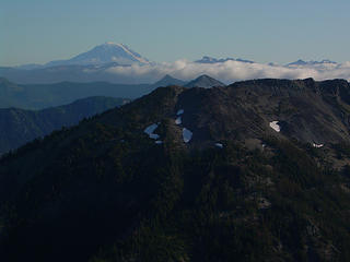 Clouds approaching Adams 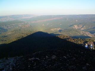 Nelson Butte's shadow 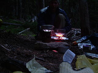 Late night dinner 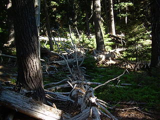 Forest morning
Home is where the hiking is.
"Peaks that have come and gone four times should halt a man in his steps." -- William O. Douglas
A balanced diet is a margarita in each hand.
Home is where the hiking is.
"Peaks that have come and gone four times should halt a man in his steps." -- William O. Douglas
A balanced diet is a margarita in each hand.
|
| Back to top |
|
|
MountainMan
Member

Joined: 15 Jul 2008
Posts: 365 | TRs | Pics
Location: San Diego |
I just want to start off by saying Fran(B.C.) deserves most of the credit for the success of this trip. As she already said, she's wanted to go here for a long time. She planned the route from trailhead, to camp site, to summit. We stuck very close to the plan and it turned out just about as well as anyone could expect.
From forest road 1502 I got some great shots of our destination and also some interesting rock formations.
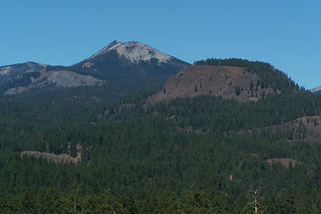 Nelson Butte and Meeks table 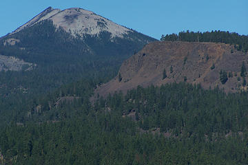 Nelson Butte and Meeks table 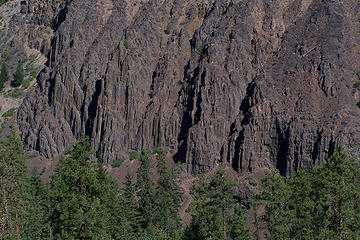 On the way to Nelson Butte 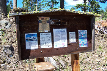 Trailhead 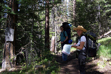 Looking at the map. About to enter the William O Douglas Wilderness 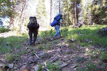 just left the trail  where we came up 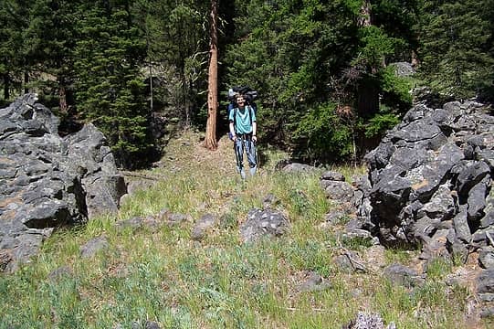 rock gateway 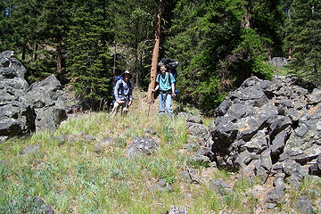 rock gateway 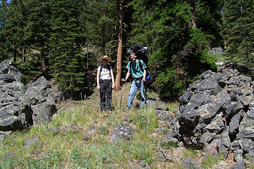 rock gateway 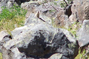 one of the elusive chipmonks 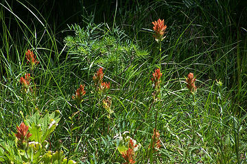 orange flowers 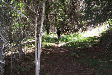 headed up the trail 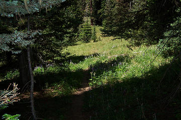 meadow 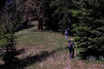 BC and Todd in the meadow 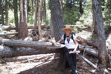 bushwacking 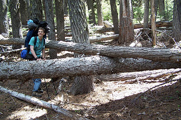 bushwacking 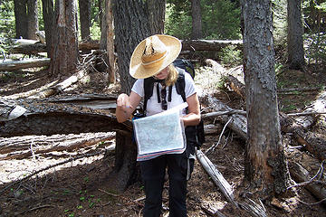 checking the map 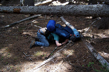 trouble getting under the tree... 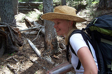 BC watching Todd trying to get under the tree. 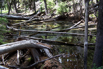 mosquito pond 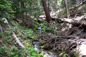 crossing a small stream 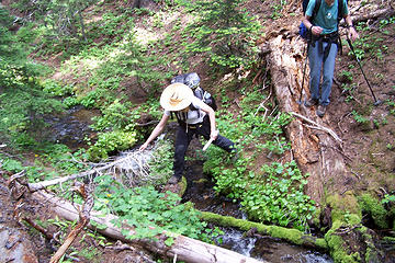 crossing a small stream 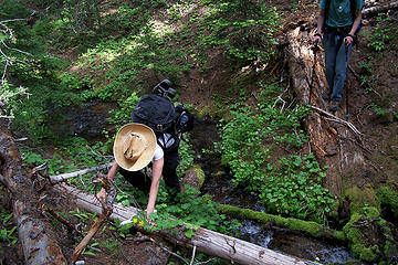 crossing a small stream  Finally, a glimpse of Nelson Butte 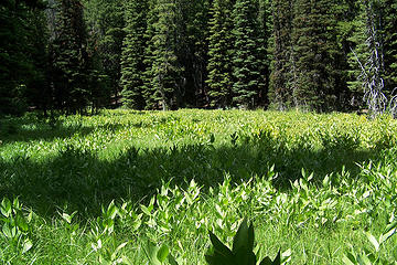 marshy area 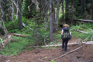 about to cross second stream 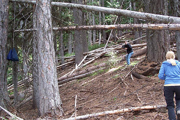 raising the bear bag  our campsite from the tent 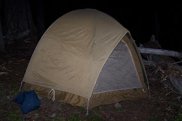 the one semi flat spot in the area 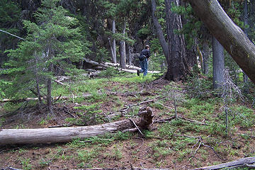 starting up for the summit 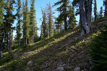 near the top of first ridge 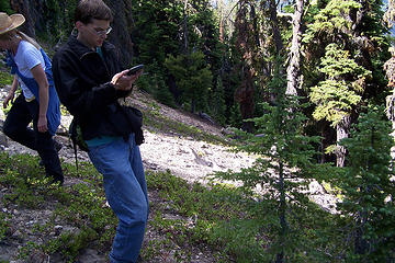 Todd marking a point on the GPS. 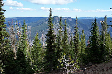 starting to get a view 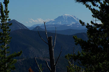 Mount Adams 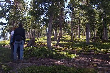 BC & Todd looking at the way up 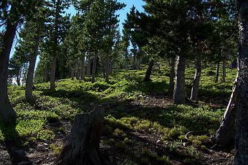 looking up the first ridge 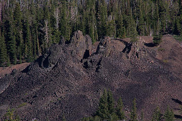 lava cones 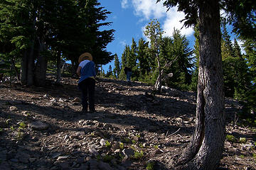 BC and Todd headed up the first ridge 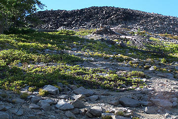 approaching the rocks 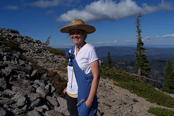 BC at the edge of the rock field 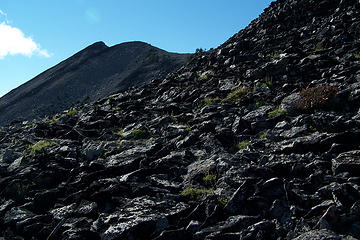 first view of the summit 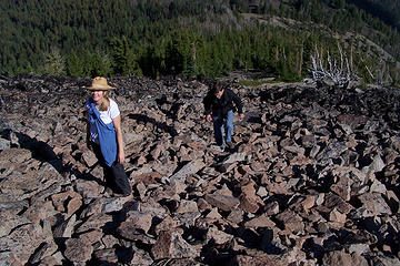 headed up the rocks 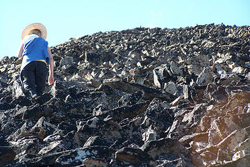 headed up the rocks 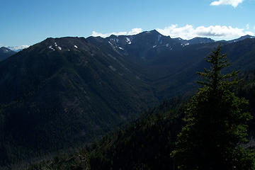 East side of Mt Aix 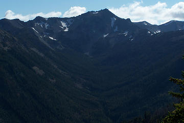 East side of Mt Aix 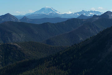 Mt Adams 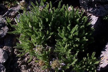 interesting plant, smells minty 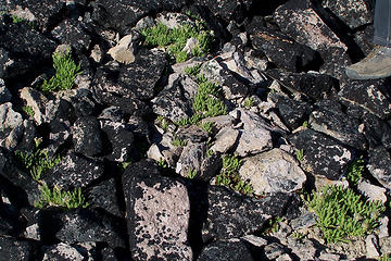 minty plants in the rocks 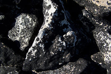 black lichen on the rocks 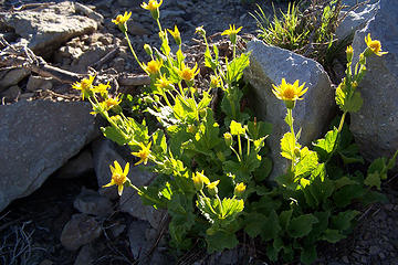 yellow flowers 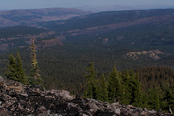 Meeks Table(left) and Devils Table 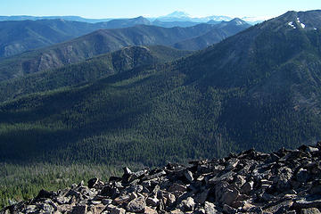 the view 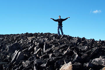 Todd posing 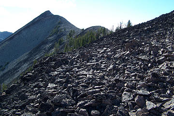 getting closer 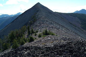 the final ridge from lower peak 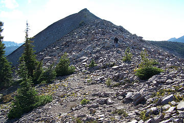 headed up the ridge 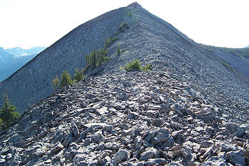 headed up the ridge 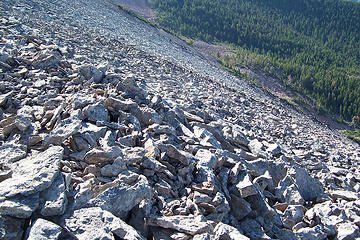 looking down from the ridge 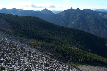 looking down from the ridge 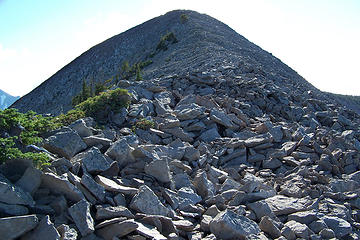 headed up the ridge 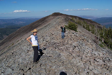 looking back along the ridge 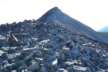 summit is in site 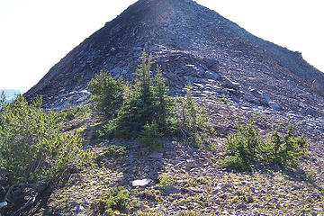 coming to the last part 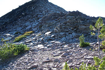 the way up to the summit 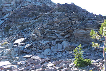 rock formations 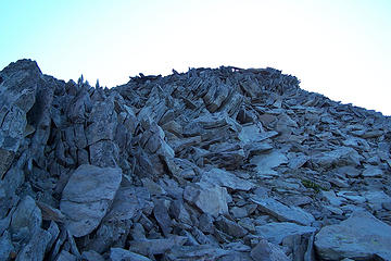 the way up to the summit 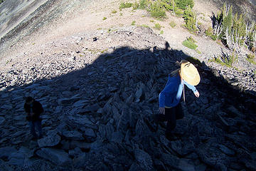 climbing up 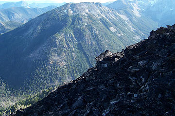 views approaching summit 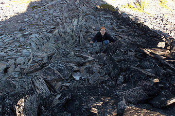 Todd 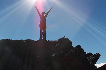 BC is first to the summit 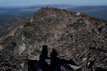 our shadows, looking east 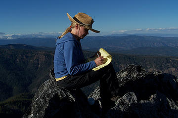 signing the summit register 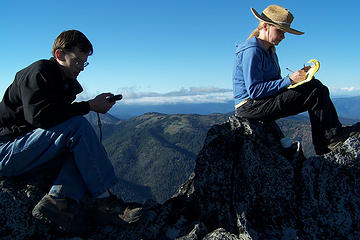 Todd and BC on the summit 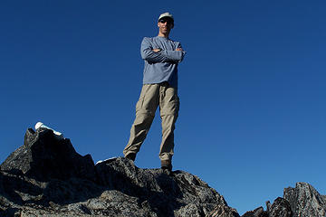 me on the summit 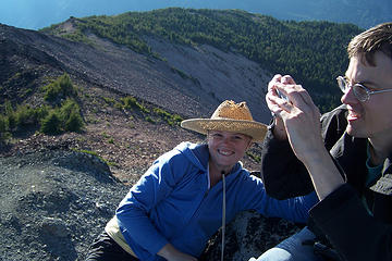 Summit 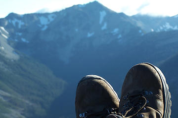 boots on Nelson Butte 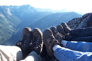 our boots on Nelson Butte 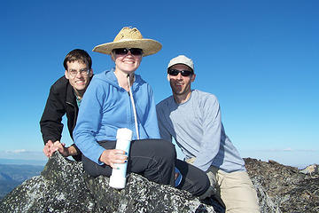 Nelson Butte Summit group photo 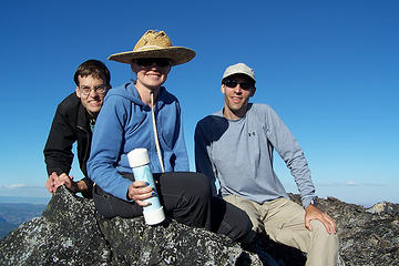 Nelson Butte Summit group photo 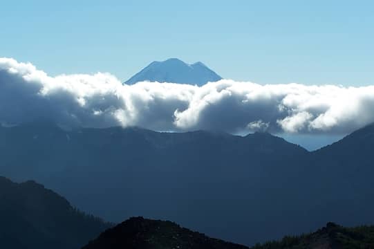 Mt Rainier 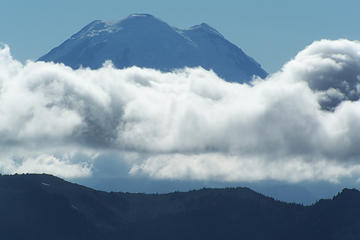 Mt Rainier 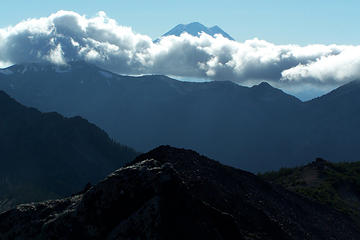 Mt Rainier 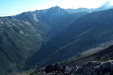 Mt Aix 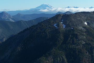 Mt Adams 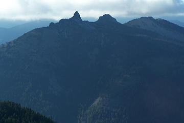 view to the north west 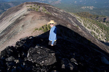 BC headed back down 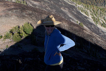 The tongue shot 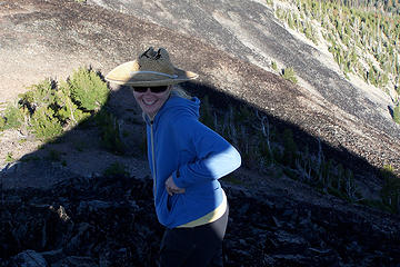 BC laughing 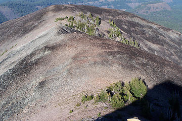 on the way down 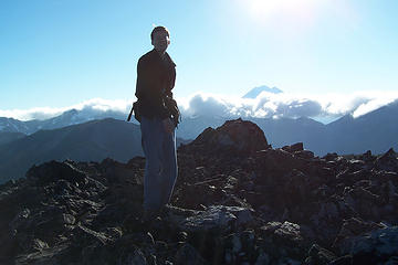 Todd about to leave the summit 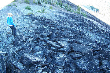 on the way down 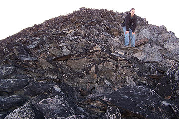 on the way down  BC peeking over a rock  BC holding on 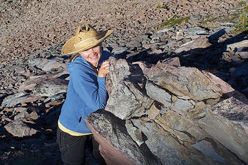 BC holding on 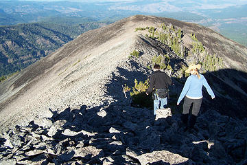 on the way down 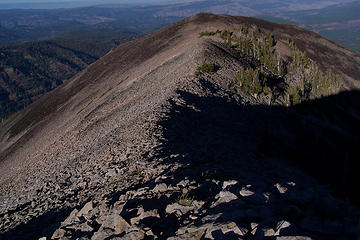 on the way down 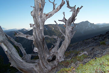 dead tree 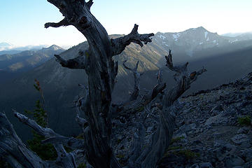 dead tree 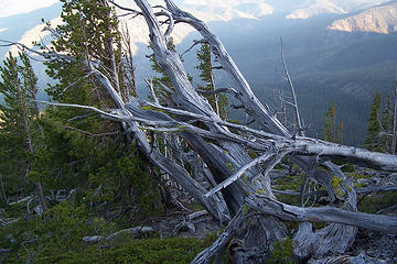 dead tree 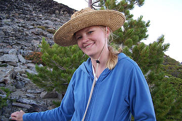 BC 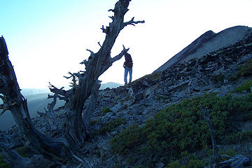 Todd taking pictures 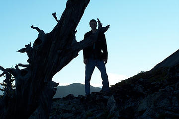 Todd silhouetted 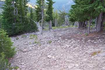 headed down the lower ridge 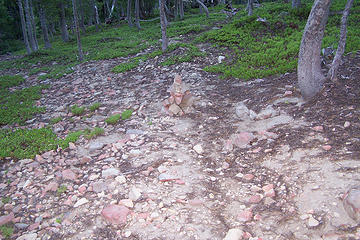 marker, time to turn left 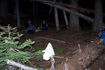 having dinner 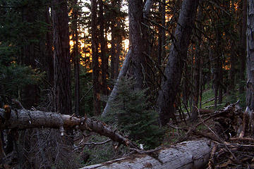 sunrise from the tent 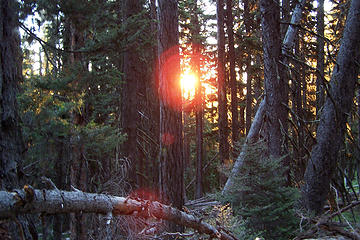 sunrise 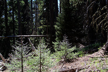 a clearing on the way back 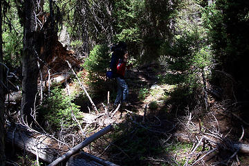 Todd 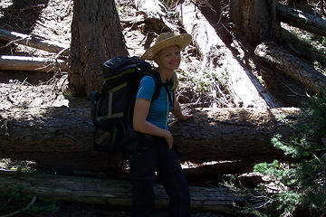 BC 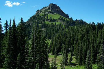 Yakima Peak from Chinook Pass 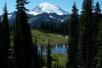 Mt Rainier from Chinook Pass 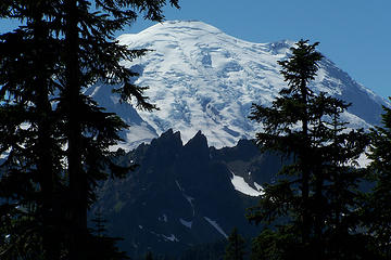 Mt Rainier from Chinook Pass
Slow down, take notice, savor the moment, appreciate the world around you and everything that you have.
Slow down, take notice, savor the moment, appreciate the world around you and everything that you have.
|
| Back to top |
|
|
EastKing
Surfing and Hiking
Joined: 28 Mar 2007
Posts: 2082 | TRs | Pics
Location: 77 miles from Seattle! |
|
EastKing
Surfing and Hiking
|
Thu Aug 07, 2008 6:29 am |
|
|
Good pictures MountainMan!!! Looks like a good time.
YouTube | SummitPost
Saw the depths of despair. Now I am salvaging what time I have left on Earth.
YouTube | SummitPost
Saw the depths of despair. Now I am salvaging what time I have left on Earth.
|
| Back to top |
|
|
tigermn
Member

Joined: 10 Jul 2007
Posts: 9242 | TRs | Pics
Location: There... |
|
tigermn
Member
|
Thu Aug 07, 2008 8:24 am |
|
|
Where is "Nelson Butte"? Which ridge/direction from Aix?
|
| Back to top |
|
|
yukon222
Member

Joined: 12 Mar 2007
Posts: 1893 | TRs | Pics
|
|
yukon222
Member
|
Thu Aug 07, 2008 8:34 am |
|
|
It's been a few years since I've been there, but when you crest the main ridge after all those ascending switchbacks (approx 6800' elev), Aix is in front of you to the East. Directly to your left/North is the Nelson Ridge. Nice ridge rambling out there.
|
| Back to top |
|
|
MountainMan
Member
Joined: 15 Jul 2008
Posts: 365 | TRs | Pics
Location: San Diego |
| yukon222 wrote: | | It's been a few years since I've been there, but when you crest the main ridge after all those ascending switchbacks (approx 6800' elev), Aix is in front of you to the East. Directly to your left/North is the Nelson Ridge. Nice ridge rambling out there. |
I think you ment to say Nelson Butte is in front of you to the east, because Aix is west and slightly south of Nelson.
Slow down, take notice, savor the moment, appreciate the world around you and everything that you have.
Slow down, take notice, savor the moment, appreciate the world around you and everything that you have.
|
| Back to top |
|
|
Bryan K
Shameless Peakbagger

Joined: 29 Sep 2005
Posts: 5129 | TRs | Pics
Location: Alaska |
|
Bryan K
Shameless Peakbagger
|
Thu Aug 07, 2008 10:35 am |
|
|
|
| Back to top |
|
|
MountainMan
Member
Joined: 15 Jul 2008
Posts: 365 | TRs | Pics
Location: San Diego |
Slow down, take notice, savor the moment, appreciate the world around you and everything that you have.
|
| Back to top |
|
|
tigermn
Member
Joined: 10 Jul 2007
Posts: 9242 | TRs | Pics
Location: There... |
|
tigermn
Member
|
Thu Aug 07, 2008 10:34 pm |
|
|
| MountainMan wrote: | | yukon222 wrote: | | It's been a few years since I've been there, but when you crest the main ridge after all those ascending switchbacks (approx 6800' elev), Aix is in front of you to the East. Directly to your left/North is the Nelson Ridge. Nice ridge rambling out there. |
I think you ment to say Nelson Butte is in front of you to the east, because Aix is west and slightly south of Nelson. |
Found it on the map ~ 3.16 miles 51.87 degrees (NE) from Aix....
|
| Back to top |
|
|
EastKing
Surfing and Hiking
Joined: 28 Mar 2007
Posts: 2082 | TRs | Pics
Location: 77 miles from Seattle! |
|
EastKing
Surfing and Hiking
|
Thu Aug 07, 2008 10:43 pm |
|
|
Great videos MountainMan!!!
YouTube | SummitPost
Saw the depths of despair. Now I am salvaging what time I have left on Earth.
YouTube | SummitPost
Saw the depths of despair. Now I am salvaging what time I have left on Earth.
|
| Back to top |
|
|
|
|


