| Previous :: Next Topic |
| Author |
Message |
Joey
verrry senior member


Joined: 05 Jun 2005
Posts: 2799 | TRs | Pics
Location: Redmond |
|
Joey
verrry senior member
|
 Sun Jul 20, 2008 5:52 pm |
|
|
This hike features a portion of the County Line trail in the Teanaway that receives extremely little use despite offering a spectacular ridge-run thru flower meadows and past weathered snags. The views, of course, are non-stop. No doubt one reason that the County Line trail heading NEly from Miller Peak toward Little Navaho is almost unknown amongst hikers is that it does not appear on the Enchantment Lakes 7.5 quad. Yet faint tread does exist for most (not all) of the way from the Miller Peak trail until shortly before the Little Navaho summit. Those who enjoy the challenge of following faint tread while watching for the occasional blaze or other trail sign, should consider adding this trip to their wanna-do list.
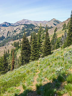 Tread of County Line trail. Distant peak on left with snow is Earl. Triangle peak near right side is Little Navaho. 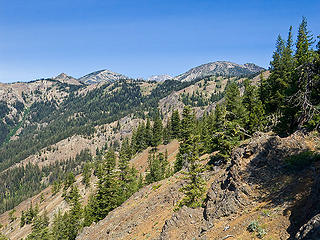 First glimpse of the County Line trail route. L to R is Little Navaho, (Big) Navaho, The Brothers. 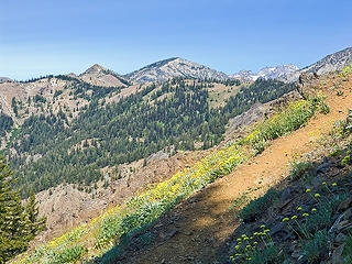 Miller Peak trail. Little Navaho and (Big) Navaho in background. 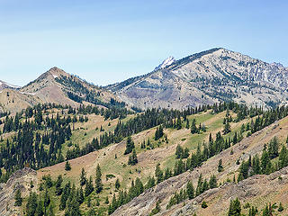 Little Navaho and (Big) Navaho. Top of Stuart in background. County Line trail runs along the ridge from right to left. 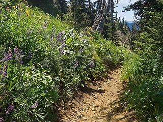 Miller Peak trail 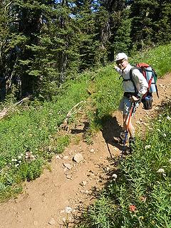 Junction of Miller Peak trail and County Line trail heading northwest. 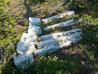 These are stashed in the saddle between Little Navaho and (Big) Navaho. There are various piles and collections. Note the serial numbers. Que es? Trail markers? County boundary war? 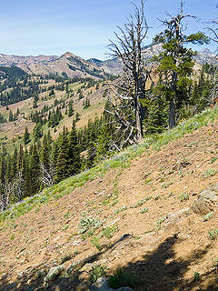 Tread of County Line trail. Little Navaho on skyline to left. 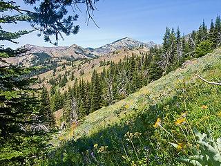 Along the County Line trail. Main peak in background is (Big) Navaho. 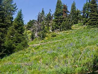 View uphill from County Line trail. 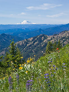 Rainier 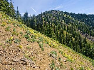 Looking back toward Miller Peak. Yes, that is the faint tread of the County Line trail in the lower center of the pic. 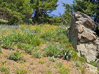 View uphill from County Line trail 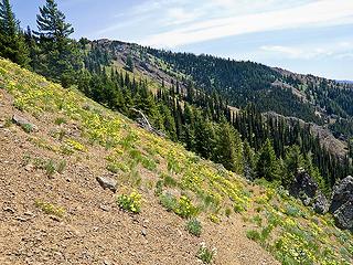 Standing in County Line trail (see the tread in lower right?) and looking back along the way we just hiked. 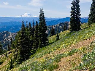 Rainier 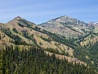 Little Navaho and (Big) Navaho. 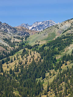 Enchantments and saddle between (Big) Navaho amd The Brothers 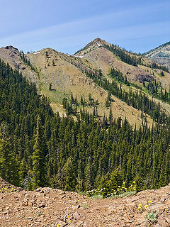 Little Navaho is a bit to right of center. 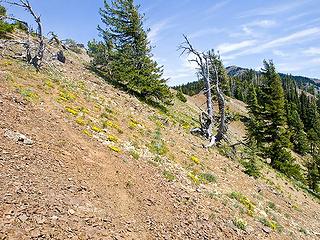 Looking back toward the last hunters' camp on the ridge. 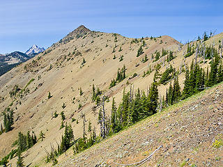 Little Navaho. The trail does a climbing traverse of this slope until it fades away a bit short of the ridge crest and summit. 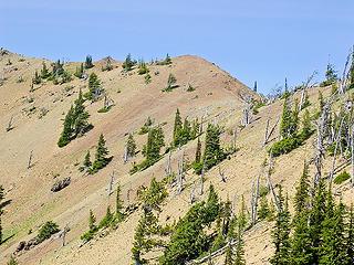 County Line trail passes a bit below the red bump. See the tread? 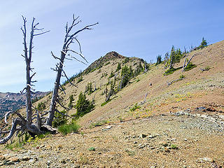 Look close to see Chuck on the County Line trail approaching Little Navaho. 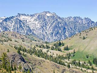 Enchantments as seen thru the pass between (Big) Navaho on left an The Brothers on the right. 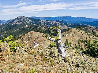 Looking back. Miller Peak on left. 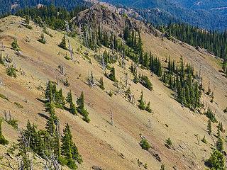 Looking back. See the trail? It's in the upper left of the pic. 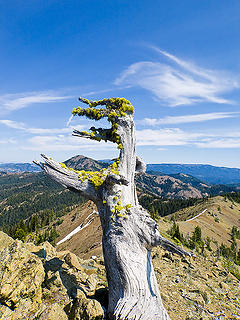 Looking back. Miller Peak embraced by snag. 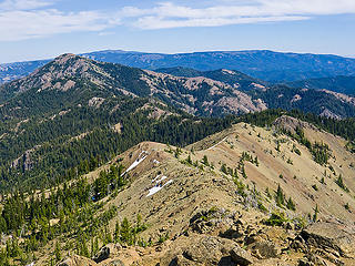 Looking back. Miller Peak on left. 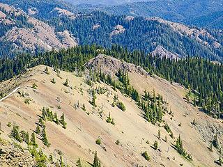 Looking back. The trail crosses near the base of the rock rib (middle right of pic) and then does a climbing traverse of this slope. 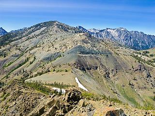 (Big) Navaho from the summit of Little Navaho. 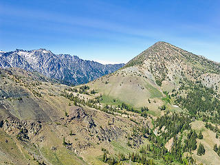 The Brothers (on the right) from summit of Little Navaho. 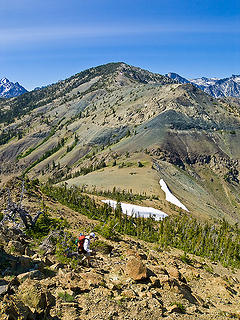 Chuck descending from Little Navaho summit to saddle 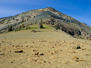 Saddle between Little Navaho and (Big) Navaho looks like a moonscape. 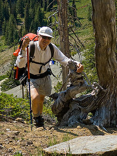 Maiden in the woods?
|
| Back to top |
  
|
|
yukon222
Member

Joined: 12 Mar 2007
Posts: 1893 | TRs | Pics
|
|
yukon222
Member
|
Mon Jul 21, 2008 5:10 pm Re: County Line trail - Miller Peak to Little Navaho 7-17-20
|
|
|
That is some excellent ridge walking. Love the views from there. Thanks for the detailed trail info! I like this pic quite a bit.
| Joey wrote: | Looking back. Miller Peak embraced by snag. |
|
| Back to top |
|
|
mgd
Member

Joined: 27 May 2003
Posts: 3143 | TRs | Pics
Location: Full Moon Saloon |
|
mgd
Member
|
Mon Jul 21, 2008 5:13 pm |
|
|
|
| Back to top |
|
|
wamtngal
Member

Joined: 13 Jun 2004
Posts: 2382 | TRs | Pics
Location: somewhere |
|
wamtngal
Member
|
Mon Jul 21, 2008 7:03 pm |
|
|
Great report, very detailed. I'm quite interested in the County Line Trail and have gotten to be more so after being on different sections over time, most recently over by Lake Ann. Do you or anyone else have a map of the entire trail or has anyone bothered to create a GPS map like Joey? PM me, if so, I'd love to do the whole original trail at some point...if it's possible.
Opinions expressed here are my own.
Opinions expressed here are my own.
|
| Back to top |
|
|
Joey
verrry senior member
Joined: 05 Jun 2005
Posts: 2799 | TRs | Pics
Location: Redmond |
|
Joey
verrry senior member
|
Mon Jul 21, 2008 8:31 pm |
|
|
Sorry wamtngal, this is the only section that I have mapped. Hopefully someone else can shed light on other lesser-traveled portions.
|
| Back to top |
|
|
|
|
You cannot post new topics in this forum
You cannot reply to topics in this forum
You cannot edit your posts in this forum
You cannot delete your posts in this forum
You cannot vote in polls in this forum
|
Disclosure: As an Amazon Associate NWHikers.net earns from qualifying purchases when you use our link(s). |


