| Previous :: Next Topic |
| Author |
Message |
Tim Hagan
Member


Joined: 22 Jul 2008
Posts: 189 | TRs | Pics
Location: Bellevue, WA |
Our party of three decided to attempt puzzlr's Mount Kent loop in the reverse direction.
We had no problem finding and ascending the road described in his account. We noticed the same evidence of previous visitors along the way.
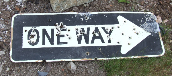 This sign became meaningful for us later when we realized that, no matter how bad the going got, going forward would be much easier than returning the way we had come. 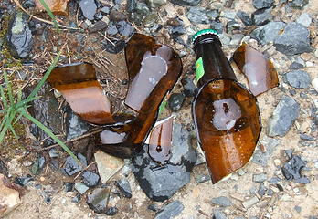 An inadvertent sacrifice to the mountain gods. 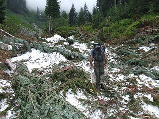 Avalanche debris in upper Alice Creek. 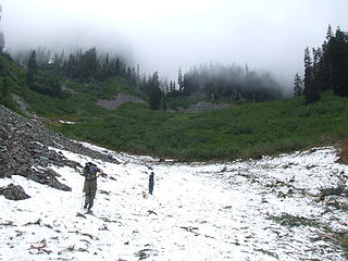 Heading towards thick brush ... 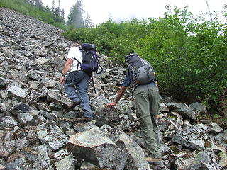 ... and talus.  The final pitch. 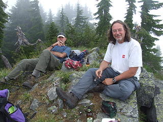 Relaxing on the summit of Mt Kent. 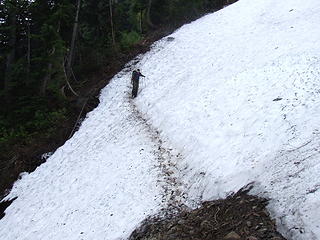 Crossing one of the snow chutes on the McClellan Butte trail. 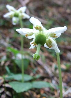 Wood nymphs (Moneses uniflora) are pretty common along the McClellan Butte trail. 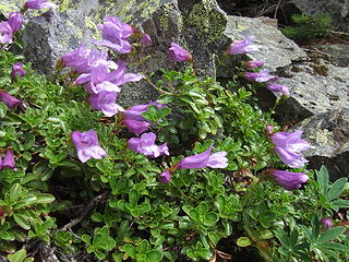 Davidson's penstemon (Penstemon davidsonii var. menziesii) near the summit of Mt Kent.
|
| Back to top |
  
|
|
puzzlr
Mid Fork Rocks

Joined: 13 Feb 2007
Posts: 7220 | TRs | Pics
Location: Stuck in the middle |
|
puzzlr
Mid Fork Rocks
|
 Sun Jul 27, 2008 2:42 pm |
|
|
Wow, most of the snow has melted out since I was there. Were the Alice Lakes melted out?
|
| Back to top |
|
|
wildernessed
viewbagger

Joined: 31 Oct 2004
Posts: 9275 | TRs | Pics
Location: Wenatchee |
You'd have thought puzzlr would have packed out his trash ! 
Living in the Anthropocene
Living in the Anthropocene
|
| Back to top |
|
|
Tim Hagan
Member
Joined: 22 Jul 2008
Posts: 189 | TRs | Pics
Location: Bellevue, WA |
| puzzlr wrote: | | Wow, most of the snow has melted out since I was there. Were the Alice Lakes melted out? |
The talus was snow free, which made for some tedious climbing, but it went pretty quickly. One reason we did the route in reverse was because we knew there would be few glissades (if any).
We could hardly see Alice Lakes through the fog but they appeared to be melted out. There was still a lot of snow in the basin surrounding the lakes though. GPS was a great help in finding the road since we couldn't see a dang thing.
|
| Back to top |
|
|
Tim Hagan
Member
Joined: 22 Jul 2008
Posts: 189 | TRs | Pics
Location: Bellevue, WA |
| wildernessed wrote: | | You'd have thought puzzlr would have packed out his trash ! |
That was our trash, not his! It blended in quite nicely with all the other trash up there.
|
| Back to top |
|
|
|
|


