| Previous :: Next Topic |
| Author |
Message |
Tim Hagan
Member


Joined: 22 Jul 2008
Posts: 189 | TRs | Pics
Location: Bellevue, WA |
Our party of four climbed Web Mountain (5335 ft) on West Defiance Ridge. We ascended the Ira Spring trail to Mason Lake.
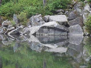 Mason Lake reflection. 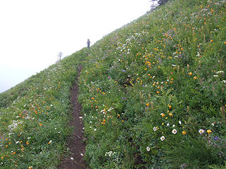 Mt Defiance trail. 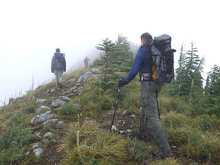 On West Defiance Ridge. 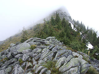 On West Defiance Ridge. 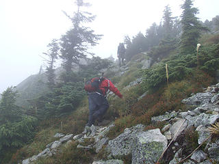 On West Defiance Ridge. 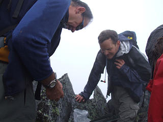 Inspecting the contents of the Geo-cache on the summit of Web Mountain. 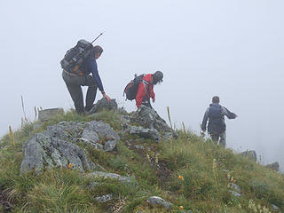 Oops, wrong ridge, guys. 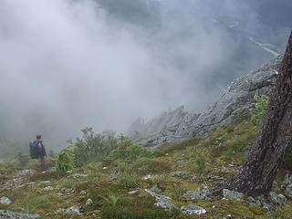 Can't see a thing, so this must be the way. 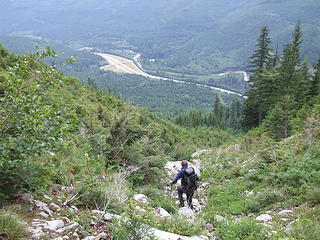 Oh yeah, this looks better. 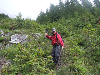 Almost down. 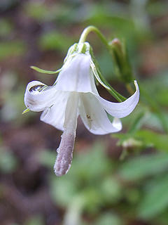 Scouler's Harebell (Campanula scouleri) on the Ira Spring trail.  Dripping wet Tiger Lilies (Lilium columbianum) on the Mt Defiance trail.
|
| Back to top |
  
|
|
Malachai Constant
Member

Joined: 13 Jan 2002
Posts: 16092 | TRs | Pics
Location: Back Again Like A Bad Penny |
I ave done the loop before and it is far easier to star from the IS trailhead and go straight at the first switchbak. then continue up toward Putrid Pete'sPeak then head right when the summit is in view and head for the ridge continue on the ridge until an easy path down to the north appears, soon you will intersect the Mount Defiance Trail follow that to Mason lake and follow either the Mason Lake or IS trail down.
"You do not laugh when you look at the mountains, or when you look at the sea." Lafcadio Hearn
"You do not laugh when you look at the mountains, or when you look at the sea." Lafcadio Hearn
|
| Back to top |
|
|
tigermn
Member

Joined: 10 Jul 2007
Posts: 9242 | TRs | Pics
Location: There... |
|
tigermn
Member
|
 Fri Aug 01, 2008 8:07 am |
|
|
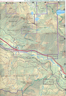
Ok I'll ask probably a stupid question but I'm a map reader/investgator type so it looks like another possible way on the map and wondered it anyone had done it.
Specifically could you hook up to this peak from Dirty Harry's creek/museum area?
From being up Dirty Harry'slast week, not sure if it would be reasonable to get up the first part. Looked real dense brush and steep.
Hmm the track I drew says 1.3 miles 2241 feet gained (1723+ ft/mile)....Maybe I'm a fool... but a curious fool I guess.
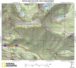 Web Mountain from Dirty Harry? Is this possible?
|
| Back to top |
|
|
Malachai Constant
Member
Joined: 13 Jan 2002
Posts: 16092 | TRs | Pics
Location: Back Again Like A Bad Penny |
here is also an established trail from the upper spur of Dirty Harry's Road just below the talus to Upper Granite Pond. There are then two routes to Banana Ridge one up the valley and the other up talus. From banana ridge you can easily acces Putrid Pete's Peak aka Web Mountain. There are geocaches both on banana ridge and along the route.
"You do not laugh when you look at the mountains, or when you look at the sea." Lafcadio Hearn
"You do not laugh when you look at the mountains, or when you look at the sea." Lafcadio Hearn
|
| Back to top |
|
|
dicey
custom title

Joined: 11 May 2004
Posts: 2870 | TRs | Pics
Location: giving cornices a wider berth |
|
dicey
custom title
|
Fri Aug 01, 2008 9:28 am |
|
|
| bikejr wrote: | | Specifically could you hook up to this peak from Dirty Harry's creek/museum area? |
Yes. The trail up Web starts right before you cross Museum creek. It's not really brushy, but it is steep, and follows the ridge crest to the summit. Trip Report
|
| Back to top |
|
|
tigermn
Member
Joined: 10 Jul 2007
Posts: 9242 | TRs | Pics
Location: There... |
|
tigermn
Member
|
Fri Aug 01, 2008 9:35 am |
|
|
| dicey wrote: | | bikejr wrote: | | Specifically could you hook up to this peak from Dirty Harry's creek/museum area? |
Yes. The trail up Web starts right before you cross Museum creek. It's not really brushy, but it is steep, and follows the ridge crest to the summit. Trip Report |
I think I saw that "trail" just before the creek. It didn't look well traveled/and kinda brushy at least where it starts.
Kind of wondered what it was/might be. Thought it might lead to the museum wherever that is.
A reason to return.
|
| Back to top |
|
|
Malachai Constant
Member
Joined: 13 Jan 2002
Posts: 16092 | TRs | Pics
Location: Back Again Like A Bad Penny |
That trail also goes to the museum Straight up to intersect an old road at a cairn then follow road to museum.
"You do not laugh when you look at the mountains, or when you look at the sea." Lafcadio Hearn
"You do not laugh when you look at the mountains, or when you look at the sea." Lafcadio Hearn
|
| Back to top |
|
|
tigermn
Member
Joined: 10 Jul 2007
Posts: 9242 | TRs | Pics
Location: There... |
|
tigermn
Member
|
Fri Aug 01, 2008 9:57 am |
|
|
| Malachai Constant wrote: | | here is also an established trail from the upper spur of Dirty Harry's Road just below the talus to Upper Granite Pond. There are then two routes to Banana Ridge one up the valley and the other up talus. From banana ridge you can easily acces Putrid Pete's Peak aka Web Mountain. There are geocaches both on banana ridge and along the route. |
Yea you mean the dotted thing that continues east/straight where you take the sharp left to continue up the trail (or alternately go up the talus)
 Dirty Harry area.
|
| Back to top |
|
|
|
|


