| Previous :: Next Topic |
| Author |
Message |
tigermn
Member


Joined: 10 Jul 2007
Posts: 9242 | TRs | Pics
Location: There... |
|
tigermn
Member
|
 Mon Aug 04, 2008 9:58 am |
|
|
All photos.
Well after speculation that we may have as many as 5 people it turned out to be just myself and Greg (EastKing).
After some brief discussion about whether to take hike #39 or #40 in the 55 hikes, we opted for the somewhat easier 39 up Rock Mountain via the Snowy Creek trail. This meant about 8.6 miles of gravel road driving up a not too bad road, but slow going ~ 25-30 minutes in a sedan. Hike 40 you basically just park it off highway 2.
Arrived at the trail head and were hiking by shortly after 09:30. 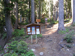 Rock Mountain Snowy Creek Trailhead.  
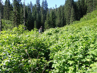 Rock Mounain brush/heather where I stepped off the trail as it was hard to see the edges.. No harm no foul. 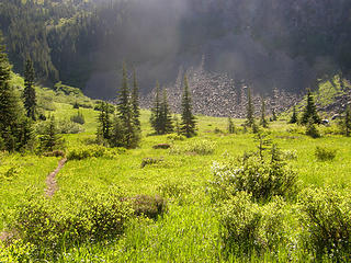 Rock Mountrain meadowns ~ 2200 feet below summit. Trail can be seen on left. Blue tent on right edge of picture. We would see the tent owners when we arrived at the summit. 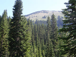 Rock Mountain from meadows ~ 2200 feet below. 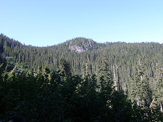 VIews from near Rock Mountain meadow ~ 2200 feet below the summit. 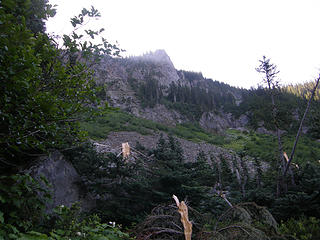 VIews from near Rock Mountain meadow ~ 2200 feet below the summit. 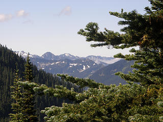 Partial views still in trees above Rock Mountain basin. 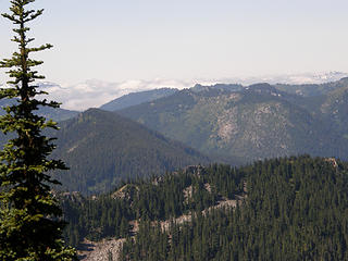 Partial views still in trees above Rock Mountain basin. 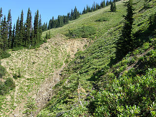 It opens up above closer to Rock Mountain summit. 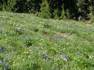 Flowers on open slopes below Rock Mt Summit. 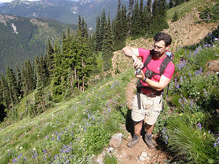 Greg (EastKing) stops to photo the flowers. 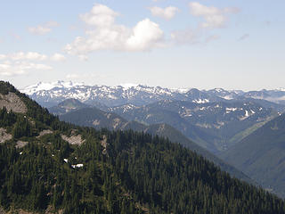 More views from open slopes below Rock Mtn. 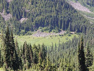 Looking down at the meadow/tent from where we came on upper slopes of Rock Mtn. 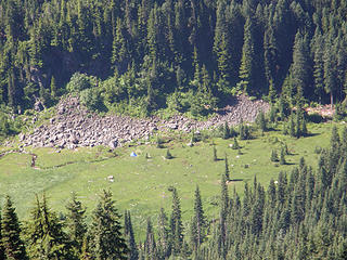 Looking down at the meadow/tent from where we came on upper slopes of Rock Mtn. 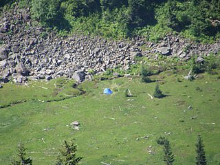 Zoom looking down at the meadow/tent from where we came on upper slopes of Rock Mtn. 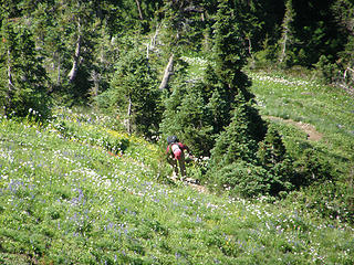 Another hiker coming up from below on upper Rock Mtn slopes. 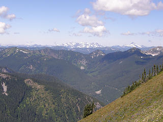 The hills are alive with the Sound of Music upper Rock Mountain slopes. 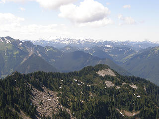 Views from Upper Rock Mountain slopes. 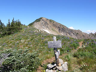 Junction to Rock Mountain summit. It is visible here. Right fork goes back down towards Rock Lake/alternate trail. 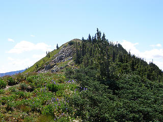 Rock Mountain summit so close we can taste it. 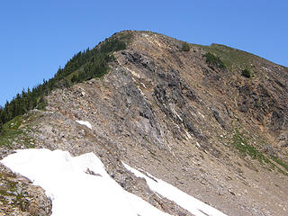 Rock Mtn summit real close now. This is easy trail hike (trail goes left/behind the ridge in this picture). 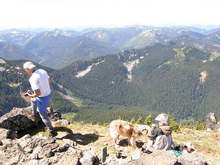 Campers with dog on Rock Mtn summit. 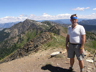 Myself on Rock Mountain summit. 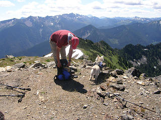 Man with Westie dog on Rock Mountain summit. 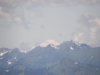 Mt Baker 77 miles away from Rock Mountain summit. This view would be short lived as distant coulds soon would block it's view. 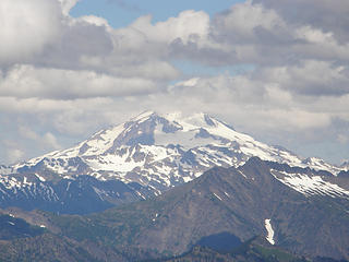 Glacier Peak 22 miles away from Rock Mtn Summit. 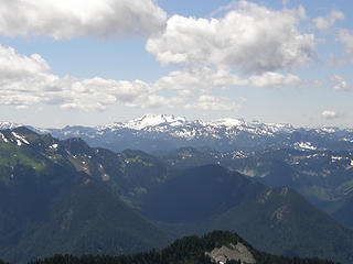 Views from Rock Mountain summit. 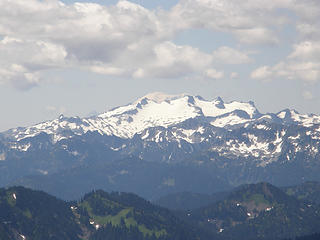 Top of Rainier (75 miles away) visible behind Mt. Daniel (19 miles distant). 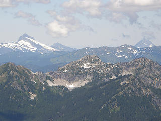 Minotaur Lake ~ 4.35 air miles away from summit of Rock Mtn. 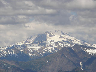 Glacier (22 miles distant) getting more in clouds from Rock Mtn summit. 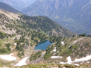 Views from viewspot just left and below summit. 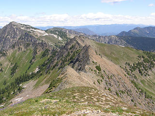 Views from viewspot just left and below summit over towards Howard. 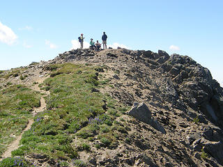 Views back to summit from viewspot just left and below summit. 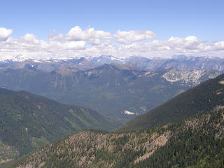 Views from viewspot just below summit. 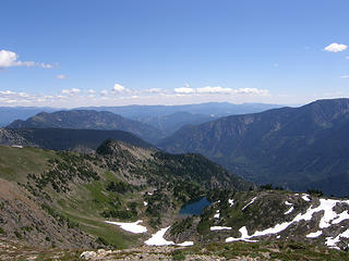 Views from viewspot just below summit. 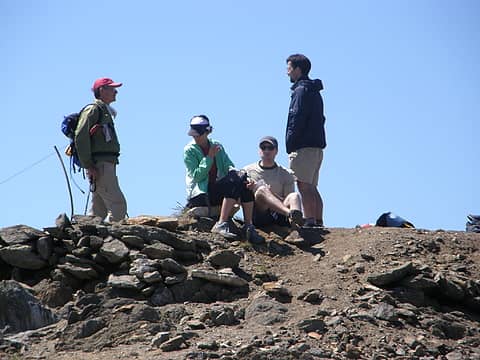 Views of summit (Greg on right, others not with us to left) from viewspot just below summit. 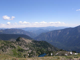 Views from "other" summit. 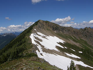 Views back to real summit from "other" summit. Noe of this snow had to be crossed. 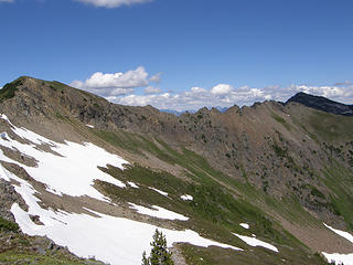 Views from "other" summit. 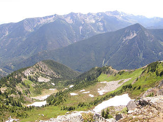 Views from "other" summit. 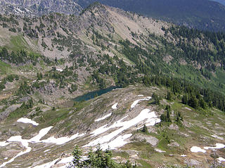 Views from "other" summit. 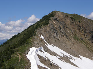 Views back upViews back up to real summit from "other" summit. to real summit from "other" summit. 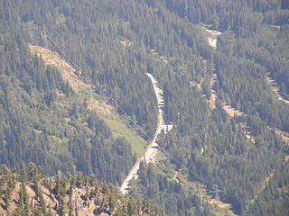 Zoom of highway 2 from "other" summit 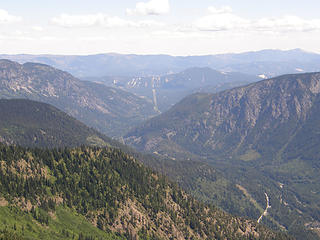 Highway 2 valley heading east from "other" summit. 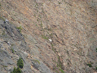 Mountain goat on cliffs east of Howard from summit trail junction sign. 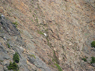 Mountain goat on cliffs east of Howard from summit trail junction sign. 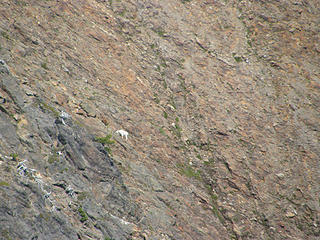 Mountain goat on cliffs east of Howard from summit trail junction sign. 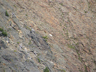 Mountain goat on cliffs east of Howard from summit trail junction sign. 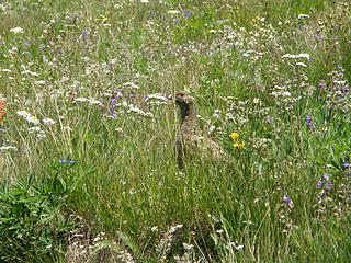 Grouse or something (I don't know my birds) on way down from Rock Mountain. 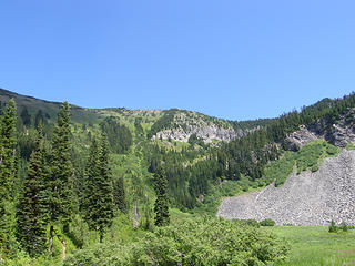 VIews back up towards summit from down below. 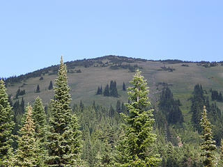 Rock Mountain from down below. 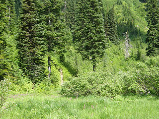 Meadow. This is looking back at where trail leaves meadow to head up Rock Mtn. 
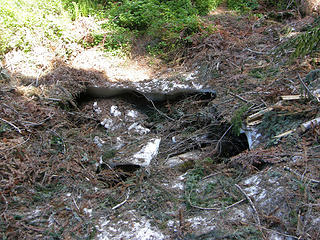 Broken snow bridge over creek lower down. A guy 2 parties behind us broke this bridge. We skirted way on the side on this one. 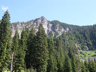 Final views back as we leave the meadows. 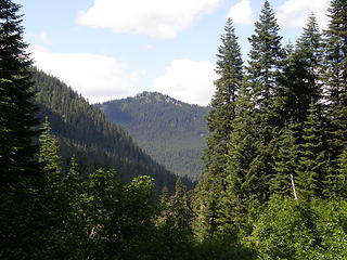 Final views back as we leave the meadows. 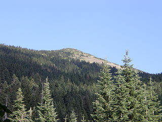 Parting shot look back up. 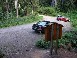 Back to car. Those last 2 easy miles always seem to take forever getting down.  EastKing took some video panos guaranteed to dizzy you out, so I'll let him post the best of those.
The summit pose pictures of him are in his camera so stay tuned.
I was spared the rap video although Greg could have had an audience of strangers, sort of like taking the show on the road.
EastKing took some video panos guaranteed to dizzy you out, so I'll let him post the best of those.
The summit pose pictures of him are in his camera so stay tuned.
I was spared the rap video although Greg could have had an audience of strangers, sort of like taking the show on the road.
|
| Back to top |
  
|
|
EastKing
Surfing and Hiking

Joined: 28 Mar 2007
Posts: 2082 | TRs | Pics
Location: 77 miles from Seattle! |
|
EastKing
Surfing and Hiking
|
Mon Aug 04, 2008 9:22 pm |
|
|
Here are all the pics I have from the trip. I will put up my dizzy panoramas and just a bit. Sorry folks, no rap video this time. Let the Rock stay the Rock!!!!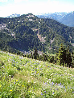 Rock Mtn 010 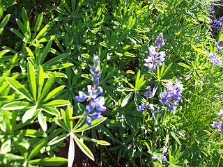 Flowers in the Alpine Meadows 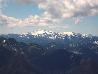 Daniel and Rainier 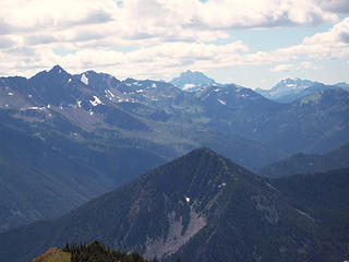 Rock Mtn 026 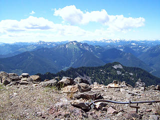 Rock Mtn 027 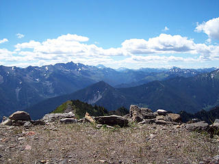 Rock Mtn 028 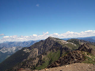 Rock Mtn 030 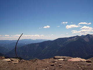 Rock Mtn 033 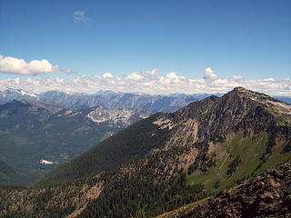 Rock Mtn 036 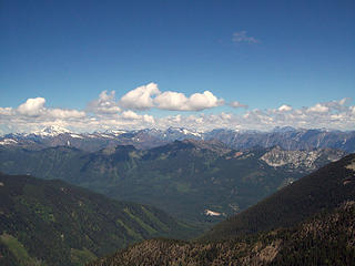 Rock Mtn 037 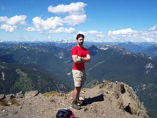 Summit pose #1 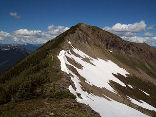 Rock Mtn 062 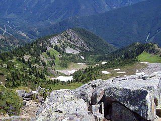 Rock Mtn 066 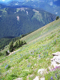 Rock Mtn 077 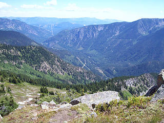 Rock Mtn 072 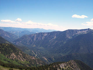 Rock Mtn 068 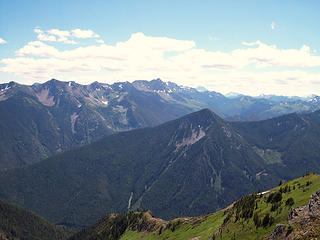 Rock Mtn 067 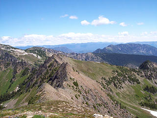 Rock Mtn 050
YouTube | SummitPost
Saw the depths of despair. Now I am salvaging what time I have left on Earth.
YouTube | SummitPost
Saw the depths of despair. Now I am salvaging what time I have left on Earth.
|
| Back to top |
|
|
BearQueen
Ready to Go

Joined: 13 May 2008
Posts: 156 | TRs | Pics
Location: Heart is on Lassen |
|
BearQueen
Ready to Go
|
Tue Aug 05, 2008 8:31 pm |
|
|
"You may say I'm a dreamer, but I'm not the only one. I hope someday you'll join us, and the world will live as one." by John Lennon
I hope to do some summits and waterfalls this year with my husband EastKing.
|
| Back to top |
|
|
tigermn
Member
Joined: 10 Jul 2007
Posts: 9242 | TRs | Pics
Location: There... |
|
tigermn
Member
|
Tue Aug 05, 2008 9:51 pm |
|
|
| EastKing wrote: | | Here are all the pics I have from the trip. |
All the pictures? I know I took more of you on the summit using your camera than that..
Didn't you get a picture of the westie that was trying to help you eat your lunch or were you too busy fending him off.. 
|
| Back to top |
|
|
Curtissimo
Member

Joined: 05 Sep 2007
Posts: 295 | TRs | Pics
Location: Mexico Lindo y Querido si Muero Lejos de Ti |
looking good, boys! congrats on the goats i have almost never seen those in the wild save mount aix.
|
| Back to top |
|
|
EastKing
Surfing and Hiking
Joined: 28 Mar 2007
Posts: 2082 | TRs | Pics
Location: 77 miles from Seattle! |
|
EastKing
Surfing and Hiking
|
Wed Aug 06, 2008 11:06 pm |
|
|
| Quote: | | All the pictures? I know I took more of you on the summit using your camera than that..
Didn't you get a picture of the westie that was trying to help you eat your lunch or were you too busy fending him off.. |
As for the pics. I have well over 100 but most are dups of these. For a while I was wondering when that owner was going to tighten the chain. That little dog was going crazy to get food. No pictures because I was fending him off. Can't blame the dog. That LITTLE dog just did 3500 feet elevation gain. Kind of reminded me of the poodles that Angry Hiker wrote about with Mailbox. I do thought would suggest that the owner keep a close tab on him next time.
YouTube | SummitPost
Saw the depths of despair. Now I am salvaging what time I have left on Earth.
YouTube | SummitPost
Saw the depths of despair. Now I am salvaging what time I have left on Earth.
|
| Back to top |
|
|
tigermn
Member
Joined: 10 Jul 2007
Posts: 9242 | TRs | Pics
Location: There... |
|
tigermn
Member
|
Wed Aug 06, 2008 11:30 pm |
|
|
| EastKing wrote: | | Quote: | | All the pictures? I know I took more of you on the summit using your camera than that..
Didn't you get a picture of the westie that was trying to help you eat your lunch or were you too busy fending him off.. |
That little dog was going crazy to get food. No pictures because I was fending him off. Can't blame the dog. That LITTLE dog just did 3500 feet elevation gain. Kind of reminded me of the poodles that Angry Hiker wrote about with Mailbox. I do thought would suggest that the owner keep a close tab on him next time. |
Yea the owners fault and those damned expandable leashes...
|
| Back to top |
|
|
MountainMan
Member

Joined: 15 Jul 2008
Posts: 365 | TRs | Pics
Location: San Diego |
Wow, it looks like you guys had some great views! That's another one to add to my list of places to go! 
Slow down, take notice, savor the moment, appreciate the world around you and everything that you have.
Slow down, take notice, savor the moment, appreciate the world around you and everything that you have.
|
| Back to top |
|
|
EastKing
Surfing and Hiking
Joined: 28 Mar 2007
Posts: 2082 | TRs | Pics
Location: 77 miles from Seattle! |
|
EastKing
Surfing and Hiking
|
Thu Aug 07, 2008 6:32 am |
|
|
It is an awesome place for views and it is relatively easy trail from the north side!!! I'd like to try nearby Mt. Howard in the future.
YouTube | SummitPost
Saw the depths of despair. Now I am salvaging what time I have left on Earth.
YouTube | SummitPost
Saw the depths of despair. Now I am salvaging what time I have left on Earth.
|
| Back to top |
|
|
|
|


