| Previous :: Next Topic |
| Author |
Message |
Conrad
Meadow bagger


Joined: 25 Aug 2006
Posts: 2298 | TRs | Pics
Location: Moscow, ID |
|
Conrad
Meadow bagger
|
 Fri Aug 22, 2008 2:12 pm |
|
|
 Ladies Pass & Cape Horn  Day 1: Up Icicle Creek
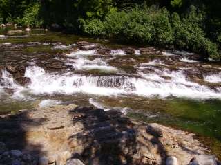
From Leavenworth we drove up the Icicle road to the current road closure at Ida Creek Campground. There's designated parking on the shoulder. I hung our Forest Pass but I don't know if it was required.
I was annoyed that the closure was so far E since I thought the washout was at Doctor Creek, a mile further W; but it turned out that just a few minutes' walk beyond the campground the creek flows over the road. Apparently the washout caused the creek to take a long detour. So here we took the detour dirt road and then the detour trail, which after about a mile returned to the Icicle road.
At Chatter Creek Guard Station we crossed the fancy footbridge to the S side of Icicle Creek and continued W on Trail 1555A, a "nature trail" which gave us 1.5 miles of easy trail walking instead of road walking. This trail routes somewhat differently than on my old Green Trails map, but by careful attention to the map I figured out how to stay on it when it crossed Jack Creek on a road bridge and ended up near Rock Island Campground.
Here we had some route confusion because (1) we had come off the trail onto the Jack Creek spur road rather than the Icicle Road as I expected, and (2) the Jack Creek Trail trailhead parking lot is now here, unbeknownst to my old GT map. But we figured it out and continued W on the Icicle Road.
Finally around noon we reached the end of the road at Blackpine Creek Horse Camp. Interestingly, just before the camp there's a signed Jackpine Trail heading uphill S which doesn't appear on my GT map at all.
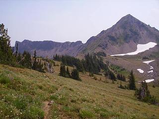
Finally after lunch we started the "real hike", NW up the Icicle Creek trail, wide, level, & even:
Day 1: Up Icicle Creek
From Leavenworth we drove up the Icicle road to the current road closure at Ida Creek Campground. There's designated parking on the shoulder. I hung our Forest Pass but I don't know if it was required.
I was annoyed that the closure was so far E since I thought the washout was at Doctor Creek, a mile further W; but it turned out that just a few minutes' walk beyond the campground the creek flows over the road. Apparently the washout caused the creek to take a long detour. So here we took the detour dirt road and then the detour trail, which after about a mile returned to the Icicle road.
At Chatter Creek Guard Station we crossed the fancy footbridge to the S side of Icicle Creek and continued W on Trail 1555A, a "nature trail" which gave us 1.5 miles of easy trail walking instead of road walking. This trail routes somewhat differently than on my old Green Trails map, but by careful attention to the map I figured out how to stay on it when it crossed Jack Creek on a road bridge and ended up near Rock Island Campground.
Here we had some route confusion because (1) we had come off the trail onto the Jack Creek spur road rather than the Icicle Road as I expected, and (2) the Jack Creek Trail trailhead parking lot is now here, unbeknownst to my old GT map. But we figured it out and continued W on the Icicle Road.
Finally around noon we reached the end of the road at Blackpine Creek Horse Camp. Interestingly, just before the camp there's a signed Jackpine Trail heading uphill S which doesn't appear on my GT map at all.
Finally after lunch we started the "real hike", NW up the Icicle Creek trail, wide, level, & even:
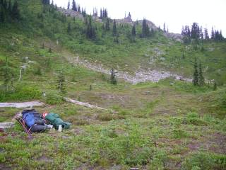
 French Creek confluence 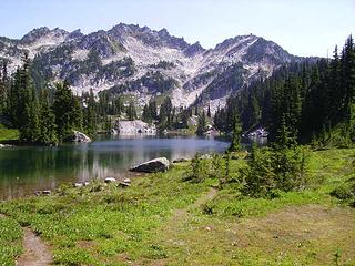 2nd Chain Lake (go left here) 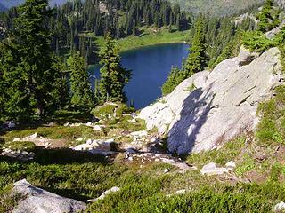 Dropping to Upper Doelle Lake 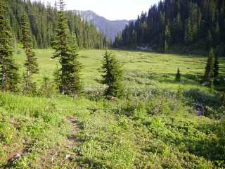 Doughgod Meadow  ) but we were tired enough not to care. It was the first night I'd slept under the stars in many years and it was kind of enchanting. ) but we were tired enough not to care. It was the first night I'd slept under the stars in many years and it was kind of enchanting.
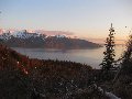
 Camp site in Little Basin (the next morning) 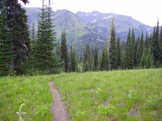 Rediscovered trail 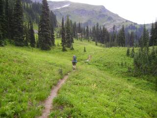 Near Lake Mary 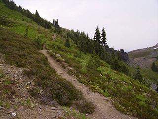 Approaching Marys Pass 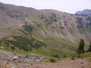 Looking across Spanish Camp Basin to Ladies Pass 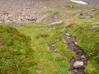 Lunch spot in Spanish Camp Basin Ladies Pass & Cape Horn 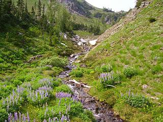 SE of Lake Edna
|
| Back to top |
  
|
|
Movenhike
\m/..mmmmetal\m/
Joined: 16 Apr 2007
Posts: 642 | TRs | Pics
Location: Leavenworth, WA |
|
Movenhike
\m/..mmmmetal\m/
|
Sat Aug 23, 2008 1:06 pm |
|
|
Awesome report
Sometimes I wish I could sleep 12 hours while camping!
That trip has been on my list, but I'm afraid I don't think I'll get to it before I leave the state in a couple weeks 
"Make it your Friend" -John Bull
"Make it your Friend" -John Bull
|
| Back to top |
|
|
Conrad
Meadow bagger
Joined: 25 Aug 2006
Posts: 2298 | TRs | Pics
Location: Moscow, ID |
|
Conrad
Meadow bagger
|
Sat Aug 23, 2008 1:25 pm |
|
|
Yeah, I could never sleep 12 hours anymore for any reason. Plus, it helps if your dad is doing the camp chores while you sleep. 
|
| Back to top |
|
|
Conrad
Meadow bagger
Joined: 25 Aug 2006
Posts: 2298 | TRs | Pics
Location: Moscow, ID |
|
Conrad
Meadow bagger
|
Sat Aug 23, 2008 3:19 pm |
|
|
| TwoFortyJeff wrote: | | Do you think it's possible to do it in two full days? |
Well, it's your call how averaging 17 miles & 3500' per day for 2 days works for you. It's actually all on trail (even if some of that trail is "abandoned"), if you can find the trail where we lost it in "Little Basin" NW of Frosty Pass. If you can't find the trail there, and have to copy our detour down to the lower 5300' basin (but you don't waste time hunting around for the lost trail like we did), that probably costs about an hour. If you can avoid the wrong turns we took around Chain & Doelle Lakes, that saves some more time.
You can probably save some more time at the beginning by staying on Icicle Road (N side of Icicle Creek) rather than taking the nature trail (S side of Icicle Creek) like we did.
Good luck!
|
| Back to top |
|
|
Conrad
Meadow bagger
Joined: 25 Aug 2006
Posts: 2298 | TRs | Pics
Location: Moscow, ID |
|
Conrad
Meadow bagger
|
Sun Aug 24, 2008 8:14 pm |
|
|
<bump>
Breathe, TR! Breathe, dammit!
|
| Back to top |
|
|
HitTheTrail
Member

Joined: 30 Oct 2007
Posts: 5456 | TRs | Pics
Location: 509 |
Want a bump ... you got it!
Thanks for the info. It sounds a little confusing but would probably be more straight forward if coming from Frosty as I would do.
|
| Back to top |
|
|
Conrad
Meadow bagger
Joined: 25 Aug 2006
Posts: 2298 | TRs | Pics
Location: Moscow, ID |
|
Conrad
Meadow bagger
|
Sun Jun 27, 2010 8:12 pm |
|
|
| HitTheTrail wrote: | | more straight forward if coming from Frosty |
I agree. Seems like all the wrong turns we took would not happen heading W.
|
| Back to top |
|
|
|
|
You cannot post new topics in this forum
You cannot reply to topics in this forum
You cannot edit your posts in this forum
You cannot delete your posts in this forum
You cannot vote in polls in this forum
|
Disclosure: As an Amazon Associate NWHikers.net earns from qualifying purchases when you use our link(s). |


