| Previous :: Next Topic |
| Author |
Message |
iron
Member


Joined: 10 Aug 2008
Posts: 6392 | TRs | Pics
Location: southeast kootenays |
|
iron
Member
|
 Thu Aug 26, 2010 12:50 pm |
|
|
quick summary:
late start (11:30a) at west fork buttermilk TH. hiked and set up camp at star lake (2:30p).
took very obvious and visible route to star peak. summit ~1 hr up. great views.
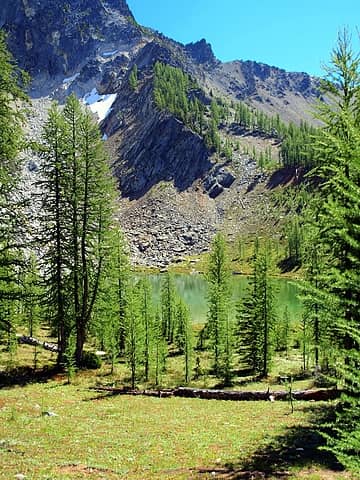 first site of star lake 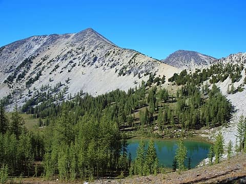 courtney peak and fish creek pass while heading up star peak 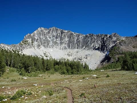 heading to gray, looking back at star 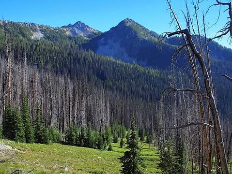 not sure when this fire happened 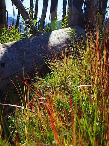 red grasses 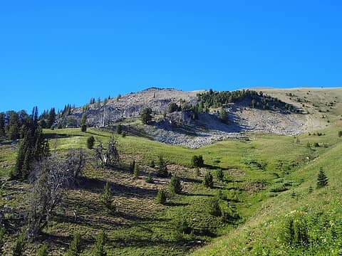 obvious drainage from gray/courtney saddle, gray on left 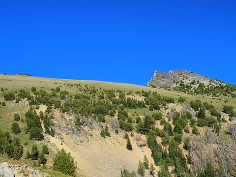 gentle ridge and courtney 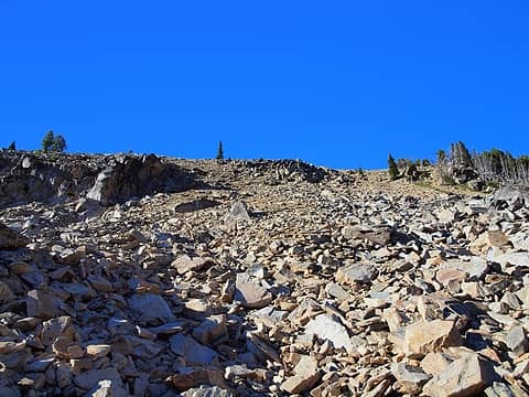 what? there's loose rock in the chelan sawtooths? 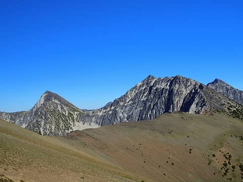 ridge from gray to courtney (R), buttermilk ridge summit on L 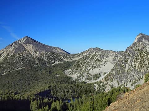 oval, buttermilk ridge, and middle oval lake 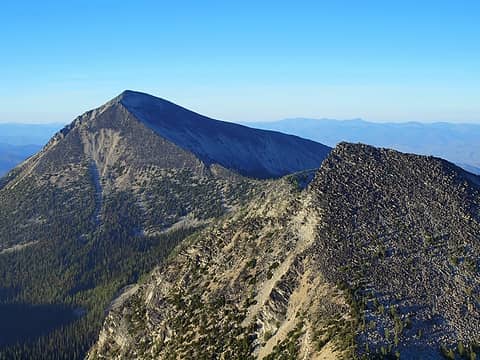 oval and buttermilk from courtney 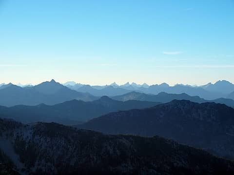 silhouettes 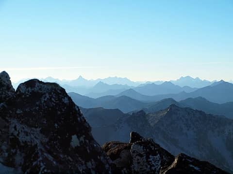 silhouettes 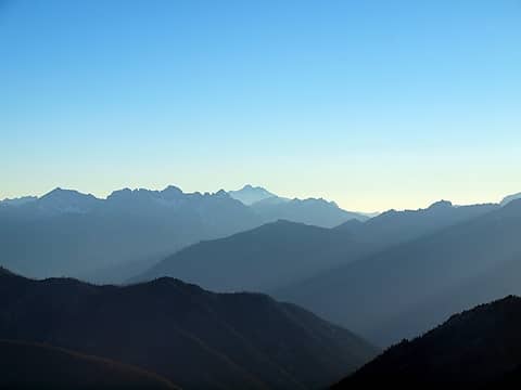 YES! peak 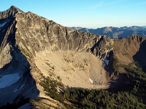 star lake basin from courtney, fish creek pass middle left 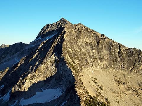 glacier cut lines across star's faces??? 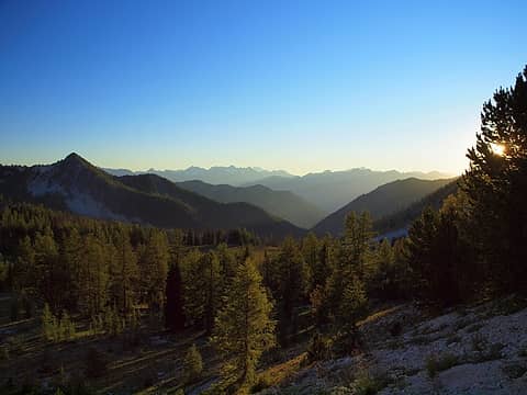 i can imagine the beauty when these larches turn golden  next day, at the early alpine start time of 8:45p, pack up and head for courtney/buttermilk saddle. easy travel with some scree, but not bad. reach saddle, head up easy class 2 ridge. up to this point, everything is class 2 or less. summit views the best yet, probably because of morning sun instead of evening light. nice views of YES! peak and my memories from 2 weeks ago come to the forefront. (10:10a)
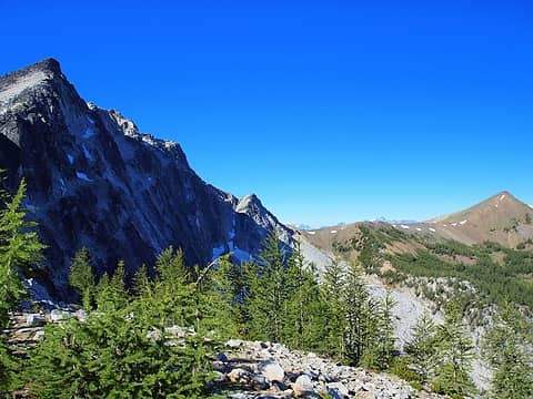 at courtney/buttermilk saddle looking towards gray 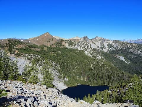 middle oval lake 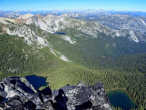 all three oval lakes 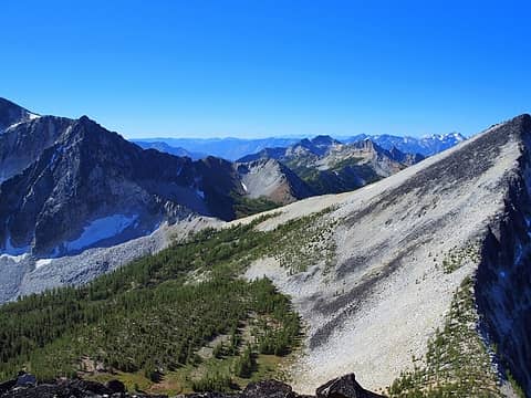 ridge coming from buttermilk summit (R) while heading towards oval 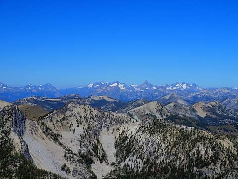 glaciers and dryness together 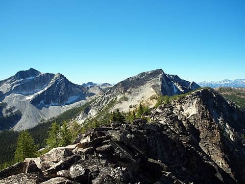 along buttermilk ridge from pt7978' 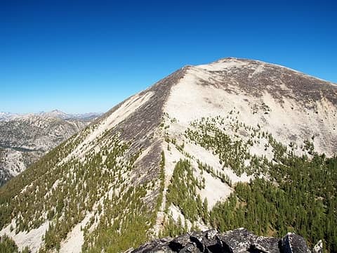 so close to oval now, just a steep, exposed ridge to follow 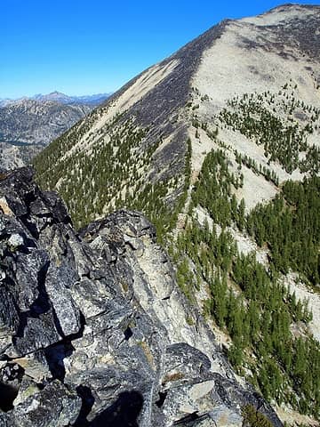 hmm... 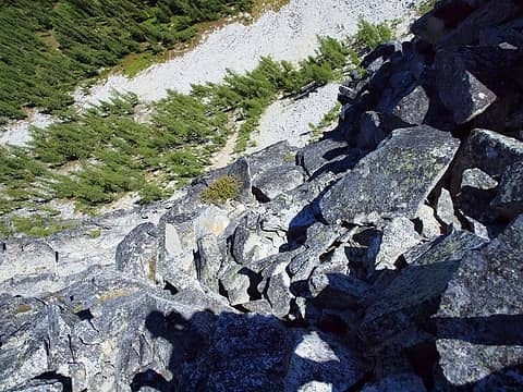 hmm... x 2 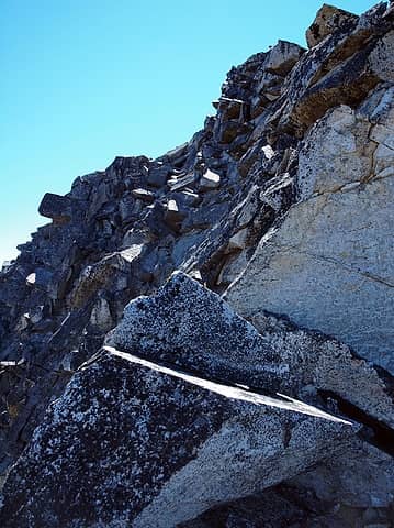 hmm... x 3 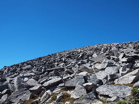 ahh, much easier, though tedious 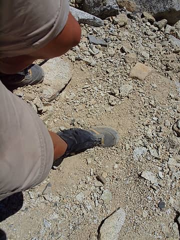 took the sandy descent route 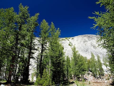 sandy descent route, lowest point of ridge 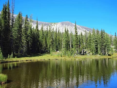 upper pond, sandy descent in background 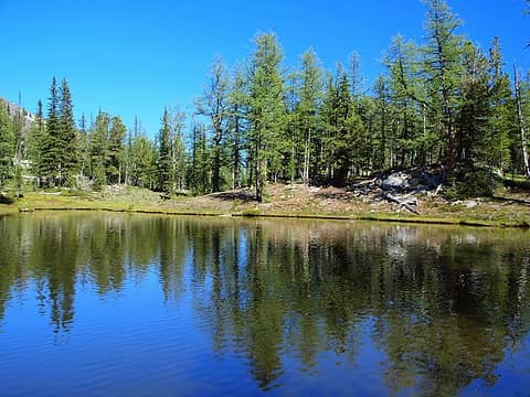 pond 6936' 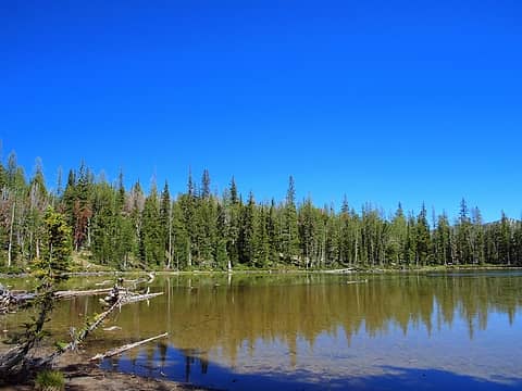 pond 6936' 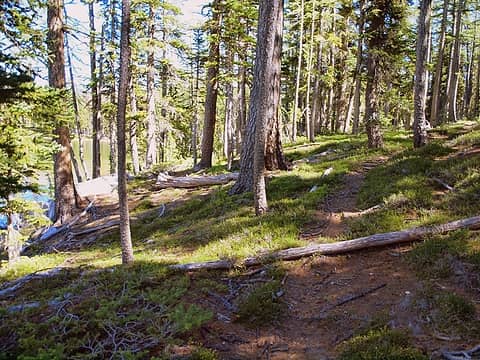 boot path on SW side of pond 6936' 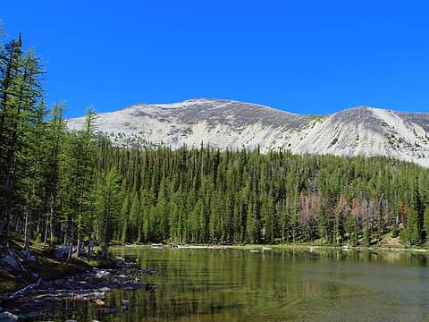 oval and pond 6936' 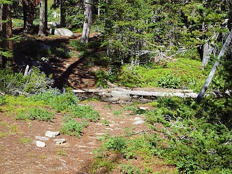 pond 6936' outlet 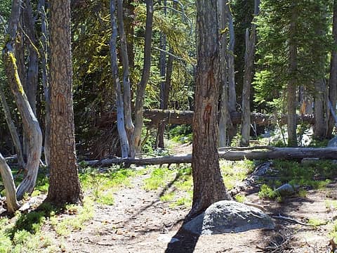 turn 180* from pond 6936' outlet for trail and follow blazed trees 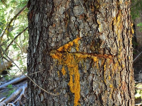 you can even follow the sappy arrows 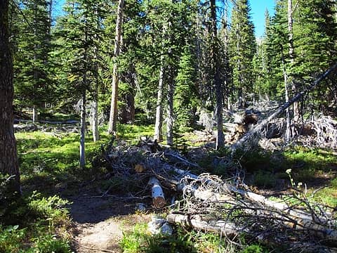 back on west fork buttermilk trail at junction with trail 436 (R) 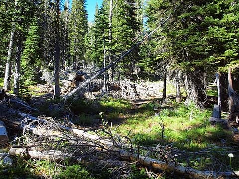 trail junction 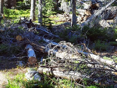 cut logs at trail junction at ~7100' 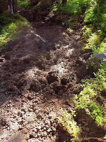 destroyed trail in parts 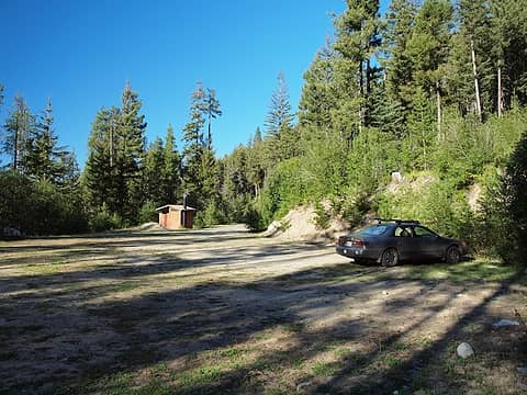 back at empty trailhead, minus me
|
| Back to top |
  
|
|
b00
Member

Joined: 29 Sep 2003
Posts: 1144 | TRs | Pics
|
|
b00
Member
|
Thu Aug 26, 2010 2:34 pm |
|
|
i wish i would have joined you, but with 8k gain and a late start, you would still be waiting for me :>)
nice work and i appreciate the route info.
:>)
|
| Back to top |
|
|
Backpacker Joe
Blind Hiker

Joined: 16 Dec 2001
Posts: 23956 | TRs | Pics
Location: Cle Elum |
Ironski youre an animal. Great work and wonderful pics.
"If destruction be our lot we must ourselves be its author and finisher. As a nation of freemen we must live through all time or die by suicide."
Abraham Lincoln
"If destruction be our lot we must ourselves be its author and finisher. As a nation of freemen we must live through all time or die by suicide."
Abraham Lincoln
|
| Back to top |
|
|
raising3hikers
Member

Joined: 21 Sep 2007
Posts: 2344 | TRs | Pics
Location: Edmonds, Wa |
Great TR and pics! You covered a lot of ground
|
| Back to top |
|
|
Backpacker Joe
Blind Hiker
Joined: 16 Dec 2001
Posts: 23956 | TRs | Pics
Location: Cle Elum |
| raising2hikers wrote: | | Great TR and pics! You covered a lot of ground |
He always does. Its a sickness. 
"If destruction be our lot we must ourselves be its author and finisher. As a nation of freemen we must live through all time or die by suicide."
Abraham Lincoln
"If destruction be our lot we must ourselves be its author and finisher. As a nation of freemen we must live through all time or die by suicide."
Abraham Lincoln
|
| Back to top |
|
|
Get Out and Go
Member

Joined: 13 Nov 2004
Posts: 2128 | TRs | Pics
Location: Leavenworth |
Congrats on a more ambitious trek in the area than my time up there this past week but probably equally satisfying.  (Oh, and to you and your partner's future as well (Oh, and to you and your partner's future as well  ). I talked to another teacher with whom I work, who just spent 5 days roaming the area between Tuckaway and Star. What a great place to hang out. Here's your Buttermilk and Courtney! ). I talked to another teacher with whom I work, who just spent 5 days roaming the area between Tuckaway and Star. What a great place to hang out. Here's your Buttermilk and Courtney!
 West Oval Lake
"These are the places you will find me hiding'...These are the places I will always go."
(Down in the Valley by The Head and The Heart)
"Sometimes you're happy. Sometimes you cry.
Half of me is ocean. Half of me is sky."
(Thanks, Tom Petty)
"These are the places you will find me hiding'...These are the places I will always go."
(Down in the Valley by The Head and The Heart)
"Sometimes you're happy. Sometimes you cry.
Half of me is ocean. Half of me is sky."
(Thanks, Tom Petty)
|
| Back to top |
|
|
Nietzsche's Horse
Equine Philosopher

Joined: 16 Aug 2010
Posts: 92 | TRs | Pics
Location: Seattle |
Excellent TR with lots of useful beta and wonderful photos. Thanks!
I have been to areas nearby during October, and felt irrepressibly giddy in the presence of the gold-turned larches. There is something almost mystical about that tree. Did you happen to notice where they were densest on your trip? Star Lake looks like a hot spot, in your photos, but were there any others?
"Trails are like that: you're floating along in a Shakespearean Arden paradise and expect to see nymphs and fluteboys, then suddenly you're struggling in a hot broiling sun of hell in dust and nettles and poison oak... just like life." - Kerouac
"Trails are like that: you're floating along in a Shakespearean Arden paradise and expect to see nymphs and fluteboys, then suddenly you're struggling in a hot broiling sun of hell in dust and nettles and poison oak... just like life." - Kerouac
|
| Back to top |
|
|
gray matter
Member
Joined: 28 Oct 2008
Posts: 312 | TRs | Pics
Location: Anacortes |
Great TR, Iron. I did Star, Courtney, and Oval in June, and was never able to find where that old trail 436 intersected with the main trail, namely because it was all under snow.
The bushwhack from about 7000' to Pond 6936 was a miserable experience without the benefit of the old trail. However, I decided to follow the outlet of the pond and hiked east southeasterly and easily intersected with the main trail on the way out. It was really pretty easy, and saved a lot of time. It sure would be great to go up and do a bit of trail maintenance up there.
-Gray
|
| Back to top |
|
|
HitTheTrail
Member

Joined: 30 Oct 2007
Posts: 5460 | TRs | Pics
Location: 509 |
Thanks for sharing your great TR. I have looked at that area a couple of times and almost went up the east fork of Fish Creek from Moore Point last summer. It is still somewhere on my list of maybe's.
|
| Back to top |
|
|
|
|
You cannot post new topics in this forum
You cannot reply to topics in this forum
You cannot edit your posts in this forum
You cannot delete your posts in this forum
You cannot vote in polls in this forum
|
Disclosure: As an Amazon Associate NWHikers.net earns from qualifying purchases when you use our link(s). |


