| Previous :: Next Topic |
| Author |
Message |
deconinc
Member


Joined: 22 Jun 2005
Posts: 34 | TRs | Pics
|
|
deconinc
Member
|
 Tue Sep 02, 2008 3:00 pm |
|
|
There's not many reports on this one, so I'll try to be informative.
I wanted a workout, and the weather forecast for Marblemount looked good. So I decided on going up Kindy Ridge (29 in Manning and Spring's 100 classics), which I hadn't done yet.
Now, the hike is in the classics book, but it is not in any of the regional books. This made me suspicious about the state of the trail.
Left Seattle at 6am, got to the trailhead a little after 8am. The trailhead is now at the fork of forest roads 1570(1) and 1570, instead of a little further along 1570, which is what's described in the book. The road to the trailhead is doable, with care, with a family car, but not a lower sports car. There are a number of creek crossings I had to take slow, but they were no problem. There were 4 other vehicles at the trailhead, all SUVs or trucks.
At the junction of the forest roads, the hike to Kindy Ridge or Found Lake goes right, on 1570. You walk the road a little over 2 miles. Felt more like 3. Pretty close to the start there are 6 washouts to cross, all easy by foot. None of them had water in them. The road is seriously overgrown in parts, so prepare on getting wet in the morning. In the last mile there were several parts were you're hunched down for an extended period to avoid branches which kind of make a gothic cathedral ceiling, that is unfortunately too low. I tried to photograph it, but it was too dark.
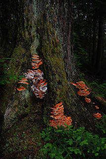
There was still blooming foxglove! Talk about a messed up summer...
At the end of the road, there's a little clearing. You could conceivably camp here, and people have done so. So far, you've gained about 1300'. The next section gains 2300' in 2 miles. More than 1/2 mile is a level meadow/ridge walk and there's also some up and down at the end. Figure out the steepness for yourself. It may be the hardest dayhike I've done, it is definitely the steepest. Think of the worst part of mailbox, but without reprieve.
The "trail" was indicated with a pink ribbon on the left of the clearing. It starts with a grade of about 50 degrees, and keeps that for a while. If the grade initially is difficult for you, consider turning back. This is by far not the worst part. The trail initially is also VERY overgrown: you have to look at your feet to see where you're going. The good news is that in the morning you're getting a shower as you work out. If you find the bushes annoying, press on. They don't last too long, about 300' up, is my guess. But they are worse than anything I've seen. After coming out of the bushes, the trail consists of roots and mud. I was nervous about having to come down it. BTW, I loved my hiking poles on this one, both going up and going down. I made a point of taking a food break with every 500 ft up, to make sure I'd be able to keep on going. Here's where I took my first break:
 First break 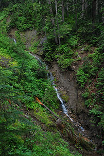 Found Creek 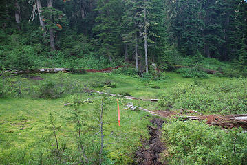 First meadow 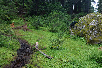 4800' saddle 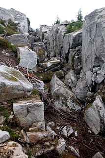 Rocks 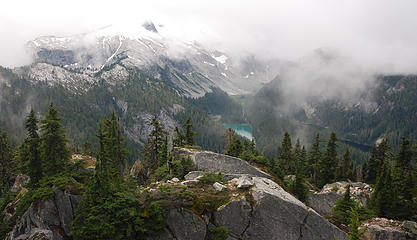 Snowking basin 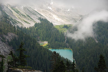 Snowking Lake 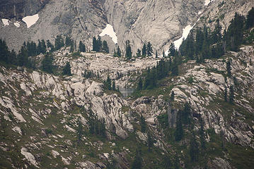 But that's not Cyclone Lake. It's a little lakelet in front of it. 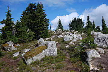 Kindy Ridge top 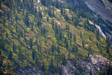 Snowking flank 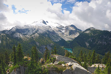 Snowking basin 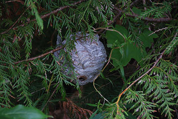 Wasps? Hornets? Poodles?
|
| Back to top |
  
|
|
wildernessed
viewbagger

Joined: 31 Oct 2004
Posts: 9275 | TRs | Pics
Location: Wenatchee |
There are quite alot of TR's on Kindy Ridge, but many will fall under some form of "Snowking" being in the title.
Snowking via Kindy Ridge
Living in the Anthropocene
Living in the Anthropocene
|
| Back to top |
|
|
deconinc
Member
Joined: 22 Jun 2005
Posts: 34 | TRs | Pics
|
|
deconinc
Member
|
Tue Sep 02, 2008 3:41 pm |
|
|
So "not many" is relative.
|
| Back to top |
|
|
wildernessed
viewbagger
Joined: 31 Oct 2004
Posts: 9275 | TRs | Pics
Location: Wenatchee |
| deconinc wrote: | | So "not many" is relative. |
Relatively speaking ! 
Living in the Anthropocene
Living in the Anthropocene
|
| Back to top |
|
|
kyle d
Member

Joined: 03 Jun 2007
Posts: 521 | TRs | Pics
Location: Ogden, UT |
|
kyle d
Member
|
Thu Sep 04, 2008 1:03 pm |
|
|
That certianly is a very scenic area, one of my favorites so far. Thanks for all the details about the route, I tend to be lazy and leave them out of my trip reports (My snowking report), but I certainly appreciate them for trying to plan trips.
I doubt you will be dissapointed if you make a return trip in a little better weather.
|
| Back to top |
|
|
touron
Member
Joined: 15 Sep 2003
Posts: 10293 | TRs | Pics
Location: Plymouth Rock |
|
touron
Member
|
Thu Sep 04, 2008 1:21 pm |
|
|
Touron is a nougat of Arabic origin made with almonds and honey or sugar, without which it would just not be Christmas in Spain.
|
| Back to top |
|
|
wildernessed
viewbagger
Joined: 31 Oct 2004
Posts: 9275 | TRs | Pics
Location: Wenatchee |
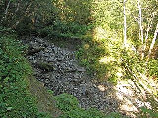 The road stops here. 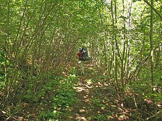 A overgrown section of the road walk to the trail.
Living in the Anthropocene
Living in the Anthropocene
|
| Back to top |
|
|
Bloated Chipmunk
Cock Rock Searcher

Joined: 29 Jan 2007
Posts: 2993 | TRs | Pics
Location: Margaritaville |
|
Bloated Chipmunk
Cock Rock Searcher
|
Thu Sep 04, 2008 1:49 pm Re: 9/1/08 - Kindy Ridge - Heaven and Hell in the North Casc
|
|
|
| deconinc wrote: | At some point I felt the call of nature, only to discover I was obeying this call 2 ft from this.
Wasps? Hornets? Poodles? |
Looks like a bald-faced hornet nest. 
Home is where the hiking is.
"Peaks that have come and gone four times should halt a man in his steps." -- William O. Douglas
A balanced diet is a margarita in each hand.
Home is where the hiking is.
"Peaks that have come and gone four times should halt a man in his steps." -- William O. Douglas
A balanced diet is a margarita in each hand.
|
| Back to top |
|
|
Dayhike Mike
Bad MFKer
Joined: 02 Mar 2003
Posts: 10958 | TRs | Pics
Location: Going to Tukwila |
Welcome to the site and thanks for the TR! I love the tree where you took your first break. I remember trying to balance on the steeeeep slope while trying to take a picture of it myself.
Regarding ribbons, this is the kind of crap I always hate seeing:
| deconinc wrote: | First meadow |
Why in the hell would someone tie a ribbon up next to an obvious rut of a trail. Simply asinine.
Any chance you pulled the ribbons on the way out? Big thumbs up to you if you did.
"There is only one basic human right, the right to do as you damn well please. And with it comes the only basic human duty, the duty to take the consequences." -P.J. O'Rourke
"Ignorance is natural. Stupidity takes commitment." -Solomon Short
"There is only one basic human right, the right to do as you damn well please. And with it comes the only basic human duty, the duty to take the consequences." -P.J. O'Rourke
"Ignorance is natural. Stupidity takes commitment." -Solomon Short
|
| Back to top |
|
|
#19
Member
Joined: 17 Dec 2001
Posts: 2197 | TRs | Pics
|
|
#19
Member
|
Thu Sep 04, 2008 6:20 pm |
|
|
| Dayhike Mike wrote: | | Why in the hell would someone tie a ribbon up next to an obvious rut of a trail. |
IIRC, it's not marking the rutted trail seen in the photo. It marks the more obscure junction of the route to the left. 
| Quote: | | You can go left or right hear. I went right, which was wrong; but it appears you can go on for a while. Go left instead, in the worst mud of the trail. |
|
| Back to top |
|
|
Mike Collins
Member
Joined: 18 Dec 2001
Posts: 3096 | TRs | Pics
|
| Quote: | | Why in the hell would someone tie a ribbon up next to an obvious rut of a trail. |
The ribbon could have been placed when the area was snowcovered. Following ones tracks is easy unless there is heavy snow occuring which can fill in the depressions. I don't use ribbon to mark routes but can see where some people who are unfamiliar with routefinding will do so.
|
| Back to top |
|
|
deconinc
Member
Joined: 22 Jun 2005
Posts: 34 | TRs | Pics
|
|
deconinc
Member
|
Thu Sep 04, 2008 8:18 pm |
|
|
Actually, a lot of work would be needed to repair the washouts. "A lot", just like "not many" is subjective, but the washouts are serious. Nothing like on the Dosewallups road, but nothing trivial either.
My impression was that the ribbon marked the return trail, not the trail up. The ribbons weren't terribly necessary, but they would be with snow. As I wrote, there were only a few, so it wasn't too offensive.
Thanks for the ID on the hornets nest.
|
| Back to top |
|
|
#19
Member
Joined: 17 Dec 2001
Posts: 2197 | TRs | Pics
|
|
#19
Member
|
Thu Sep 04, 2008 8:59 pm |
|
|
| deconinc wrote: | | My impression was that the ribbon marked the return trail, not the trail up. The ribbons weren't terribly necessary, but they would be with snow. As I wrote, there were only a few, so it wasn't too offensive.
. |
I appreciate your well reasoned approach to orange tape. Never hung tape, but I don't freak out seeing it occasionally.
| Quote: | | Any chance you pulled the ribbons on the way out? Big thumbs up to you if you did. |
|
| Back to top |
|
|
|
|
You cannot post new topics in this forum
You cannot reply to topics in this forum
You cannot edit your posts in this forum
You cannot delete your posts in this forum
You cannot vote in polls in this forum
|
Disclosure: As an Amazon Associate NWHikers.net earns from qualifying purchases when you use our link(s). |


