| Previous :: Next Topic |
| Author |
Message |
iron
Member


Joined: 10 Aug 2008
Posts: 6392 | TRs | Pics
Location: southeast kootenays |
|
iron
Member
|
 Mon Sep 08, 2008 10:09 pm |
|
|
full disclosure: i'm still new to the mountaineering world. consequently, my descriptions will likely vary from what your interpretations are. hence, i try to have more photos than text...
okay, so i heard some good things about daniel and that it should be well within my grasp given my current skillset (<1 year of actually exploring the mountains as opposed to dayhikes to lakes and such). my buddy hollywood (NWH: b00) thought that since i liked exercise, this would be a fun trip.
i didn't research much at all. i glanced at the 75 scrambles in WA book for trailhead directions, looked at the pics justus posted in their recent TR, and talked to my friend mary (aka the little dripper) who had done the trip about a month earlier. 3 sources of info = confusion. plus, since i'm semi new to route finding, things were bound to go haywire.
got to the trailhead - check. off to a good start. the bad thing was it was nearly 10a. that's not a good time to start when you're dayhiking something you don't have a clue about.
found the trail - check. so far so good.
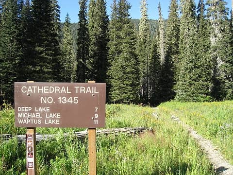 trailhead 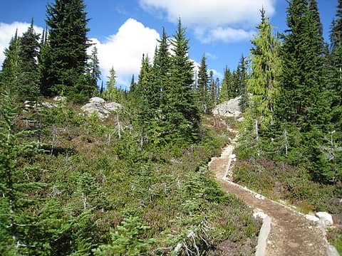 well-maintained trail 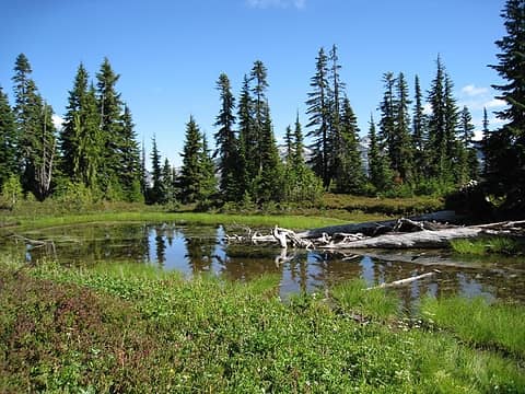 small pond before pass 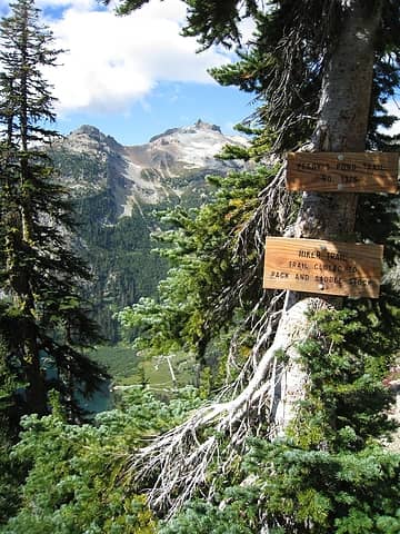 trail junction leading down to peggy's pond 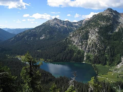 deep lake 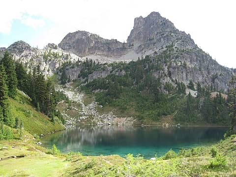 peggy's pond with cathedral rock 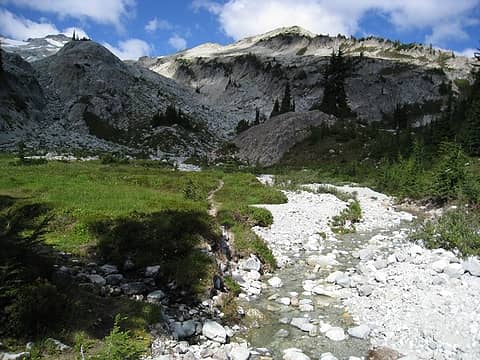 creek from drainage basin 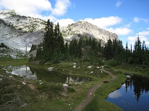 heading towards drainage basin 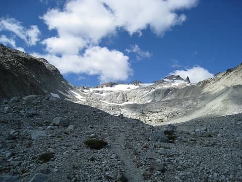 on boot path up drainage basin 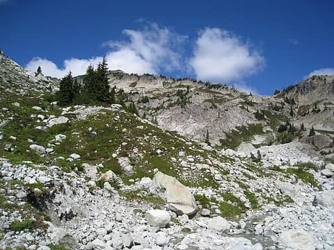 drainage basin 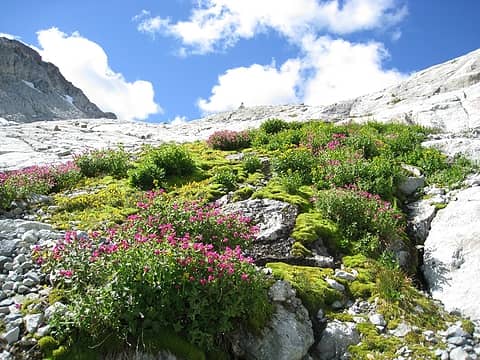 last of the plant life in the basin 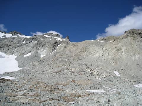 continuing up 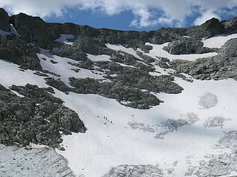 a group of 5 practicing ice axe arrests and boot glissades 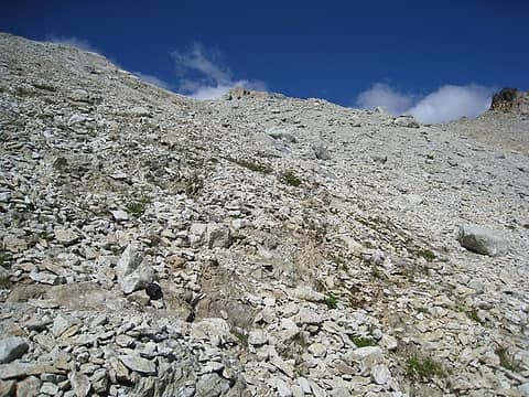 loose talus and scree 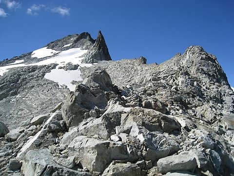 east summit and ridge i was temporarily on 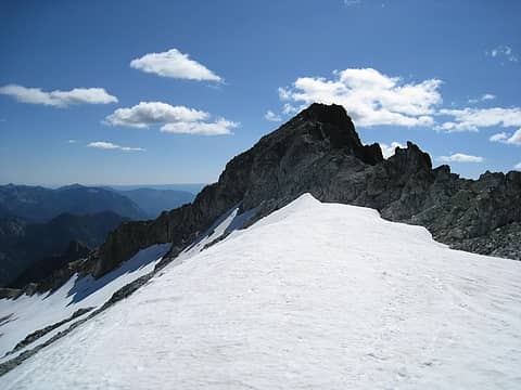 coming off and over snowfield to meet saddle between east summit and east bump 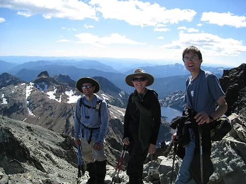 mountain man, bloated chipmunk, and todd 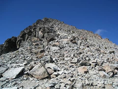 east summit 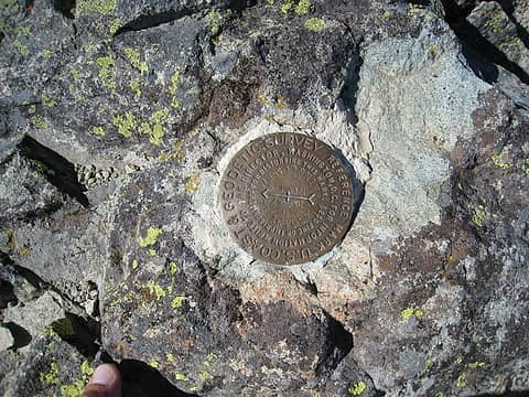 benchmark on east summit 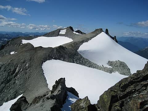 looking back to central and west (true) summits 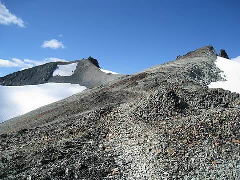 by gosh, a trail! 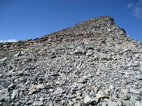 central summit 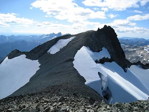 west summit and ridge above daniel glacier 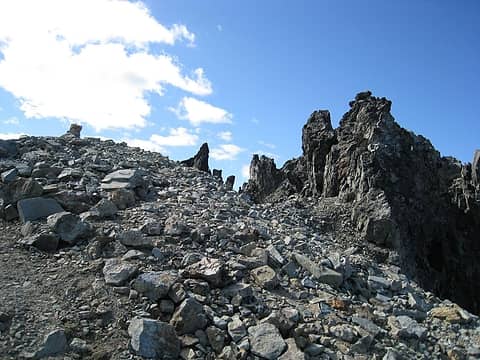 final ascent of west summit 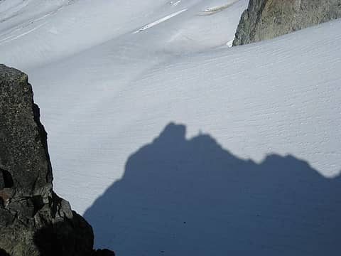 little ole me on top (don't let the shadows fool you). 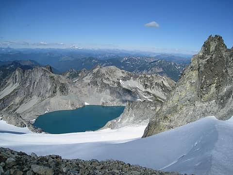 pea soup lake and daniel glacier 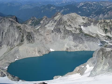 pea soup lake 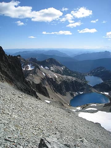 venus and spade lakes 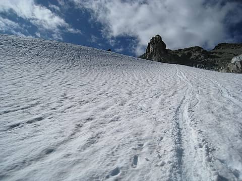 glissade down snowfield from ridge 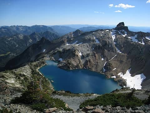 circle lake from east southeast ridge leading to peggy's pond 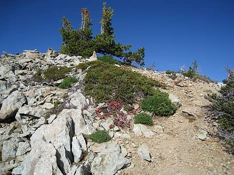 and a ridge trail too! 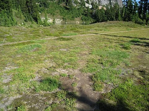 unmarked 'trail' junction - main trail in distance 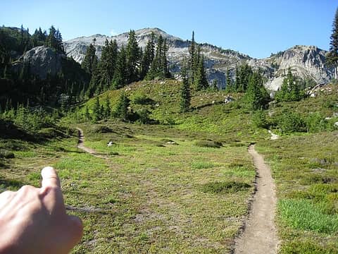 go left and you're on the way up the ridge, right and you're heading towards the basin
|
| Back to top |
  
|
|
Bloated Chipmunk
Cock Rock Searcher

Joined: 29 Jan 2007
Posts: 2993 | TRs | Pics
Location: Margaritaville |
Home is where the hiking is.
"Peaks that have come and gone four times should halt a man in his steps." -- William O. Douglas
A balanced diet is a margarita in each hand.
|
| Back to top |
|
|
Ingunn
Hiking Viking
Joined: 01 Feb 2008
Posts: 1751 | TRs | Pics
Location: Redmond |
|
Ingunn
Hiking Viking
|
Tue Sep 09, 2008 12:13 am |
|
|
Wow, you make *really* good time!  Looks like a perfect day, love the photos! Looks like a perfect day, love the photos!
|
| Back to top |
|
|
Layback
Cascades Expatriate

Joined: 16 Mar 2007
Posts: 5712 | TRs | Pics
Location: Back East |
|
Layback
Cascades Expatriate
|
Tue Sep 09, 2008 8:48 am |
|
|
Great TR & pics. Thanks for sharing! 
|
| Back to top |
|
|
mntsun
Wunderer

Joined: 08 Jul 2007
Posts: 206 | TRs | Pics
Location: Squaresville |
|
mntsun
Wunderer
|
Tue Sep 09, 2008 12:22 pm |
|
|
Nice work! I like how you try to hide the shameless peakbagging of the three summits by attributing it to navigation errors. 
|
| Back to top |
|
|
b00
Member

Joined: 29 Sep 2003
Posts: 1144 | TRs | Pics
|
|
b00
Member
|
Thu Sep 11, 2008 9:35 pm |
|
|
2:15 down, you would done better with me along - you could have done it twice as good 4:30
:>)
|
| Back to top |
|
|
|
|
You cannot post new topics in this forum
You cannot reply to topics in this forum
You cannot edit your posts in this forum
You cannot delete your posts in this forum
You cannot vote in polls in this forum
|
Disclosure: As an Amazon Associate NWHikers.net earns from qualifying purchases when you use our link(s). |


 We saw you moving pretty quickly down that ridge!!
  Good to meet you up there. Thanks for taking our photo! Congrats on summiting Daniel.