| Previous :: Next Topic |
| Author |
Message |
Yana
Hater


Joined: 04 Jun 2004
Posts: 4212 | TRs | Pics
Location: Out Hating |
|
Yana
Hater
|
 Tue Sep 16, 2008 9:09 pm |
|
|
Disclaimer: as I dont have a working camera right now, I have shamelessly stolen diceys photos to spice up this report. (consequently, pics labeled "me" are actually dicey, not me...  )
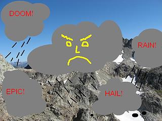
The weather was horrible! We got lost! We got snowed on! We had to rappel with the whippets 25 utility cord leash! 6 times! We had to use one of the whippets as a rappel anchor! We had to eat the other one! We epicked big time! We climbed Fernow by accident instead of Greenwood! Who could find the summit of Greenwood in these hazardous conditions: )
The weather was horrible! We got lost! We got snowed on! We had to rappel with the whippets 25 utility cord leash! 6 times! We had to use one of the whippets as a rappel anchor! We had to eat the other one! We epicked big time! We climbed Fernow by accident instead of Greenwood! Who could find the summit of Greenwood in these hazardous conditions:
 Terrible conditions on Greenwood 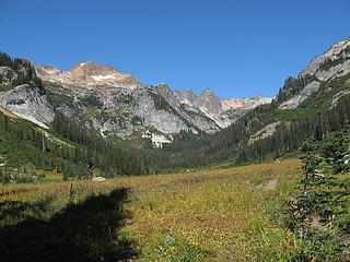 spider meadows 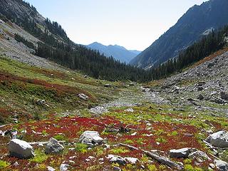 phelps basin 1 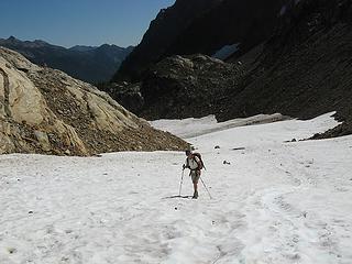 me hiking up to spider gap 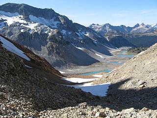 A group heading down to Lyman Lakes 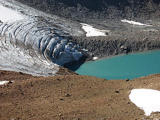 lyman glacier snout and upper lyman lake 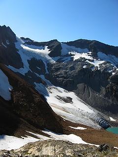 lyman glacier 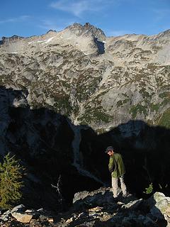 checking out the route to Dumbell across phelps cr. basin 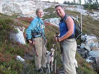 morning visitors 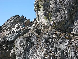 Yana, Tisha, and Jeremy reach the ledge 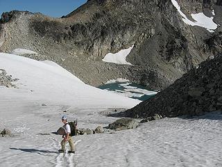 Yana wants to swim in the tarn  We enjoyed the views for a while and observed some people on the summit of Dumbell our next destination. We enjoyed the views for a while and observed some people on the summit of Dumbell our next destination.
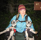
 My giant head blocking Bonanza behind 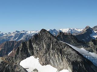 dumbell from greenwood 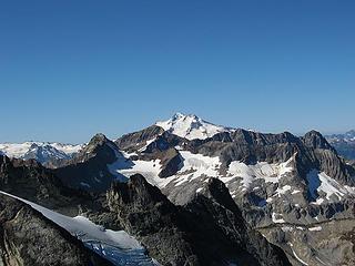 glacier peak 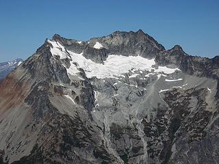 bonanza peak and the isella glacier 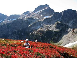 Yana and whippets in red 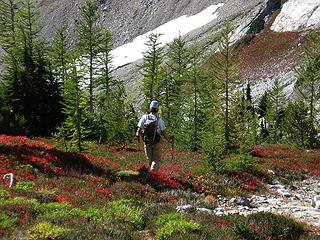 descending through larches 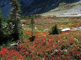 Rowena fall colors
PLAY SAFE! SKI ONLY IN CLOCKWISE DIRECTION! LET'S ALL HAVE FUN TOGETHER!
PLAY SAFE! SKI ONLY IN CLOCKWISE DIRECTION! LET'S ALL HAVE FUN TOGETHER!
|
| Back to top |
  
|
|
Schmidt Alti-Dude
4th class poster

Joined: 06 Jul 2007
Posts: 1361 | TRs | Pics
Location: Looking for Adventure 201! |
We'd had this trip on the back burner for a while and this was to be our first foray into the Spider Meadows area but as soon as the date was set we had a family function that we couldn't skip out on. We thought we were going to miss this adventure until dicey mentioned that Randy and company had done this trip as a dayhike. Well, if Randy could do it, then so could we  !
We left Jeremy's grandparent's place in Bickleton (very small town about 45 minutes south of Sunnyside) as soon as we could but it was still 8:00PM before we were on the road. No problem, since we were already in Eastern Washington right - wrong! After stops for snacks and gas plus taking a wrong turn, we arrived at the trailhead around 12:30AM. We decided to arrange our packs now instead of in the morning and it was well past one before we settled under the blankets in the front seats of our Nissan Altima. !
We left Jeremy's grandparent's place in Bickleton (very small town about 45 minutes south of Sunnyside) as soon as we could but it was still 8:00PM before we were on the road. No problem, since we were already in Eastern Washington right - wrong! After stops for snacks and gas plus taking a wrong turn, we arrived at the trailhead around 12:30AM. We decided to arrange our packs now instead of in the morning and it was well past one before we settled under the blankets in the front seats of our Nissan Altima.
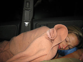 Night, night, Babe  . We slowly ate breakfast and put on our boots in the car before hitting the trail at 5:30. We blasted the 2.5 miles to the Wilderness boundary in 45 minutes and then had a little incident in a meadow right before the turn at Leroy Creek that leads to Maude and 7FJ. The whippets, who had been in perfect "trail formation" (Babe in front, whippets following, Dude in rear) until this point suddenly perked up and went tearing through the meadow. That is when we saw the llamas picketed on the far side of the clearing. A load shout from Tisha stopped the dogs in their tracks and they came back immediately but I felt sorry for the people in the tents being woken at 6:30 by our cries . We slowly ate breakfast and put on our boots in the car before hitting the trail at 5:30. We blasted the 2.5 miles to the Wilderness boundary in 45 minutes and then had a little incident in a meadow right before the turn at Leroy Creek that leads to Maude and 7FJ. The whippets, who had been in perfect "trail formation" (Babe in front, whippets following, Dude in rear) until this point suddenly perked up and went tearing through the meadow. That is when we saw the llamas picketed on the far side of the clearing. A load shout from Tisha stopped the dogs in their tracks and they came back immediately but I felt sorry for the people in the tents being woken at 6:30 by our cries  . .
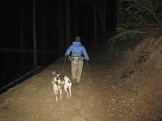 Heading up the trail at o'dark thirty 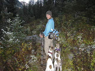 It's a little frosty out  . .
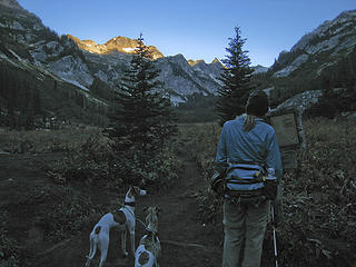 Reading the Spider Meadows sign 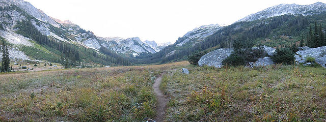 Spider Meadows  (we're on 9/8)! (we're on 9/8)!
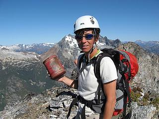
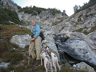 Pausing by a waterfall on the way up to Dumbell 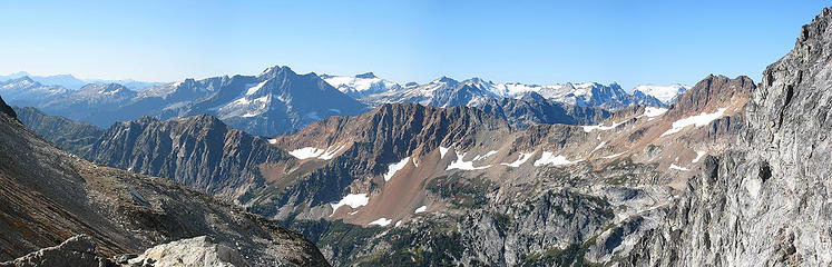 4 labels Looking back from the head of the talus field 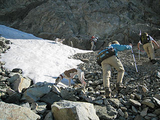 Whippets eat the snow while the humans do the climbing 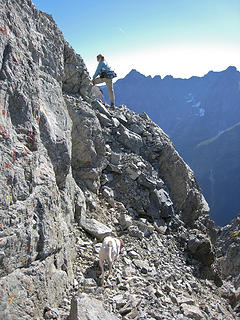 The start of the ledge around Dumbell 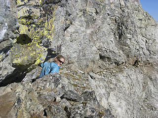 Babe plays peek-a-boo on the ledge 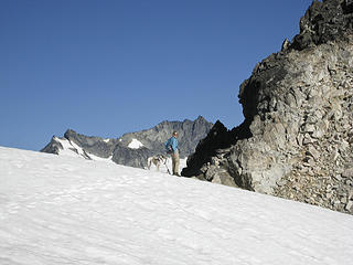 Babe on the snowfield with Bonanza behind 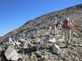 Yana describes the route up Bonanza  11 labels Glacier to Bonanza from the route up to Greenwood 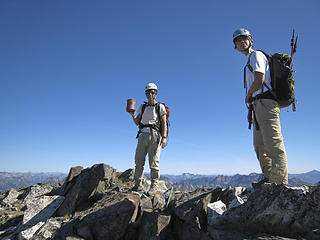 The original summit resigter can (but no register)! 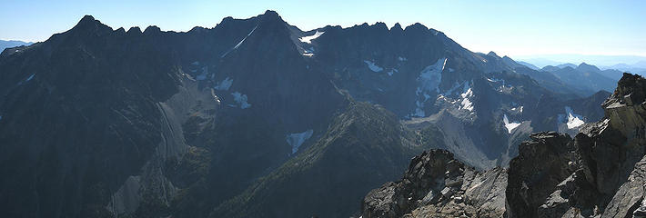 Copper, Fernow, 7 Finger Jack, & Maude from Greenwood 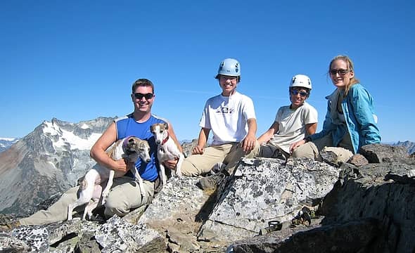 Greenwood summit shot 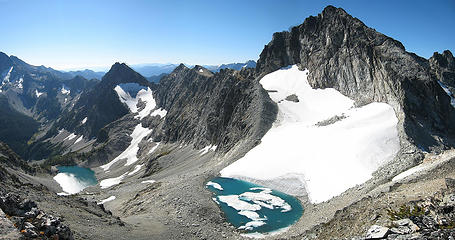 5 labels Dumbell Lake and Greenwood Lake below Dumbell Mountain 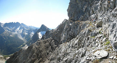 Traversing the 'Baby Carriage' ledge 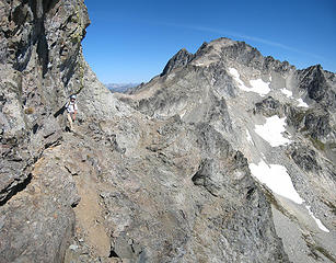 Yana on the ledge 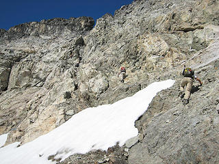 Heading up to the class 4 section of Dumbell 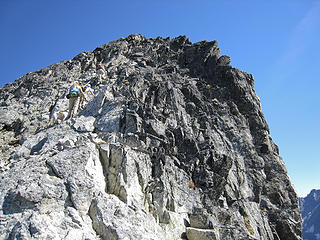 Dumbell summit ahead 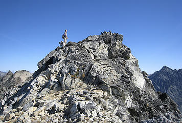 Babe and the whippets reach the summit 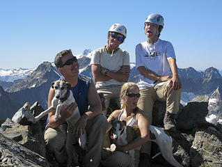 Dumbell dumbells 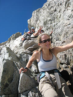 Fun in the class 4 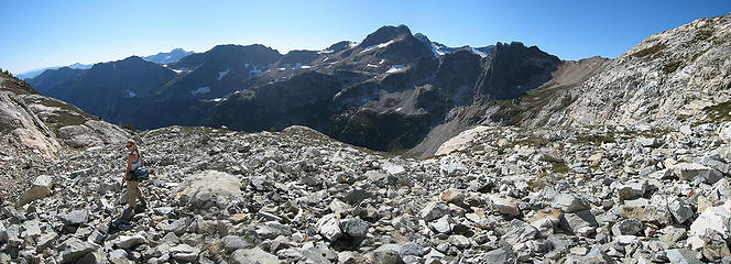 Back on the talus field 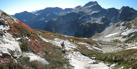 Yana leads the way through the fall colors 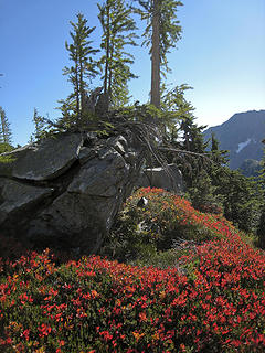 An example of what this area offers 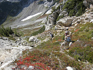 Down, down, down, to the Phelps Basin 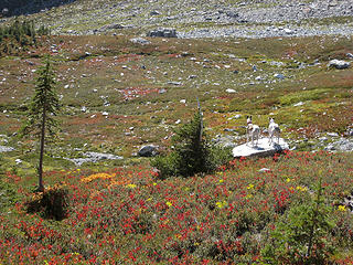 Whippets survey the colorful basin 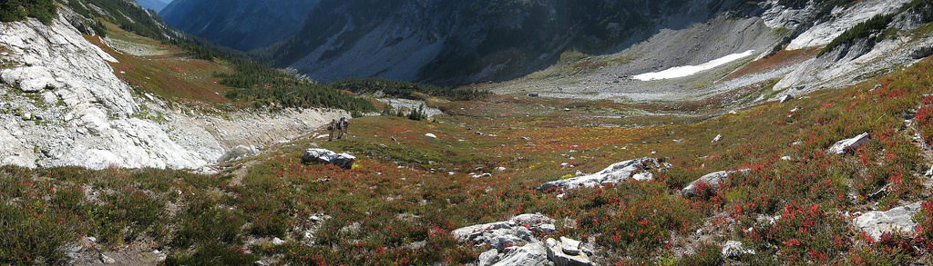 Fall colors in the Phelps Basin 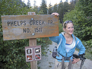 Just another lucky trailhead shot
Anything stated by me in no way reflects the attitudes or opinions of my wife
Anything stated by me in no way reflects the attitudes or opinions of my wife
|
| Back to top |
|
|
Schmidt Alti-Babe
The Ice Queen
Joined: 11 Mar 2008
Posts: 606 | TRs | Pics
Location: Buried by backlogged pictures |
Beautiful area. It was nice to see the views we missed on Clark and Luahna. I'd definitely go back! I especially loved the fall color display.
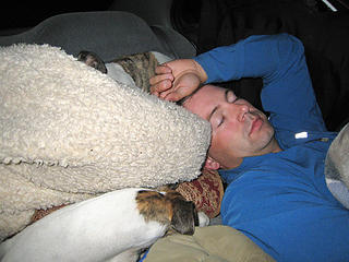 Dude and the whippets asleep in the car 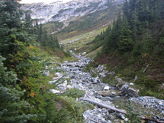 Phelps Basin ahead 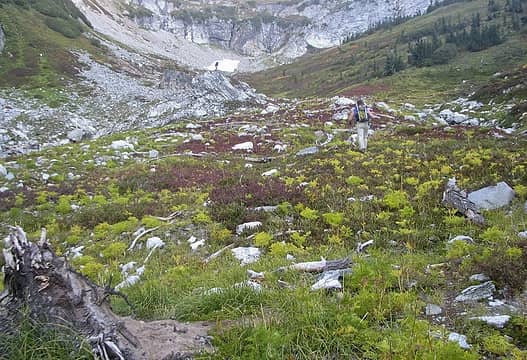 Yana awaits our arrival 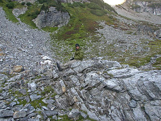 Camo Dicey 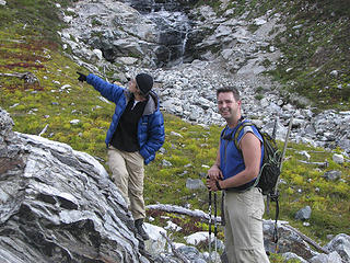 Yana tries to explain something important to Dude, Dude finds better things to do 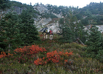 Splash of orange 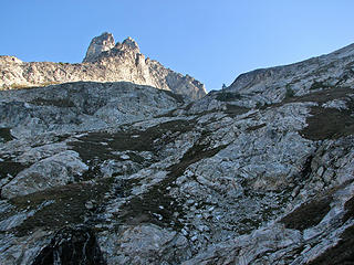 Dumbell false summit 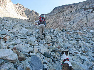 Talus time 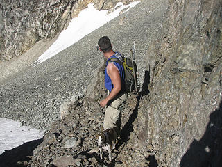 Dude checks on the other party's progress 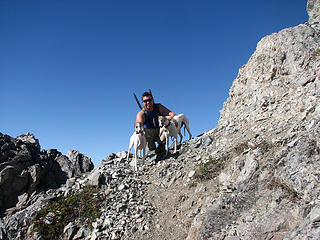 It's "Baby Carriage" time, whippets 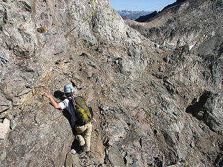 Hold on tight! 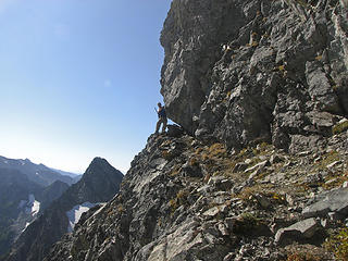 Dude on the ledge 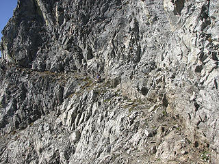 Ledge walking 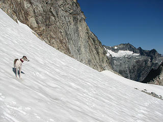 Rowena and Bonanza 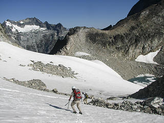 Slick descent down the snow 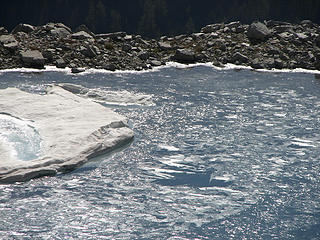 Icy Greenwood tarn 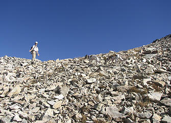 Why are you guys stopping again??? 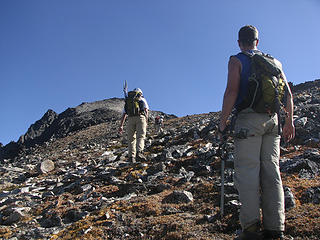 Greenwood summit just ahead 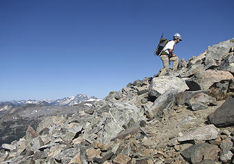 Extreme Yana! 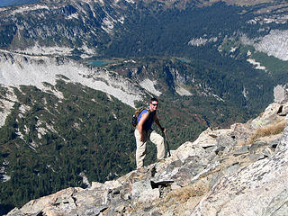 Dude with Lyman Lakes behind 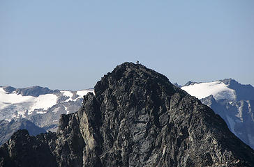 Dumbell summit 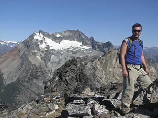 Dude on Greenwood, Bonanza behind 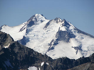 Glacier from Greenwood 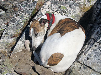 A quick whippet nap 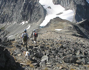 Descending from Greenwood 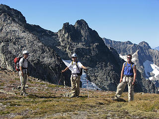 Cool x 3 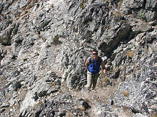 Dude on the class 3-4 rock 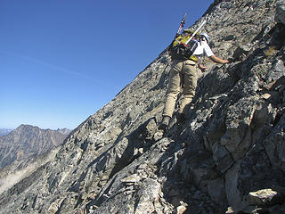 Yana makes everything look easy 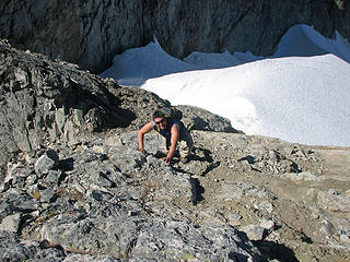 Nope. No exposure here. 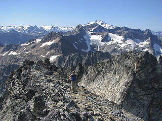 Dude on Dumbell ridge, Glacier in the distance 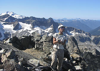 Dicey tackles the summit register 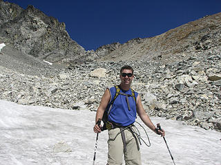 Dude and the talus basin 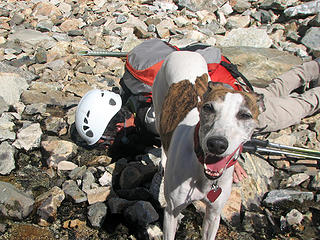 Rowena says, "Well, I just wait until they give me water, but if you want to do it that way, okay." 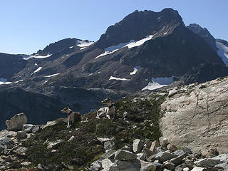 Whip posse posing 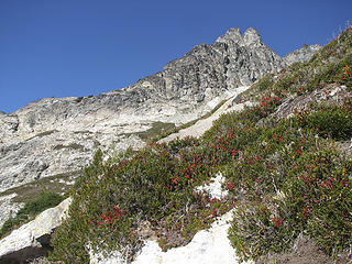 Leaving the Dumbell basin  Red on display 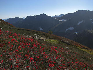 Crimson glory 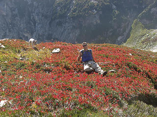 Enjoying the soft heather and huckleberry 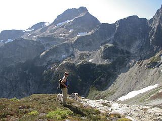 Spider Gap across the valley 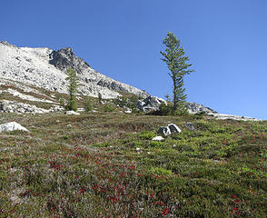 Lone larches 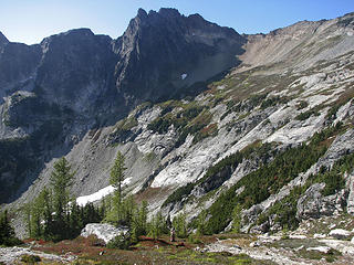 Chiwawa across the valley 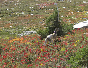 Kiefer in the heather 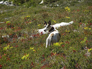 Who me? Just call me Bat Dog!!! 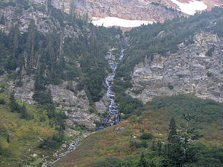 Waterfall from Spider Gap 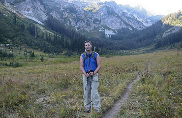 Dude in Spider Meadows
|
| Back to top |
|
|
Tom_Sjolseth
Born Yesterday

Joined: 30 May 2007
Posts: 2652 | TRs | Pics
Location: Right here. |
Nice trip, dudes and dudettes. Was the original summit register still on Greenwood? Ralph Titerud's 1937 FA of Mt. Fernow was still there when we climbed it about 10 years ago. Recently someone told me it was gone, but I see Dicey (er... Yana) holding up the red cinnamon can.
|
| Back to top |
|
|
Matt
Tea, Earl Grey, Hot

Joined: 30 Jan 2007
Posts: 4307 | TRs | Pics
Location: Shoreline |
|
Matt
Tea, Earl Grey, Hot
|
Tue Sep 16, 2008 10:19 pm |
|
|
Wonderfully entertaining writing, Yana.
Where's the "whippets on the ledge" photo?
Edit: Of course, Babe edited in her photos above after I'd already posted this comment.
As beacons mountains burned at evening. J.R.R. Tolkien
As beacons mountains burned at evening. J.R.R. Tolkien
|
| Back to top |
|
|
kleet
meat tornado
Joined: 06 Feb 2002
Posts: 5303 | TRs | Pics
Location: O no they dih ent |
|
kleet
meat tornado
|
Wed Sep 17, 2008 8:06 am |
|
|
| Matt wrote: | | Where's the "whippets on the ledge" photo? |
Kinda funny you're asking for more photos!
A fuxk, why do I not give one?
A fuxk, why do I not give one?
|
| Back to top |
|
|
wamtngal
Member

Joined: 13 Jun 2004
Posts: 2382 | TRs | Pics
Location: somewhere |
|
wamtngal
Member
|
Wed Sep 17, 2008 9:01 am |
|
|
Nice! And great that you guys got to visit that area with views this time. I was just discussing that area with a friend earlier this month when we were over in the Leroy area. Looks like it is indeed a good trip to add to the list!
Opinions expressed here are my own.
Opinions expressed here are my own.
|
| Back to top |
|
|
goats gone wild
Mr. Goat

Joined: 19 Aug 2007
Posts: 2524 | TRs | Pics
Location: Vampireville |
.....leaving me wanting to return over and over in what ever capacity that may be, even if one day my knees are too old and I can only see the mountains from my porch.
Jason Hummel
|
| Back to top |
|
|
yukon222
Member

Joined: 12 Mar 2007
Posts: 1893 | TRs | Pics
|
|
yukon222
Member
|
Wed Sep 17, 2008 11:00 am |
|
|
Spectacular trip and pics. Looks like the weather cooperated very nicely.
So the Schmidts no longer need to even camp out in the woods for long trips? Just get up early and go all day and then back out? 
|
| Back to top |
|
|
cartman
Member
Joined: 20 Feb 2007
Posts: 2800 | TRs | Pics
Location: Fremont |
|
cartman
Member
|
Wed Sep 17, 2008 12:48 pm |
|
|
| Yana wrote: | | cursing at having to ruin our impeccable manicures. |
I hate it when that happens.
| Yana wrote: | | There is a curious tarn here (not on the map) that had large chunks of ice in it, but more interestingly, the entire thing was covered by a thinner, transparent sheet of ice! |
Matt insisted on swimming in it and climbing on the iceberg when we were there two years ago: http://www.mtnvista.net/Mountains/Mountains%202006/06%2008-26%20Dumbell,%20Greenwood,%20Genius.htm
| Yana wrote: | | Anyway, we walked up talus and dirt to the summit of Greenwood, which has the famous original summit register can but the original register is gone. I was super bummed to not get to see it in person. |
That is a bummer. It was still there when we were up there. It was hilarious to read Ralph Titerud's two pages from the 1930s, especially since he thought he'd summitted Fernow.
|
| Back to top |
|
|
gone
Member
Joined: 08 Feb 2008
Posts: 1051 | TRs | Pics
|
|
gone
Member
|
Wed Sep 17, 2008 12:57 pm |
|
|
Wonderful!
Those ledge/exposure shots made my palms sweat! 
|
| Back to top |
|
|
twodogdad
Member
Joined: 21 Nov 2006
Posts: 846 | TRs | Pics
Location: seattle |
|
twodogdad
Member
|
Wed Sep 17, 2008 1:25 pm dumbbell
|
|
|
Doom Rain (or is it Pain?) Hail: perfect tags for my alpine pursuits. Your Bulgarian bottom line reminds me of something I can't recall the source of: gori tilileiski. Must be a fairy tale. Does it ring a bell? tdd
|
| Back to top |
|
|
twodogdad
Member
Joined: 21 Nov 2006
Posts: 846 | TRs | Pics
Location: seattle |
|
twodogdad
Member
|
Wed Sep 17, 2008 1:36 pm dumbbell, dogs
|
|
|
This caught our attention: whippets summiting their first two 100. We thought you were way ahead of us (Boon has 3 summits; Docs only 1). Do the pics give a fair sense of the worst terrain--from a dog's point of view? Thanks, the Doodles.
Great photography, as usual
tdd
|
| Back to top |
|
|
John Morrow
Member

Joined: 03 Apr 2007
Posts: 1526 | TRs | Pics
Location: Roslyn |
Thanks for the awesomely detailed route descriptions, Yana. First time I've got the sense of how fun the scrambling looks on those two peaks. Can't wait to get up there!
John
Tell me, what is it you plan to do with your one wild and precious life?-Mary Oliver
A nation that continues year after year to spend more money on military defense than on programs of social uplift is approaching spiritual doom.
― MLK Jr.
Tell me, what is it you plan to do with your one wild and precious life?-Mary Oliver
A nation that continues year after year to spend more money on military defense than on programs of social uplift is approaching spiritual doom.
― MLK Jr.
|
| Back to top |
|
|
Yana
Hater
Joined: 04 Jun 2004
Posts: 4212 | TRs | Pics
Location: Out Hating |
|
Yana
Hater
|
Wed Sep 17, 2008 2:50 pm |
|
|
| John Morrow wrote: | | Thanks for the awesomely detailed route descriptions, Yana. First time I've got the sense of how fun the scrambling looks on those two peaks. Can't wait to get up there!
John |
Hope you can avoid the hordes, unlike us! It's definitely a great area to visit.
I went back and looked at my route descriptions, which apparently suffered from some slight right/left dyslexia. All fixed now, though.
cartman - I wanted to swim in it too, mainly because I can't allow Matt to upstage me in the "swimming in frozen lakes" category, but it was FROZEN (and also, we didn't have a lot of time to linger).
tdd - that sounds familiar to me also, but I also can't think of why. I'll ask my parents and get back to you (or they could just respond to this thread, since I know they read the TR: HINT HINT).
PLAY SAFE! SKI ONLY IN CLOCKWISE DIRECTION! LET'S ALL HAVE FUN TOGETHER!
PLAY SAFE! SKI ONLY IN CLOCKWISE DIRECTION! LET'S ALL HAVE FUN TOGETHER!
|
| Back to top |
|
|
|
|
You cannot post new topics in this forum
You cannot reply to topics in this forum
You cannot edit your posts in this forum
You cannot delete your posts in this forum
You cannot vote in polls in this forum
|
Disclosure: As an Amazon Associate NWHikers.net earns from qualifying purchases when you use our link(s). |


 Wish I could climb like you guys. I didn't know there could ever be too many handholds.