| Previous :: Next Topic |
| Author |
Message |
Sadie's Driver
Sadie's Driver


Joined: 24 Apr 2006
Posts: 1763 | TRs | Pics
Location: Welcome Pass |
Where we last left this story, the driver had had a taste of the Sierras bagging Echo and Angora Echo and Angora Peaks in advance of the arrival of Middle E. A few years back, I had hiked Tallac and the Velma Lakes by myself - taking the "standard" routes. However, with Barry along, adventure would be added!  Standard routes be damned! He arrived in South Lake Tahoe on Wednesday afternoon and we headed back north around the west side of Lake Tahoe towards Tahoe City - which would be our base "camp" (read: cabin) for the next four and a half days. The weather was perfect - in the 70s in the afternoons - but chilly in the evening and early morning - but shorts were always derigueur. Hiking would begin on Thursday. The following report(s) are a collaborative effort. Barry will add his pics.
Day One Mt. Tallac (9,735); Gilmore and Half Moon Lakes (the Driver report)
14-15 miles; 3400+ of gain; 6 ½ hours
We picked the Glen Alpine Trail to Tallac, mainly on the advice of the nice Forest Service Ranger who considered this to be a more interesting route. Of course, its also 2 ½ miles longer than the Baldwin Beach route thats the standard trail to the summit. You turn off of the main route around the west side of Lake Tahoe (Rt. 89) on Fallen Leaf Road similar to the route for Angora Lakes; but you stay on Fallen Leaf all the way to the end and the trailhead. Standard routes be damned! He arrived in South Lake Tahoe on Wednesday afternoon and we headed back north around the west side of Lake Tahoe towards Tahoe City - which would be our base "camp" (read: cabin) for the next four and a half days. The weather was perfect - in the 70s in the afternoons - but chilly in the evening and early morning - but shorts were always derigueur. Hiking would begin on Thursday. The following report(s) are a collaborative effort. Barry will add his pics.
Day One Mt. Tallac (9,735); Gilmore and Half Moon Lakes (the Driver report)
14-15 miles; 3400+ of gain; 6 ½ hours
We picked the Glen Alpine Trail to Tallac, mainly on the advice of the nice Forest Service Ranger who considered this to be a more interesting route. Of course, its also 2 ½ miles longer than the Baldwin Beach route thats the standard trail to the summit. You turn off of the main route around the west side of Lake Tahoe (Rt. 89) on Fallen Leaf Road similar to the route for Angora Lakes; but you stay on Fallen Leaf all the way to the end and the trailhead.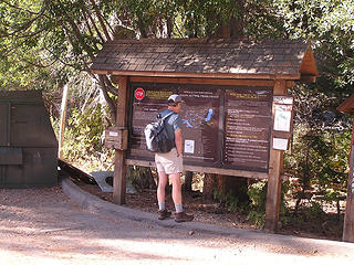 Barry at Glen Alpine Springs trailhead 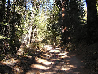 Road continues through deciduous and evergreen growth 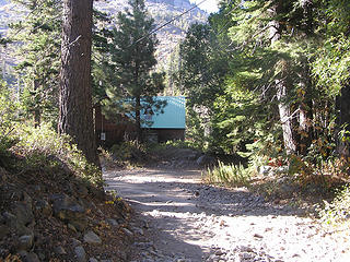 Old road starts this trip - abandoned buildings along the way 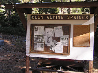 Bulletin Board at base of Glen Alpine Resort 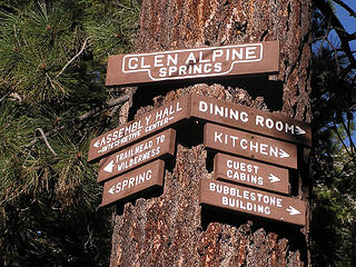 A once-active resort 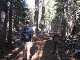 Just entering Desolation Wilderness 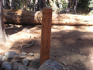 One of many trail markers 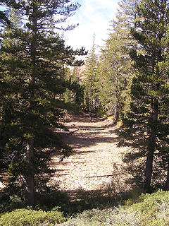 Dried out pond 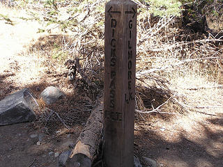 Intersection between PCT (Dick's Pass Trail) and route to Gilmore Lake 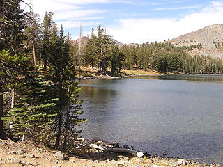 Gilmore Lake from the southern shore 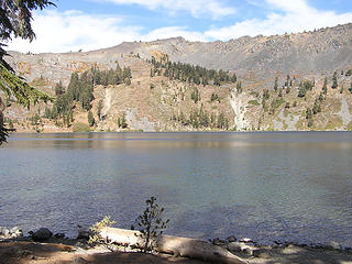 Ridges around Gilmore Lake 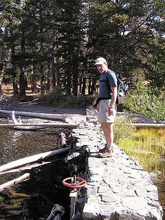 Breakwater at Gilmore outlet 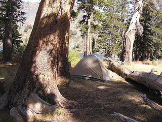 Campers at Gilmore 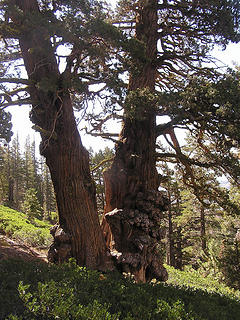 Gnarly trees 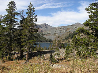 First glimpse of Gilmore Lake 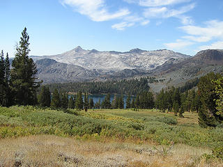 On trail to Tallac summit 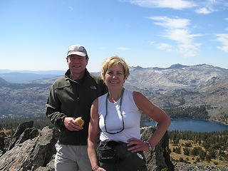 Invasion of the NW Hikers! 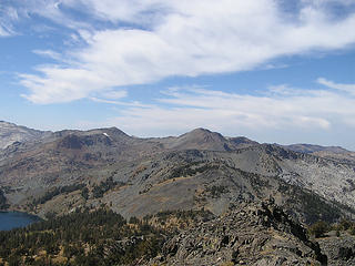 More views from the summit of Tallac 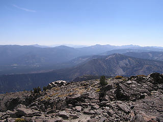 Looking to Echo and Angora Peaks (south) from summit of Tallac 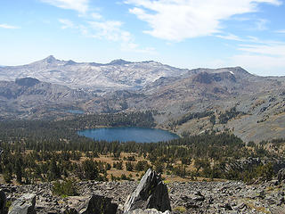 Gilmore Lake from summit of Tallac - looking Southwest (Pyramid Peak pointy one on the left) 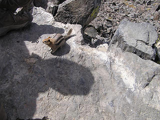 Wildlife on Tallac 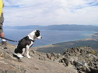 Summit dog 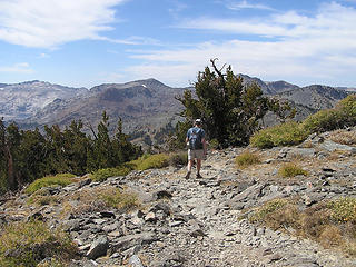 Heading off of Tallac summit 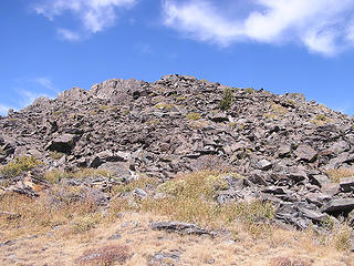 Tallac Summit 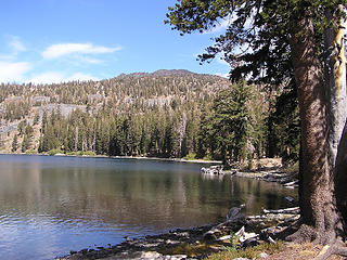 Tallac from the western shore of Gilmore 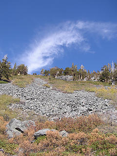 Our "shortcut" from Gilmore down to Half Moon Lake trail 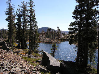 Lakelet just before Half Moon 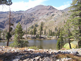 Dick's Peak from Half Moon trail 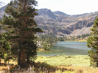 Half Moon Lake (Day Two has a picture from above) 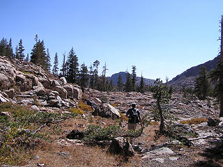 Heading back towards Glen Alpine 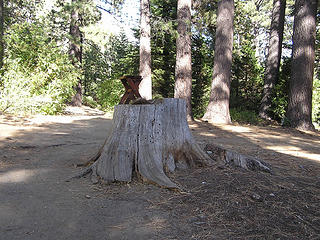 Apparently a "resting throne" at the end of the hike near the resort 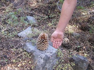 "Car bomb" pine cone - they'll do some damage if it lands on you! 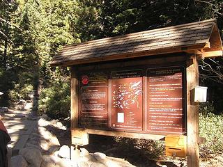 Eagle Lake trailhead 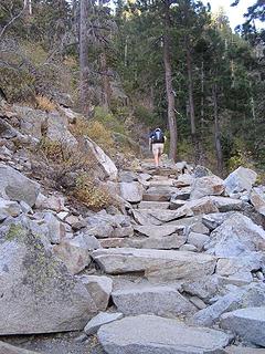 Jim K steps up the Eagle Lake Loop 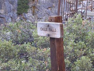 Well, the sign says Eagle Falls! 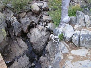 Eagle Falls in reality! 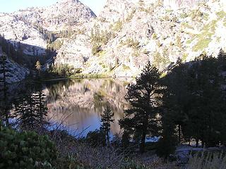 Eagle Lake 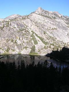 Reflection in Eagle Lake 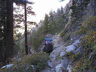 Another erstwhile camper 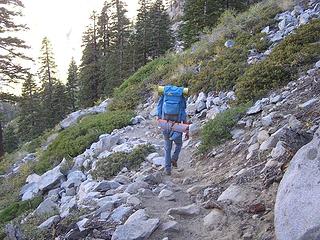 High school camper loaded down 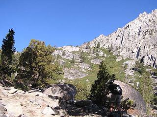 Great views on our route towards Dick's Lake  Wonderful views everywhere 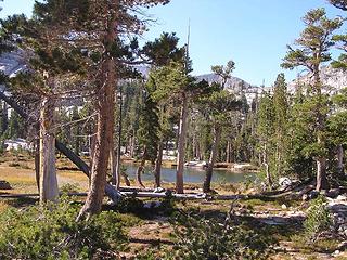 Small lakes on route to Dick's Lake  Our trailmarker route 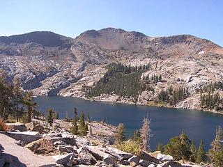 Dick's Lake and Dick's Peak behind - with the ridge on the right that we should have followed to the summit 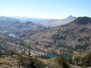 Half Moon Lake in foreground, Susie Lake to the left and Aloha lake in distance in front of Pyramid Peak 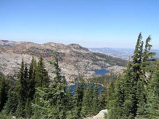 Dick's Lake in foreground - Fontanillis beyond 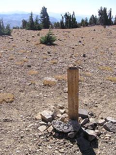 Dick's Pass (PCT) 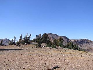 Dick's Pass 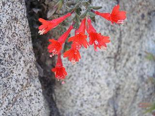 Mountain Fuschia 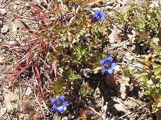 Gentian in bloom at Dick's Pass 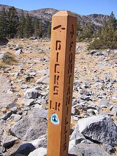 Trailmarker 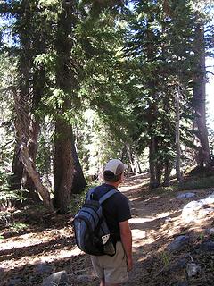 Trail from Dick's Lake to Fontanillis Lake 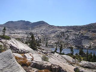 Ridge to Dicks Peak beyond Fontanillis Lake - the route we'll take next time 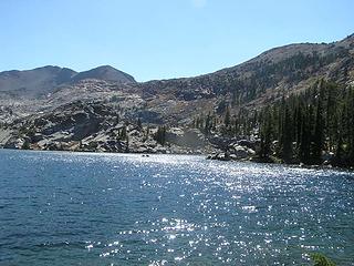 Lovely Fontanillis Lake 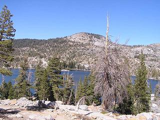 Middle Velma Lake 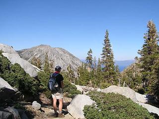 Barry on the Eagle Lake trail with Lake Tahoe in distance 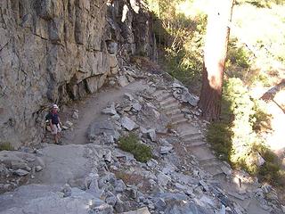 Steps and more steps along Eagle Lake Trail 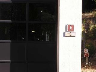 Small sign giving a clue to trailhead 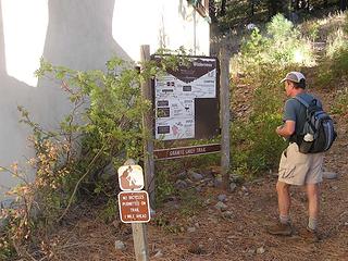 At Granite Chief trailhead - tucked behind the Squaw Valley Fire station 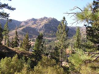 Squaw Valley area  ) There were a couple of small meadows filled with dead balsamroot, crispy and brown and crackling as we walked though. ) There were a couple of small meadows filled with dead balsamroot, crispy and brown and crackling as we walked though.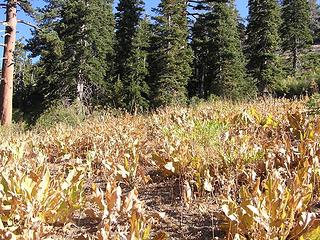 Rustling Balsamroot - dried and crinkly like a starched petticoat 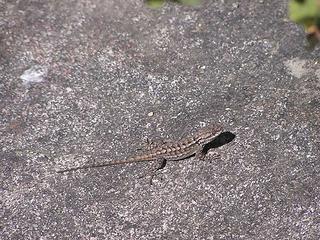 More wildlife 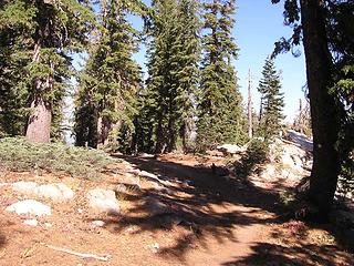 North on PCT 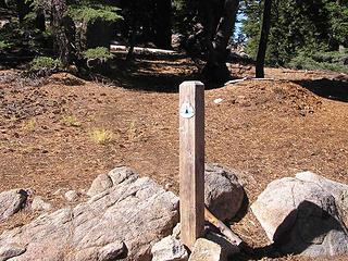 Arriving on the Crest Trail 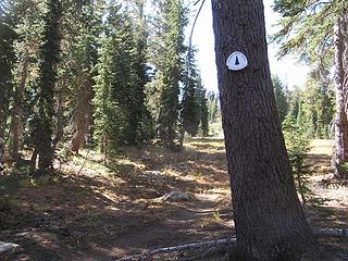 South on the PCT 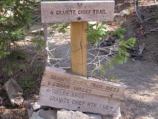 Intersection of PCT with Granite Chief trail (always longer than the books describe!) 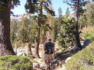 Hiking south on the Crest Trail approaching Granite Chief 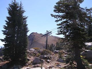 Chairlift crosses the PCT 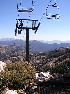 Squaw Valley lifts 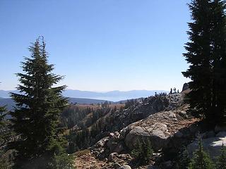 Lake Tahoe in the distance  ). We ran into a couple at this point who wondered where the Pacific Crest Trail was - which we so "knowledgeably" were able to point out to them! We continued briefly on the PCT, thinking that we would encounter the actual Granite Chief summit trail, but, alas, no. We did find the Wilderness, however. ). We ran into a couple at this point who wondered where the Pacific Crest Trail was - which we so "knowledgeably" were able to point out to them! We continued briefly on the PCT, thinking that we would encounter the actual Granite Chief summit trail, but, alas, no. We did find the Wilderness, however.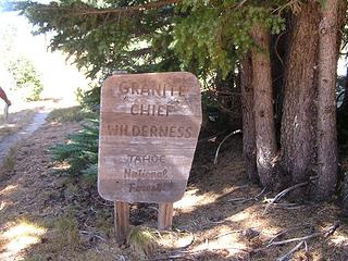 Entering the Granite Chief Wilderness (along the PCT) 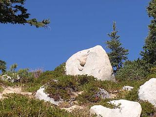 Happy face greeting us on the way up to Granite Chief 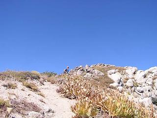 Barry heading up to summit of Granite Chief 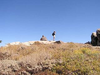 On the summit 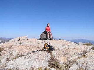 Driver on the summit 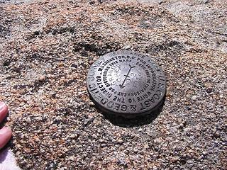 USGS on Granite Chief summit 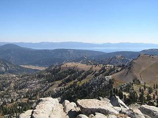 Squaw Valley from Granite Chief (Lake Tahoe in distance) 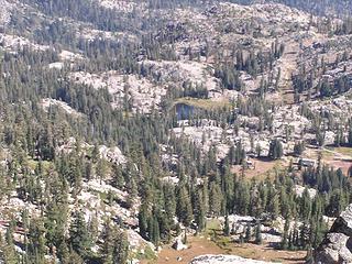 Shirley Lake from the summit of Granite Chief 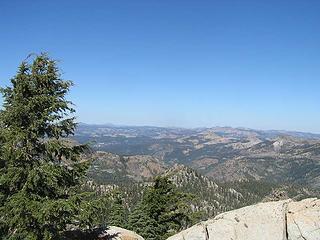 Looking north from Granite Chief summit 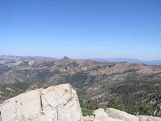 Tinker Knob from summit of Granite Chief 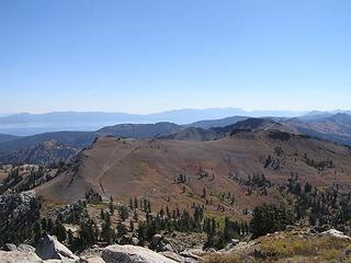 Looking south to Emigrant Pass from summit of Granite Chief 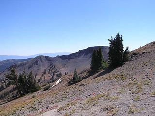 Squaw Peak 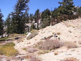 The actual start of the trail up to Granite Chief - we missed when we passed by on the PCT 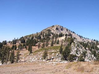 Granite Chief from the PCT 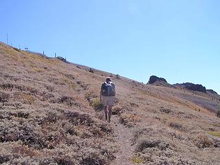 Heading up to Emigrant Pass 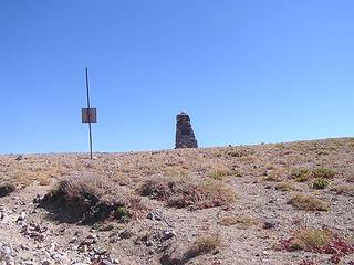 Emigrant memorial 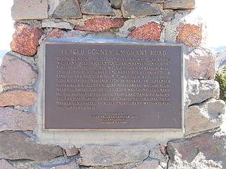 Emigrant Memorial 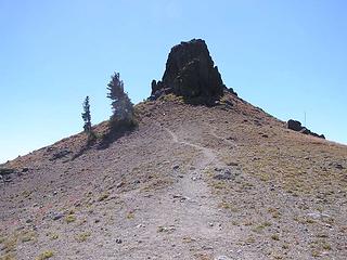 "Emigrant Peak" as called by the locals 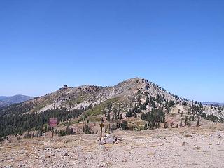 Granite Chief and Needle Peak from Emigrant Pass 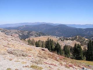 Squaw Valley plateau (location of upper restaurant) 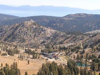 Maintenance area for Squaw Valley on the high plateau above the resort area - Lake Tahoe in the distance 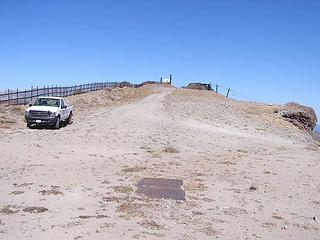 Truck high up on Emigrant Pass - no driver in sight 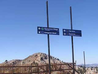 A little research for ski season! 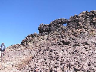 Hiking up to the "Hole in the Wall" to the northeast of Emigrant Pass  down to Shirley Lake. down to Shirley Lake.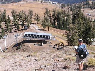 The Shirley Lake Express - might have been a better method of reaching the lake! 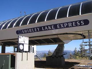 Unfortunately, not running!  Once at the lake, we found the trail back to the ski resort area. This trail was a twisty maze through the rocks and trees, marked with paint of various colors, Once at the lake, we found the trail back to the ski resort area. This trail was a twisty maze through the rocks and trees, marked with paint of various colors,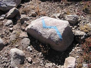 Dubious "trail markers" on a dubious "trail"! 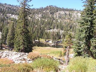 Shirley Lake - not exactly your stunning alpine destination!  Great trip!!! Great trip!!! 
Four-paw buddy lets me tag along!
Four-paw buddy lets me tag along!
|
| Back to top |
  
|
|
Middle E
no more moustache

Joined: 10 Feb 2008
Posts: 432 | TRs | Pics
Location: Seattle, WA |
|
Middle E
no more moustache
|
 Mon Sep 29, 2008 7:18 pm |
|
|
This was my first time doing any extended hiking in any part of the Sierras. One certainly can't complain about the sun, and moderate temperatures, or the spectacular scenery. On the other hand...somehow it seems too easy, and compared to the Cascades the dryness is just a bit austere and lifeless. But I'd go back!  Here's a few additional photos...
Day one
Here's a few additional photos...
Day one
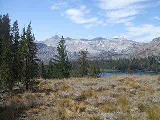 Pyramid behind Gilmore Lake 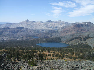 Gilmore Lake from Mt. Tallac 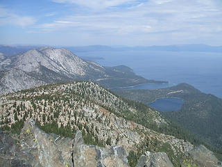 Looking north past Emerald Bay 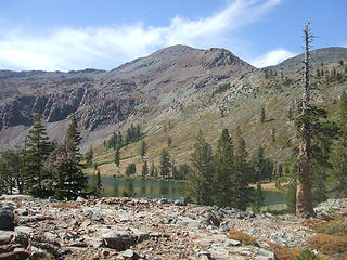 Dick's Peak behind Half Moon Lake 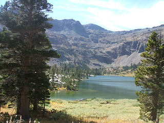 Half Moon Lake 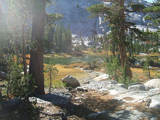 Tarn 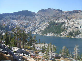 Dick's Lake 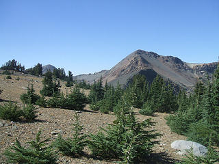 Dick's Peak from Dick's Pass 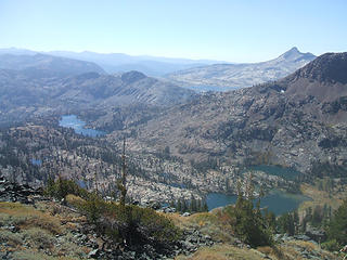 Many lakes from Dick's Pass 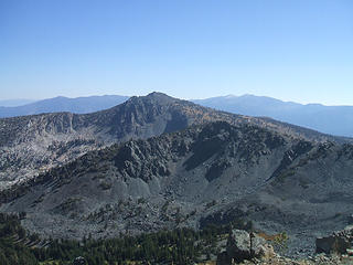 Mt. Tallac from near Dick's Pass 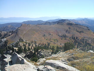 Emigrant Pass from Granite Chief 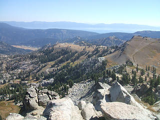 Squaw Valley area from Granite Chief 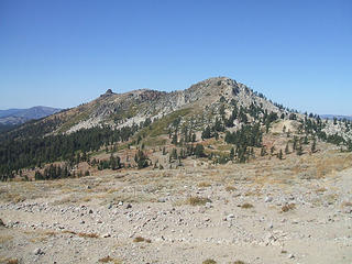 Granite Chief from Emigrant Pass
pithy yet insightful signature
pithy yet insightful signature
|
| Back to top |
|
|
|
|
You cannot post new topics in this forum
You cannot reply to topics in this forum
You cannot edit your posts in this forum
You cannot delete your posts in this forum
You cannot vote in polls in this forum
|
Disclosure: As an Amazon Associate NWHikers.net earns from qualifying purchases when you use our link(s). |


