| Previous :: Next Topic |
| Author |
Message |
Schmidt Altitude
Whippet Entourage


Joined: 28 Mar 2007
Posts: 803 | TRs | Pics
Location: The Quah |
Dates: Sunday, November 16
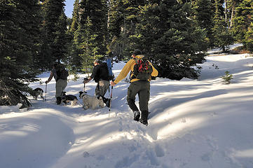
Crew: GeoTom and Jasper, yukon222, Schmidt Altitude (Babe, Row, Kief, Dude)
Summits (in order we gained them): Yellow Hill 5527 (unranked), Elbow Peak 5720 (#81 Back Court 100), Humerus Hill 5920 (#76 Back Court 100), Jolly Mountain 6443 (#60 Back Court 100, #13 Teanaway 20)
Route: Yellow Hill Trail, #1222, to Jolly Mountain Trail, #1307
Hiking Stats: ~15.25 miles* traveled, 6352 feet gained, 6775 feet descended, 10 hour 1 minute car to car including breaks *According to TOPO!, Green Trails has the mileage around 17.5
Resources: Green Trails Maps No 208, Kachess Lake, and No 209, Mount Stuart
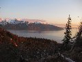
After dropping off Toms truck at Cayuse Horse Camp a magical storm swept us all up in Yukons Vibe and transported us to the old spur road just past the Indian Camp Ground on the Middle Fork Teanaway River. At first we were fearful we wouldnt be able to find our way back to Toms truck until we found an old manuscript written by The Good Witch Sadies Driver describing how to find the Wizard of the Teanaways, the mysterious JimK, who could hopefully show us the way home. And how were we supposed to find this Wizard you might ask? Quite simple stated the manuscript, Just follow the Yellow Hill Trail, just follow the Yellow Hill Trail, just follow, follow, follow, follow, follow the Yellow Hill Trail! . . .
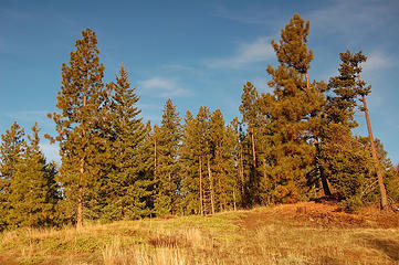
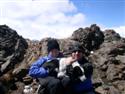
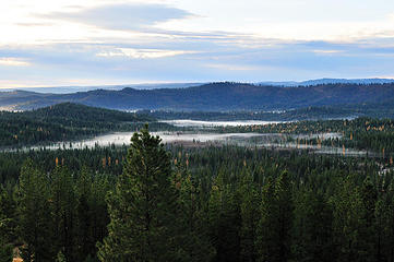 Still a few golden larches to be seen 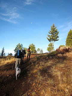 On the old spur road under the moon 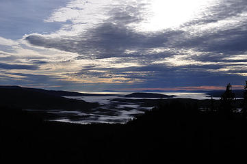 Mysterious red sky in the south 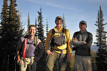 Yella' Boyz 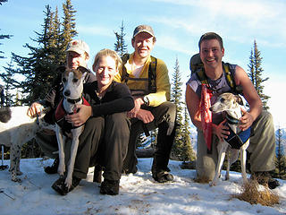 Yellow Hill group shot 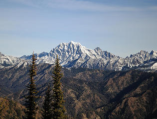 Mount Stuart from the Yellow Hill trail  On the trail 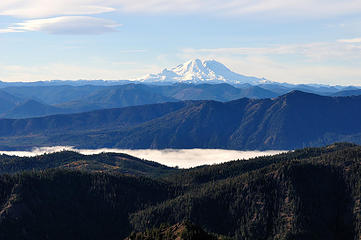 Rainier from Point 5438' 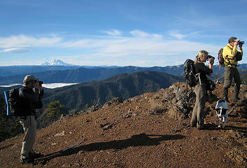 Oh no, now they all have a DSLR!  Ridge walk to Elbow Peak 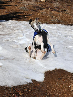 Yes, ever more snow rolling whippets 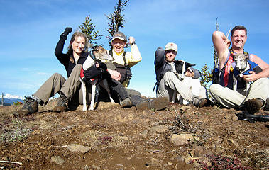 Our Elbow elbows 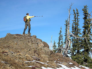 Where is the Wizard of the Teanaway? 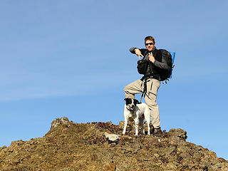 NW Hikers are loose on the trail! 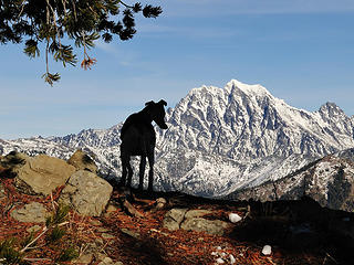 Rowena silhouetted in front of Stuart 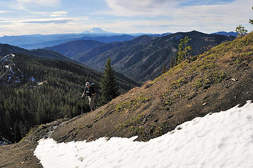 GeoTom on the trail  . The trail drops about 500 feet from Elbow Peak to the lowest point but it has so many ups and downs that the cumulative counter elevation is much more than that . The trail drops about 500 feet from Elbow Peak to the lowest point but it has so many ups and downs that the cumulative counter elevation is much more than that  . For us, this was the most mentally exhausting part of the trail. Eventually, we turned the corner where the trail makes a bend and heads west for a bit and ran up the next high point, exhaulting in finally reaching our goal only to discover that there was an even higher point just beyond . For us, this was the most mentally exhausting part of the trail. Eventually, we turned the corner where the trail makes a bend and heads west for a bit and ran up the next high point, exhaulting in finally reaching our goal only to discover that there was an even higher point just beyond  . The problem was that we didnt write down the elevation of Humerus Hill and since it is not marked on maps we assumed the Point 5750 written on the map was the summit. We made our way to the true Humerus Hill summit (5920+) and enjoyed the views NE of the Stuart Range and surrounding peaks. It took us about a hour and half to go between Elbow and Humerus (the name is a play on words with the two peaks it sits between the humerus is the bone of the upper arm, one of the bones connected to the elbow joint and is a homonym to humorous which is a synonym of jolly). . The problem was that we didnt write down the elevation of Humerus Hill and since it is not marked on maps we assumed the Point 5750 written on the map was the summit. We made our way to the true Humerus Hill summit (5920+) and enjoyed the views NE of the Stuart Range and surrounding peaks. It took us about a hour and half to go between Elbow and Humerus (the name is a play on words with the two peaks it sits between the humerus is the bone of the upper arm, one of the bones connected to the elbow joint and is a homonym to humorous which is a synonym of jolly).
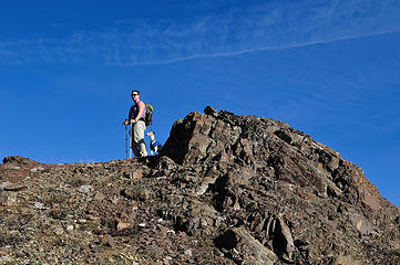 Wait a minute, that hill over there looks higher!!! 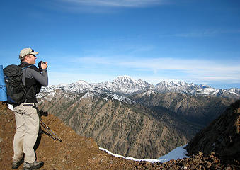 Great views from Humerus Hill 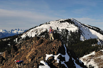 Dude on Humerus Hill with Jolly Mountain behind 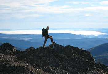 Humerus hill goes down to the Babe! 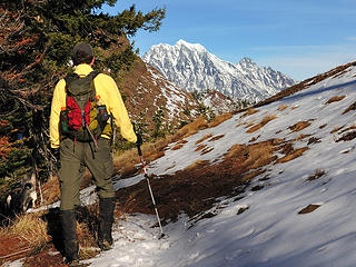 Is Yukon itching to climb Stuart again?!? 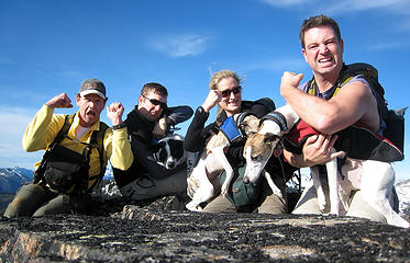 Humerus hilarity  Jolly and Stuart from Humerus Hill  which wouldnt be too bad if we hadnt hit deep snow on the east face of Jolly. Our momentum came to a grinding halt as we trudged up unbroken, knee deep, hard, wet snow which wouldnt be too bad if we hadnt hit deep snow on the east face of Jolly. Our momentum came to a grinding halt as we trudged up unbroken, knee deep, hard, wet snow  . Even though Humerus Hill and Jolly Mountain are a little over a mile apart (as the crow flies - cacaw!) it took us nearly two hours to hike between the summits! All our hard work was rewarded with the best views of the entire trip. We could see clearly from Three Queens Mountain to Navaho Peak with all the myriad of peaks we have climbed and yet to climb in between! Someone had built a large windbreak on the summit but we didnt find the Wizard in his fortress . Even though Humerus Hill and Jolly Mountain are a little over a mile apart (as the crow flies - cacaw!) it took us nearly two hours to hike between the summits! All our hard work was rewarded with the best views of the entire trip. We could see clearly from Three Queens Mountain to Navaho Peak with all the myriad of peaks we have climbed and yet to climb in between! Someone had built a large windbreak on the summit but we didnt find the Wizard in his fortress  . .
 Finding the deep snow 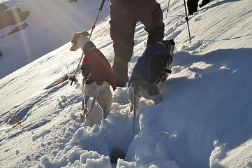 The whippets are working hard to keep pace with the two-leggers 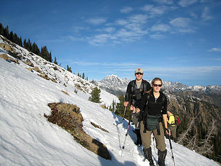 On the east side of Jolly Mountain 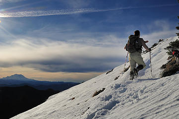 Dude's still breaking the trail 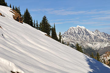 Untouched snow and Mount Stuart 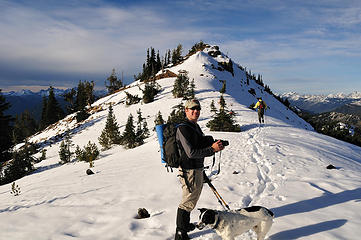 Now it's just a little ridge walk to the Jolly Mtn summit 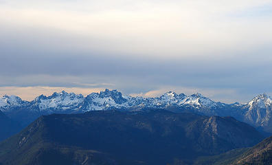 Chikamin, Lemah, Chimney Rock, Summit Chief, & Bears Breast from Jolly  Pano north from Jolly Mtn  . Soon we were following the trail off Sasse Ridge into the Salmon la Sac creek drainage, past the Paris Creek Trail, #1307.1, junction and the final 3 miles to the trailhead. Those last three miles seemed to take forever, especially for yukon222 and Babe. Yukon had been battling an off-again/on-again cold for weeks and spent more time hacking, snorting, and spitting as the day progressed . Soon we were following the trail off Sasse Ridge into the Salmon la Sac creek drainage, past the Paris Creek Trail, #1307.1, junction and the final 3 miles to the trailhead. Those last three miles seemed to take forever, especially for yukon222 and Babe. Yukon had been battling an off-again/on-again cold for weeks and spent more time hacking, snorting, and spitting as the day progressed  . Babe started off the day feeling fine but developed a cough and slight fever as time went on . Babe started off the day feeling fine but developed a cough and slight fever as time went on  . Tom and Dude started to get worried that they were going to have to carry their companions off the mountain . Tom and Dude started to get worried that they were going to have to carry their companions off the mountain  . Somehow they both found the inner strength to pull through and we made it to the truck at 5:45PM, exactly ten hours after starting. . Somehow they both found the inner strength to pull through and we made it to the truck at 5:45PM, exactly ten hours after starting.
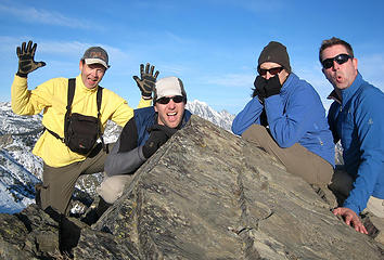 Jolly jokesters 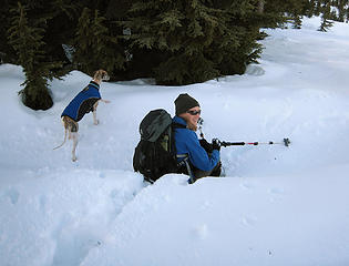 Down goes Babe! 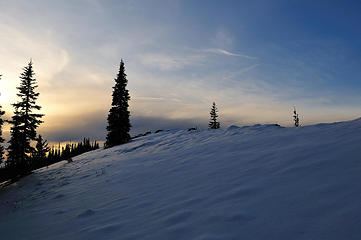 A beautiful ending to a great day 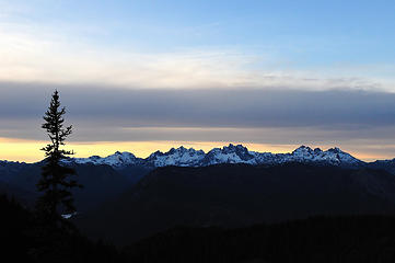 Sunset color on some of our favorite Home Court peaks 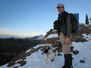 A boy and his dog 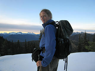 Babe's not feeling too well but she's a trooper
"Forest 101: These big wood stick things are called trees. The big rocks are called mountains, and the little rocks are their babies." Elliott from Open Season
"Forest 101: These big wood stick things are called trees. The big rocks are called mountains, and the little rocks are their babies." Elliott from Open Season
|
| Back to top |
  
|
|
yukon222
Member

Joined: 12 Mar 2007
Posts: 1893 | TRs | Pics
|
|
yukon222
Member
|
 Wed Nov 19, 2008 7:36 pm |
|
|
Wow, what a fun late fall season dayhike! Plenty of timing issues though, trying to squeeze in a long hike plus the extra driving time related to the one-way traverse and two car shuttle. It all worked out well, although 4hrs sleep, 4:15am wake-up call, 3hrs driving, 10hrs of almost non-stop hiking and 3hrs driving sure made for a long day.  Definitely recommend the South-North traverse direction as the views keep expanding the farther north you travel. Plus the Sun is at your back for better photos and vision. Would get old in a hurry if you had to keep turning around to gaze at the broad views of the Stuart Range.
Jolly Mtn summit is very nice with commanding views in all directions. And there is already a 48" high rock windbreak on the summit to shelter your tent or bivy. No water sources (other than snow) along this long traverse until you are in the Salmon La Sac creek basin near the endpoint.
Definitely recommend the South-North traverse direction as the views keep expanding the farther north you travel. Plus the Sun is at your back for better photos and vision. Would get old in a hurry if you had to keep turning around to gaze at the broad views of the Stuart Range.
Jolly Mtn summit is very nice with commanding views in all directions. And there is already a 48" high rock windbreak on the summit to shelter your tent or bivy. No water sources (other than snow) along this long traverse until you are in the Salmon La Sac creek basin near the endpoint.
 DSC_8277 - golden light at Yellow Hill 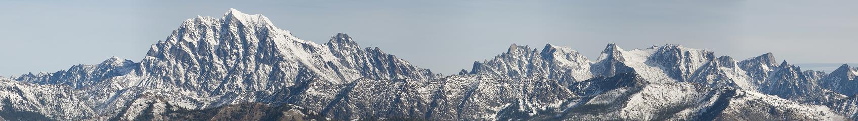 pano4 - Stuart Range 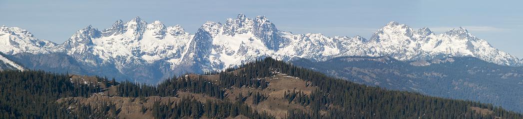 pano7 - Lemahs, Chimney and Summit Chief DSC_8417 - Dude getting psyched up for tough slog DSC_8426 - cutting up Jolly Mtn 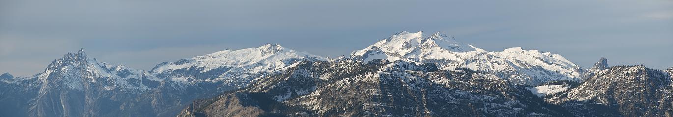 pano12 - Hinman, Daniel and friends DSC_8462 - north view descending from Jolly Mtn DSC_8466 - icy light pano15 - Lemahs and Chiefs
|
| Back to top |
|
|
GeoTom
Member

Joined: 19 May 2005
Posts: 3215 | TRs | Pics
Location: Earth |
|
GeoTom
Member
|
Wed Nov 19, 2008 7:37 pm |
|
|
Looks like you guys had a great trip.
Unfortunately for me I had to wake up even earlier to make the initial drive to North Bend.  Good thing I had prepared the coffee the night before and just had to hit the switch Good thing I had prepared the coffee the night before and just had to hit the switch  A very enjoyable day with good company.
  Here are a few photos of mine. Similar to the previous ones, but different too:
 A pleasant fall morning 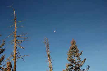 The moon 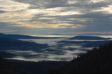 Clouds in the valley 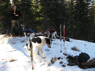 Dogs (and Babe) on Yellow) 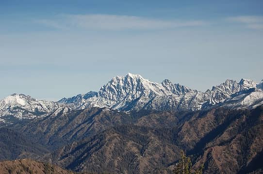 View of Stuart 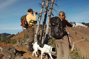 More shutter delay 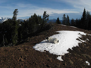 Yes Angry Hiker, I found another snowpatch 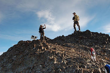 Humerus Hill antics 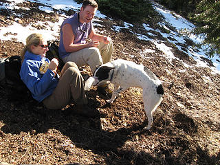 Jasper is hungry 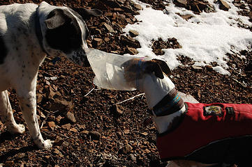 Rowena cannot bite Jasper through the bag 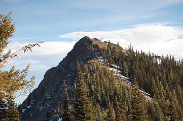 Goodbye Humerus 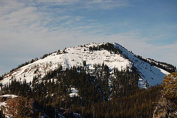 Hello Jolly 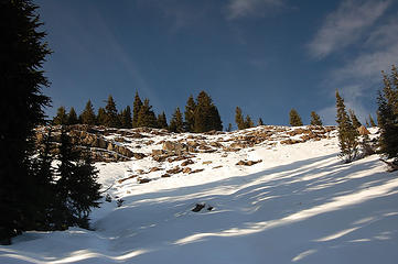 Jolly south slopes 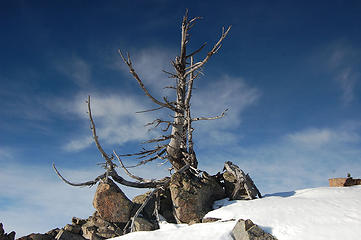 -Snag on Jolly 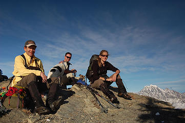 Jolly hikers 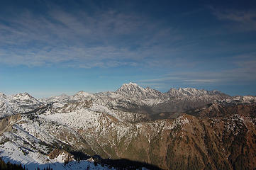 Views from Jolly 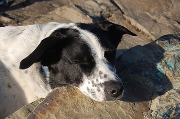 Nap time 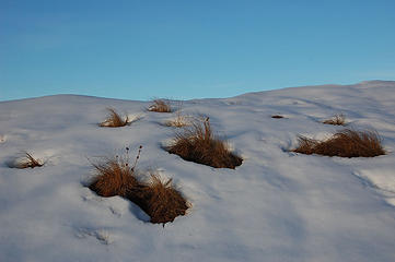 Grass 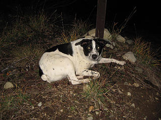 What? Another 2 miles to go?  The girls looking at Jasper
|
| Back to top |
|
|
Go Jo
of the lykkens

Joined: 08 Jun 2003
Posts: 2248 | TRs | Pics
Location: Around The Bend |
|
Go Jo
of the lykkens
|
Wed Nov 19, 2008 8:19 pm |
|
|
| Schmidt Altitude wrote: | Yella' Boyz Yellow Hill group shot |
Dorothy's easy to peg and I see a few ToTos in there, but who's who for the Scarecrow, the Lion & the Tin Man?  Very creative and informative TR, hope all who were ailing are on the road to recovery...
|
| Back to top |
|
|
wamtngal
Member

Joined: 13 Jun 2004
Posts: 2382 | TRs | Pics
Location: somewhere |
|
wamtngal
Member
|
Wed Nov 19, 2008 8:23 pm |
|
|
Nice way to tie all of those together! I always thought of those more as winter excursions, but by tying them all together, you created an interesting trip!
Opinions expressed here are my own.
Opinions expressed here are my own.
|
| Back to top |
|
|
Jasper
Cascade Snow Pig

Joined: 13 Apr 2008
Posts: 350 | TRs | Pics
Location: Burrowing in the snow |
|
Jasper
Cascade Snow Pig
|
Wed Nov 19, 2008 8:28 pm |
|
|
I had a good time, and even got to play a little with the whippets.
Although, I am still pissed about riding in the canopy of dad's truck while everyone else rode up front after the hike.
|
| Back to top |
|
|
GeoTom
Member
Joined: 19 May 2005
Posts: 3215 | TRs | Pics
Location: Earth |
|
GeoTom
Member
|
Wed Nov 19, 2008 8:46 pm |
|
|
| the lykkens wrote: | | Dorothy's easy to peg and I see a few ToTos in there, but who's who for the Scarecrow, the Lion & the Tin Man? |
I know you might think I am Dorothy, but in reality Alti-Babe was.
The 3 Toto's have been renamed: Roto, Kieto and Jasto.
Since I like rocks (and metals too I guess?) I will be the Tin Man. Yukon222 is the Lion as he was wearing a yellow shirt. That leaves Alti-Dude as the scarecrow. Fitting. 
|
| Back to top |
|
|
Go Jo
of the lykkens
Joined: 08 Jun 2003
Posts: 2248 | TRs | Pics
Location: Around The Bend |
|
Go Jo
of the lykkens
|
Wed Nov 19, 2008 8:49 pm |
|
|
 I didn't say nuthin' I didn't say nuthin'
|
| Back to top |
|
|
Schmidt Alti-Dude
4th class poster

Joined: 06 Jul 2007
Posts: 1361 | TRs | Pics
Location: Looking for Adventure 201! |
In the original version of the trip report that I abandoned because I didn't know the story well enough to convert it into a whole trip report, Steve was the Tinman, Tom the lion, I was the Scarecrow, Tisha was Dorothy, Jasper was Toto, and the whippets were the winged monkeys.
Anything stated by me in no way reflects the attitudes or opinions of my wife
Anything stated by me in no way reflects the attitudes or opinions of my wife
|
| Back to top |
|
|
EastKing
Surfing and Hiking

Joined: 28 Mar 2007
Posts: 2082 | TRs | Pics
Location: 77 miles from Seattle! |
|
EastKing
Surfing and Hiking
|
Wed Nov 19, 2008 10:11 pm |
|
|
Great trip!!!! I am going to get some directions for this group of mountains!!! Jolly Mountain has been on my list for a while.
YouTube | SummitPost
Saw the depths of despair. Now I am salvaging what time I have left on Earth.
YouTube | SummitPost
Saw the depths of despair. Now I am salvaging what time I have left on Earth.
|
| Back to top |
|
|
Magellan
Brutally Handsome

Joined: 26 Jul 2006
Posts: 13116 | TRs | Pics
Location: Inexorable descent |
|
Magellan
Brutally Handsome
|
Wed Nov 19, 2008 10:34 pm |
|
|
|
| Back to top |
|
|
Movenhike
\m/..mmmmetal\m/
Joined: 16 Apr 2007
Posts: 642 | TRs | Pics
Location: Leavenworth, WA |
|
Movenhike
\m/..mmmmetal\m/
|
Wed Nov 19, 2008 11:03 pm |
|
|
Gee, I keep wantin' ta hate you guys but hey, nice work. have fun.
"Make it your Friend" -John Bull
"Make it your Friend" -John Bull
|
| Back to top |
|
|
Ingunn
Hiking Viking

Joined: 01 Feb 2008
Posts: 1751 | TRs | Pics
Location: Redmond |
|
Ingunn
Hiking Viking
|
Wed Nov 19, 2008 11:05 pm |
|
|
Mmm, fantastic mountain (and snoozy pups) photos!
|
| Back to top |
|
|
Sadie's Driver
Sadie's Driver

Joined: 24 Apr 2006
Posts: 1763 | TRs | Pics
Location: Welcome Pass |
Four-paw buddy lets me tag along!
|
| Back to top |
|
|
ree
Member

Joined: 29 Jun 2004
Posts: 4399 | TRs | Pics
|
|
ree
Member
|
Thu Nov 20, 2008 9:50 am |
|
|
Very pretty.
|
| Back to top |
|
|
|
|
You cannot post new topics in this forum
You cannot reply to topics in this forum
You cannot edit your posts in this forum
You cannot delete your posts in this forum
You cannot vote in polls in this forum
|
Disclosure: As an Amazon Associate NWHikers.net earns from qualifying purchases when you use our link(s). |


 What did you just say???

 The scary thing is, I think you think this makes sense!
Love the pics from all of you DSLR-ers. I am sooo jealous - and inadequate!
The scary thing is, I think you think this makes sense!
Love the pics from all of you DSLR-ers. I am sooo jealous - and inadequate!