| Previous :: Next Topic |
| Author |
Message |
Tim Hagan
Member


Joined: 22 Jul 2008
Posts: 189 | TRs | Pics
Location: Bellevue, WA |
This is the fourth of five reports describing some hikes I made during a month-long trip to the Garhwal Himalayas of Uttarakhand state in northern India:
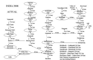
1. Valley of Flowers and Hem Kund 9/22-9/25/08
2. Badrinath, Vasundhara Falls and Auli 9/25-9/26/08
3. Kedarnath and Tungnath 9/27-9/29/08
4. Gangotri and the Source of the Ganges 10/3-10/6/08
5. Yamunotri and Mussoorie 10/7-10/9/08
 The Perfect Plan 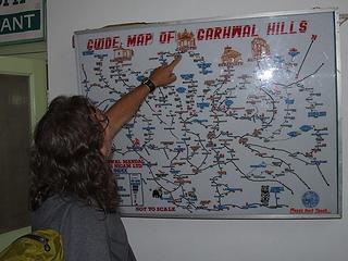 Kim pointing out Gangotri on the map at the GMVN hotel in Uttarkashi 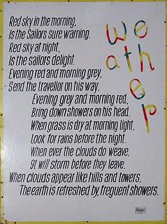 We-ath-e-r Chart at the GMVN hotel in Uttarkashi 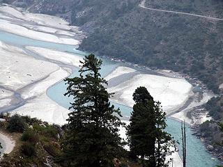 Bhagirathi River near Harsil 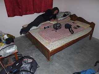 Hotel room in Gangotri 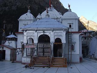 Gangotri temple 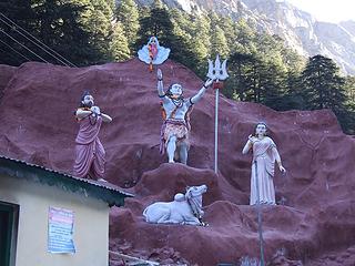 Shiva and friends at Gangotri temple 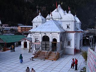 Gangotri temple 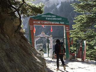 Entrance gate at Gangotri National Park 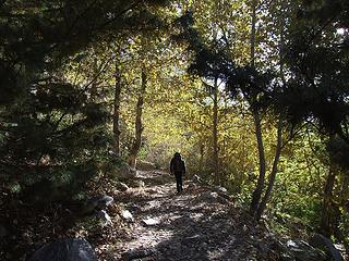 Trail to Bhojbasa 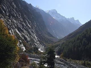 Bhagirathi valley trail along cliff base at left 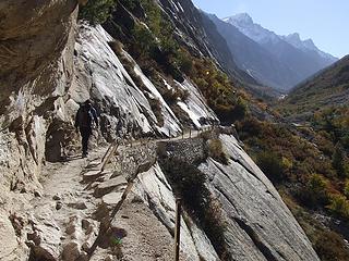 Cliff-hugging trail to Bhojbasa 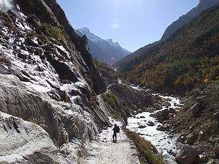 Watery slabs along trail to Bhojbasa 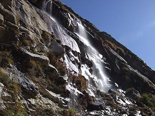 Watery slabs along trail to Bhojbasa 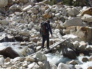 Stream crossing near Chirbasa 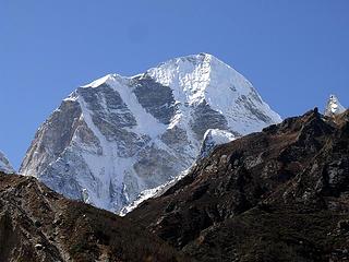 A peek at an impossible peak 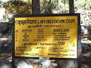 Reforestation project at Chirbasa 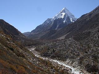 Bhagirathi valley 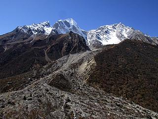 Peaks on south side of Bhagirathi valley 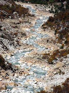 Bhagirathi River 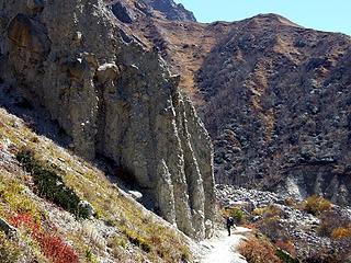 Hoodoos on the Bhojbasa trail 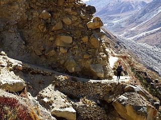 Nasty bit on the Bhojbasa trail 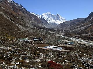 Bhojbasa with the Bhagirathi Peaks in the background 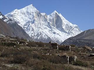 Ibex at Bhojbasa with the Bhagirathi Peaks in the background 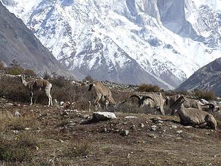 Ibex at Bhojbasa 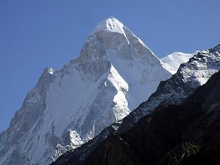 Shivling from Bhojbasa 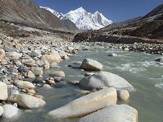 Bhagirathi River at Bhojbasa 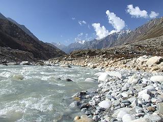 Bhagirathi River at Bhojbasa 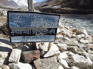 "Please don't dirty bank of Mother Ganga" sign at Bhojbasa 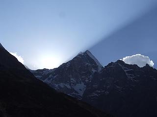 Sunset from Bhojbasa 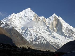 Bhagirathi Peaks from Bhojbasa 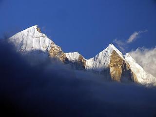 Bhagirathi Peaks at sunset from Bhojbasa 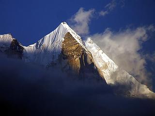 Bhagirathi Peaks at sunset from Bhojbasa 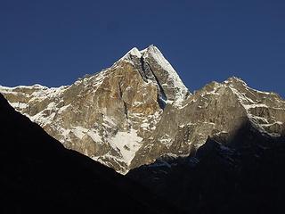 Sunrise from Bhojbasa 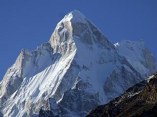 Shivling from Bhojbasa 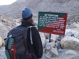 Sign near Gaumukh 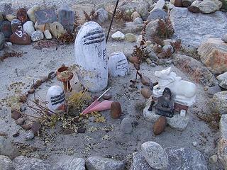 Shrine near Gaumukh 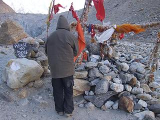 "Temple" near Gaumukh Gangotri Glacier in the background 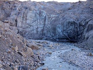 Gaumukh at terminus of Gangotri Glacier 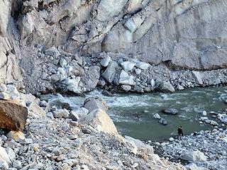 Gaumukh at terminus of Gangotri Glacier 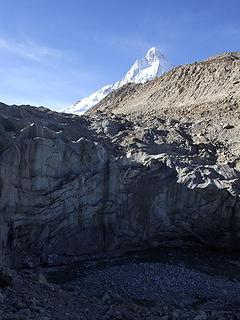 Shivling from Gaumukh 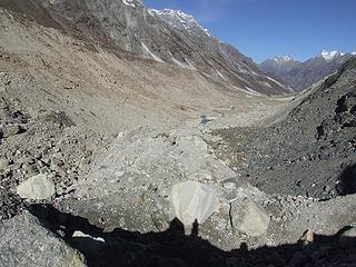 On the Gangotri Glacier above Gaumukh 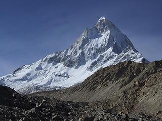 Shivling from Gangotri Glacier near Gaumukh 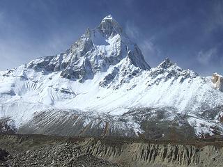 Shivling from Gangotri Glacier 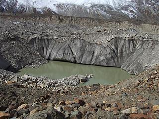 Pool on Gangotri Glacier 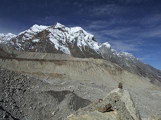 View near Nandanban 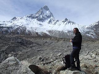 Kim and Shivling near Nandanban 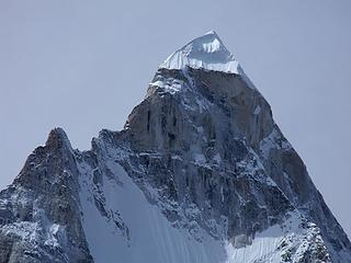 Shivling from Nandanban 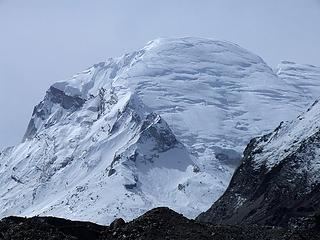 Kedar Dome (?) from Nandanban 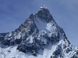 Shivling from Nandanban 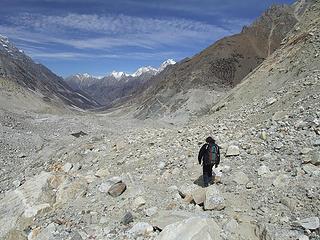 Heading back down the Gangotri Glacier from Nandanban 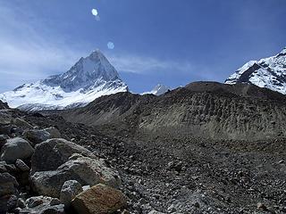 Shivling and Tapovan from Gangotri Glacier above Gaumukh 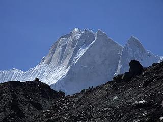 People on ridge near Tapovan (close-up of previous photo) 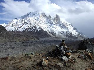 Bhagirathi Peaks from Tapovan 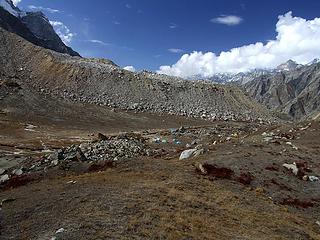 Tapovan camp 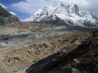 Bhagirathi Peaks from moraine above Tapovan 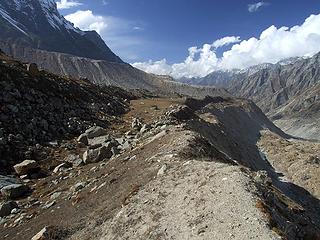 Moraine above Tapovan 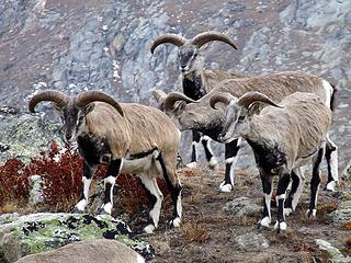 Ibex at Tapovan 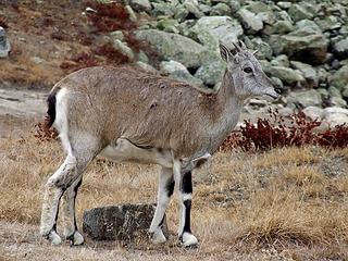 Ibex at Tapovan 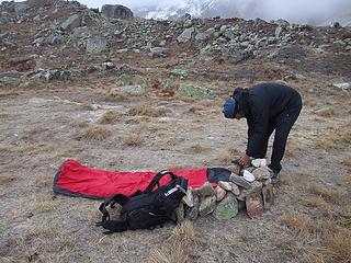 Kim building a wall around his bivy sack at Tapovan 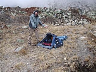 Me and my bivy tent at Tapovan 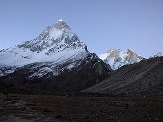 Shivling shining in pre-dawn light 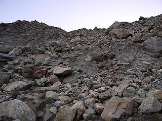 Looking back up the "trail" to Tapovan 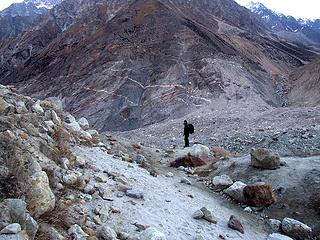 On the Gangotri Glacier below Tapovan 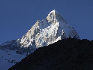 Shivling from Gangotri Glacier 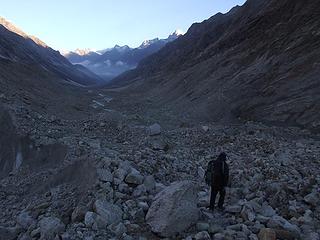 Descending Gangotri Glacier 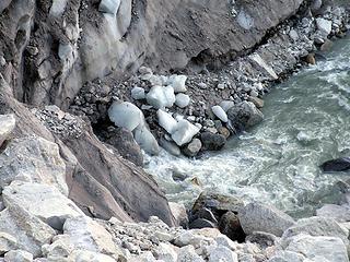 Gaumukh 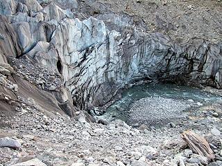 Gaumukh 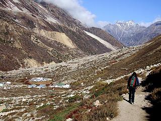 Returning to Bhojbasa 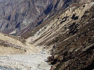 Trail along the Bhagirathi River 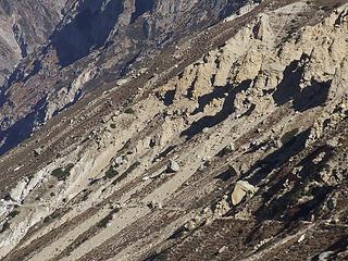 Slide area along the Bhagirathi River 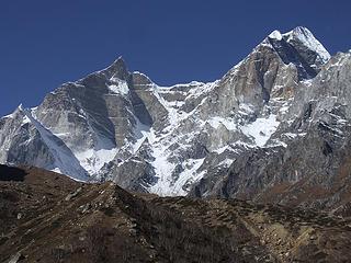 More unclimbable peaks 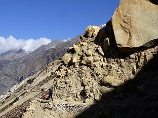 Kim dodges a big one on the Gangotri trail 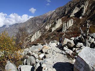 Hoodoos on the Gangotri trail 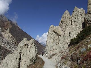 Hoodoos on the Gangotri trail 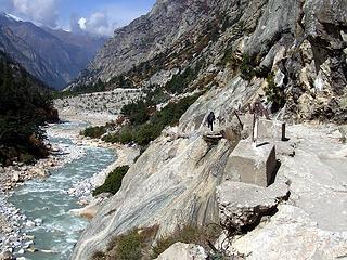 Cat-walk along the Bhagirathi River 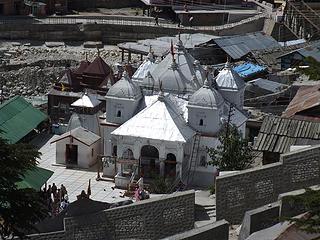 Gangotri temple
|
| Back to top |
  
|
|
Sabahsboy
Member

Joined: 18 Jul 2006
Posts: 2484 | TRs | Pics
Location: SW Sno County |
Overwhelming and spectacular (all an understatement)! Kudos for the TR and photo journal. The late day shots are terrific...heck, it is all terrific! Shivling is an ultra-awesome peak! Altogether, magnificent presentation!
|
| Back to top |
|
|
GeoTom
Member

Joined: 19 May 2005
Posts: 3215 | TRs | Pics
Location: Earth |
|
GeoTom
Member
|
 Tue Nov 25, 2008 8:35 pm |
|
|
Shivling =  Thanks again Tim. Hopefully Part 5 won't be too long in coming
|
| Back to top |
|
|
Tazz
Member

Joined: 27 Apr 2005
Posts: 7902 | TRs | Pics
|
|
Tazz
Member
|
Tue Nov 25, 2008 8:42 pm |
|
|
Wow! thanks! amazing peaks... 
|
| Back to top |
|
|
Jennifer S.
Member

Joined: 06 Aug 2007
Posts: 228 | TRs | Pics
Location: South Puget Sound |
Simply incredible! You are not good for my travel urges!!!
|
| Back to top |
|
|
Magellan
Brutally Handsome

Joined: 26 Jul 2006
Posts: 13116 | TRs | Pics
Location: Inexorable descent |
|
Magellan
Brutally Handsome
|
Tue Nov 25, 2008 11:58 pm |
|
|
Gorgeous! Thanks for sharing. 
|
| Back to top |
|
|
Ingunn
Hiking Viking
Joined: 01 Feb 2008
Posts: 1751 | TRs | Pics
Location: Redmond |
|
Ingunn
Hiking Viking
|
Wed Nov 26, 2008 12:14 am |
|
|
I have never seen Shivling before, but oh. my. god.  Fantastic photos, what an amazing trip you've had!
|
| Back to top |
|
|
Backpacker Joe
Blind Hiker

Joined: 16 Dec 2001
Posts: 23956 | TRs | Pics
Location: Cle Elum |
And here I thought that there would be something worth shooting! HA!
Great job.
"If destruction be our lot we must ourselves be its author and finisher. As a nation of freemen we must live through all time or die by suicide."
Abraham Lincoln
"If destruction be our lot we must ourselves be its author and finisher. As a nation of freemen we must live through all time or die by suicide."
Abraham Lincoln
|
| Back to top |
|
|
|
|
You cannot post new topics in this forum
You cannot reply to topics in this forum
You cannot edit your posts in this forum
You cannot delete your posts in this forum
You cannot vote in polls in this forum
|
Disclosure: As an Amazon Associate NWHikers.net earns from qualifying purchases when you use our link(s). |


