| Previous :: Next Topic |
| Author |
Message |
Schmidt Altitude
Whippet Entourage


Joined: 28 Mar 2007
Posts: 803 | TRs | Pics
Location: The Quah |
Date: Thursday, December 4, 2008
Crew: Schmidt Altitude Team (Babe, Row, Kief, Dude)
Summit: Tyler Peak 6364 (#59 Olympic Mountains 100, #47 Rain Shadow 100)
Hiking Stats: ~6 miles round trip, 3432 gained, 2:01 up, 1:17 down
With the weekend weather forecast looking soggy and Thursday supposed to be the best day of the week, we headed out for a little mid-week dayhike. Tyler Peak can clearly be seen from Sequim and despite the fact that we've been up it's neighboring peak, Baldy, several times, we had yet to summit it.
We drove on the forest service roads towards the Upper Dungeness Trail (Camp Handy, Royal Basin) but split off on spur road 120 two miles before the trailhead and drove to the berm that marks the start of the Maynard Burn Trail to Mount Baldy. However, we weren't going to Baldy and set off to find the "secret" trail that goes up the Mueller Creek Valley to the ridge between Baldy and Tyler. For some reason, we thought it started right at the creek but after following a faint path for a few minutes we cut uphill to where we thought the trail should be and came across it. We were pleased to find this supposedly unmaintained trail well established with signs of recent work. We knew the trail was popular with hunters so we shouldn't have been surprised.
Selection of Dude's photos:
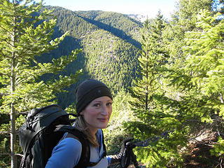 Babe on the way up 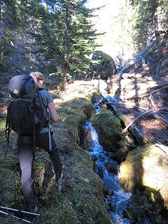 Stopping to take some pics of a small stream 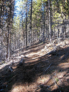 A surprisingly well maintained trail 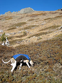 Kiefer smells something 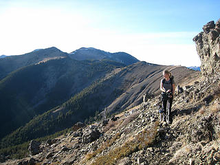 Taking in the views 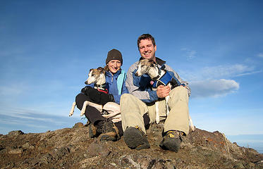 Schmidt Altitude on Tyler Peak 6364' 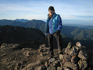 Babe on the summit 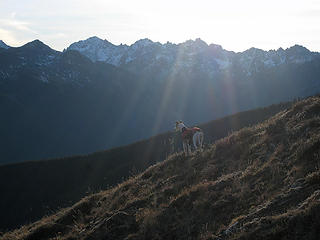 Rowena leads the way back down 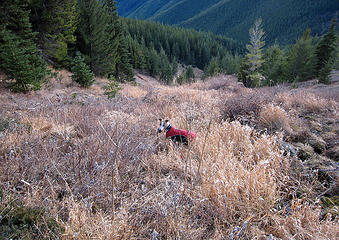 She caught something! Is it a mouse? A chipmunk? - No, it's a rock!!! 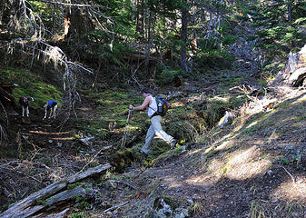 Creek crossing 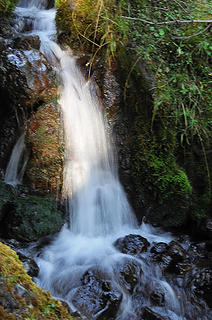 Small plunge 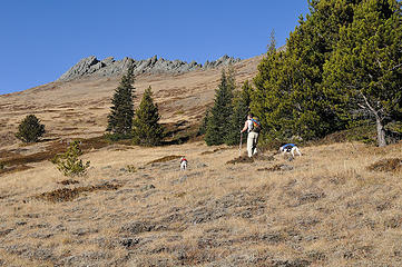 Forget the trail, let's just head up! 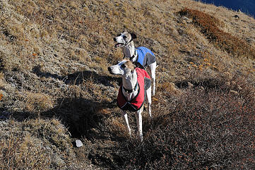 Soaking in the sunshine 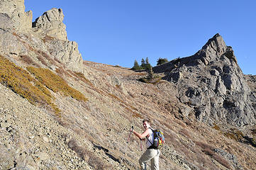 Attaining the ridge crest 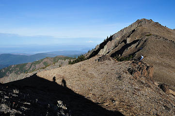 Shadows and our first views of the true Tyler summit 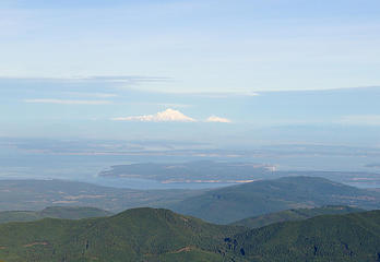 Baker and Shuksan 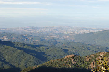 Sequim and the Dungeness Valley 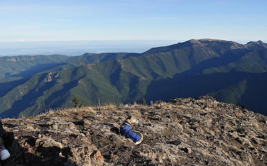 Kiefer enjoying the fruits of her labor 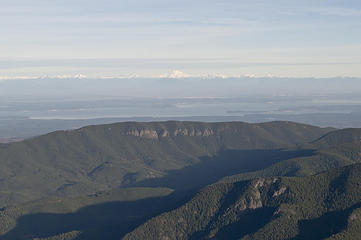 Glacier Peak behind Zion Ridge 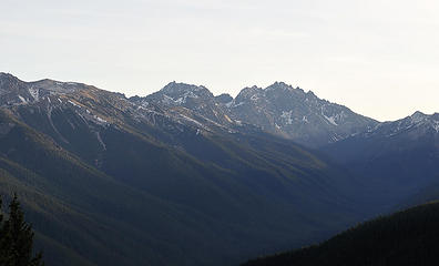 Warrior, Constance and Inner Constance 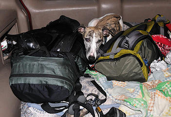 Strange Kiefer...why does she have to lay on our gear? 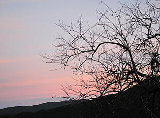 Barren sunset 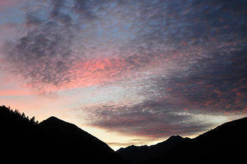 Colors getting deeper
"Forest 101: These big wood stick things are called trees. The big rocks are called mountains, and the little rocks are their babies." Elliott from Open Season
"Forest 101: These big wood stick things are called trees. The big rocks are called mountains, and the little rocks are their babies." Elliott from Open Season
|
| Back to top |
  
|
|
Magellan
Brutally Handsome

Joined: 26 Jul 2006
Posts: 13116 | TRs | Pics
Location: Inexorable descent |
|
Magellan
Brutally Handsome
|
 Sun Dec 07, 2008 8:37 pm |
|
|
Never heard of it. Thanks for bringing it to my attention. 
|
| Back to top |
|
|
seattlehikertoo
Member

Joined: 26 Jun 2008
Posts: 582 | TRs | Pics
Location: Finding an alternative to Mailbox Pk |
Nice one again. I saw Tyler on a map, but no marked trail up, and it looks doable from Seattle in a daytrip that would allow me to get back by 530p. I miss the seclusion of the Olympics. How long does it take to get there if I took the Kingston ferry?
|
| Back to top |
|
|
GeoTom
Member
Joined: 19 May 2005
Posts: 3215 | TRs | Pics
Location: Earth |
|
GeoTom
Member
|
Sun Dec 07, 2008 8:48 pm |
|
|
| Quote: | | not bad for our first ever hike in December! |
Can this be true?
Nice job. I was hoping to sneak that one in before you sometime though. 
|
| Back to top |
|
|
yukon222
Member

Joined: 12 Mar 2007
Posts: 1893 | TRs | Pics
|
|
yukon222
Member
|
Sun Dec 07, 2008 9:50 pm |
|
|
Sweet looking hike with amazing weather conditions for December! Can't get over how open that high terrain is - tons of roaming possibilities.
|
| Back to top |
|
|
dicey
custom title

Joined: 11 May 2004
Posts: 2870 | TRs | Pics
Location: giving cornices a wider berth |
|
dicey
custom title
|
Sun Dec 07, 2008 9:51 pm |
|
|
| GeoTom wrote: | | Quote: | | not bad for our first ever hike in December! |
Can this be true? |
 Just so you know, the weather is not always like this in December
  Lol - whippet rock hunter!
Poor rock didn't stand a chance against the mighty Rowena...
Lol - whippet rock hunter!
Poor rock didn't stand a chance against the mighty Rowena...
|
| Back to top |
|
|
Go Jo
of the lykkens

Joined: 08 Jun 2003
Posts: 2248 | TRs | Pics
Location: Around The Bend |
|
Go Jo
of the lykkens
|
Sun Dec 07, 2008 10:30 pm |
|
|
| Schmidt Altitude wrote: | Soaking in the sunshine |
Wonder what Kiefer is telling you here?
Glad you had a chance to get out and put some sunshine into your week. Welcome to December hiking, you're officially year 'round now! ~Jo
|
| Back to top |
|
|
Schmidt Altitude
Whippet Entourage
Joined: 28 Mar 2007
Posts: 803 | TRs | Pics
Location: The Quah |
| seattlehikertoo wrote: | | Nice one again. I saw Tyler on a map, but no marked trail up, and it looks doable from Seattle in a daytrip that would allow me to get back by 530p. I miss the seclusion of the Olympics. How long does it take to get there if I took the Kingston ferry? |
Sequim is about 1 hour from the Kingston ferry dock (the way I drive). The trailhead is about another 40 minutes drive. You might even have time for a Tyler - Baldy double with a loop down the Maynard Burn trail. -Dude
"Forest 101: These big wood stick things are called trees. The big rocks are called mountains, and the little rocks are their babies." Elliott from Open Season
"Forest 101: These big wood stick things are called trees. The big rocks are called mountains, and the little rocks are their babies." Elliott from Open Season
|
| Back to top |
|
|
seattlehikertoo
Member
Joined: 26 Jun 2008
Posts: 582 | TRs | Pics
Location: Finding an alternative to Mailbox Pk |
Thanks "Dude." I will be burning the midnight oil until 2a to finish my work for tomorrow so I can hike.
|
| Back to top |
|
|
Dane
Other

Joined: 14 Mar 2006
Posts: 2466 | TRs | Pics
Location: Seattle |
|
Dane
Other
|
Sun Dec 07, 2008 11:07 pm |
|
|
Have you guys ever traversed further along Graywolf Ridge, past Pt. 7076 and gotten a view of the route descending to Royal Basin? I'd like to do that one some day - you could put together a sweet loop if from Royal Basin you continued to Deception Basin/Gunsight Pass/Constance Pass/Camp Handy.
Without judgement what would we do? We would be forced to look at ourselves...
-Death
Without judgement what would we do? We would be forced to look at ourselves...
-Death
|
| Back to top |
|
|
Schmidt Altitude
Whippet Entourage
Joined: 28 Mar 2007
Posts: 803 | TRs | Pics
Location: The Quah |
| Dane wrote: | | Have you guys ever traversed further along Graywolf Ridge, past Pt. 7076 (Greywolf South) and gotten a view of the route descending to Royal Basin? I'd like to do that one some day - you could put together a sweet loop if from Royal Basin you continued to Deception Basin/Gunsight Pass/Constance Pass/Camp Handy. |
Shhhh! Dane, quit giving away our sweet ideas. Yep, we have thought of that one but haven't been past Baldy yet. We've already done the rest of the loop though. We'll have to add on something else to make it even more epic  . .
"Forest 101: These big wood stick things are called trees. The big rocks are called mountains, and the little rocks are their babies." Elliott from Open Season
"Forest 101: These big wood stick things are called trees. The big rocks are called mountains, and the little rocks are their babies." Elliott from Open Season
|
| Back to top |
|
|
Magellan
Brutally Handsome
Joined: 26 Jul 2006
Posts: 13116 | TRs | Pics
Location: Inexorable descent |
|
Magellan
Brutally Handsome
|
Sun Dec 07, 2008 11:13 pm |
|
|
| HJT wrote: | | Magellan wrote: | | Never heard of it. Thanks for bringing it to my attention. |
Brutally Handsome: You need to do some more hiking on the Olympic Peninsula! You naughty boy! |
Loooooong ways and a boat ride from my house to there.
|
| Back to top |
|
|
Schmidt Altitude
Whippet Entourage
Joined: 28 Mar 2007
Posts: 803 | TRs | Pics
Location: The Quah |
| Magellan wrote: | | HJT wrote: | | Magellan wrote: | | Never heard of it. Thanks for bringing it to my attention. |
Brutally Handsome: You need to do some more hiking on the Olympic Peninsula! You naughty boy! |
Loooooong ways and a boat ride from my house to there. |
Longer than we regularly take to travel to the Cascades? Weak excuse!!
"Forest 101: These big wood stick things are called trees. The big rocks are called mountains, and the little rocks are their babies." Elliott from Open Season
"Forest 101: These big wood stick things are called trees. The big rocks are called mountains, and the little rocks are their babies." Elliott from Open Season
|
| Back to top |
|
|
seattlehikertoo
Member
Joined: 26 Jun 2008
Posts: 582 | TRs | Pics
Location: Finding an alternative to Mailbox Pk |
The ferry ride makes it easier. I would go to the Olympics to hike as easily as I would to the eastern end of the Mtn Loop Hwy or beyond Stevens Pass. This is especialy true for place in the N Buckhorn since it is much, much drier. This is a secret that most do not know.
In the case of Baldy, it is further west so I would think it would get more precip. From your photos, apparently not.
|
| Back to top |
|
|
yukon222
Member
Joined: 12 Mar 2007
Posts: 1893 | TRs | Pics
|
|
yukon222
Member
|
Mon Dec 08, 2008 2:35 pm |
|
|
Is the forest road typically buried in snow (once the snows arrive  ) such that it makes this area unaccessible till late Spring? Or is at low enough elevation that you can drive there till deep into the Winter? ) such that it makes this area unaccessible till late Spring? Or is at low enough elevation that you can drive there till deep into the Winter?
|
| Back to top |
|
|
|
|


