| Previous :: Next Topic |
| Author |
Message |
trailjunky
Backcountry Bumpkin'


Joined: 14 Jun 2004
Posts: 1124 | TRs | Pics
Location: timberline |
|
trailjunky
Backcountry Bumpkin'
|
 Tue Dec 09, 2008 12:34 am |
|
|
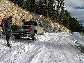
The alarm sounded at 4:50am and eventually I met Dave off 195 just south of town around 6:45am. We picked up Division heading north and eventually went left at the Y toward the Kettle Crest, and Sherman Pass.
The pass itself is the historic site used by Native Americans as a camp while crossing the Kettle River Range in search of salmon below Kettle Falls on the Columbia River. After parking at the pass, we walked the icy road to a sign marking trail 13 heading south along the Kettle River Range.
The trail didnt waste time dropping elevation to a horse corral before crossing highway 20 and regaining the snow covered path on the opposite side of the road. From there trail 13 headed uphill switch backing the north side of Sherman Peak. Once at the junction with trail 72 we went left, clockwise while gaining more elevation across the now icy trail. Before long we reached an impressive wall of granite along the rocky north face of Sherman Peak, gravity is definitely at work here by the amount of Volkswagen sized boulders strewn about. Back on the trail we gained more elevation to a sign describing the scene before us detailing the great White Mountain fire of 1988. Just below the sign we picked up a treeless bench affording great views of the socked in Columbia River Basin to the east and Columbia Mountain and the Kettle Crest to the north.
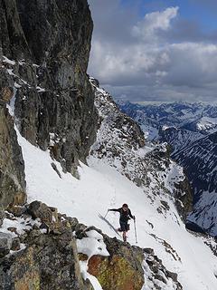
After packing away cameras we approached Sherman Peaks eastside while continuing clockwise around the mountain. Silver snags and an abundant new forest of chin high pines lined the path. Negotiating more ice Dave and I worked our way precariously up the slippery path. After gaining a small ridge we dropped down the south slopes of Sherman where the first jaw dropping views greeted us. Snow Peak dominated the foreground followed by White Mountain and many other green ridges surrounded by clouds creating islands of evergreens as far as the eye could see. Continuing in a southwesterly direction we picked a line that looked welcoming and commenced north, cross country, toward the 6,998 summit of Sherman Peak. It took a little patience negotiating the fallen silver snags buried under the new growth from the White Mountain fire of 1988, but eventually we reached the rime iced covered pines at timberline, and before long, the summit. The wind was howling making for a rather uncomfortable break where temps dropped into the low teens on the rocky pinnacle. Using my hands became a real chore before I finally had to put the camera down to thaw my frigid digits. The view from the summit was spectacular, to the north was Columbia Mountain and the northern reaches of the Kettle Crest. To our west we could spot what looked like Tiffany Mountain and the North Cascades. Looking south was the southern terminus of the Kettles, and to our east were the snow capped peaks of the Selkirk Crest in Idaho and the Salmo-Priest Wilderness Area including Abercrombie Mountain. After a short break we packed up, and began the steep decent off Shermans summit. Following a rather monotonous decent we regained trail 13 where we continued clockwise before reaching the junction with trail 72 and went right.
We spent a short time traversing grassy slopes covered with more silver snags before diving back into a canopy of lodge pole pine. The forest was very welcoming, and offered some unique features to keep us interested along the way. Nearing a meadow we picked up an unmarked trail and beat our way over fresh moose tracks to tiny Sherman Lake and its frozen surface, what a bonus. It didnt think this lake would be that easy to find, after the short break we beat ourselves back out of there and down to the trailhead.
This was a great hike in an area that I had overlooked for far to long. I will be back, and hopefully soon. If you ever get a chance to visit this lonely landscape you wont be disappointed, and considering its up for wilderness designation it could use a little attention. We covered a little more than 6 miles with side trips to the summit and lake with about 1600 of elevation gained.
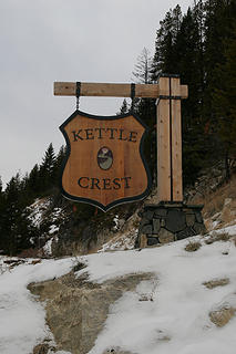 The Kettle Crest at Sherman Pass, Washington. 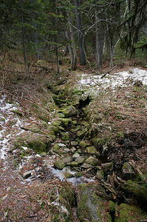 Lush creek along the Sherman Peak Loop, Kettle River Range, Washington. 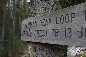 Old sign along the Sherman Peak Loop, Kettle River Range, Washington. 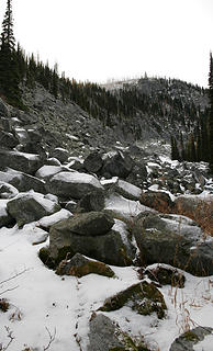 The rocky north side of Sherman Peak, Kettle River Range, Washington. 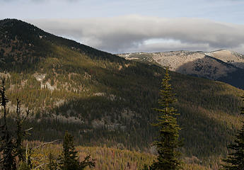 Looking north along the Kettle Crest from the Sherman Peak Loop, Kettle River Range, Washington. 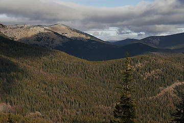 Looking north along the Kettle Crest from the Sherman Peak Loop, Kettle River Range, Washington. 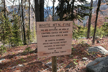 Info along the Kettle Crest Trail, Washington. 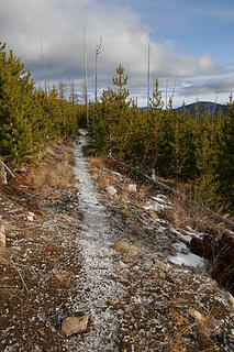 Snow covered trail along the Sherman Peak Loop, Kettle River Range, Washington. 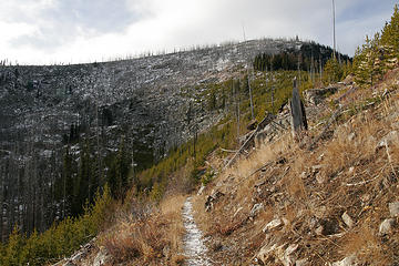 Sherman Peak along the Kettle Crest, Kettle River Range, Washington. 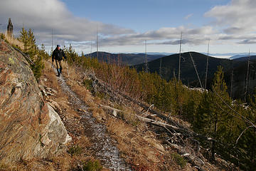 Dave traverses a shoulder of Sherman Peak along the Kettle Crest, Kettle River Range, Washington. 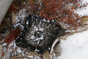 Frozen stump along the Sherman Peak Loop, Kettle River Range, Washington. 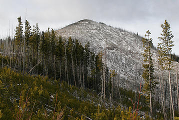 Sherman Peak from near the Kettle Crest, Kettle River Range, Washington. 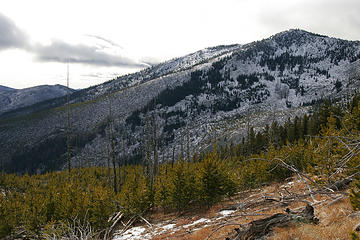 A view south along the Kettle Crest from the Sherman Peak Loop, Kettle River Range, Washington. 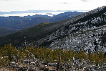 A view south along the Kettle Crest from the Sherman Peak Loop, Kettle River Range, Washington. 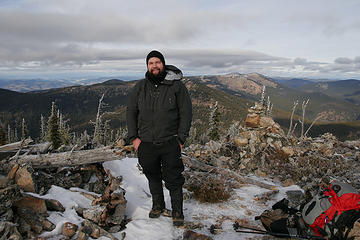 Tanner on the summit of Sherman Peak, elevation 6,998.' Kettle River Range, Washington. 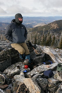 Dave boils a cup of tea on the summit of Sherman Peak, elevation 6,998.' Kettle River Range, Washington. 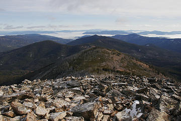 A view east from the summit of Sherman Peak, Kettle River Range, Washington. 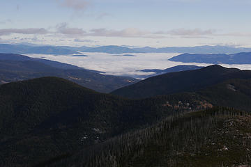 A view east from the summit of Sherman Peak, Kettle River Range, Washington. 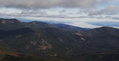 A view east from the summit of Sherman Peak, Kettle River Range, Washington. 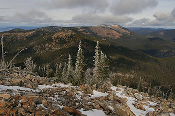 Looking north along the Kettle Crest from the summit of Sherman Peak, Kettle River Range, Washington. 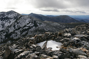 A view south along the Kettle Crest from the summit of Sherman Peak, Kettle River Range, Washington. 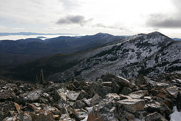 A view south along the Kettle Crest from the summit of Sherman Peak, Kettle River Range, Washington. 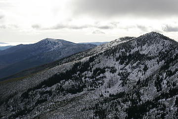 A view south along the Kettle Crest from the summit of Sherman Peak, Kettle River Range, Washington. 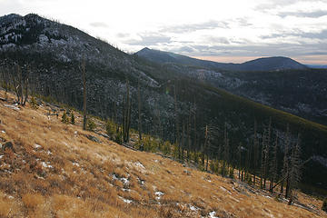 The southern Kettles from the trail along the Sherman Peak Loop, Kettle River Range, Washington. 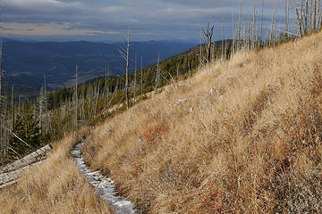 Looking north along the Kettle Crest from the Sherman Peak Loop, Kettle River Range, Washington. 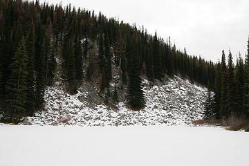 Frozen Sherman Lake along the Sherman Peak Loop, Kettle River Range, Washington. 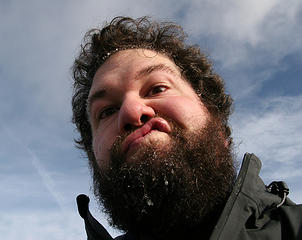 Self portrait on the summit of Sherman Peak, Kettle River Range, Washington.
|
| Back to top |
  
|
|
Hulksmash
Cleaning up.

Joined: 20 Apr 2008
Posts: 7113 | TRs | Pics
Location: Arlington |
|
Hulksmash
Cleaning up.
|
Tue Dec 09, 2008 1:28 am |
|
|
I was curious about those grassy slopes last Saturday. How's the flower show in the spring? Or does the grass just turn green? I was thinking about doing the Kettle crest next spring. Except i won't be driving there and back the same day  Any hazards like ticks Any hazards like ticks  or rattle snakes that time of the year? or rattle snakes that time of the year?
"Bears couldn't care less about us....we smell bad and don't taste too good. Bugs on the other hand see us as vending machines." - WetDog
Albuterol! it's the 11th essential
"Bears couldn't care less about us....we smell bad and don't taste too good. Bugs on the other hand see us as vending machines." - WetDog
Albuterol! it's the 11th essential
|
| Back to top |
|
|
Spotly
Member

Joined: 06 Jan 2004
Posts: 3723 | TRs | Pics
Location: Spokane Valley |
|
Spotly
Member
|
Tue Dec 09, 2008 8:34 am |
|
|
Hulksmash, Some flowers but mostly just green grass. Ticks and snakes are around but I've never had a problem with them in that area.
The hike into the Snow Peak Cabin is roughly 4 miles and doable all year, depending on snow conditions. I spent a few days in there a few winters ago and had a blast. You can get reservations through the Ranger Station in Republic. The cost is $30 per night. It's more difficult to get the permit in the winter because it's a fairly popular ski/snowshoe destination.
If you decide to head up there this winter (hint hint), as the snow starts to build up (if it does), it's best to stay off the trail on the east side of the mountain and take the main trail CCW around Sherman Peak instead.
|
| Back to top |
|
|
Alpendave
Member

Joined: 01 Aug 2008
Posts: 863 | TRs | Pics
|
Here are my photos from the trip. Plus a video clip from the summit. In the video, I mistakenly refer to the northern Kettle Crest as the southern one 
 Parking area or ice skating rink? 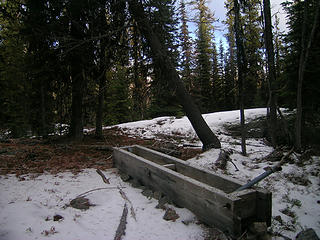 Watering trough at start of the trail 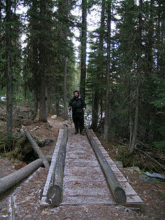 Bridge over a spring fed creek 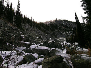 Rock basin on the east side of Sherman Peak 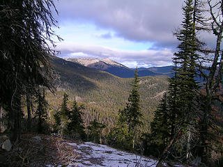 Looking north from the first viewpoint 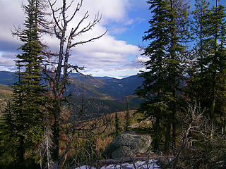 Looking toward Idaho 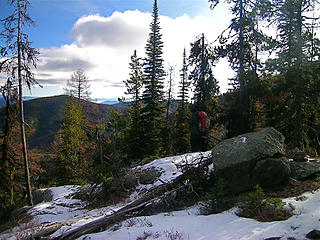 Tanner taking photos from the first viewpoint 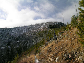 First view of the summit from the trail 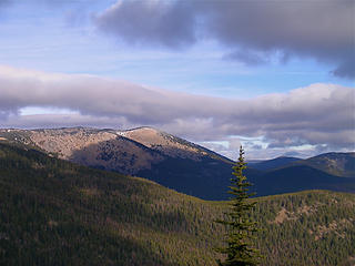 First view of the Kettle Crest to the north 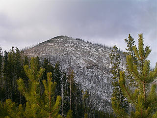 The summit of Sherman Peak from the SW 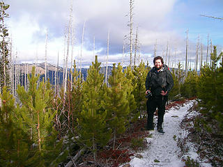 Tanner among young lodgepole pines 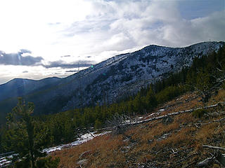 Views keep getting better 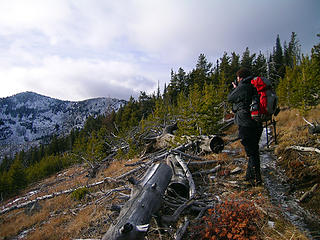 Tanner the photographer 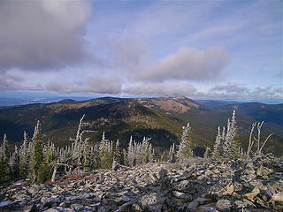 Looking north along the Kettle Crest 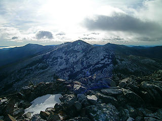 1 label Looking at Snow Peak along the Kettle Crest south of Sherman Peak. 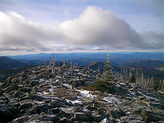 Looking west from the summit of Sherman Peak 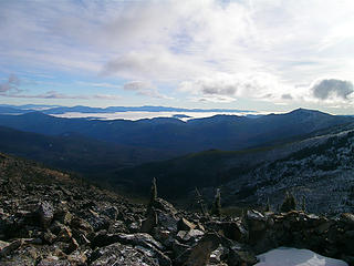 South of Sherman Peak. 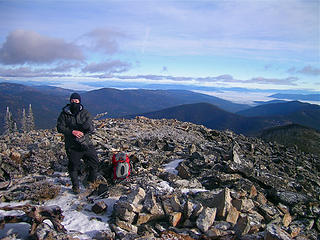 Tanner trying to stay warm on the summit of Sherman Peak 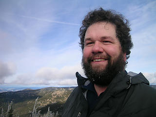 Tanner with ice goobers on his beard 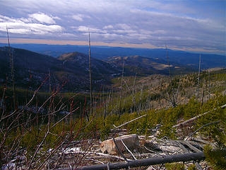 Looking NW to Highway 20 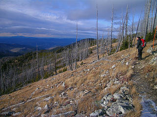 Tanner (Trailjunky) taking it in 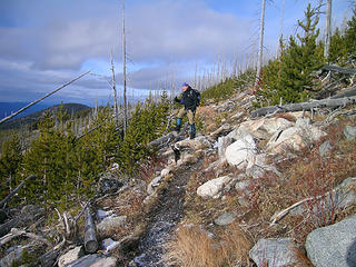 Alpendave taking it in 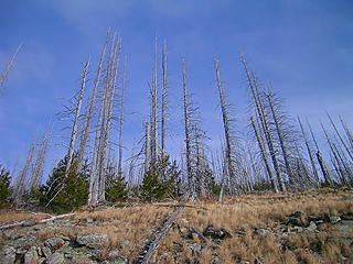 Nice snags 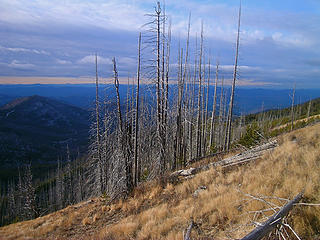 Looking NW again 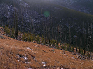 Open meadows on Sherman Peak;s NW side 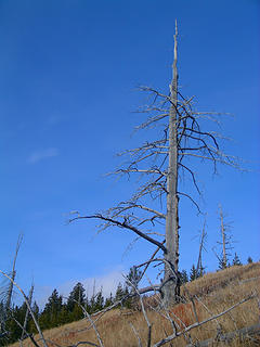 Lone snag Sherman Peak's NW side 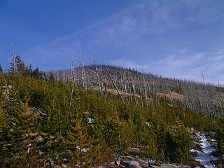 Sherman Peak's northwest side 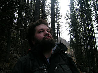 Tanner the philosopher 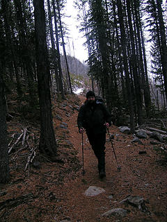 Notice the larch needles on the ground 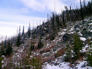 Granite rubble on Sherman Peak's north side 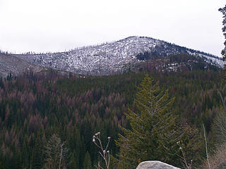 West side of Sherman Peak from Highway 20
|
| Back to top |
|
|
Magellan
Brutally Handsome

Joined: 26 Jul 2006
Posts: 13116 | TRs | Pics
Location: Inexorable descent |
|
Magellan
Brutally Handsome
|
Wed Dec 10, 2008 7:50 am |
|
|
Great stuff fellas! 
|
| Back to top |
|
|
trailjunky
Backcountry Bumpkin'
Joined: 14 Jun 2004
Posts: 1124 | TRs | Pics
Location: timberline |
|
trailjunky
Backcountry Bumpkin'
|
Wed Dec 10, 2008 12:14 pm |
|
|
Nice work Dave, love the video.
|
| Back to top |
|
|
Quark
Niece of Alvy Moore

Joined: 15 May 2003
Posts: 14152 | TRs | Pics
|
|
Quark
Niece of Alvy Moore
|
Wed Dec 10, 2008 1:31 pm |
|
|
I had to put my jealous hat on to read this report, once I read the title.
Thanks for the report and pics, guys!
"...Other than that, the post was more or less accurate."
Bernardo, NW Hikers' Bureau Chief of Reporting
"...Other than that, the post was more or less accurate."
Bernardo, NW Hikers' Bureau Chief of Reporting
|
| Back to top |
|
|
Josh Journey
a.k.a Josh Lewis
Joined: 01 Nov 2007
Posts: 4836 | TRs | Pics
|
| Alpendave wrote: | Just checking to see how posting photos from webshots works.
 |
Atleast they finally got rid of those awful ads that drove me away from there.
|
| Back to top |
|
|
|
|
You cannot post new topics in this forum
You cannot reply to topics in this forum
You cannot edit your posts in this forum
You cannot delete your posts in this forum
You cannot vote in polls in this forum
|
Disclosure: As an Amazon Associate NWHikers.net earns from qualifying purchases when you use our link(s). |


