yew
non-technical

Joined: 12 Dec 2005
Posts: 1173 | TRs | Pics
Location: Bellingham |
|
yew
non-technical
|
 Wed Apr 22, 2009 10:08 pm |
|
|
After hiking the Highline Trail/AZT near Pine, and camping on the Fossil Creek Rd, I started driving back toward northwest Arizona, to try to bypass incoming cool, wet, windy weather.
Just as I was pulling into Camp Verde, AZ, about 1 mile east of I-17, the Chevy Aveo from Budget rental car company out of Las Vegas airport died. The RPMs just sputtered down to zero so I pulled over and turned on the hazard lights.    It was a 10 minute walk to a pay phone. This was lucky. The car could've died "out in the middle of nowhere". It was a totally frustrating fiasco calling the non-assisting Budget roadside assistance, the non-assisting GMC/Chevy roadside assistance, Cottonwood, AZ towing company, Flagstaff towing company, GMC dealership in Cottonwood, and Budget in Las Vegas. Everybody kept saying to call somebody else.
Eventually, the car was towed into Cottonwood and I was stuck at the dealership. The fuel pump died even though the Chevy Aveo rental car only had about 4300 miles on it. Of course, the fuel pump was not in stock and there was a parts order delay so I could not leave that day. I had to get a hotel and the GMC dealership got me an Enterprise rental car until the replacement arrived.
To salvage the end of the day, I spent about 3 hours driving the Red Rock Road loop in Sedona and squeezed in a 45 minute hike at an old ranch that cost $8 per day to visit. The $8 is charged by a concessionaire permitted by the US Forest Service. There are a lot of tourists at this old ranch on national forest land.
It was a 10 minute walk to a pay phone. This was lucky. The car could've died "out in the middle of nowhere". It was a totally frustrating fiasco calling the non-assisting Budget roadside assistance, the non-assisting GMC/Chevy roadside assistance, Cottonwood, AZ towing company, Flagstaff towing company, GMC dealership in Cottonwood, and Budget in Las Vegas. Everybody kept saying to call somebody else.
Eventually, the car was towed into Cottonwood and I was stuck at the dealership. The fuel pump died even though the Chevy Aveo rental car only had about 4300 miles on it. Of course, the fuel pump was not in stock and there was a parts order delay so I could not leave that day. I had to get a hotel and the GMC dealership got me an Enterprise rental car until the replacement arrived.
To salvage the end of the day, I spent about 3 hours driving the Red Rock Road loop in Sedona and squeezed in a 45 minute hike at an old ranch that cost $8 per day to visit. The $8 is charged by a concessionaire permitted by the US Forest Service. There are a lot of tourists at this old ranch on national forest land.
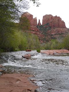 redrock near Sedona, AZ  Mingus Mountain area from near Woodchute Trailhead on Prescott National Forest, near Jerome, Arizona. 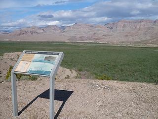 sign at Pearce Ferry parking area, Lake Mead National Recreation Area, Arizona 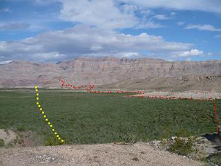 How to get to the Grand Canyon from the west. Yellow is the desired route. Red is the route taken. Tamerisk choked washes that were awful to bushwhack through are not shown. From Pearce Ferry, Lake Mead National Recreation Area, Arizona. 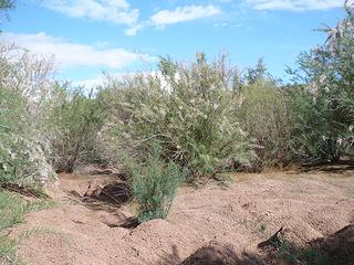 a relatively open tamerisk area. Lake Mead used to cover this ground before it dropped. 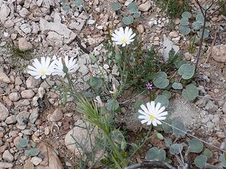 chicory flower near Pearce Ferry 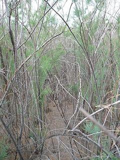 dense tamerisk near Pearce Ferry 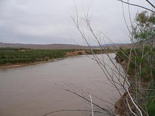 Colorado River near Pearce Ferry 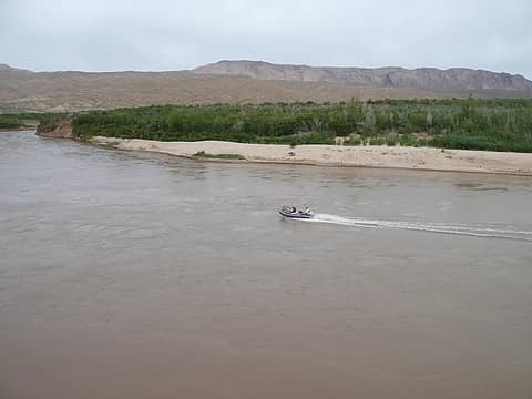 Colorado River near Pearce Ferry 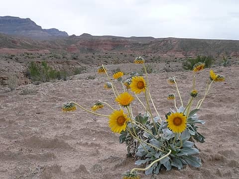 wildflower near Pearce Ferry, Arizona 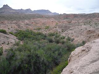 tamarisk choked wash near Pearce Ferry, Lake Mead National Recreation Area, Arizona 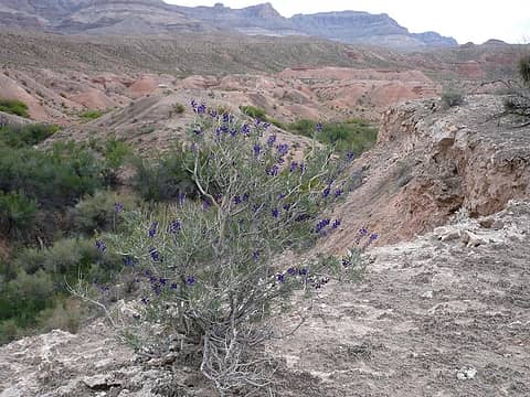 Grand Wash Cliffs/west end of the Grand Canyon from Pearce Ferry, Lake Mead National Recreation Area 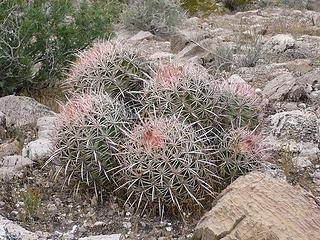 barrel cactus near Pearce Ferry, Lake Mead National Recreation Area  This is near the boundary of Grand Canyon National Park and Lake Mead Rec Area. It was cloudy with a few rain showers and gusty winds. This is near the boundary of Grand Canyon National Park and Lake Mead Rec Area. It was cloudy with a few rain showers and gusty winds.
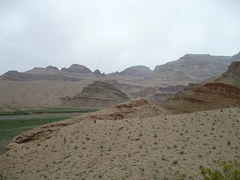 west end/beginning of the Grand Canyon 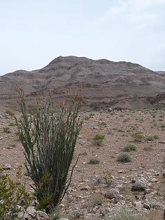 ocotillo and Grand Wash Cliffs from the route from Pearce Ferry 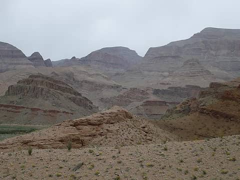 west end/beginning of the Grand Canyon 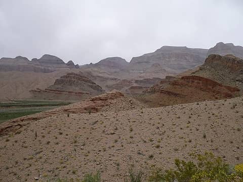 west end/beginning of the Grand Canyon 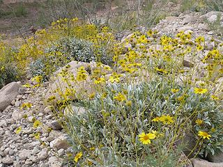 wildflowers near Grand Wash Cliffs, Pearce Ferry 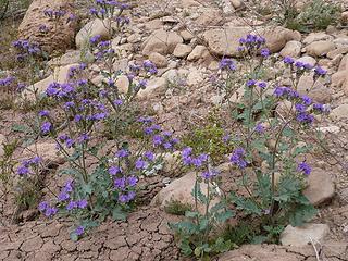 wildflowers near Grand Wash Cliffs, Pearce Ferry 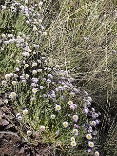 wildflowers near Grand Wash Cliffs, Pearce Ferry 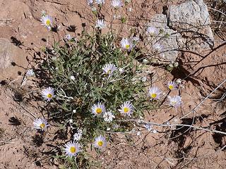 wildflowers near Grand Wash Cliffs, Pearce Ferry 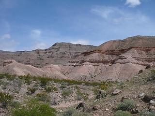 Grand Wash Cliffs from the route from Pearce Ferry 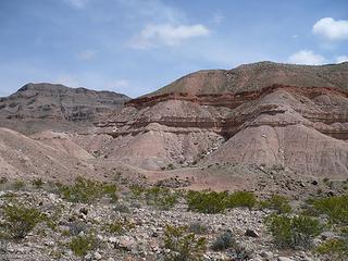 Grand Wash Cliffs barrel cactus near Pearce Ferry, Lake Mead National Recreation Area 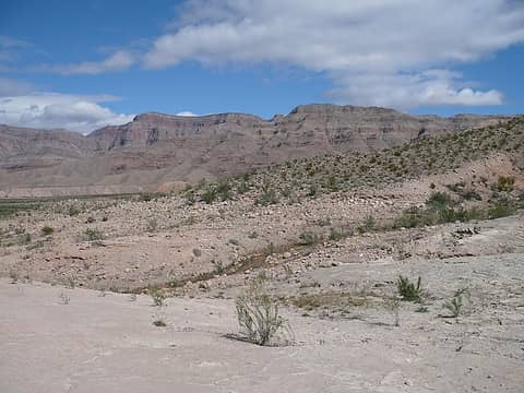 Grand Wash Cliffs/west end of the Grand Canyon from Pearce Ferry, Lake Mead National Recreation Area 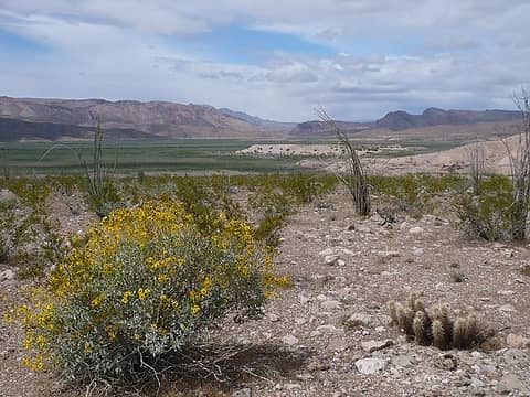 looking north to The Big Bad Tamerisk Bush along the Colorado River west of Grand Wash Cliffs east of Pearce Ferry 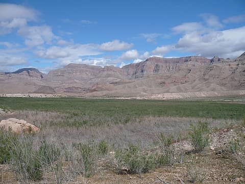 Grand Wash Cliffs/west end of the Grand Canyon from Pearce Ferry, Lake Mead National Recreation Area
"I aint jokin woman, I got to ramble...We gonna go walkin through the park every day." - Led Zeppelin
"I aint jokin woman, I got to ramble...We gonna go walkin through the park every day." - Led Zeppelin
|


 You never fail to find some new wilderness area I've previously did not know about. Thanks for the report.