| Previous :: Next Topic |
| Author |
Message |
SlowWalker
Perma-grinner

Joined: 23 Aug 2005
Posts: 888 | TRs | Pics
Location: Seattle |
|
SlowWalker
Perma-grinner
|
 Mon Apr 27, 2009 11:11 am |
|
|
Not sure the history of the unofficial name of this peak, but it seems most folks on this board like to call it W. Granite. It is easier to type.  With all the ski areas now closed on Fridays, Jon and I chose W. Granite as a good start to the hiking season with a little skiing as a side benefit. Jon is an experienced ski mountaineer who uses tele gear. I am a hiker and alpine skier who has done a few small ski tours in the last two or three years.
I still don't have proper touring gear. Last year I used my Alpine Trekkers and a pair of borrowed skins, but this year I have new skis that are too big for borrowed skins, so my Trekkers could do me no good. Thus I committed to carrying my skis on my back all the way to the top, wearing ski boots the whole time, and snowshoes above 3,500'.
With all the ski areas now closed on Fridays, Jon and I chose W. Granite as a good start to the hiking season with a little skiing as a side benefit. Jon is an experienced ski mountaineer who uses tele gear. I am a hiker and alpine skier who has done a few small ski tours in the last two or three years.
I still don't have proper touring gear. Last year I used my Alpine Trekkers and a pair of borrowed skins, but this year I have new skis that are too big for borrowed skins, so my Trekkers could do me no good. Thus I committed to carrying my skis on my back all the way to the top, wearing ski boots the whole time, and snowshoes above 3,500'.
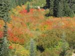
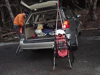 That's a lot of stuff strapped to that small pack 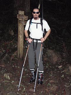 jt working the dirt trail in ski boots 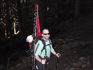 Me, loaded up and heading out 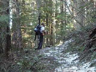 jt on the Pratt Lake trail 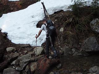 Stream crossing on the Pratt Lake trail 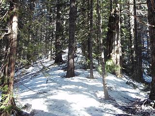 Leaving the trail and heading up to W. Granite Mtn 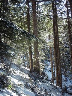 Just keep on heading uphill 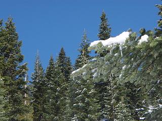 New April snow on the trees 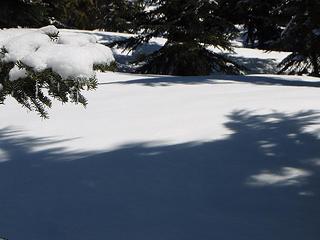 W Granite Mtn ski 011 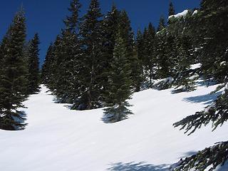 Still a long way to go to reach the top 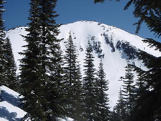 First peek at Granite Mtn and the lookout tower 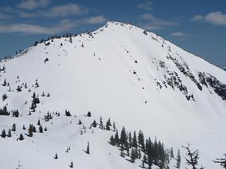 Granite Mtn from W Granite Mtn 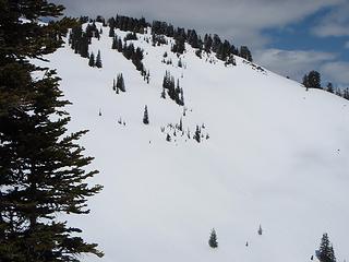 W Granite Mtn and the slope we skied 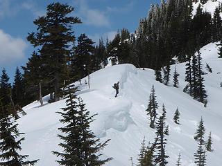 jt on a cornice 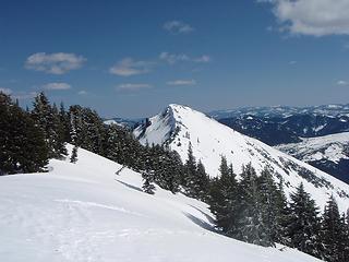 From the summit of W Granite Mtn 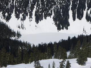 Lake Tuscohatchie, 4.24.09 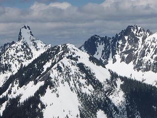 Kaleetan and Chair peaks 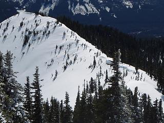 Ridge leading to final ascent of W. Granite 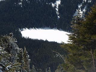 Olallie Lake, 4.24.09 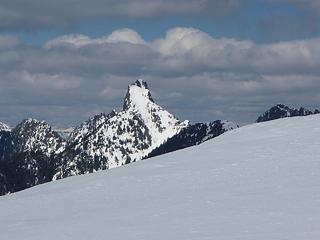 Kaleetan from W Granite Mtn 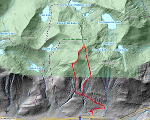 W. Granite route 4.22.09
|
| Back to top |
  
|
|
GeoTom
Member

Joined: 19 May 2005
Posts: 3215 | TRs | Pics
Location: Earth |
|
GeoTom
Member
|
Mon Apr 27, 2009 12:59 pm |
|
|
| SlowWalker wrote: | | Quite a nice day to be in the mountains, but I don't want to carry my skis while wearing snowshoes and climbing up steep, slushy slopes again! |
I can't imagine why not.  Nice trip.
|
| Back to top |
|
|
SlowWalker
Perma-grinner
Joined: 23 Aug 2005
Posts: 888 | TRs | Pics
Location: Seattle |
It was tough.  It is kind of a strange sensation to be suffering through something like that, yet not really minding the suffering.
We had no deadline, so there was no pressure to get there by a certain time. And I figured coming down was going to be easy and fun enough to forget about the waist deep slush. Plus, it's good training for trips yet to come.
A note about conditions and gear. The snow was getting cooked and we could see evidence of loose wet slides around, but they all appeared to be several days old or more. We each had a shovel, beacon and probe. We chose our line down with avies in mind, avoiding rollovers and other areas that looked suspect.
Just before we switched back from skis to foot travel, we crossed a creek and as I came across the bank, a small slab kicked loose from under my skis. The slab was about 10' x 15' and maybe 6" deep. It slid about 10' down toward the creek before stopping. Nothing too bad, but we stayed alert and in sight of each other until we got back into the forest. It is kind of a strange sensation to be suffering through something like that, yet not really minding the suffering.
We had no deadline, so there was no pressure to get there by a certain time. And I figured coming down was going to be easy and fun enough to forget about the waist deep slush. Plus, it's good training for trips yet to come.
A note about conditions and gear. The snow was getting cooked and we could see evidence of loose wet slides around, but they all appeared to be several days old or more. We each had a shovel, beacon and probe. We chose our line down with avies in mind, avoiding rollovers and other areas that looked suspect.
Just before we switched back from skis to foot travel, we crossed a creek and as I came across the bank, a small slab kicked loose from under my skis. The slab was about 10' x 15' and maybe 6" deep. It slid about 10' down toward the creek before stopping. Nothing too bad, but we stayed alert and in sight of each other until we got back into the forest.
|
| Back to top |
|
|
|
|
You cannot post new topics in this forum
You cannot reply to topics in this forum
You cannot edit your posts in this forum
You cannot delete your posts in this forum
You cannot vote in polls in this forum
|
Disclosure: As an Amazon Associate NWHikers.net earns from qualifying purchases when you use our link(s). |


