| Previous :: Next Topic |
| Author |
Message |
tigermn
Member


Joined: 10 Jul 2007
Posts: 9242 | TRs | Pics
Location: There... |
|
tigermn
Member
|
 Sun Apr 26, 2009 9:01 pm |
|
|
Laziness to do much planning and not killing the whole day led me to Si. I had actually not visited for about a month.
The intent was to go part way up the new trail and try and hook up just past the 1 mile area over to the old trail and continue up. That didn't quite work out...
OH well.. more on that later.
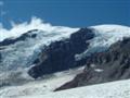
What to look forward to.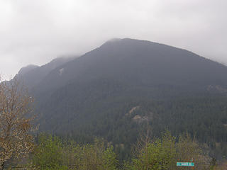 Mt. Si (mostly) from below before arriving at trailhead. 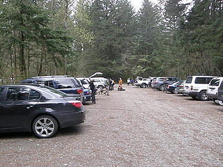 Mt Si parking lot. Parking in 2nd area filling up fast. Some already parked in 3rd area. 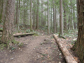 Lower Talus junction Mt. Si trail. 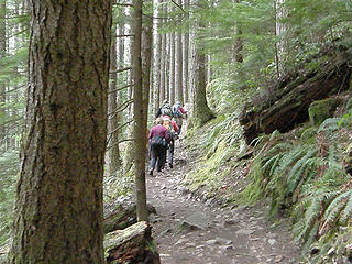 Hikers nearing the Vista point Mt Si trail. 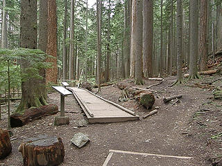 Snag flats Mt Si trail. 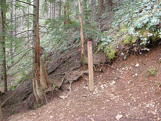 Mt Si trail 2.5 mile sign. No signs of snow yet. 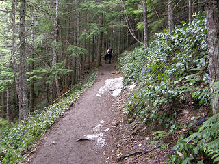 First even hint of short lived snow before 2.5 mile sign. 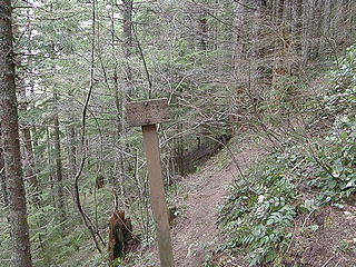 Mt Si 3.0 mile sign. Snow started before here but still patchy clear spots. 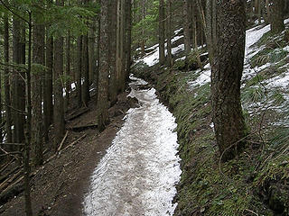 Now the snow (more like hardpacked ice) is starting a little past the 3.0 mile sign. Still kind of avoidable on sides. 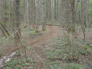 Mt Si old trail beginnings. Surprisingly little snow on the old trail until it almost meets back up with the new trail. 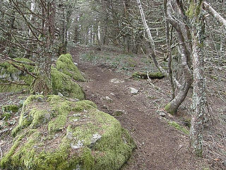 Mt Si old trail maybe halfway from cutoff to rejoining new trail. Snow? What Snow? This would prove to be a much more snow free route than the new trail. 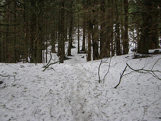 Mt Si old trail a few hundred feet before rejoining the new trail. 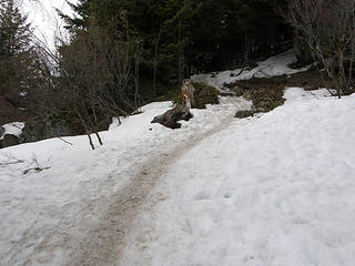 Back on the new trail. Ahead is the infamous part people often slip and slide on without traction devices. 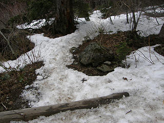 Rejoin new trail from Old trail. This is looking back down the old trail. 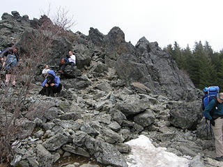 Rock to go up Mt Si trail on way to basin. 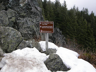 Traditiona sign near top of rocks Mt Si trail. It's melting out for sure but not today. Pretty cool up here now. Freezing level said to be 3500 feet. 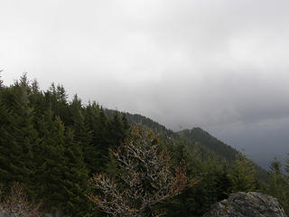 Views from above Mt Si rocks. Teneriffe where are you? 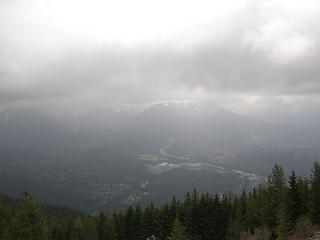 Views from above Mt Si rocks. 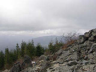 Views from above Mt Si rocks. 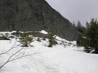 Arriving at the Mt Si basin area. Where is the sign? 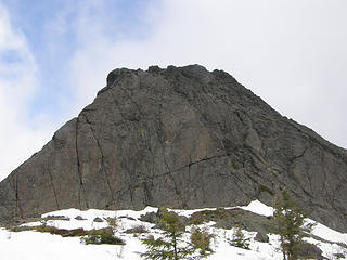 Haystack from arrival at Mt Si basin. 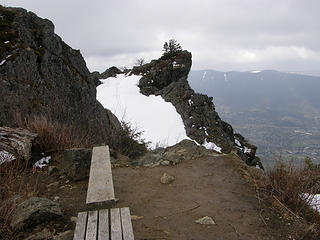 The point and benches from Mt Si basin. 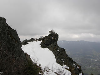 The point from Mt Si basin benches. 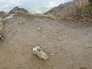 Robbery jays while eating my lunch at Mt Si basin bench. 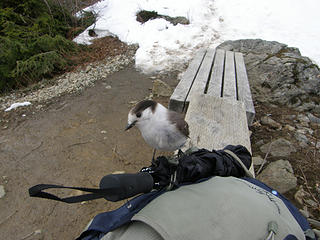 Robbery jays while eating my lunch at Mt Si basin bench. 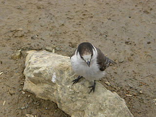 Robbery jays while eating my lunch at Mt Si basin bench. 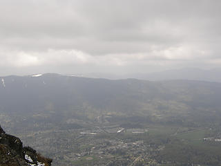 Views from Mt Si basin benches. 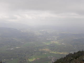 Views from Mt Si basin benches. 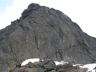 Views from Mt Si basin benches. 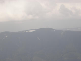 Rattlesnake from Mt Si basin bench. 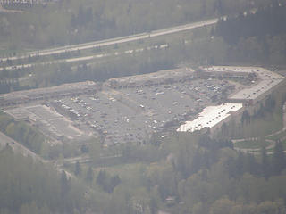 Outlet malls from Mt Si basin bench. 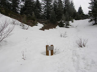 Sign nearing haystack bench Mt Si basin. 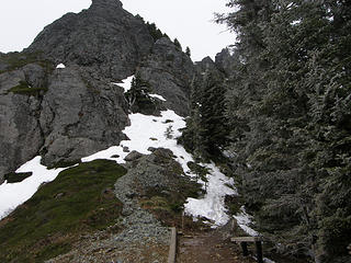 Looking towards Haystack approach. 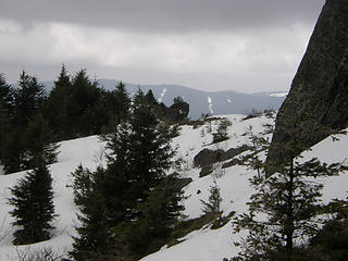 Views out from Haystack bench. 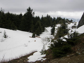 Views out from Haystack bench. 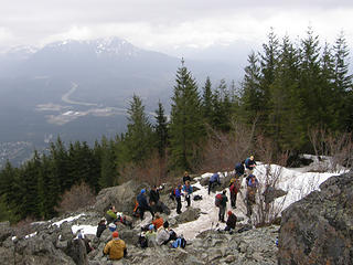 Tons of people below rocks on Mt Si. Almost blocking the trail in places. 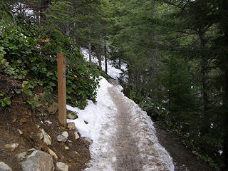 Mt Si trail 3.5 mile sign. A lot more snow/ice this way than taking the old trail cutoff. 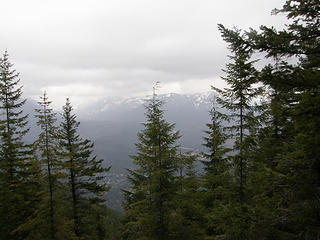 View from 3.5 mile sign vista. 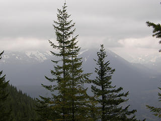 View from 3.5 mile sign vista. 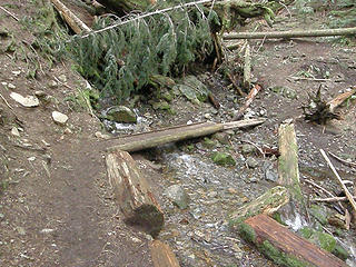 The Mt Si "to creek" 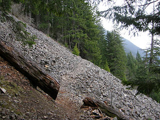 Mt Si Talus field on Talus loop. 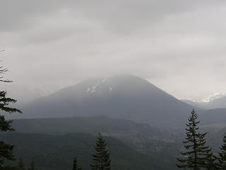 Views from Mt Si talus field on Talus loop trail. 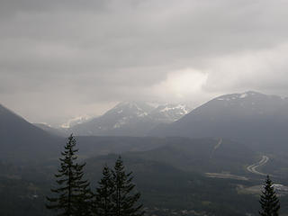 Views from Mt Si talus field on Talus loop trail. 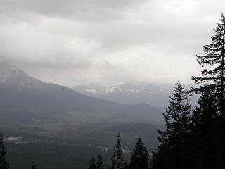 Views from Mt Si talus field on Talus loop trail. 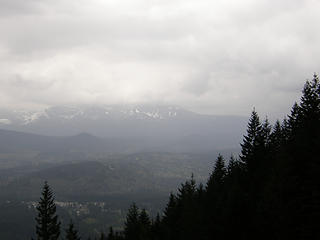 Views from Mt Si talus field on Talus loop trail.
|
| Back to top |
  
|
|
EastKing
Surfing and Hiking

Joined: 28 Mar 2007
Posts: 2082 | TRs | Pics
Location: 77 miles from Seattle! |
|
EastKing
Surfing and Hiking
|
Sun Apr 26, 2009 11:56 pm |
|
|
The Haystack is looking like it is going to clear soon. I have some unfinished business with it!! Good TR and pics. 
YouTube | SummitPost
Saw the depths of despair. Now I am salvaging what time I have left on Earth.
YouTube | SummitPost
Saw the depths of despair. Now I am salvaging what time I have left on Earth.
|
| Back to top |
|
|
tigermn
Member
Joined: 10 Jul 2007
Posts: 9242 | TRs | Pics
Location: There... |
|
tigermn
Member
|
Mon Apr 27, 2009 9:55 am |
|
|
Yea I suspect the haystack will melt out soon and around the back on the actual rocks might even be mostly gone but I didn't walk back there to check. Shoulda just for reporting purposes.
It was cold up there though so it didn't feel like much was melting on Saturday. Freezing level was said to be 3500 feet. My gloved hands were cold after sitting around a bit eating lunch.
Just to enhance the fact that most of the people up there are not seasoned hikers/climbers. When I was taking my microspikes off on the way down where the snow/ice started a couple walking up made a comment that they basically never figured there'd still be snow on the hike....
To be fair I saw many/most people without traction and quite a few just wearing running shoes and they seemed to be making it up albeit at times carefully. Not my idea of fun.
|
| Back to top |
|
|
summithound
Climbing Connoisseur
Joined: 26 Jul 2004
Posts: 1766 | TRs | Pics
Location: Everett, WA |
|
summithound
Climbing Connoisseur
|
Wed Apr 29, 2009 3:27 pm |
|
|
Thanks for the informative trip report tigerman. The snow on Si sure has been disappearing quickly.
Pain is just weakness leaving the body.
Pain is just weakness leaving the body.
|
| Back to top |
|
|
1k
Member

Joined: 29 Jun 2004
Posts: 606 | TRs | Pics
Location: Ballard |
|
1k
Member
|
Thu Apr 30, 2009 12:22 pm |
|
|
If you want to avoid the this....
| tigerman wrote: | Just before 9AM I arrived.
Mt Si parking lot. Parking in 2nd area filling up fast. Some already parked in 3rd area. |
....try this:
https://www.nwhikers.net/forums/viewtopic.php?t=20316&highlight
Starts at the school bus turn around almost exactly 1 mile from the Si parking lot. Probably still too much snow on the ridge to get by without gaiters, but the ridge gets sunlight all day so you never know.
Anyway, sure beats contending with the swarming masses!
Life is short, hike hard...
Life is short, hike hard...
|
| Back to top |
|
|
tigermn
Member
Joined: 10 Jul 2007
Posts: 9242 | TRs | Pics
Location: There... |
|
tigermn
Member
|
Thu Apr 30, 2009 2:26 pm |
|
|
| 1k wrote: | If you want to avoid the this....
| tigerman wrote: | Just before 9AM I arrived.
Mt Si parking lot. Parking in 2nd area filling up fast. Some already parked in 3rd area. |
....try this:
https://www.nwhikers.net/forums/viewtopic.php?t=20316&highlight
Starts at the school bus turn around almost exactly 1 mile from the Si parking lot. Probably still too much snow on the ridge to get by without gaiters, but the ridge gets sunlight all day so you never know.
Anyway, sure beats contending with the swarming masses! |
I often have used that as my return route off of SI. Usually when I leave early enough the crowds going up aren't so bad, but coming down.... Going over and down the Teneriffe road you are lucky to see a few people at all and usually on the lower road.
You do have a 1 1/4 mile road walk back to your car this way though.
|
| Back to top |
|
|
Doomgoggles
Valar

Joined: 06 Feb 2005
Posts: 148 | TRs | Pics
Location: Kitsap |
How does one FIND the Talus Loop junctions?
I went up Si yesterday (4/30) intending to hike the Loop trail, but I didn't see any signs or anything that seemed like a reasonable junction until the 'Creek Access' sign just before Snag Flats. I ended up just summiting Mt. Sie instead.
I'm convinced it doesn't exist and is a conspiracy. Add to that the fact that when I click on your photo of the junction, it says the attachment doesn't exist!  Something is afoot. Something is afoot.
Now for wrath, now for ruin...and the Red Dawn!
Now for wrath, now for ruin...and the Red Dawn!
|
| Back to top |
|
|
tigermn
Member
Joined: 10 Jul 2007
Posts: 9242 | TRs | Pics
Location: There... |
|
tigermn
Member
|
Fri May 01, 2009 1:27 pm |
|
|
| Doomgoggles wrote: | | How does one FIND the Talus Loop junctions?
I went up Si yesterday (4/30) intending to hike the Loop trail, but I didn't see any signs or anything that seemed like a reasonable junction until the 'Creek Access' sign just before Snag Flats. I ended up just summiting Mt. Sie instead.
I'm convinced it doesn't exist and is a conspiracy. Add to that the fact that when I click on your photo of the junction, it says the attachment doesn't exist! Something is afoot. |
The lower junction isn't marked at all, but is a pretty obvious trail going off to the right just under .8 miles up. It of course joins back up with the main trail at the "to creek" sign.
This is the waypoint for it.
N47.49294 W121.72831
|
| Back to top |
|
|
Doomgoggles
Valar
Joined: 06 Feb 2005
Posts: 148 | TRs | Pics
Location: Kitsap |
| tigerman wrote: | | The lower junction isn't marked at all, but is a pretty obvious trail going off to the right just under .8 miles up. It of course joins back up with the main trail at the "to creek" sign.
This is the waypoint for it.
N47.49294 W121.72831 |
Ah, I see: thank you very much.
Now for wrath, now for ruin...and the Red Dawn!
Now for wrath, now for ruin...and the Red Dawn!
|
| Back to top |
|
|
|
|


