| Previous :: Next Topic |
| Author |
Message |
Bowregard
Member

Joined: 05 Feb 2019
Posts: 562 | TRs | Pics
Location: Sammamish |
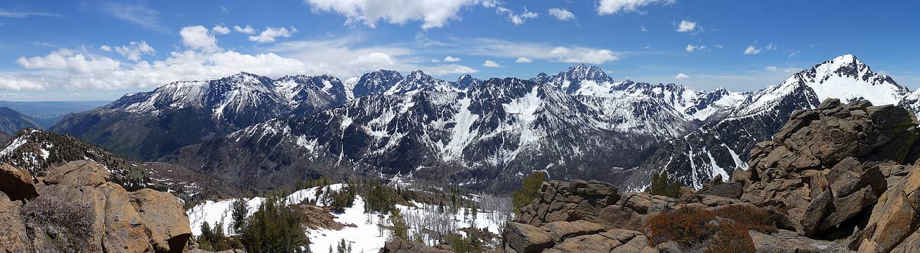
This is an old one from 6/6/2015 taken from Kaleetan:
Has anybody figured out an easy way to line up Peakfinder labels with images? (I mean images without GPS info - not integrated via the APP).
I did this one by generating a pdf in Peakfinder, importing it into PS, then aligning, scaling, and deforming the ridge lines to match the image before erasing the ridge lines to clean it up. But that seemed like the hard way to me.
|
| Back to top |
  
|
|
Bowregard
Member
Joined: 05 Feb 2019
Posts: 562 | TRs | Pics
Location: Sammamish |
Ran across a few panoramas from Alaska 2007. Looking for feedback on processing - tend to get a bit too heavy handed and lose my objectivity after awhile.
Denali from the SouthEast - 7/14/2007 @ 10 PM
Same spot 9 AM next morning (we really lucked out with the weather)
Glacier Bay sunshine
 NWtrax, half fast NWtrax, half fast
NWtrax, half fast |
| Back to top |
|
|
Bowregard
Member
Joined: 05 Feb 2019
Posts: 562 | TRs | Pics
Location: Sammamish |
Two panoramas 6 years apart from Mt Winchester looking SE.
July 29, 2015
July 27, 2021
I was surprised I couldn't really see any snow amount differences. I Like the 2015 one better.
|
| Back to top |
|
|
Riverside Laker
Member

Joined: 12 Jan 2004
Posts: 2818 | TRs | Pics
|
zimmertr, Bowregard |
| Back to top |
|
|
FiveNines
Member

Joined: 01 Oct 2010
Posts: 526 | TRs | Pics
|
 Icicle to 8mile
Cyclopath, half fast, Bowregard, awilsondc, Tom, Schroder
Cyclopath, half fast, Bowregard, awilsondc, Tom, Schroder |
| Back to top |
|
|
fairweather friend
Member
Joined: 31 May 2012
Posts: 322 | TRs | Pics
Location: Not so dispersed |
I have always loved these two side-by-side hills in GCNP! You can see them on the Carbon-Lava Loop Hike when running the Colorado River through the Grand Canyon. There's another hike along Lava Creek that shows you the eroded backside of the hill on the left. It looks like this:
Fantastic color combinations in the striated rock! (Please note the hiker on the bottom right for scale.)
Cyclopath, NWtrax, half fast, awilsondc, JonnyQuest
Cyclopath, NWtrax, half fast, awilsondc, JonnyQuest |
| Back to top |
|
|
Obi Tony Kenobi
Waterfall Crazy!

Joined: 25 Jun 2007
Posts: 1899 | TRs | Pics
Location: Marysville, WA |
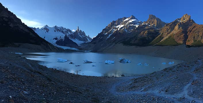 Cerro Torre in Parque Nacional Los Glacieres, Argentina
|
| Back to top |
|
|
Schroder
Member

Joined: 26 Oct 2007
Posts: 6722 | TRs | Pics
Location: on the beach |
|
Schroder
Member
|
 Thu Jul 14, 2022 4:51 pm |
|
|
The photo is backwards
It should be
|
| Back to top |
|
|
ScottP
Member

Joined: 01 Jul 2003
Posts: 397 | TRs | Pics
|
|
ScottP
Member
|
Sat Jul 16, 2022 6:05 pm |
|
|
Crater Lake from the summit of Mt Scott...
Cyclopath, InFlight, NWtrax
Cyclopath, InFlight, NWtrax |
| Back to top |
|
|
williswall
poser

Joined: 30 Sep 2007
Posts: 1968 | TRs | Pics
Location: Redmond |
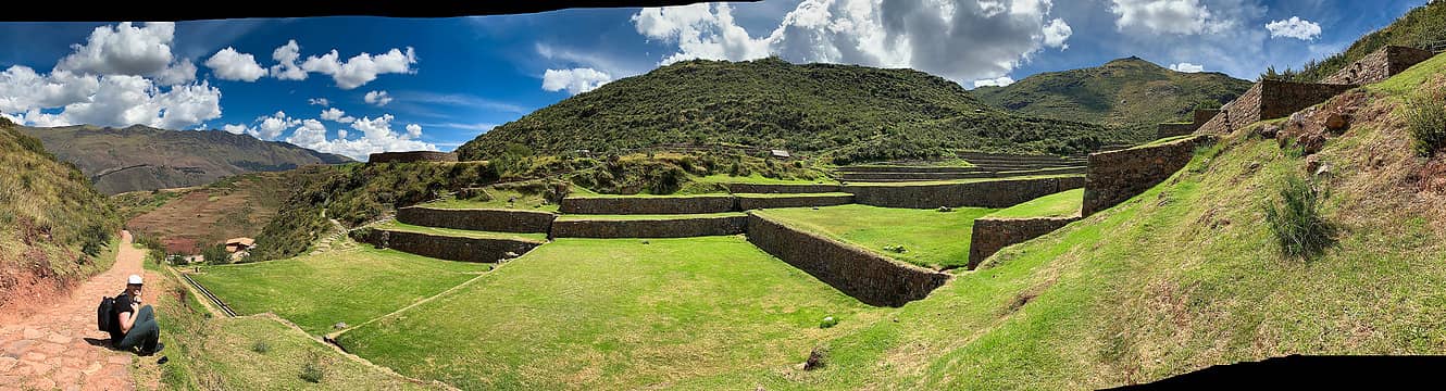 Tipon pano 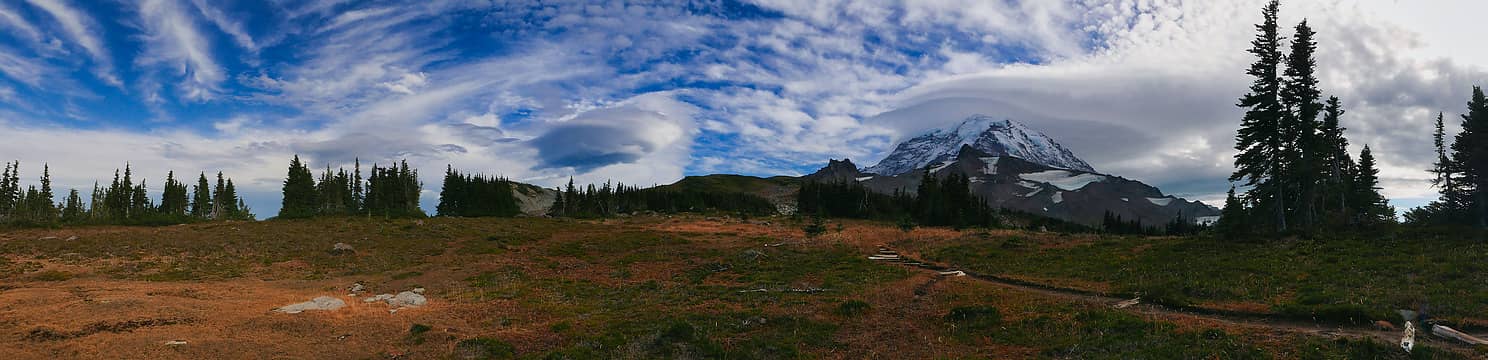 Spray Park pano 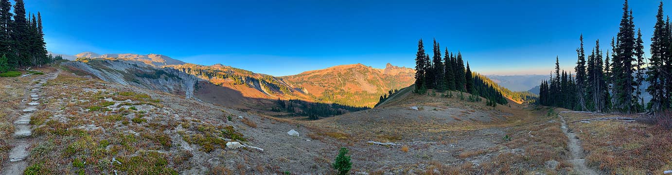 Rainier pano 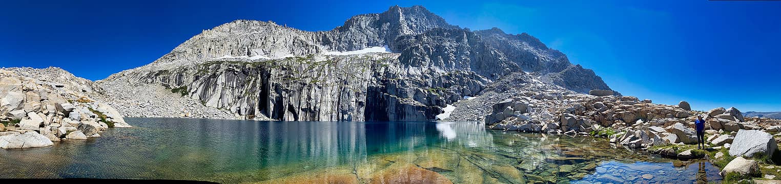 Precipice Lake pano 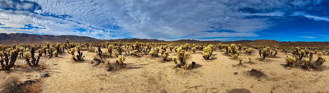 Joshua Tree pano 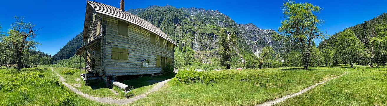 EV pano
I desire medium danger
williswall.com
Cyclopath, InFlight, Kenji, awilsondc, mike, zimmertr, Bowregard
I desire medium danger
williswall.com
Cyclopath, InFlight, Kenji, awilsondc, mike, zimmertr, Bowregard
|
| Back to top |
|
|
PowderPawn
Candidate

Joined: 30 Jul 2022
Posts: 57 | TRs | Pics
Location: Spokane |
This might be the greatest thread on here!
|
| Back to top |
|
|
InFlight
coated in DEET

Joined: 20 May 2015
Posts: 847 | TRs | Pics
Location: Seattle area |
|
InFlight
coated in DEET
|
Thu Aug 11, 2022 5:50 pm |
|
|
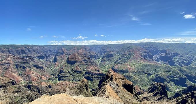 Waimea Canyon, Kauai
I went to the woods because I wished to live deliberately... ― Henry David Thoreau
Cyclopath, awilsondc
I went to the woods because I wished to live deliberately... ― Henry David Thoreau
Cyclopath, awilsondc
|
| Back to top |
|
|
Bowregard
Member
Joined: 05 Feb 2019
Posts: 562 | TRs | Pics
Location: Sammamish |
Here are a few from the Canadian Rockies:
Icefields Parkway:
Wilcox Pass view of Columbia Icefield and Athabasca Glacier:
Yoho - Iceline Trail:
Healy Pass - Scarab Peak & Lake, Egypt Lake:
Took a bunch of photos with the intent of making wider panos from them but unless they are worth printing I find I don't have a good use for them (hard to display well).
Cyclopath, NWtrax, Tom, awilsondc, Gil, InFlight
Cyclopath, NWtrax, Tom, awilsondc, Gil, InFlight |
| Back to top |
|
|
Schroder
Member
Joined: 26 Oct 2007
Posts: 6722 | TRs | Pics
Location: on the beach |
|
Schroder
Member
|
Sat Oct 01, 2022 10:18 am |
|
|
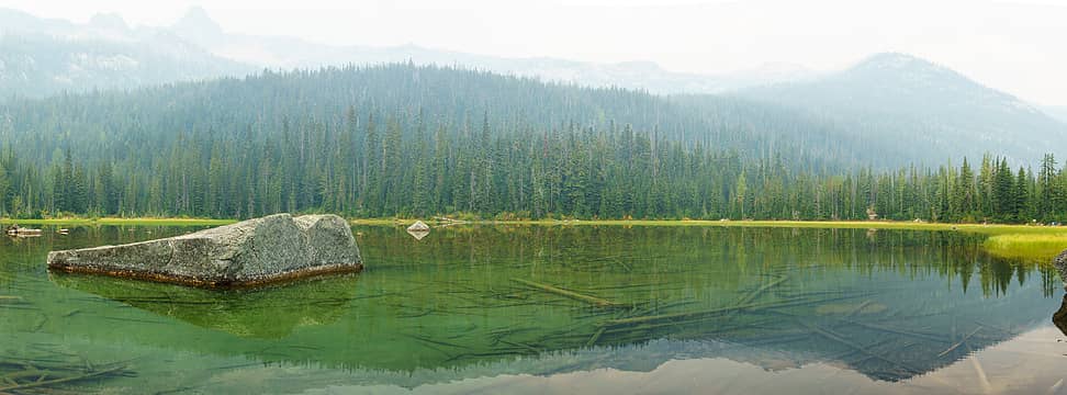 A smoky Cutthroat Lake
Cyclopath, Tom, awilsondc, Gil, InFlight, JonnyQuest
Cyclopath, Tom, awilsondc, Gil, InFlight, JonnyQuest |
| Back to top |
|
|
ScottP
Member
Joined: 01 Jul 2003
Posts: 397 | TRs | Pics
|
|
ScottP
Member
|
Fri Nov 04, 2022 5:10 pm |
|
|
Red Rock Canyon National Conservation Area - Las Vegas
Cyclopath, Tom
Cyclopath, Tom |
| Back to top |
|
|
|
|
You cannot post new topics in this forum
You cannot reply to topics in this forum
You cannot edit your posts in this forum
You cannot delete your posts in this forum
You cannot vote in polls in this forum
|
Disclosure: As an Amazon Associate NWHikers.net earns from qualifying purchases when you use our link(s). |


