| Previous :: Next Topic |
| Author |
Message |
Bloated Chipmunk
Cock Rock Searcher


Joined: 29 Jan 2007
Posts: 2993 | TRs | Pics
Location: Margaritaville |
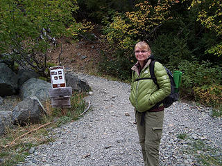
Yesterday MM & I were off to see the larches in the Teanaway, hoping to beat the crowds by visiting on a Friday w/less-than-perfect weather. To our surprise everyone & their grandmothers were there.   We set off on the Esmeralda Basin trail, located at the very end of the NF Teanaway River rd. (which had more potholes than what I remember from previous yrs.). It was cloudy & cold. @ least 1/2 a dozen cars were already in the lot, & 3 more arrived as we were gearing up.
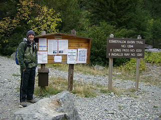 MM bundled up @ the TH 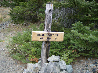 We turned to the right here 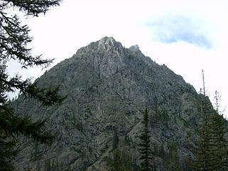 Patch of blue 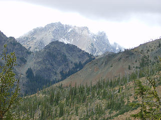 Gallagher Head / East end of Hawkins 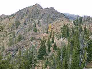 Lonely larch 
 Junction @ Ingalls Pass 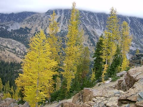 Larches near Ingalls Pass 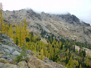 Larches in Headlight Basin 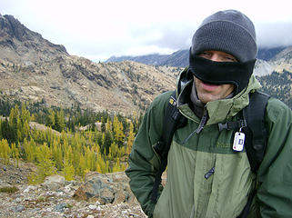 MM attempts to keep his nose warm 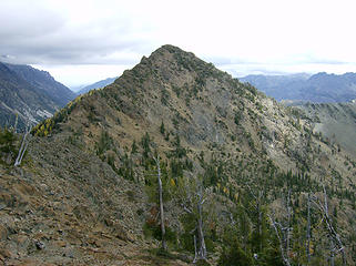 Looking back toward Ingalls Pass 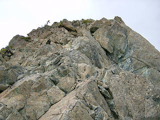 One of the rocky bulges 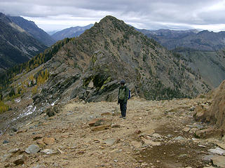 MM on the ridge coming up from Ingalls Pass 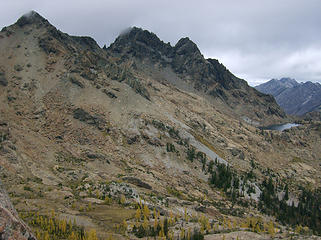 S. & N. Ingalls Pks. & Lk. Ingalls 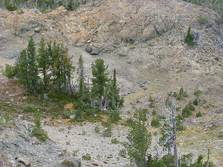 Is this the non-existent Lk. Campfire Girls? 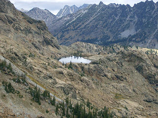 Lk. Ingalls 
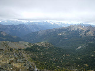 View to the NW 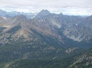 More peaks to the NW 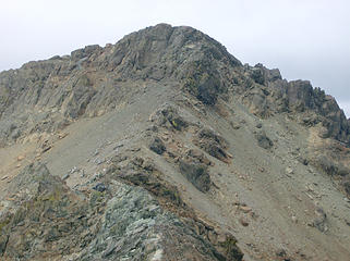 S. Ingalls Pk. to the north 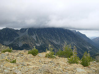 1 label Stuart has his head in the clouds 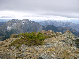 View to the west 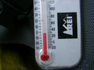 Below freezing on the summit. 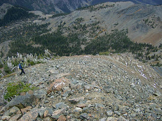 The route down the west ridge of Fortune Pk. 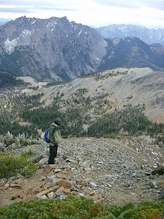 MM heading down 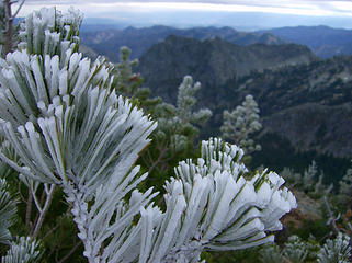 Rime ice 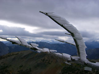 Rime ice 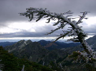 Rime ice 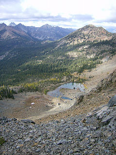 Lk. Ann 
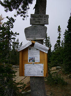
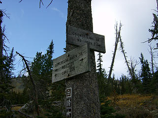 Junction 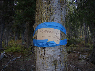 Sophisticated sign. Too bad it's pointing in the complete opposite direction of Esmeralda Pks. ;-) 
Home is where the hiking is.
"Peaks that have come and gone four times should halt a man in his steps." -- William O. Douglas
A balanced diet is a margarita in each hand.
Home is where the hiking is.
"Peaks that have come and gone four times should halt a man in his steps." -- William O. Douglas
A balanced diet is a margarita in each hand.
|
| Back to top |
  
|
|
mhutch
Member

Joined: 21 Sep 2008
Posts: 168 | TRs | Pics
|
|
mhutch
Member
|
 Sat Oct 10, 2009 4:51 pm |
|
|
ok I don't feel so bad about missing S. Ingalls again, yeah it was a little cold  nice pics!
|
| Back to top |
|
|
Nisquaww
Hot balls

Joined: 09 Jan 2006
Posts: 1239 | TRs | Pics
Location: Red of Mond |
|
Nisquaww
Hot balls
|
Sat Oct 10, 2009 7:14 pm |
|
|
Sweet ice shots. Das coold!
"Why do you have a beard?"
"I don't have a beard. It's just the light; it plays funny tricks." ~ Shel Silverstein
"Why do you have a beard?"
"I don't have a beard. It's just the light; it plays funny tricks." ~ Shel Silverstein
|
| Back to top |
|
|
MountainMan
Member

Joined: 15 Jul 2008
Posts: 365 | TRs | Pics
Location: San Diego |
This trip had a nice perspective for me, on mountains that we've done and mountains that we still want to do. We didn't get to see Stuart, but at least the clouds lifted enough to see most things around us. We knew it was going to be cold, but after all the nice weather we've been having, I still wasn't quite prepared for the 28 deg. plus (or should I say minus) wind chill on the summit.  Anyway, here are my pictures: Anyway, here are my pictures:
 BC at the TH.  Larchs near Ingalls pass. 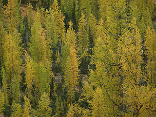 Larchs near Ingalls pass. 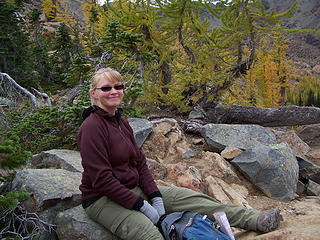 BC & Larchs near Ingalls pass. 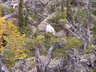 Mtn Goat 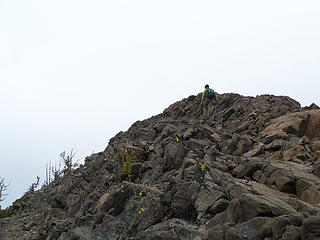 Heading up to Fortune from Ingalls Pass. 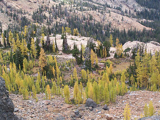 Larches near Lake Ingalls. 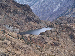 Lake Ingalls  Ingalls Peaks. 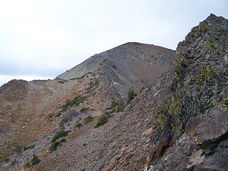 Fortune Pk from county line ridge. 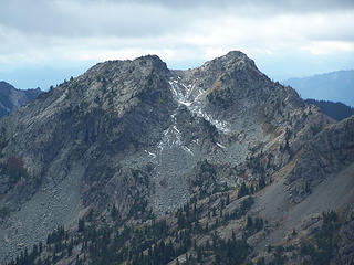 Zoom of Esmerelda Pks on the way up. 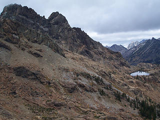 Ingalls Peak and Lake 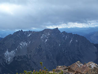 Hawkins Mtn from Fortune Pk. 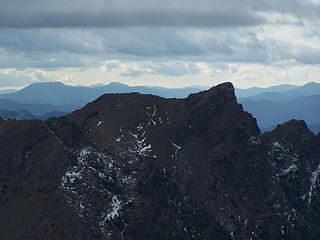 Zoom of Hawkins Mtn 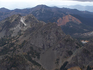 Esmerelda and Gallagher Head Lake 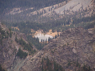 Gallagher Head Lake 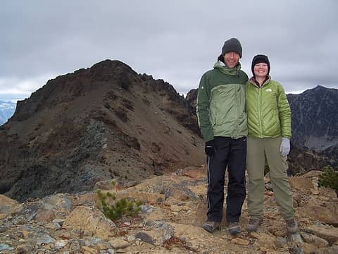 Us on Fortune Pk. 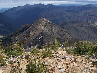 Looking back the way we came, from Fortune. 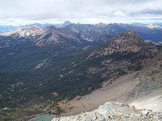 View NW 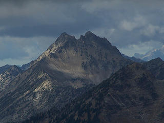 Anybody know what this Peak/Pks is/are?  Pano Of South Ingalls Pk. 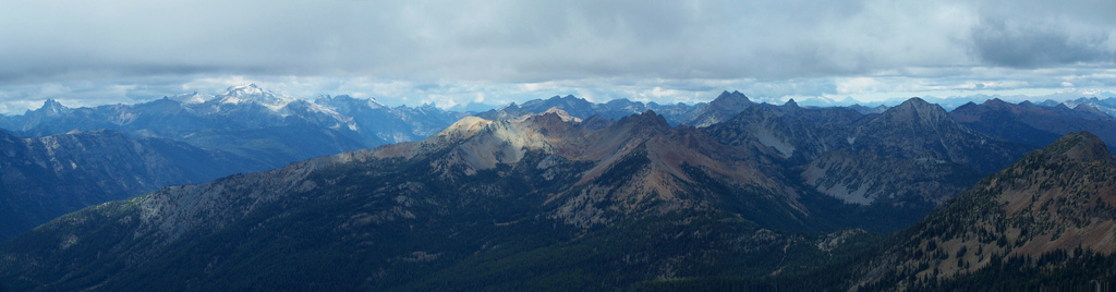 Pano, west to NW. 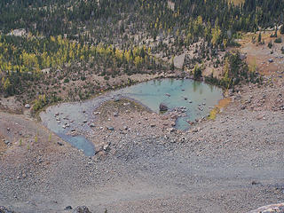 Lake Ann from Fortune Pk. 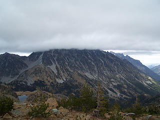 Stuart in the clouds 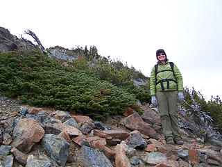 BC on the way down. 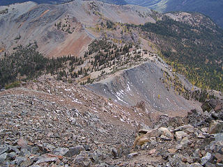 Looking down at the trail to Lake Ann. 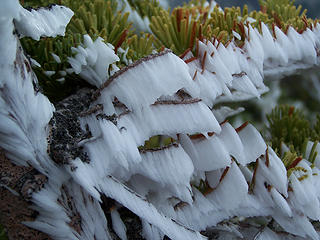 Rime frost 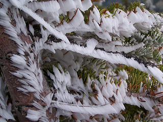 Rime frost  Rime frost 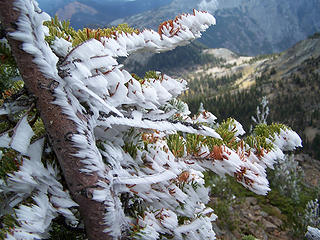 Rime frost 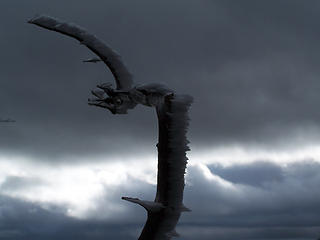 Branch w/ Rime frost 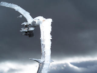 Flash of branch w/ Rime frost. 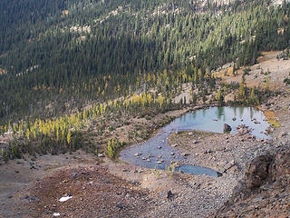 Lake Ann and larches 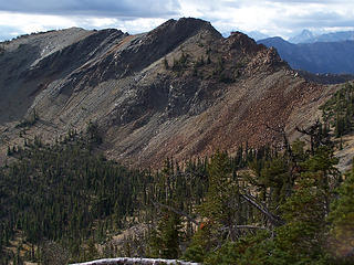 Small mtn. south of Lake Ann.
Slow down, take notice, savor the moment, appreciate the world around you and everything that you have.
Slow down, take notice, savor the moment, appreciate the world around you and everything that you have.
|
| Back to top |
|
|
DIYSteve
seeking hygge

Joined: 06 Mar 2007
Posts: 12655 | TRs | Pics
Location: here now |
|
DIYSteve
seeking hygge
|
Tue Oct 13, 2009 8:04 am |
|
|
| Bloated Chipmunk wrote: | Is this the non-existent Lk. Campfire Girls? |
Looks like it. When it dries up varies from year to year, usually between early August and mid-September. As I have previously observed, Lake CFG is the smallest thing I've ever seen labeled a "lake" on a map.
|
| Back to top |
|
|
puzzlr
Mid Fork Rocks

Joined: 13 Feb 2007
Posts: 7220 | TRs | Pics
Location: Stuck in the middle |
|
puzzlr
Mid Fork Rocks
|
Tue Oct 13, 2009 9:40 am |
|
|
Wrong direction for Jolly (based on the pano). It's in the right place and based on GE looks like The Cradle.
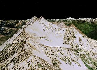 The Cradle
|
| Back to top |
|
|
DIYSteve
seeking hygge
Joined: 06 Mar 2007
Posts: 12655 | TRs | Pics
Location: here now |
|
DIYSteve
seeking hygge
|
Tue Oct 13, 2009 10:57 am |
|
|
Yeah, The Cradle makes sense. I hadn't figured out which direction from Fortune the pic was taken. Gotta ski that bowl on The Cradle one of these years.
|
| Back to top |
|
|
Bloated Chipmunk
Cock Rock Searcher
Joined: 29 Jan 2007
Posts: 2993 | TRs | Pics
Location: Margaritaville |
Thanks puzzlr & BigSteve for helping to ID those pics!
Home is where the hiking is.
"Peaks that have come and gone four times should halt a man in his steps." -- William O. Douglas
A balanced diet is a margarita in each hand.
Home is where the hiking is.
"Peaks that have come and gone four times should halt a man in his steps." -- William O. Douglas
A balanced diet is a margarita in each hand.
|
| Back to top |
|
|
|
|


