| Previous :: Next Topic |
| Author |
Message |
yew
non-technical

Joined: 12 Dec 2005
Posts: 1173 | TRs | Pics
Location: Bellingham |
|
yew
non-technical
|
 Wed Jun 03, 2009 7:22 am |
|
|
FR 2060, the Clear Creek Rd is passable although there are a few spots where a sedan will have to go with care. There's an avalanche deposit that narrows the road and 2 dips with big gravel. I had to chop out 3 windfalls over the road with a Pulaski. An SUV was there when I arrived at the TH.
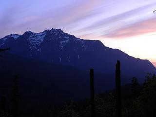
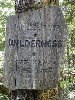 Wilderness boundary sign on 8 Mile Creek Trail  Helena Peak area from 8 Mile Creek Trail, Boulder River Wilderness, Mt Baker-Snoqualmie National Forest, Washington. 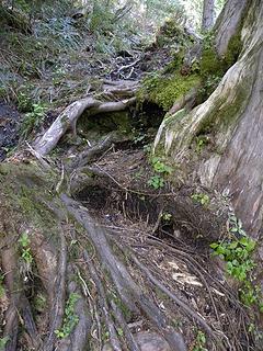 wet, rocky, rooty, steep 8 Mile Creek Trail to Squire Creek Pass 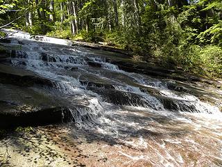 waterfalls over slab on 8 Mile Creek Trail 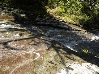 waterfalls over slab on 8 Mile Creek Trail 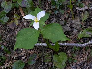 western trillium on 8 Mile Creek Trail 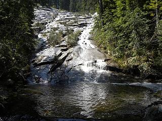 waterfalls over slab on 8 Mile Creek Trail 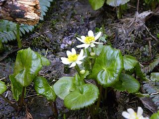 Marsh marigold on 8 Mile Creek Trail 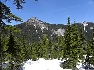 looking northeast from west of Squire Creek Pass, Boulder River Wilderness. 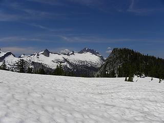 Mt Bullen and Whitehorse Mtn from Squire Creek Pass, Boulder River Wilderness. 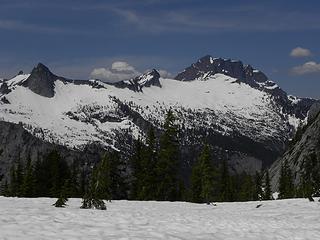 Mt Bullen and Whitehorse Mtn from Squire Creek Pass, Boulder River Wilderness. 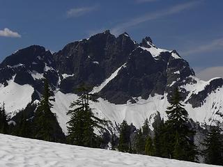 Three Fingers from Squire Cr Pass, , Boulder River Wilderness.
"I aint jokin woman, I got to ramble...We gonna go walkin through the park every day." - Led Zeppelin
"I aint jokin woman, I got to ramble...We gonna go walkin through the park every day." - Led Zeppelin
|
| Back to top |
  
|
|
Grizzy
Yellow Cedar Hugger

Joined: 16 Jul 2006
Posts: 1936 | TRs | Pics
Location: Switchbacks |
|
Grizzy
Yellow Cedar Hugger
|
Wed Jun 03, 2009 7:28 am |
|
|
Nice!  So route finding isn't a problem on the snowy portion? Thanks for the pictures, it is a very cool place.
All the birds have flown up and gone;
A lonely cloud floats leisurely by.
We never tire of looking at each other -
Only the mountain and I. ~Li Po~
All the birds have flown up and gone;
A lonely cloud floats leisurely by.
We never tire of looking at each other -
Only the mountain and I. ~Li Po~
|
| Back to top |
|
|
whitebark
Member
Joined: 08 Jul 2005
Posts: 1864 | TRs | Pics
Location: Seattle |
Good news that the 8 mile creek trailhead is accessible! Last Sunday, I hiked toward the pass via Squire Creek. Now that the Squire Creek route is two miles longer due to the landslide damage, the 8 mile route is probably the quickest way to the pass.
Snow begins at 3000' on the Squire Creek route, just when you break out of the trees below Jumbo Mountain (check my WTA report).
|
| Back to top |
|
|
Hulksmash
Cleaning up.

Joined: 20 Apr 2008
Posts: 7113 | TRs | Pics
Location: Arlington |
|
Hulksmash
Cleaning up.
|
Wed Jun 03, 2009 9:16 am |
|
|
WOW! that AVI deposit already melted that much! I figured it would be July before that would happen!
"Bears couldn't care less about us....we smell bad and don't taste too good. Bugs on the other hand see us as vending machines." - WetDog
Albuterol! it's the 11th essential
"Bears couldn't care less about us....we smell bad and don't taste too good. Bugs on the other hand see us as vending machines." - WetDog
Albuterol! it's the 11th essential
|
| Back to top |
|
|
don b
Member

Joined: 22 Feb 2006
Posts: 369 | TRs | Pics
|
|
don b
Member
|
Wed Jun 03, 2009 9:19 am |
|
|
I was rock climbing on 3 O'Clock rock on Sunday and we stopped at the avy spot and rode our bikes to the trailhead. A CC.com climber had hand dug the road out as well as cutting out the big tree that had fallen during our absence. He calls himself "I need to climb" and this certainly demonstrates that! Great work on his part!
|
| Back to top |
|
|
yew
non-technical
Joined: 12 Dec 2005
Posts: 1173 | TRs | Pics
Location: Bellingham |
|
yew
non-technical
|
Wed Jun 03, 2009 9:43 pm |
|
|
| Grizzy wrote: | | ...So route finding isn't a problem on the snowy portion? ... |
The route beyond the snow-filled ravine about 1/2 mile beyond the big pool below the slab waterfall was totally covered with snow. I probably lost the real trail and just followed my own course after the ravine. I've never been up there when the trail is free of snow so I don't know how far I was off from the buried trail.
---------------------------
Oh yeah
...the night before I car camped up on what I think is a spur of FR 2420 on Gold Mountain above the White Chuck whitewater put-in. The campsite was next to an old burnt and logged area. The views from the scenic clearcut/burn were nice. This spur road would be a nice double track mountain bike ride if it were longer.
 Jumbo Mountain from a spur of FR 2420 near Darrington 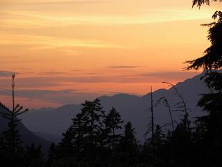 sunset from a spur road on Gold Mtn 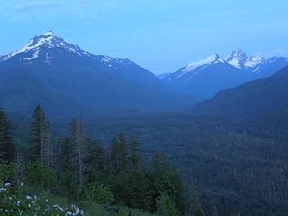 Mt Pugh and Sloan Peak from a spur on Gold Mountain near Darrington at evening 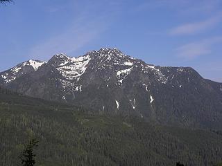 Jumbo Mountain from a spur of FR 2420 near Darrington 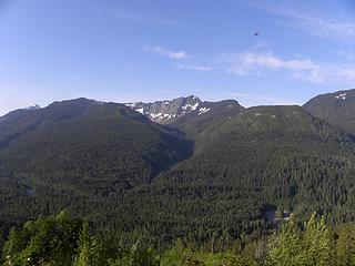 Helena Ridge from Gold Mtn spur road 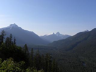 Mt Pugh and Sloan Peak from a spur on Gold Mountain near Darrington 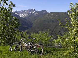 Helena Ridge from Gold Mtn spur road 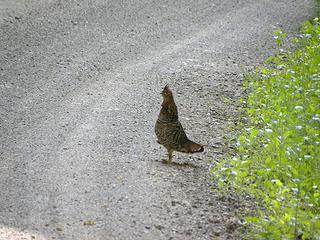 ruffed grouse mama hen on Gold Mtn near Darrington, Washington 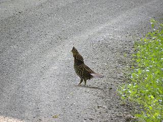 ruffed grouse mama hen on Gold Mtn near Darrington, Washington 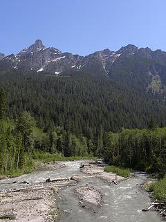 White Chuck Mtn and the White Chuck from the huge washout on FR 23 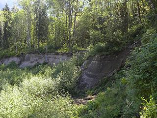 FR 23 on the White Chuck River 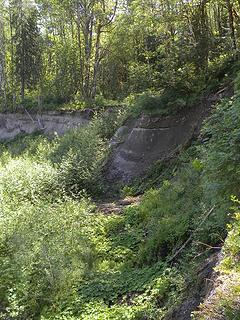 FR 23 on the White Chuck River
"I aint jokin woman, I got to ramble...We gonna go walkin through the park every day." - Led Zeppelin
"I aint jokin woman, I got to ramble...We gonna go walkin through the park every day." - Led Zeppelin
|
| Back to top |
|
|
Quark
Niece of Alvy Moore

Joined: 15 May 2003
Posts: 14152 | TRs | Pics
|
|
Quark
Niece of Alvy Moore
|
Wed Jun 03, 2009 10:04 pm |
|
|
Yew, the White Chuck Bench trail is pretty exciting. I didn't visit it before it was all washed out. Since then, I've visited it twice - it's a beautiful lowland trail that locals used a lot, and one that I'll use time and time again. There are awesome river views, and it's a gorgeous forest.
The White Chuck Rd decision hasn't been made yet - I contacted the person in charge of the EA today, to check on the status. She said that so many people commented that they're still preparing their matrix. It'll be forthcoming in the next couple o' weeks.
Cool pic of the grouse.
Glad to see more trip reports on Squire Creek. I had my first visit last year. If the Forest Service knows people visit it, perhaps it'll get more regular attention. The trail from 8 Mile to 3 O'Clock rock was practically re-built several years ago, but as you know the worst of it is beyond the Rock (and the whole other side is pretty bad).
I found a photo last night of the Jumbo Mtn washout (Squire Creek road side of this trail), a few months after it happened. I'll scan it and post it next week. I think fwb's trip report of the Jumbo climb had good current washout photos - I'll post it on that t hread for comparison.
"...Other than that, the post was more or less accurate."
Bernardo, NW Hikers' Bureau Chief of Reporting
"...Other than that, the post was more or less accurate."
Bernardo, NW Hikers' Bureau Chief of Reporting
|
| Back to top |
|
|
|
|
You cannot post new topics in this forum
You cannot reply to topics in this forum
You cannot edit your posts in this forum
You cannot delete your posts in this forum
You cannot vote in polls in this forum
|
Disclosure: As an Amazon Associate NWHikers.net earns from qualifying purchases when you use our link(s). |


