| Previous :: Next Topic |
| Author |
Message |
Joey
verrry senior member


Joined: 05 Jun 2005
Posts: 2798 | TRs | Pics
Location: Redmond |
|
Joey
verrry senior member
|
 Wed Jun 24, 2009 7:52 am |
|
|
The trip to Coney Basin is a fine hike for our overly-friendly dog. It does not appear to be too popular (we saw no one), comes equipped with dog-water and as reported here - is snow free.
As for a people hike, while it is true that some of the old mine road/trail looks like this:
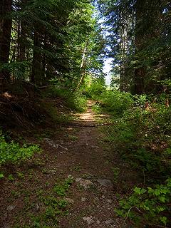 Mine road/trail 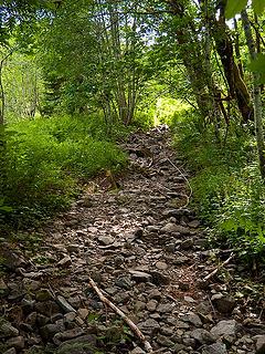 Mine road/trail 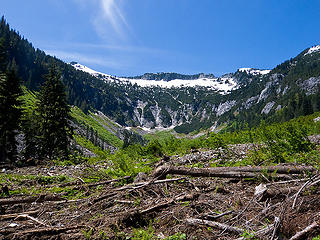 Coney Basin headwall and avi debris.  Columbine 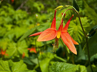 Columbine 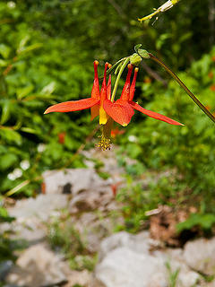 Columbine  Columbine 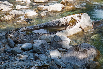 Bathtub 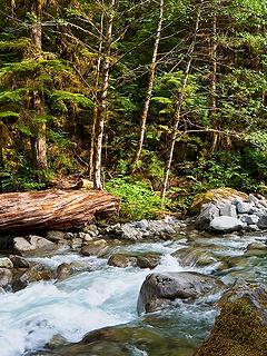 West Fork Miller River 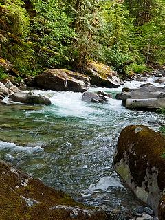 West Fork Miller River 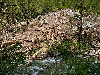 West Fork of Miller River and slide on south side 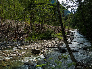 West Fork of Miller River and slide on south side
|
| Back to top |
  
|
|
Gil
Member

Joined: 29 Sep 2004
Posts: 4062 | TRs | Pics
|
|
Gil
Member
|
Wed Jun 24, 2009 7:57 am |
|
|
Nice report! Like the river.
Friends help the miles go easier.
Klahini
Friends help the miles go easier.
Klahini
|
| Back to top |
|
|
Jimbo
Member

Joined: 14 Feb 2005
Posts: 1558 | TRs | Pics
Location: Arlington |
|
Jimbo
Member
|
Wed Jun 24, 2009 8:47 am |
|
|
Thanks JoeY, I'm headed there in a week 
Guns only have two enemies; rust and politicians
Guns only have two enemies; rust and politicians
|
| Back to top |
|
|
fishonjoe
Member

Joined: 13 Feb 2006
Posts: 278 | TRs | Pics
Location: Marysville, Wa. USA |
So did you make it across Coney Creek? Is there usually some sort of crossing when the water level is lower (log, etc.)?
|
| Back to top |
|
|
Hiker Mama
Member

Joined: 25 Jun 2006
Posts: 3451 | TRs | Pics
Location: Lynnwood |
Mmmm, Columbine! 
|
| Back to top |
|
|
Joey
verrry senior member
Joined: 05 Jun 2005
Posts: 2798 | TRs | Pics
Location: Redmond |
|
Joey
verrry senior member
|
Wed Jun 24, 2009 11:53 am |
|
|
| fishonjoe wrote: | | So did you make it across Coney Creek? Is there usually some sort of crossing when the water level is lower (log, etc.)? |
No, we did not attempt to cross Coney Creek. We turned around where the road used to cross on a log bridge (long since gone). The creek is not all that wide at this point but is still being feed by substantial snow melt from the high country.
We could not see very far up or downstream and did not search for a friendly crossing log. I don't know about "usually" since this is the first time I've been by this way.
|
| Back to top |
|
|
fishonjoe
Member
Joined: 13 Feb 2006
Posts: 278 | TRs | Pics
Location: Marysville, Wa. USA |
|
| Back to top |
|
|
H. Hound
Member

Joined: 09 May 2003
Posts: 1205 | TRs | Pics
Location: Exit 32 |
|
H. Hound
Member
|
Wed Jun 24, 2009 5:02 pm |
|
|
| fishonjoe wrote: | | Is there usually some sort of crossing when the water level is lower (log, etc.)? |
We didn't find one a few years ago, but it's not that bad after the snow melts off
I poked around a few weeks ago, and didn't find a log. Coney Creek braids just before hitting the Miller, so fording it down lower looked better to me.
|
| Back to top |
|
|
fishonjoe
Member
Joined: 13 Feb 2006
Posts: 278 | TRs | Pics
Location: Marysville, Wa. USA |
That pic says it all! Thanks
|
| Back to top |
|
|
|
|


