| Previous :: Next Topic |
| Author |
Message |
Arete
Member


Joined: 29 Oct 2006
Posts: 137 | TRs | Pics
Location: Bothell, WA |
|
Arete
Member
|
 Mon Jun 29, 2009 9:59 pm |
|
|
We couldn't get out for the beautiful weather Saturday, so we chose an east-side hike to escape the early morning drizzle on the west side Sunday. Weve thoroughly enjoyed Rock Mountain (6852 ft on Nason Ridge) from the Snowy Creek approach twice before and figured it was about time to pay our dues on the steep trail up from Highway 2. After all, we had a perfect group for the trail, which Harvey describes as needing folks either young and stubborn or old and ornery.  In addition we had a few pair of new boots that were in need of some rigorous field testing. In addition we had a few pair of new boots that were in need of some rigorous field testing. 
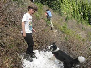
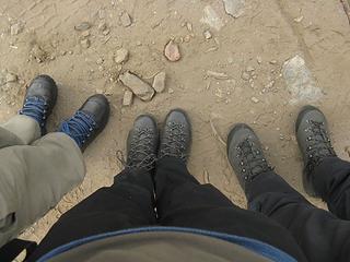 Three pairs of virgin boots. Can't think of a better trail to try them out on! 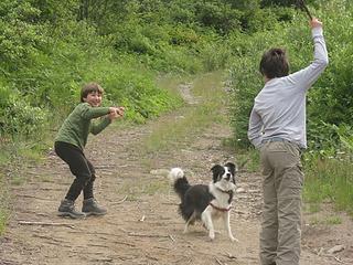 Getting rid of some of that excess energy at the trailhead before we start up  There were plenty of wonderful blooms to distract us (and provide excuses to stop while taking pictures) especially the stonecrop and Lewisia carpeting the slopes around 3500 4000 ft. There were plenty of wonderful blooms to distract us (and provide excuses to stop while taking pictures) especially the stonecrop and Lewisia carpeting the slopes around 3500 4000 ft. 
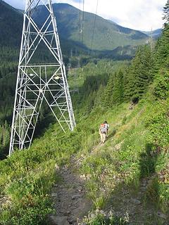 Climbing up past the power poles 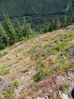 The steep lower slopes 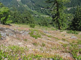 Looking down the steep lower slopes, blooming with Lewisia. 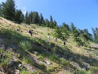 The steep lower slopes 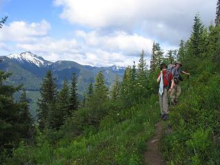 Climbing up into the subalpine vegetation and bugs   Luckily that only lasted about a half hour and after that the breezes kept them at bay the remainder of the day. Luckily that only lasted about a half hour and after that the breezes kept them at bay the remainder of the day.  The first snow patch was at 5500 feet and by about 5600 feet the snow was mostly continuous. The ridgeline at 5700 feet gave us our first views up to the upper slopes and we followed snow slopes above to the ridge (6200 ft) overlooking Rock Lake. The snow was well consolidated and easy to walk up.
 First snow patch at about 5500 ft 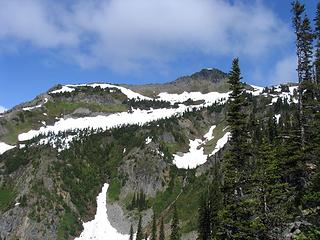 First good view of upper slopes of Rock Mtn (knoll is the false summit of the summit ridge; summit not visible here) from 5700 ft. 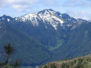 The view toward Jim Hill Mtn 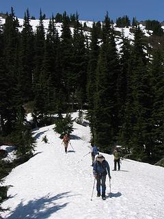 Travering snowy ridge at about 5850 ft toward the slopes leading up to the ridge above Rock Lk. 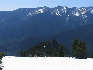 Climbing the snow slopes up to the ridge above Rock Lake. Meadowy point on ridge down below (5700 ft) is where we got our first good view of the upper slopes of the mountain. 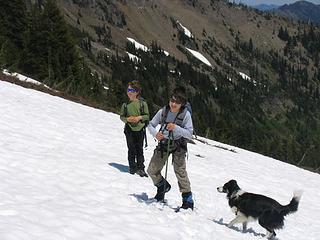 Climbing snow slopes to the ridge above Rock Lake 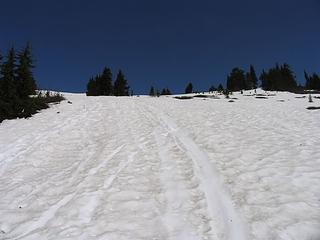 Snow slopes leading up to the ridge above Rock Lake 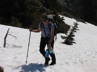 Arriving at the ridge above Rock Lake 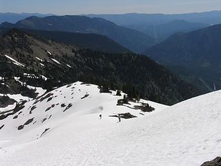 Looking down to the ridge above Rock Lk 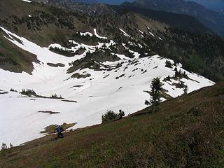 Climbing the switchback trail up steep heather slopes to the summit ridge (Rock Lk below) 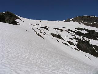 Looking up from the ridge above Rock Lake to the summit ridge (summit on right; route of ascent up to snow-free knoll on left). 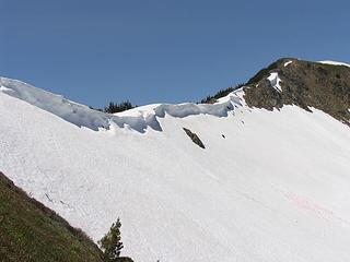 Cornice along summit ridge 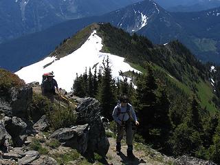 The last switchback to the top. Switchbacks up to the summit ridge visible in background on steep heather slope (facing to left). 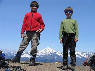 The younger crowd wondering when the hard work starts. 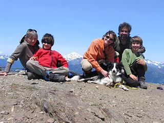 Group photo on top  A young companion joined us in sunning ourselves on top 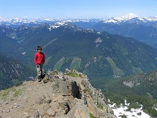 Looking north off of the summit 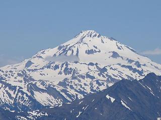 Glacier Pk from the summit 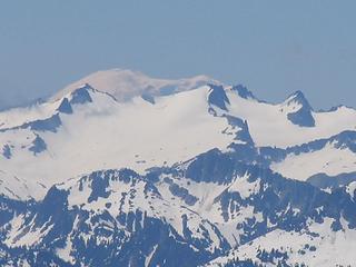 View from the summit: Mount Rainier "peaking" out behind Mt Daniel. 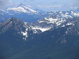 View from the summit: Labyrinth Mtn and Minotaur Lake (foreground). Sloan Pk behind. 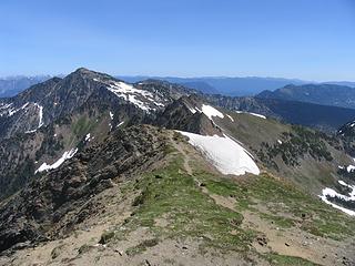 Looking east along Nason Ridge to Mount Howard 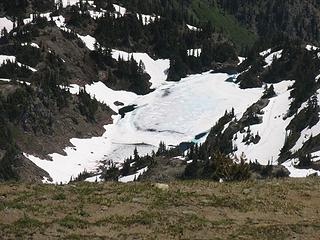 Rock Lake just starting to melt out 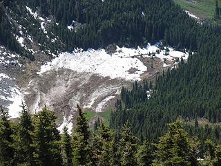 Avalanche debris covering meadow above Snowy Creek on the west side of Rock Mtn 
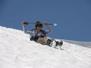 Starting our all-too-short, but fun glissades 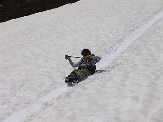 Glissading down the upper slopes 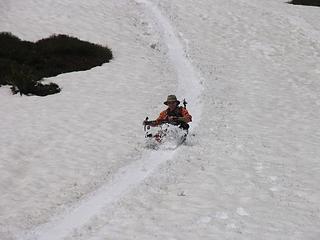 Enjoying the descent!
|
| Back to top |
  
|
|
the Zachster
Member

Joined: 17 Jan 2007
Posts: 4776 | TRs | Pics
Location: dog training |
Oh my gosh...those kids are AWESOME!  That is one tough grunt and they clearly have energy to spare. I am so impressed! And jealous!
Nice to see a little snow up there still. That is one tough grunt and they clearly have energy to spare. I am so impressed! And jealous!
Nice to see a little snow up there still.
"May I always be the kind of person my dog thinks I am"
"May I always be the kind of person my dog thinks I am"
|
| Back to top |
|
|
|
|
You cannot post new topics in this forum
You cannot reply to topics in this forum
You cannot edit your posts in this forum
You cannot delete your posts in this forum
You cannot vote in polls in this forum
|
Disclosure: As an Amazon Associate NWHikers.net earns from qualifying purchases when you use our link(s). |


