| Previous :: Next Topic |
| Author |
Message |
kyle d
Member


Joined: 03 Jun 2007
Posts: 521 | TRs | Pics
Location: Ogden, UT |
|
kyle d
Member
|
 Sat Jul 04, 2009 7:19 pm |
|
|
Silver Star has long been an intriguing mountain to me, in no small part due to its looming presence and jagged profile from Washington Pass and Highway 20.
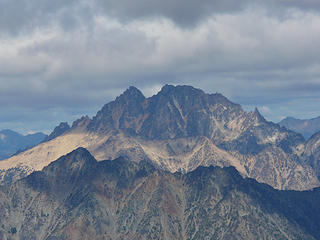 Silverstar 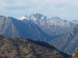 Silverstar 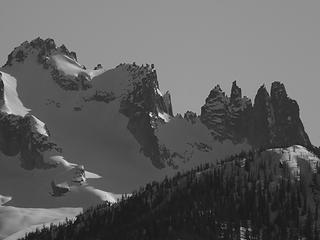 Silverstar 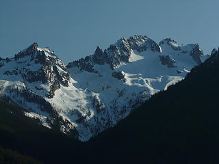 Silverstar evening 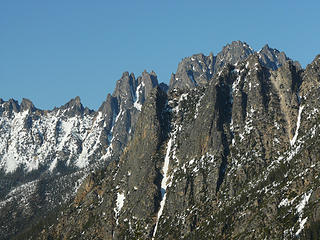 Silverstar 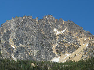 Silverstar from the trailhead -- getting ready to go. 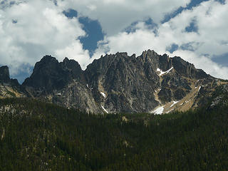 Departing shot 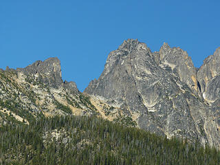 Head for the gap, Burgundy Col 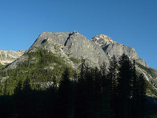 Views begin right away 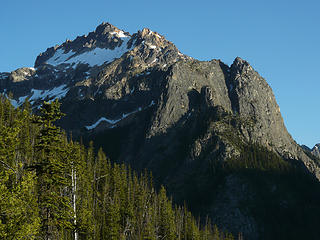 Peak? 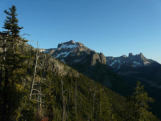 Views along the trail below the Basin 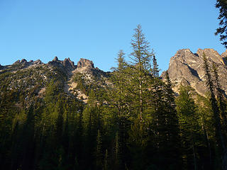 Campsite in a larch grove Campsite in a larch grove 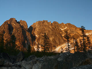 Silver star evening 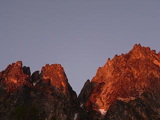 Evening alpenglow 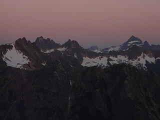 Waiting for the dawn 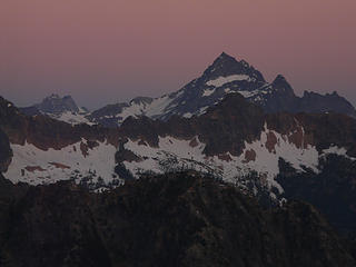 Pre-dawn Black Peak 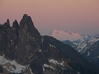 The Liberty Bell with alpenglow on Dome Peak behind 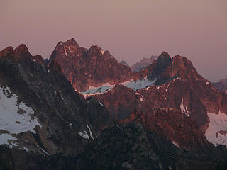 Morning alpenglow 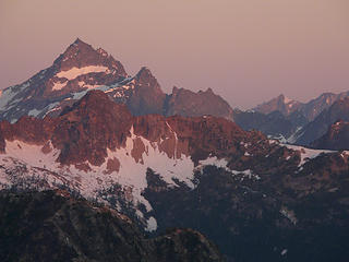 Black peak looking red 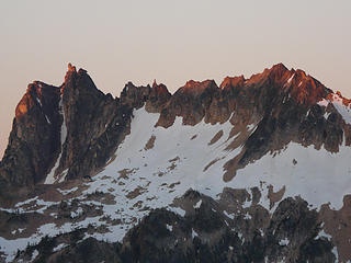 The sun has risen 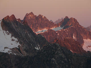 Rugged peak alpenglow 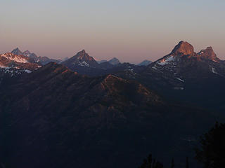 Morning 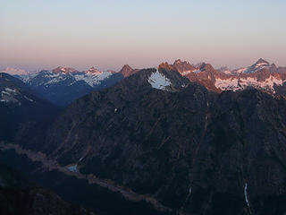 Sunrise 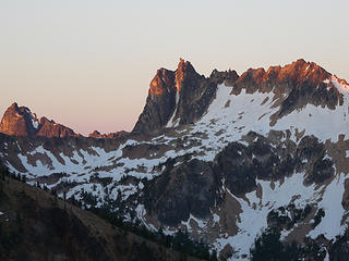 Alpenglow 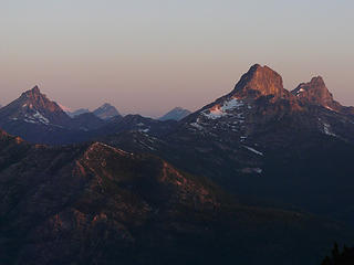 Tower Mountain morning 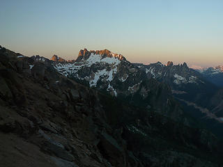 Alpenglow 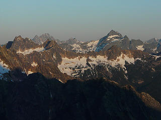 Goode to Black 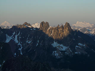 Glacier Peak to Dome, some light on the Liberty Bell 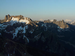 Morning light in the mountains 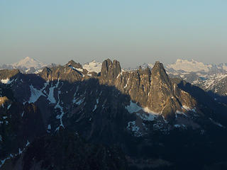 The Liberty Bell now illuminated with sun. Glacier Peak and Dome behind 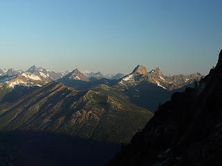 Tower Mountain and friends from the col 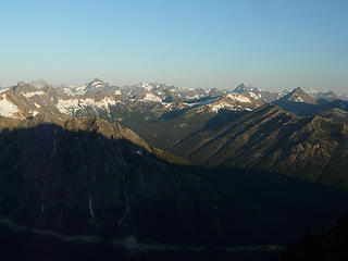 The North Cascades from Burgundy Col 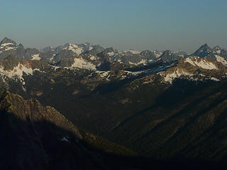 Views from the Col 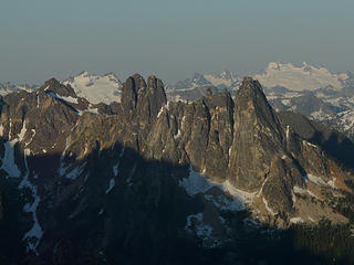 Liberty Bell and Early Winter Spires. Dome behind right. 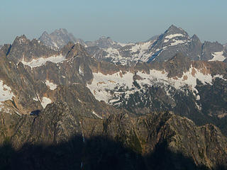 Goode to Black a little later in the morning 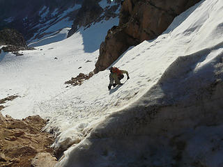 Heading down from Burgundy col to the glacier. 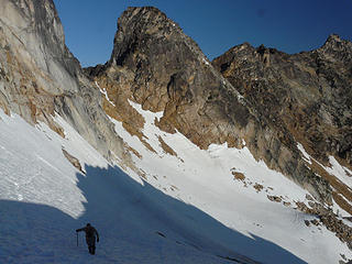 Crossing the Glacier 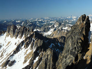 Mountain sea 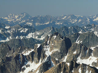 Mountains 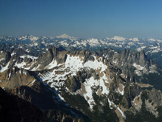 Glacier Peak and surrondings 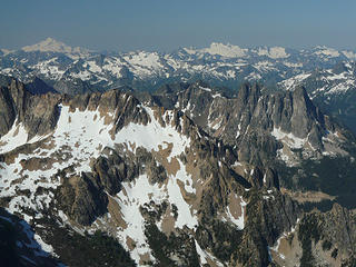 Glacier Peak and many more 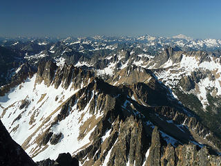 The North Cascades 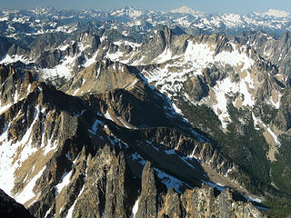 Many layers 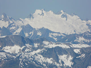 Dome zoom 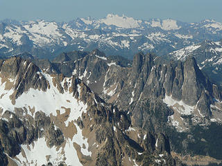 Liberty Bell and beyond 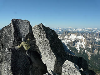 Wildernessed goes for the summit of Silverstar 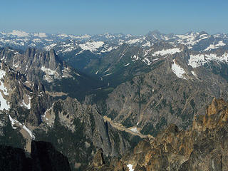 Washington pass 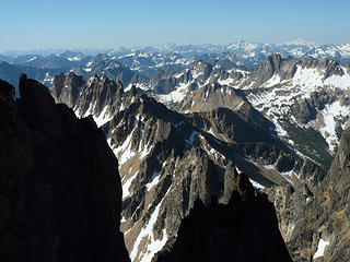 Unending mountains 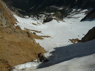 Almost back to the col 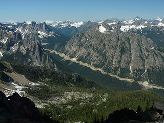 North Cascades highway and Washingon Pass from Burgundy col 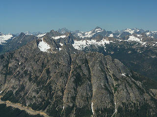 Lots of rock 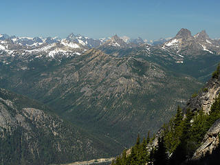 Toward Tower 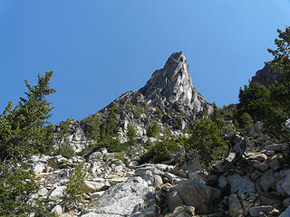 Burgundy spire? 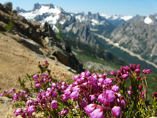 heather 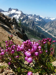 Heather 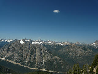 Storm cloud 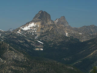 Tower 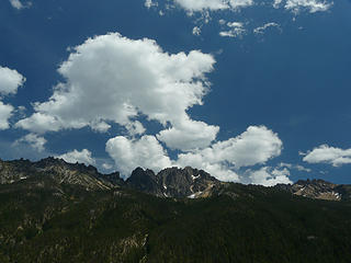 Silverstar 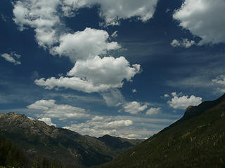 Clouds 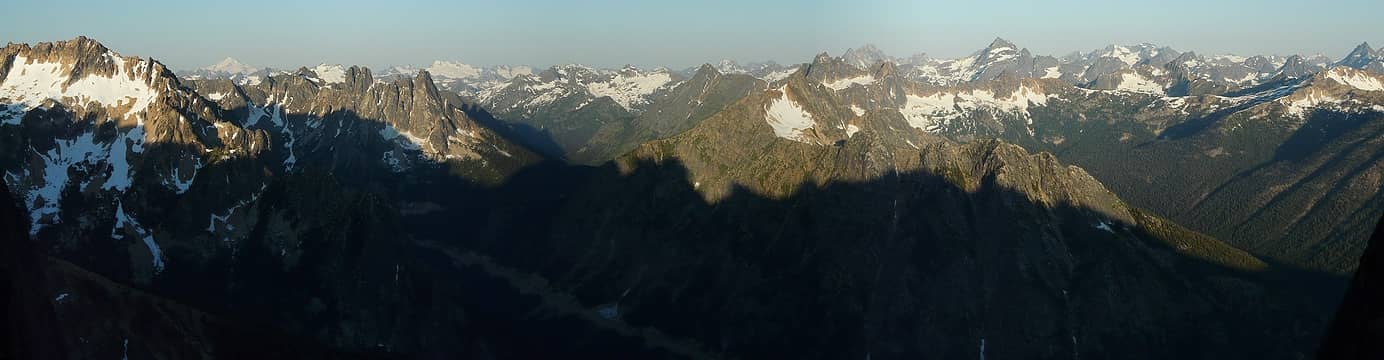 Morning panorama from the col 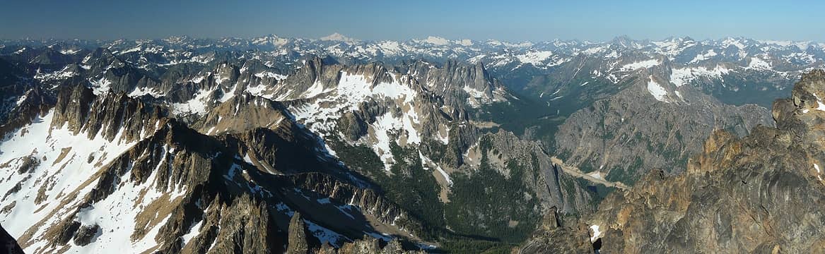 Silver star panorama 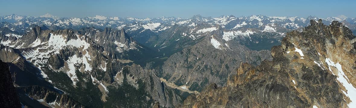 Summit pano 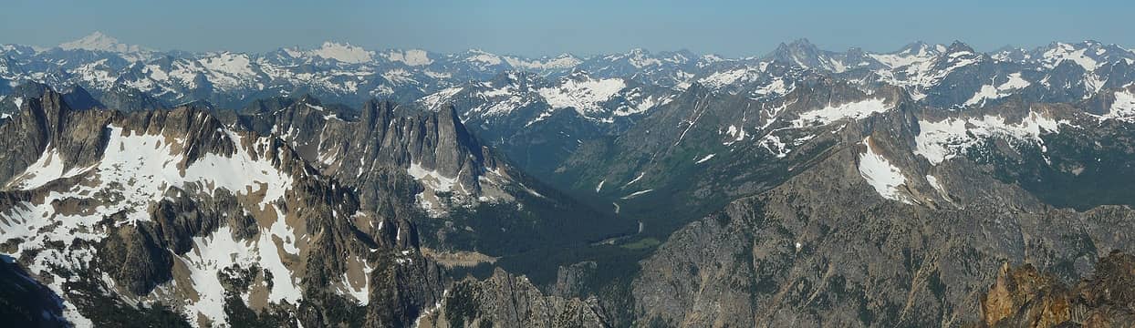 Panorama
|
| Back to top |
  
|
|
wildernessed
viewbagger

Joined: 31 Oct 2004
Posts: 9275 | TRs | Pics
Location: Wenatchee |
Location : West of Winthrop, Wa. ( Milemarker 166 )
Map : GTM Washington Pass
Guidebooks : Summit Routes, Washingtons Highest Mountains
Stats : 6.5 mi, 5800 r/t
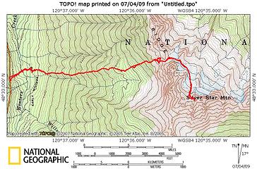 Silver Star Mountain via Burgundy Col 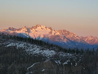 Sunrise on Silver Star 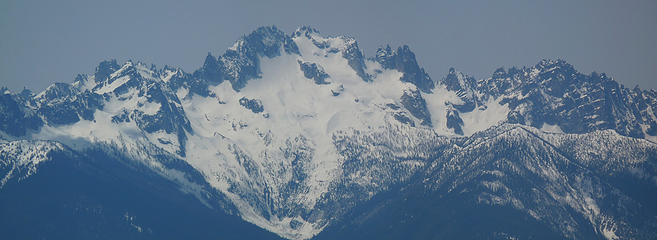 North side ofSilver Star from McLeod 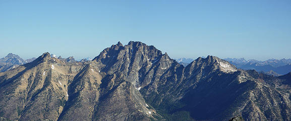 South side of Silver Star from Abernathy Peak 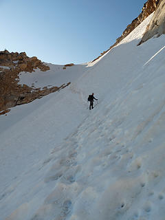 Kyle along the snowfield beneath the Burgundy Col 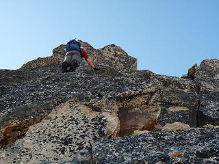 Kyle on the slab ramp to the summit exit. 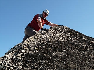 Kyle on the Northern of the two highpoints. 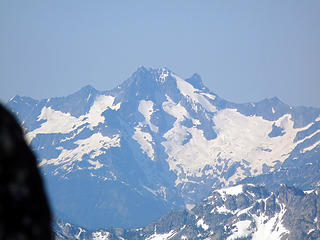 Bonanza 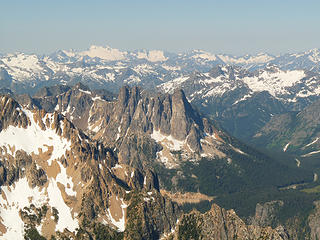 Liberty Bell and a lot more... 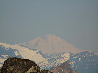 Mt. Baker 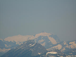 Shuksan through some haze in the distance. 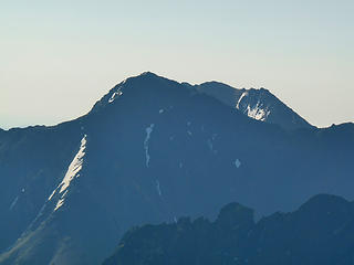 Early morning on North Gardner. 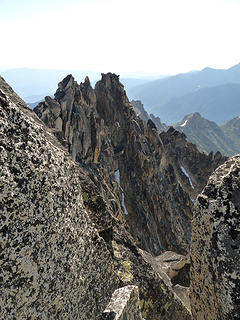 South side of Silver Star through a hole in the boulders. 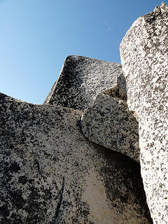 Silver Star summit from our rest and lunch brunch spot. 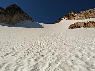 Nice glissade down. kyle is the dot at the col about ready for his freefall. 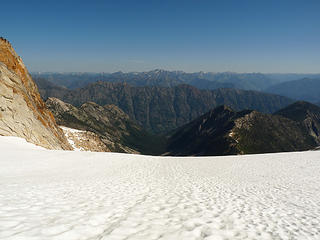 Lower part of the glacier and entry point for Silver Star Creek route. 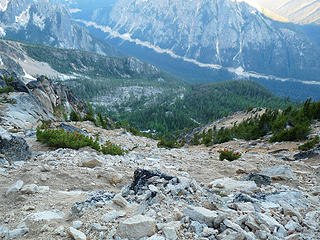 Looking down a section of gully towards Rt. 20, the camp at 6400' can be seen to the right. 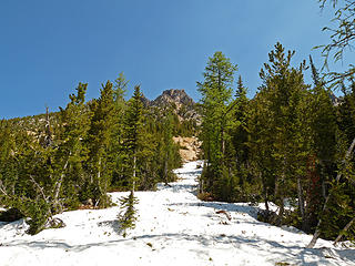 Compact snow just above the 6400' camp. 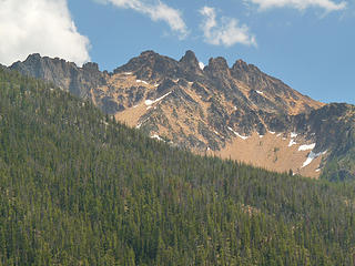 Big Snagtooth from Hwy 20 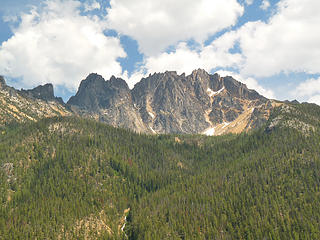 Silver Star from Hwy 20 you can see the bench at 6400' and Burgundy Creek to it's right.  Early Morning Pano 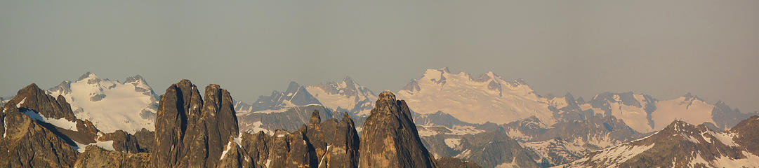 Early morning pano from Burgundy Col 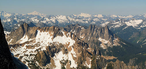 Pano from summit area 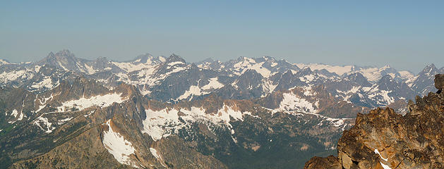 Pano from summit area II
Living in the Anthropocene
Living in the Anthropocene
|
| Back to top |
|
|
wildernessed
viewbagger
Joined: 31 Oct 2004
Posts: 9275 | TRs | Pics
Location: Wenatchee |
 Sweet ! Sweet !
Living in the Anthropocene
Living in the Anthropocene
|
| Back to top |
|
|
TrailPair
Member

Joined: 17 Apr 2005
Posts: 1699 | TRs | Pics
|
That is an awesome trip.....a little adventure  and lots of spectacular scenery. and lots of spectacular scenery. 
This thing called work is interfering with my play
This thing called work is interfering with my play
|
| Back to top |
|
|
the Zachster
Member

Joined: 17 Jan 2007
Posts: 4776 | TRs | Pics
Location: dog training |
What Trail Pair says!  That was my first Mountaineers climb after finishing the Basic course and we had a great time too. As I recall it was quite a challenge finding water at that campsite...barely a trickle coming out of the ground. Beautiful photos...thank you! That was my first Mountaineers climb after finishing the Basic course and we had a great time too. As I recall it was quite a challenge finding water at that campsite...barely a trickle coming out of the ground. Beautiful photos...thank you!
"May I always be the kind of person my dog thinks I am"
"May I always be the kind of person my dog thinks I am"
|
| Back to top |
|
|
seawallrunner
dilettante

Joined: 27 Apr 2005
Posts: 3307 | TRs | Pics
Location: Lotusland |
Beautiful photos, both of you!!
|
| Back to top |
|
|
BeyondLost
Crazy Bob
Joined: 07 Jul 2007
Posts: 3601 | TRs | Pics
Location: Whidbey Island, WA |
What else can I say? Just spectacular!
|
| Back to top |
|
|
twodogdad
Member
Joined: 21 Nov 2006
Posts: 846 | TRs | Pics
Location: seattle |
Glad you made it. You were in our thoughts, what with the heat picking up on Thursday: our descent from 6500 to Early Winters felt far more arduous than going up the day before, only because of the heat. How's your tan?
Did you get to the base of the summit block by scrambling left (and going up that narrow chimney we did) or right? If you didn't see the chimney you must have gone right. tdd
|
| Back to top |
|
|
cartman
Member
Joined: 20 Feb 2007
Posts: 2800 | TRs | Pics
Location: Fremont |
|
cartman
Member
|
Sun Jul 05, 2009 1:06 am |
|
|
Terrific photos guys!
We went left like you did several yrs. ago, tdd. A bit of 4th class. Came down the right side of the summit block, easy third.
|
| Back to top |
|
|
Schmidt Altitude
Whippet Entourage

Joined: 28 Mar 2007
Posts: 803 | TRs | Pics
Location: The Quah |
Inspiring!
"Forest 101: These big wood stick things are called trees. The big rocks are called mountains, and the little rocks are their babies." Elliott from Open Season
"Forest 101: These big wood stick things are called trees. The big rocks are called mountains, and the little rocks are their babies." Elliott from Open Season
|
| Back to top |
|
|
wildernessed
viewbagger
Joined: 31 Oct 2004
Posts: 9275 | TRs | Pics
Location: Wenatchee |
| twodogdad wrote: | | Glad you made it. You were in our thoughts, what with the heat picking up on Thursday: our descent from 6500 to Early Winters felt far more arduous than going up the day before, only because of the heat. How's your tan?
Did you get to the base of the summit block by scrambling left (and going up that narrow chimney we did) or right? If you didn't see the chimney you must have gone right. tdd |
Niko,
We went right, with just a very minimal section of exposed slab climbing around a corner into a gulley and to the top. It was in the mid- 80's out at the car, in the 100's down through The valleys.
Living in the Anthropocene
Living in the Anthropocene
|
| Back to top |
|
|
DIYSteve
seeking hygge

Joined: 06 Mar 2007
Posts: 12655 | TRs | Pics
Location: here now |
|
DIYSteve
seeking hygge
|
Sun Jul 05, 2009 9:16 am |
|
|
Nice work on a classic route! Great pics
|
| Back to top |
|
|
RichP
Member

Joined: 13 Jul 2006
Posts: 5634 | TRs | Pics
Location: here |
|
RichP
Member
|
Sun Jul 05, 2009 9:30 am |
|
|
Very nice photos, both of you. Sorry we couldn't do this trip together. Hopefully we'll team up again sometime.
|
| Back to top |
|
|
wildernessed
viewbagger
Joined: 31 Oct 2004
Posts: 9275 | TRs | Pics
Location: Wenatchee |
| RichP wrote: | | Very nice photos, both of you. Sorry we couldn't do this trip together. Hopefully we'll team up again sometime. |
I imagine we will. At least everyone got to enjoy it in the end, and that's a good thing.
Living in the Anthropocene
Living in the Anthropocene
|
| Back to top |
|
|
Tom_Sjolseth
Born Yesterday

Joined: 30 May 2007
Posts: 2652 | TRs | Pics
Location: Right here. |
Let me reiterate since I had to delete my post on Wildy's original TR...
Nice photos, and well-written writeups.
|
| Back to top |
|
|
|
|
You cannot post new topics in this forum
You cannot reply to topics in this forum
You cannot edit your posts in this forum
You cannot delete your posts in this forum
You cannot vote in polls in this forum
|
Disclosure: As an Amazon Associate NWHikers.net earns from qualifying purchases when you use our link(s). |


