Tag Man
side hiller


Joined: 20 May 2008
Posts: 602 | TRs | Pics
Location: Where the roots all twist... |
|
Tag Man
side hiller
|
 Sun Jul 12, 2009 4:27 pm |
|
|
Got a late start and hit what I thought was the Maynard Burn Trail but turns out I was on the newer Tyler Peak Trail. I got to the ridge and some Marines that were camped on the ridge (who also boasted several times about their 80 pound packs full of beer) told me I was actually on the Tyler Peak Trail. No matter, both trails lead to the same ridge and soon I was on my way to Baldy. My original goal was to hike to the top of Grey Wolf but due to my late start this would have to wait for another day. Excellent views this trip of the interior Olympics including Grey Wolf, Tyler, Buckhorn, Royal Creek drainage, Mount Olympus, Sequim, San Juans and Canada. Tyler Peak trail and the Maynard Burn Trail are both very steep. If you want a water source on the way up or down I would suggest the Tyler Peak Trail. I think The Maynard Burn Trail is better maintained as I saw no blow downs when Tyler had several. All in all a good trip but very tiring with what my GPS says is 4250 feet of Elevation gain in 7 miles RT. Whichever route you take, it is a good idea to either be very proficient at route finding or take a GPS. When you come out of the trees near the top, the trails just peter out and if you are not paying attention to where they are they can be hard to find on the way out, especially if the weather turns bad. I started at 12:00 and was back to my car at 6:15. When you park at the trailhead which is really just the end of a washed out road, walk to the end of the road which is a turn around and look directly to your right and you should see the Tyler Peak Trail. To take the Maynard Burn Trail, go to the end of the road and instead of going right up the Tyler Peak Trail walk straight onto the trail which is just the abandoned section of road, you will see the trail when it branches off to the right and heads straight up hill. Its un-marked but obvious. To get to the trailhead, follow directions to the Dungeness River trail that starts near the Dungeness River bridge on forest road 2870. About a mile or so before you get to the bridge and parking area there is a turn off on the right. Follow this for a mile or 2 to the parking area. If this road is too rough for your car, you can park at the Dungeness trailhead parking mentioned above and hike the Dungeness River trail to the Royal Basin Trail and then to the Lower Maynard Burn Trail but this adds about 500 feet of elevation gain to the hike plus about 3 miles. The road isn't really that bad.
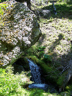 Creek on Tyler peak trail 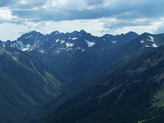 7 labels Royal Creek drainage and The Needles 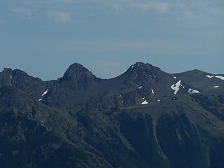 Mount Buckhorn 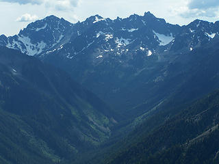 Royal Creek drainage and The Needles 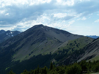 Grey Wolf Ridge 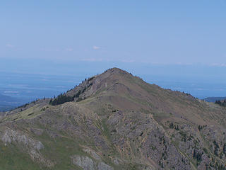 Tyler Peak 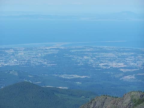 Sequim 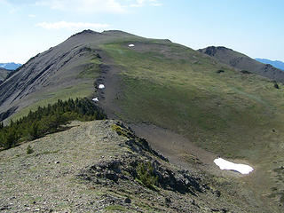 Mount Baldy 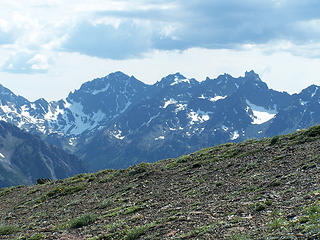 The Needles 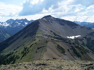 Grey Wolf Ridge 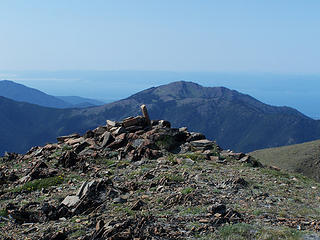 Baldy Summit 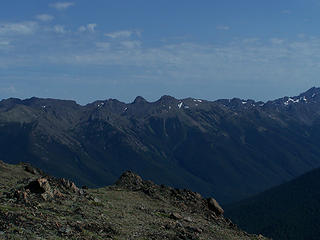 Buckhorn 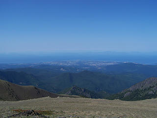 Sequim 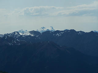 Mount Olympus 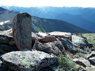 Baldy Summit Chipmunk 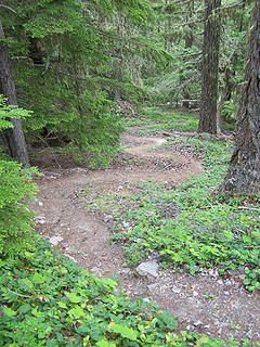 Tight switchbacks on Maynard Burn Trail  Panorama Grey Wolf Mountain 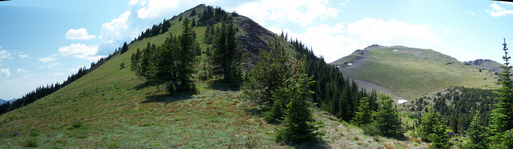 Panorama Point 6537 and Baldy 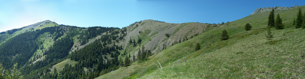 Panorama looking west from below Tyler Peak 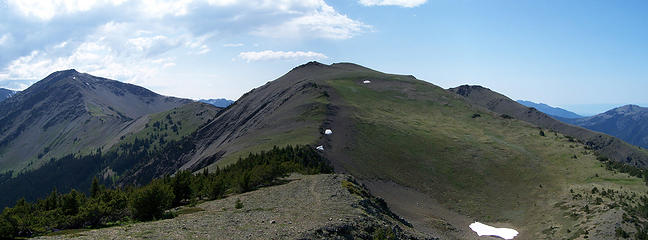 Panorama Grey Wolf and Baldy 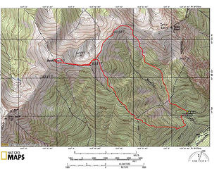 Baldy Loop Map 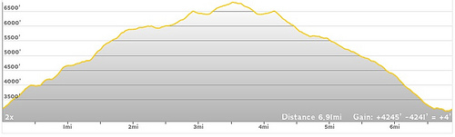 Baldy Loop Elevation Profile
|


