| Previous :: Next Topic |
| Author |
Message |
phil.a.rouse@gmail.com
Member


Joined: 27 Jul 2009
Posts: 2 | TRs | Pics
Location: Seattle |
This was a four day loop trip, starting and finishing at the N Fork Skykomish river trailhead. This trail loop mostly consisted of ridge hiking, with lots of mtn views and meadow walking. We drove out FS road 65 from Hwy 2 near Skykomish to avoid the Index-Galena road washout. The loop started out with a nice forest hike up Quartz creek to Curry gap. The trail was pleasant, if slightly underused and overgrown in a few places. We took the Bald Eagle ridge trail from the Curry gap trail junction, a route that felt seldom used, lots of soft tread and wild strawberries growing in the trail, and a good place to avoid company - until we found a half-eaten pb&j sandwich in the middle of the trail. The Bald Eagle ridge trail quickly ascended to meadows and mtn views to the west (Monte Cristo Peak) before turning the corner for views across the Skykomish river to the south. Camping spots were sparse from Curry gap until near Long John mtn.
Our first camp near a stream and on the edge of a meadow was buggy (mosquitos) this time of year. Day 2 we continued along the ridge trail over June mtn to views of Glacier Peak, then around the ridge to Dishpan gap. There were a few small snowfields to cross, nothing significant and all melting very quickly. There were no major snowfields to cross on the entire loop trail this time of year. The wildflowers were out in all the meadows, but not yet at their peak. We had plenty of snow fed streams as a source of water for the entire trip, until W Cady ridge on the last day.
We finally encountered some other hiking parties when we reached the PCT at Dishpan gap, and camped near Wards pass with fantastic views in nearly every direction. Day 3 we headed south on the PCT through more meadows and continuous views around Skykomish peak and then down into the forest again at Cady pass. We did not see any other hiking parties after Cady pass until our way down W Cady ridge. We stopped for a quick splash in Pass creek on a hot day, then ascended out of the forest again to the meadows at Benchmark mtn. We camped the 3rd night on top of benchmark mtn, watched sunset and sunrise on Glacier Peak, and woke to a strong E wind blowing gritty dirt and dust off the ridge and into our tents. We descended to a nice campsite in the trees for breakfast, then hiked out W Cady ridge back to the trailhead.
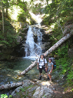 4 waterfall 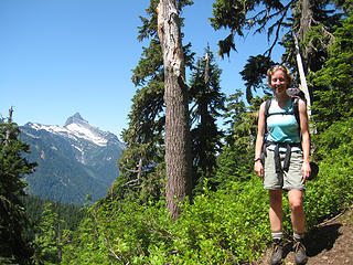 8 bald eagle ridge 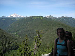 10 bald eagle ridge 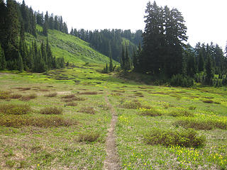 21 June mtn 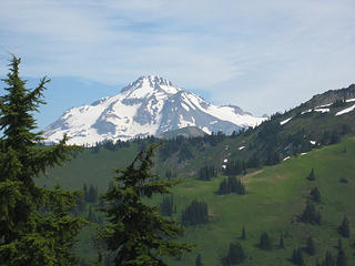 29 June mtn 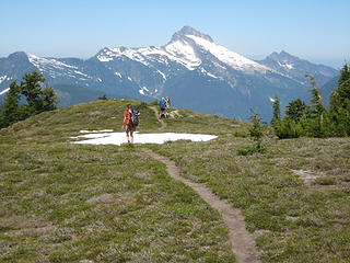 35 June mtn 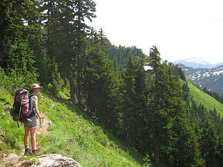 42 June mtn 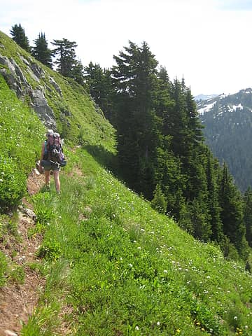 44 June mtn 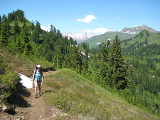 54 Dishpan gap 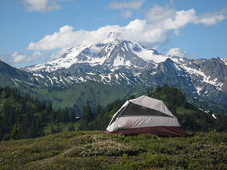 61 Wards pass camp 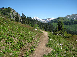 71 Skykomish peak 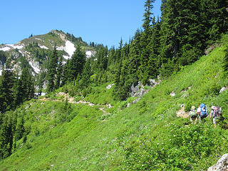 73 Skykomish peak 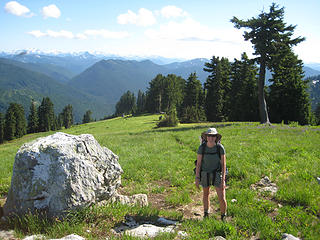 96 Benchmark mtn 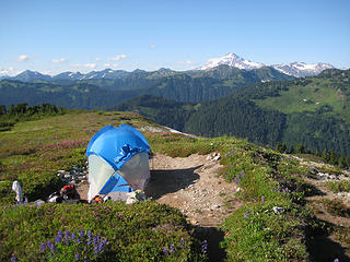 101 Benchmark mtn
|
| Back to top |
  
|
|
dRoberts
Member

Joined: 23 Apr 2008
Posts: 176 | TRs | Pics
Location: Ephrata |
|
dRoberts
Member
|
 Tue Jul 28, 2009 1:02 am |
|
|
For since the creation of the world God's invisible qualities-his eternal power and divine nature-have been clearly seen, being understood from what has been made, so that men are without excuse. Rom. 1:20
|
| Back to top |
|
|
Conrad
Meadow bagger

Joined: 25 Aug 2006
Posts: 2298 | TRs | Pics
Location: Moscow, ID |
|
Conrad
Meadow bagger
|
Tue Jul 28, 2009 7:44 am |
|
|
I've done most of your route in dayhike pieces, but I like the great loop trip you put together. Nice pix.
|
| Back to top |
|
|
jeremybe
Ol' One-shirt

Joined: 17 Jul 2008
Posts: 275 | TRs | Pics
Location: Seattle |
|
jeremybe
Ol' One-shirt
|
Tue Jul 28, 2009 7:45 am |
|
|
Looks like a great time.  We camped near the W Cady trailhead before we went up to Blanca Lake on Sunday. Definitely would like to go back and do something like ya'll. Great views!
|
| Back to top |
|
|
Opus
Wannabe

Joined: 04 Mar 2006
Posts: 3700 | TRs | Pics
Location: The big rock candy mountain |
|
Opus
Wannabe
|
Tue Jul 28, 2009 7:59 am |
|
|
Nice! That was my planned trip over last weekend before work and weather got in the way. How was water access on W. Cady ridge and Benchmark?
|
| Back to top |
|
|
Trevor
Member
Joined: 31 Jan 2004
Posts: 1562 | TRs | Pics
Location: Edmonds, WA |
|
Trevor
Member
|
Tue Jul 28, 2009 8:07 am |
|
|
Thanks for sharing. I really admire this area.
|
| Back to top |
|
|
phil.a.rouse@gmail.com
Member
Joined: 27 Jul 2009
Posts: 2 | TRs | Pics
Location: Seattle |
There were small snowmelt streams still running at the trail junction from W Cady ridge to Benchmark mountain, and a few little streams near the top of W Cady ridge, then nothing until we were in the lower part of the valley. There were still a few snow patches on top of Benchmark mtn that had trickles of water while the sun was out during the day.
|
| Back to top |
|
|
|
|
You cannot post new topics in this forum
You cannot reply to topics in this forum
You cannot edit your posts in this forum
You cannot delete your posts in this forum
You cannot vote in polls in this forum
|
Disclosure: As an Amazon Associate NWHikers.net earns from qualifying purchases when you use our link(s). |


 Makes me wish I didn't have to drive so far for a west approach. I'll be doing an eastern approach for my loop in the area.
  Thanks for the TR again!