| Previous :: Next Topic |
| Author |
Message |
Schmidt Altitude
Whippet Entourage


Joined: 28 Mar 2007
Posts: 803 | TRs | Pics
Location: The Quah |
- Date: Sunday, July 19, 2009
- Crew: yukon222, Schmidt Altitude team (Babe, Row, Kief, Dude)
- Summits (in order that we climbed them): Hard Cheese 5766', Hard Knox 5841' (#45 Home Court 100), Thorp Mountain 5854' (#44 HC100), French Cabin Mountain 5724' (#48 HC100), French Tongue 5400+', Kachess Ridge 5525 (#61 HC100)
- Location: Kachess Ridge area of the Alpine Lake Wilderness
- References: Randy's 2002 Hard Knox-Kachess Ridge-French Tongue trip report, Type E's Hard Knox trip report
We'd been kicking around the idea of visiting the peaks in the French Cabin Creek area for some time. After Dude cut his finger at work Saturday night, thus making him unable to hold an ice axe, we scrapped what we had planned on doing Sunday and switched to this trip.
We drove up the Kachess Dam Road and series of Forest Service roads to park on Kachess Ridge in the low spot between Hard Knox and the ridge summit. We almost felt guilty about starting out at 4900' - almost. We made our way over to the trail (the USGS map has it wrong, it comes much closer to the road than indicated) and headed north. Before going by Hard Knox the trail passes by Point 5766. Since we were so close, we wandered over to the highest point and took a pictures on the "summit". Since this point lies between Hard Knox and Kachess Ridge, Dude dubbed it "Hard Cheese" (sounded a little better than Hard Chess). Onward we went, first down 200' and then up to the summit of Hard Knox (a.k.a. South Thorp). Various maps have the west summit being higher but it didn't look any higher to us and looking back from various angles throughout the day seemed to indicate that the east summit is indeed higher (sorry Type E).
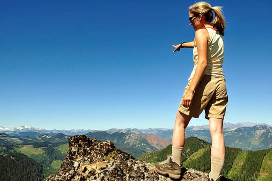
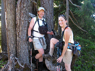 Tagging Hard Cheese 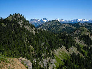 Hard Knox and Thorp Mountain 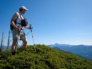 Yukon goes to the school of Hard Knox 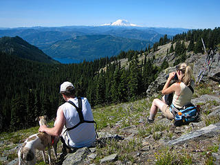 Hanging at the summit 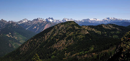 17 labels Hibox to Daniel behind Thorp Mountain 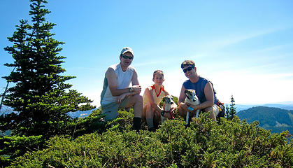 Hard Knox summit pic 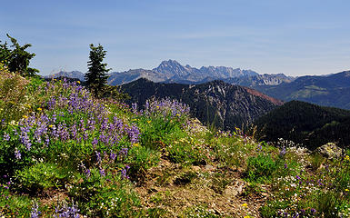 Alpine blooms and Mount Stuart 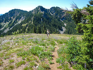 Babe and blooms 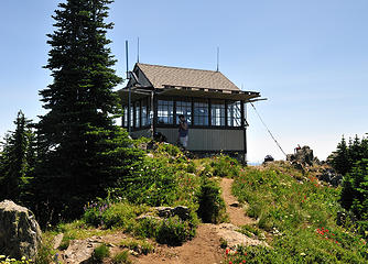 Dude at the Lookout 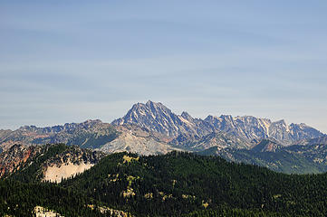 Mount Stuart from Thorp Mountain 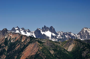 Lemah, Chimney Rock, and Summit Chief 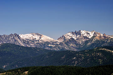 Bears Breast, Hinman, Daniel 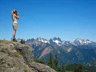 Babe gets her shot 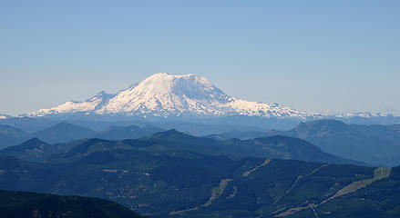 Mount Rainier 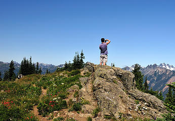 Panoramination 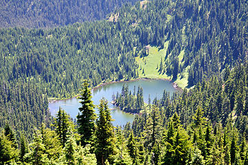 Thorp Lake 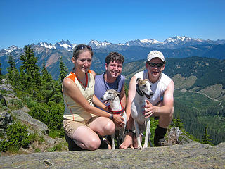 Thorp Mountain group shot 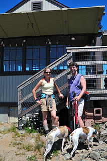 Jeremy and Tisha at the Thorp Mountain Lookout, 07/19/09 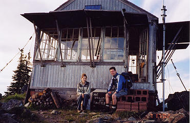 Jeremy and Tisha at the Thorp Mountain Lookout, 07/17/02 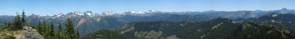 36 labels Pano looking northerly from Thorp Mountain 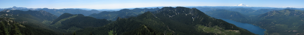 Stuart to Rainier from Thorp Mountain 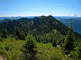 5 labels Kachess Ridge, Mount Rainier and our parking spot 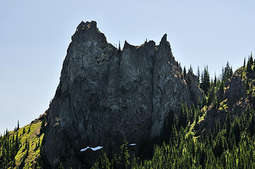 The French Tongue 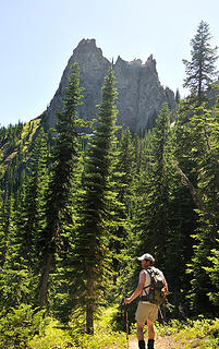 Yukon leads the way to French Pass 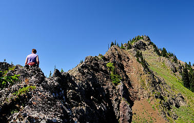 Dude on the way up to French Cabin Mountain 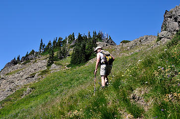 Yukon almost to the summit 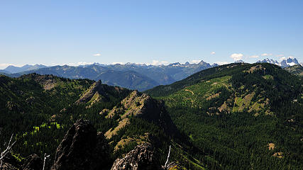 View W-NW from French Cabin Mountain 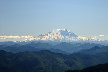 Mount Rainier from French Cabin Mountain 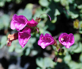 Vicious flowers ready to bite! 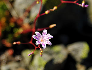 Columbia lewisia  Smiling on the summit 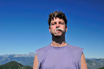 Mountain Goat hair mustache 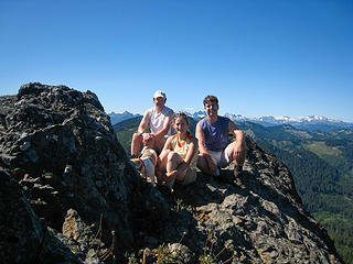 French Cabin Mountain gathering 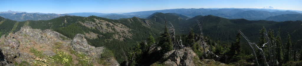 7 labels View of Stuart to Rainier from French Cabin Mountain 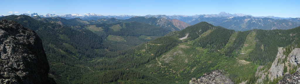 View North to East from French Cabin Mountain 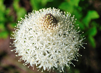 Bear Grass 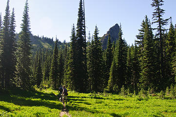 Now it's time for French Tongue and Kachess Ridge  Rowena takes a dirt bath as we rest at the pass 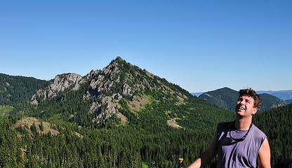 Yikes, the French Tongue looks intimidating from here 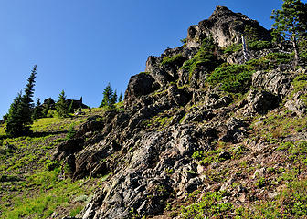 Scrambling around the French Tongue 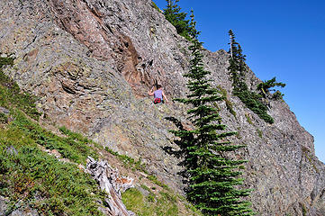 Dude walks along the ledge looking for the route up  Where's dad going? 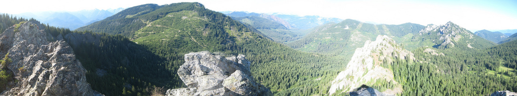 French Tongue summit pano 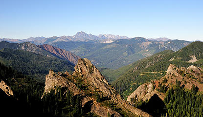 French Tongue in front, Mount Stuart behind from Kachess Ridge 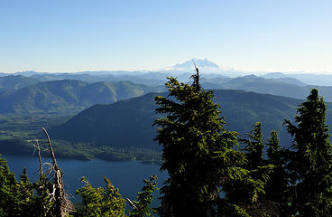 Kachess Lake and Mount Rainier from Kachess Ridge 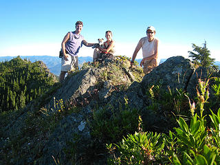 S-Team on Kachess Ridge 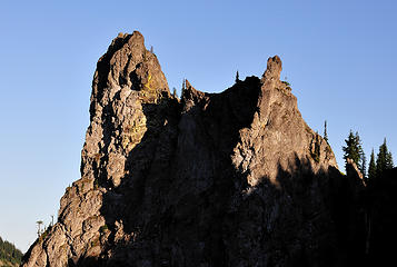 Another angle of the French Tongue from our way back to the truck 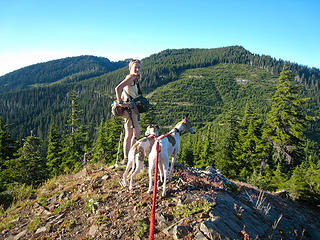 Babe leads the way back to the truck  A toast to a great day of peakbagging
"Forest 101: These big wood stick things are called trees. The big rocks are called mountains, and the little rocks are their babies." Elliott from Open Season
"Forest 101: These big wood stick things are called trees. The big rocks are called mountains, and the little rocks are their babies." Elliott from Open Season
|
| Back to top |
  
|
|
yukon222
Member

Joined: 12 Mar 2007
Posts: 1893 | TRs | Pics
|
|
yukon222
Member
|
 Wed Aug 05, 2009 4:41 pm |
|
|
More pics!!! 
 DSD_2732 Alti-Babe picking out peaks from French Cabin West Peak summit 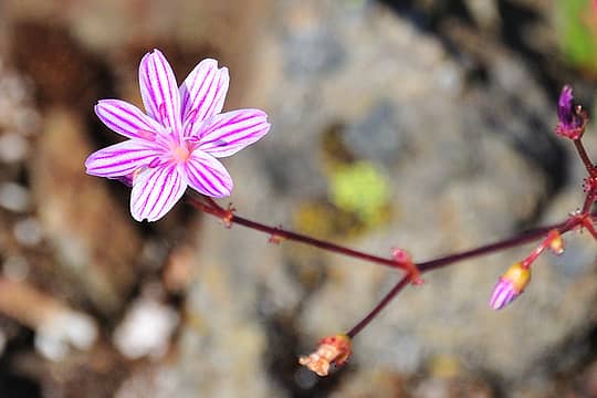 DSD_2751 Columbia Lewisia - tiny 1/2" flower 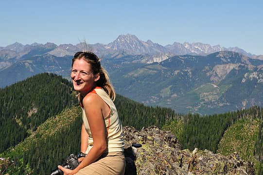 DSD_2766 Alti-Babe enjoying French Cabin West Peak summit  DSD_2778 "Why'd you wake me up?" 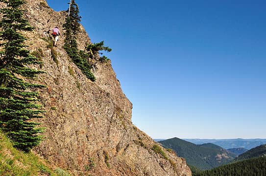 DSD_2783 Alti-Dude climbing French Tongue 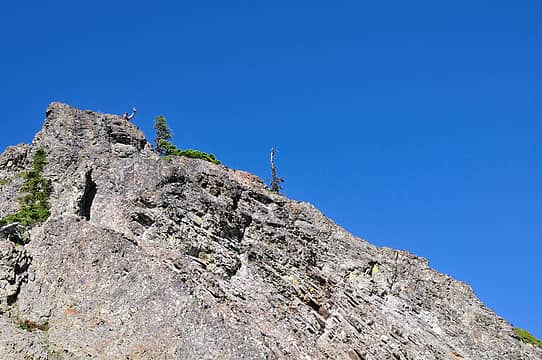 DSD_2786 Alti-Dude topping out on French Tongue 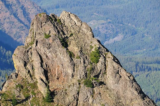 8 labels DSD_2811 French Tongue's Class 3+
|
| Back to top |
|
|
gone
Member

Joined: 08 Feb 2008
Posts: 1051 | TRs | Pics
|
|
gone
Member
|
Wed Aug 05, 2009 5:38 pm |
|
|
Cool trip, lot of great info and pics!   I've been eyeballing the French Cabin Basin for a while, thinking to perhaps come up from the creek, wondering whether it might make for a nice fall hike.
Thanks for sharing all the details!
I've been eyeballing the French Cabin Basin for a while, thinking to perhaps come up from the creek, wondering whether it might make for a nice fall hike.
Thanks for sharing all the details!
|
| Back to top |
|
|
Type E
Member

Joined: 19 Aug 2006
Posts: 1381 | TRs | Pics
|
|
Type E
Member
|
Wed Aug 05, 2009 5:41 pm |
|
|
Great, now I have to go back and do Hard Knox again. That area is so much nicer than one would think just looking at a map. Maybe I will have to go back and mount the Little Pecker since I will be so close.....maybe mounting isn't the right word.
E
|
| Back to top |
|
|
Roughneck
Member

Joined: 06 Jan 2008
Posts: 50 | TRs | Pics
|
Nice to meet you and thanks for the trail info. Your photos are great! I'll certainly have to go back and spend some more time in the area.
|
| Back to top |
|
|
Go Jo
of the lykkens

Joined: 08 Jun 2003
Posts: 2248 | TRs | Pics
Location: Around The Bend |
|
Go Jo
of the lykkens
|
Wed Aug 05, 2009 8:36 pm |
|
|
| Schmidt Altitude wrote: | Jeremy and Tisha at the Thorp Mountain Lookout, 07/17/02 |
I love the retro rewind!
Great pictures from a plethora of peaks, well done all. ~Jo
|
| Back to top |
|
|
Schmidt Altitude
Whippet Entourage
Joined: 28 Mar 2007
Posts: 803 | TRs | Pics
Location: The Quah |
| yukon222 wrote: | 8 labels DSD_2811 French Tongue's Class 3+ |
Gotta love those zoom lenses. I labeled the route that I took up. It was easier to summit than it looks from afar but there was still some exposure. -Dude
ewb: We don't know about fall colors but being a tad cooler in temperature would have been nice.
Type E: mounting  Roughneck: Thanks
"Forest 101: These big wood stick things are called trees. The big rocks are called mountains, and the little rocks are their babies." Elliott from Open Season
"Forest 101: These big wood stick things are called trees. The big rocks are called mountains, and the little rocks are their babies." Elliott from Open Season
|
| Back to top |
|
|
DIYSteve
seeking hygge

Joined: 06 Mar 2007
Posts: 12655 | TRs | Pics
Location: here now |
|
DIYSteve
seeking hygge
|
Thu Aug 06, 2009 3:23 pm |
|
|
Cool mini-high route. I scrambled the knob you call "French Tongue" back in the early 90's with a guy who lives near there, but I never expected to see mention of it in a TR. 
|
| Back to top |
|
|
Magellan
Brutally Handsome

Joined: 26 Jul 2006
Posts: 13116 | TRs | Pics
Location: Inexorable descent |
|
Magellan
Brutally Handsome
|
Thu Aug 06, 2009 3:32 pm |
|
|
Just about exactly seven years since the first photo. I like the concept. I think time has been kind to you two.
|
| Back to top |
|
|
she hikes in beauty
Member

Joined: 12 Jul 2009
Posts: 166 | TRs | Pics
Location: North Bend, WA |
Nice pics. Heading up that way this weekend....Been out that way before but will try a different route this time.
Hope the weather is nice!
|
| Back to top |
|
|
EastKing
Surfing and Hiking

Joined: 28 Mar 2007
Posts: 2082 | TRs | Pics
Location: 77 miles from Seattle! |
|
EastKing
Surfing and Hiking
|
Thu Aug 06, 2009 11:55 pm |
|
|
Nice TR! It is good to see you'll still knocking them down!!
YouTube | SummitPost
Saw the depths of despair. Now I am salvaging what time I have left on Earth.
YouTube | SummitPost
Saw the depths of despair. Now I am salvaging what time I have left on Earth.
|
| Back to top |
|
|
puzzlr
Mid Fork Rocks

Joined: 13 Feb 2007
Posts: 7220 | TRs | Pics
Location: Stuck in the middle |
|
puzzlr
Mid Fork Rocks
|
Fri Aug 07, 2009 1:07 am |
|
|
Nice trip - an underrated area. Can you add some hints about how you drive up to where you started?
Did you consider going out to Pt 5418 east of Hard Knox? When I was near Thorp this spring it looked spectacular.
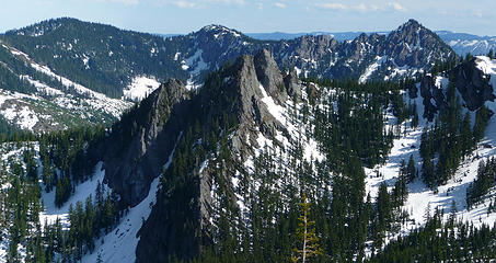 4 labels I was surprised to see such rugged terrain in this part of the cascades. The rock in the middle is marked Pt 5418 on the topo maps, but it deserves a name. French Cabin Mountain is the long ridge in the back.
|
| Back to top |
|
|
yukon222
Member
Joined: 12 Mar 2007
Posts: 1893 | TRs | Pics
|
|
yukon222
Member
|
Fri Aug 07, 2009 6:36 am |
|
|
Sure, Puzzlr.
Exit 70 at Easton, over I-90, left on road so you are heading back to the north. Go past 3, maybe 4 roads/driveways on your right until you see Forest Service Road 4818 on your right (it is also the road that gets you back towards Thomas Mtn, Silver Creek, etc). Stay on this 4818 for several miles as it wraps around the east side of Lake Kachess. You'll go past a bunch of cabins, then look for FS Road 4824 off to your right to get up the ridge.
Up until that point, the road is in decent shape. 4824 is narrower and a few more potholes. A car could make it with careful driving. Halfway up the ridge around 3300', turn right onto FS 115. Follow that the rest of the way to the ridge. On the first Topo map Alti-Dude posted, my truck was parked at Waypoint 006. He also has that map labelled. I've attached another map with the road numbers.
The ridgeline hiking up there was excellent. Steady breeze, mix of trees/sunshine and consistent good views. Dude mentioned the rocky point you are talking about. In fact, he said it was "Puzzlr's Point" as he thought you had climbed it before. Didn't really consider running over to tag it as we had a full day planned already. Think the day was 13 miles and 6500' vertical.
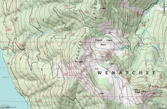 french cabin roads
|
| Back to top |
|
|
|
|
You cannot post new topics in this forum
You cannot reply to topics in this forum
You cannot edit your posts in this forum
You cannot delete your posts in this forum
You cannot vote in polls in this forum
|
Disclosure: As an Amazon Associate NWHikers.net earns from qualifying purchases when you use our link(s). |


