| Previous :: Next Topic |
| Author |
Message |
Middle E
no more moustache


Joined: 10 Feb 2008
Posts: 432 | TRs | Pics
Location: Seattle, WA |
|
Middle E
no more moustache
|
 Sun May 06, 2012 9:33 pm |
|
|
Well, it was not exactly a huge expedition. After the last potential adventurer withdrew late the night before it was down to Matt and me, and Gus (sans the Driver). We headed out Hwy 2 to have a go at Johnson Ridge, Sunrise and Scorpion.
The condition of the Becker Rd was far better than one would imagine from the posted road conditions. There was not a speck of snow to be seen on the road for the first 7 miles, and in fact we easily drove spur road 6520 to the switchback at 2000' (about 2 miles from the Beckler Rd) where we parked and headed up. One could drive much further, but that would have provided no advantage. We headed up a bit after 9am.
The first 600-700' from the road was steep in places. The best grade is right on the nose of the ridge, but it was difficult to ascertain where that was. Brush and downfall were present but not unbearable. At about 2600' we encountered a cliff band, but skirted to the right until we found a feasible route up and over. From there the grade was much improved.
At 3000' we found the road and followed it just below the ridge crest. By now we were on snow and were using snowshoes, although the snow was still fairly firm in the morning coolness.
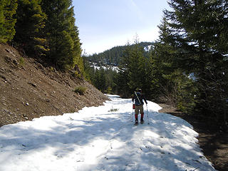 On the road to Sunrise 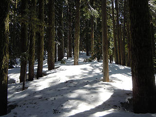 Ridge walk 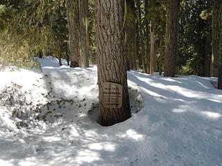 Entering the Wilderness 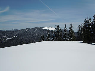 Scorpion from Sunrise 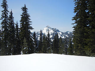 Mt. Fernow from Sunrise 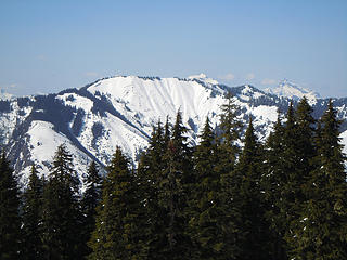 Evergreen Mtn. from Sunrise 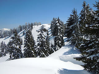 Nearing Scorpion summit 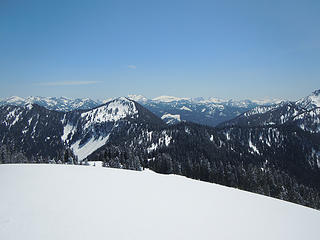 Captain's Pt. from Scorpion 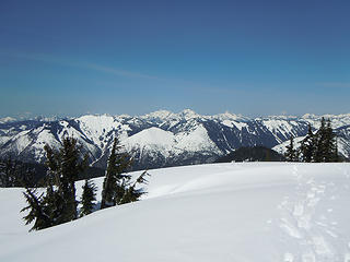 Looking north from Scorpion 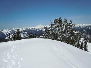 Glacier Pk. from Scorpion 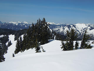 Ridge from Scorpion (Evergreen Mtn. to right) 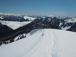 Looking toward Mt. Stuart from Scorpion 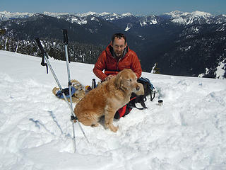 Matt and Gus
pithy yet insightful signature
pithy yet insightful signature
|
| Back to top |
  
|
|
Middle E
no more moustache
Joined: 10 Feb 2008
Posts: 432 | TRs | Pics
Location: Seattle, WA |
|
Middle E
no more moustache
|
Thu May 17, 2012 8:35 am |
|
|
Just adding the GPS track that Matt sent along. Red is the up route, yellow the down.
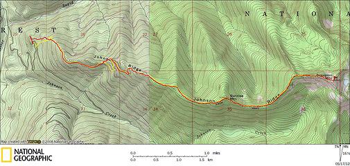 Sunrise/Scorpion GPS Track
pithy yet insightful signature
pithy yet insightful signature
|
| Back to top |
|
|
Joey
verrry senior member

Joined: 05 Jun 2005
Posts: 2798 | TRs | Pics
Location: Redmond |
|
Joey
verrry senior member
|
Thu May 17, 2012 7:24 pm |
|
|
Looks like it is not quite flower time.
|
| Back to top |
|
|
|
|
You cannot post new topics in this forum
You cannot reply to topics in this forum
You cannot edit your posts in this forum
You cannot delete your posts in this forum
You cannot vote in polls in this forum
|
Disclosure: As an Amazon Associate NWHikers.net earns from qualifying purchases when you use our link(s). |


