| Previous :: Next Topic |
| Author |
Message |
Randy
Cube Rat


Joined: 18 Dec 2001
Posts: 2910 | TRs | Pics
Location: Near the Siamangs |
|
Randy
Cube Rat
|
 Sun Sep 13, 2009 1:01 pm |
|
|
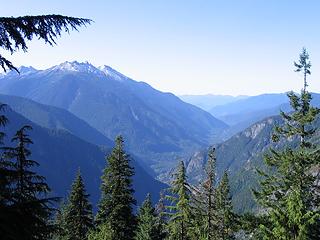
Davis is one of those road-visible summits along HWY 20 that begs to be climbed much like Graybeard or Liberty Bell. Justus and I finally connected on a perfect (albeit scorching hot) September day to make it happen.
We parked at the Gorge Creek overlook (1100) and started up the brief tourist trail around 0830. The first 3000 of gain go up steep forest scattered with large slab cliffs that require strategic avoidance. We followed a mix of game trails and what looked like old people trails to the south ridge at about 4500 little to no brush along the way.
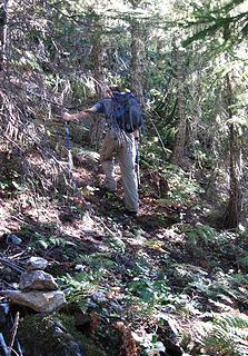 Passing a Stray Cairn on the Ascent 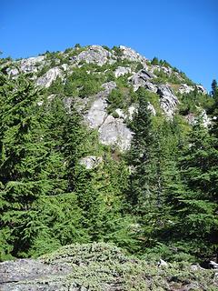 South Ridge, First Views 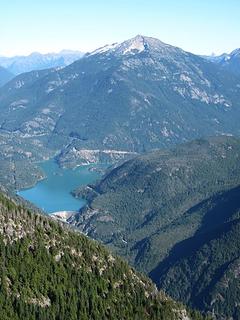 Ruby, Dam 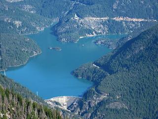 Dam, Lake, HWY 20 Overlook 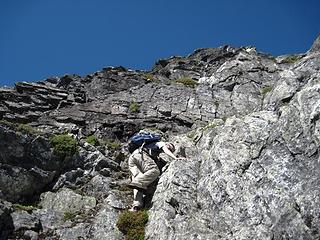 Starting up the Rock Step 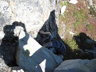 Group Shot 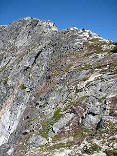 Final Ridge Section 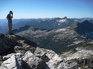 Justus and Triumph 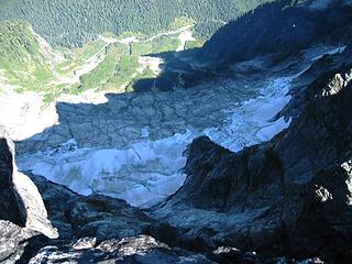 Davis' Dramatic NE Face 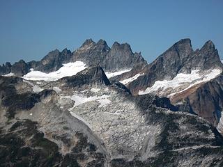 Pickets Zoom 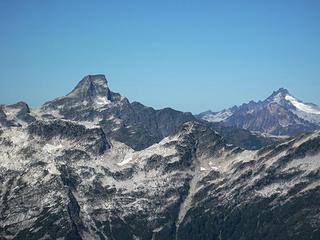 Luna, Redoubt 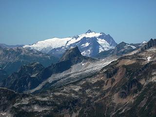 Shuksan 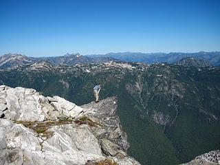 Justus Takes in a 3000' Drop, Hozomeen Behind 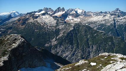 Pickets 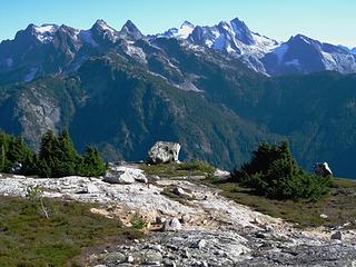 Snowfield, etc.  NWHikers Rappel Booty
|
| Back to top |
  
|
|
Justus S.
Member

Joined: 17 Nov 2004
Posts: 1298 | TRs | Pics
Location: WA |
I'd been wanting to get up Davis on a nice day for a while. When I got the ping from Randy I was sold, even if it did require over 6k gain in a few miles, wow.
Arriving at the Gorge Creek parking area, the route up Davis looked steep. We would give it a go though and hope for the best. Travel for the most part was pretty good and finding the intermittent game/climbers trail up high made it much better. The trail definitely aided in route finding to the alpine.
 Some views on the way up 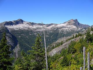 Things opend up and we had some nice view, Ross and Roost 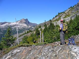 Randy checking out the views 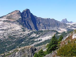 Roost 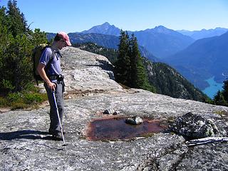 Randy hoping this isn't our only water source 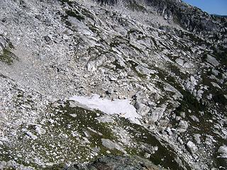 Water!!!  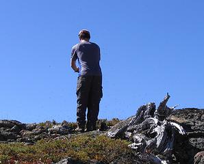 Randy surrounded by bugs 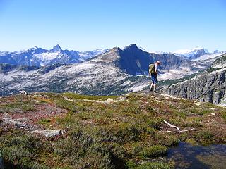 Triumph to the Chopping Block 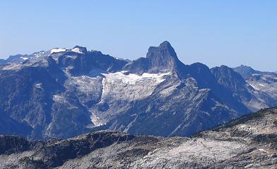 Triumph 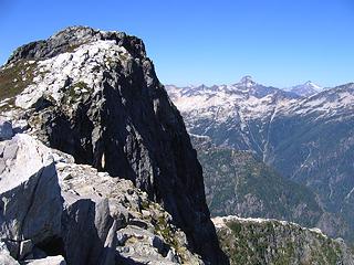 Nearing the summit 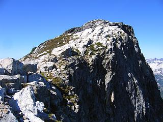 Randy checking out the views down 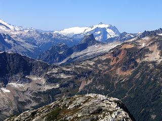 Shuksan and the Chopping Block 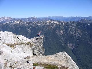 Randy checking out what is below 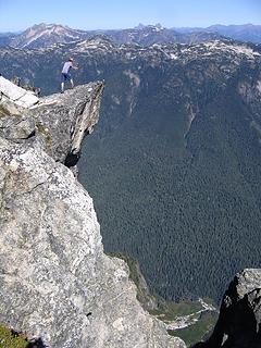 Whoa, that's a long way down 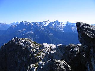 Snowfield group 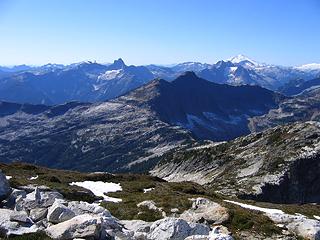 Baker 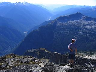 Looking down to the Hwy below 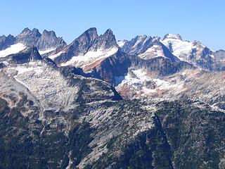 Pickets 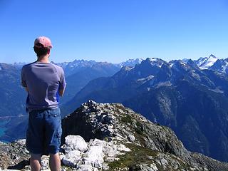 View east 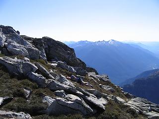 Nap time 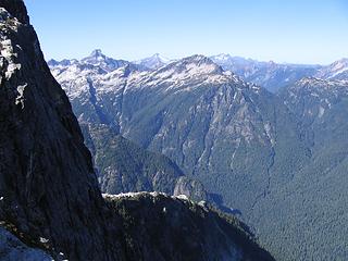 Parting face shot 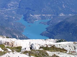 Boat on Diablo Lake 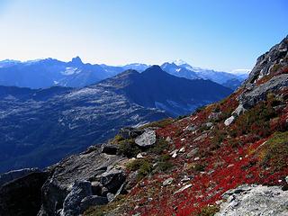 Fall is almost here 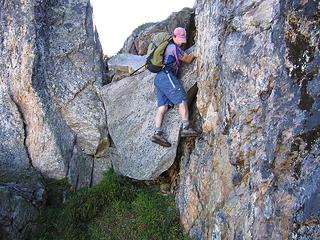 Randy having a little fun getting off this boulder 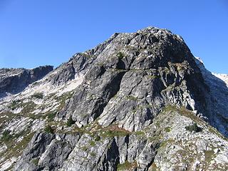 Looking back at the ridge route up Davis 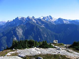 A nice parting view 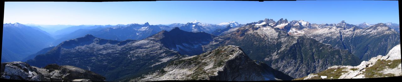 DavisPano
|
| Back to top |
|
|
Tom
Admin
Joined: 15 Dec 2001
Posts: 17853 | TRs | Pics
|
|
Tom
Admin
|
Sun Sep 13, 2009 1:20 pm |
|
|
Looks like a lot of fun... though my knees would protest the 6500' drop.  I've always been impressed by that NE face of Davis! I've always been impressed by that NE face of Davis! 
|
| Back to top |
|
|
Justus S.
Member
Joined: 17 Nov 2004
Posts: 1298 | TRs | Pics
Location: WA |
pics posted 
|
| Back to top |
|
|
Randy
Cube Rat
Joined: 18 Dec 2001
Posts: 2910 | TRs | Pics
Location: Near the Siamangs |
|
Randy
Cube Rat
|
Sun Sep 13, 2009 5:19 pm |
|
|
Great shots Justus! Thanks again for the fun day.
|
| Back to top |
|
|
aywolfpac
Member

Joined: 27 Jan 2008
Posts: 1286 | TRs | Pics
Location: Burlington, WA |
Those pictures looking down from that rock are pretty hairy. 
|
| Back to top |
|
|
forest gnome
Forest nut...
Joined: 24 Apr 2003
Posts: 3520 | TRs | Pics
Location: north cascades!! |
so what was below that pointy outcroping??
possible base jumping potential....where can u land??
|
| Back to top |
|
|
Justus S.
Member
Joined: 17 Nov 2004
Posts: 1298 | TRs | Pics
Location: WA |
Gnome, air!  Check out Randy's Ne Face shot. Don't think it is vertical enough to base jump. Check out Randy's Ne Face shot. Don't think it is vertical enough to base jump.
|
| Back to top |
|
|
Magellan
Brutally Handsome

Joined: 26 Jul 2006
Posts: 13116 | TRs | Pics
Location: Inexorable descent |
|
Magellan
Brutally Handsome
|
Sun Sep 13, 2009 8:24 pm |
|
|
No register? Nice quick work you gents made of this peak.  It seems to be getting more popular. Not like Tiger popular, but multiple ascents in one year.
|
| Back to top |
|
|
Randy
Cube Rat
Joined: 18 Dec 2001
Posts: 2910 | TRs | Pics
Location: Near the Siamangs |
|
Randy
Cube Rat
|
Sun Sep 13, 2009 8:55 pm |
|
|
Unfortunately, the register is no longer on the summit. We literally took the summit apart looking for it. It's a shame because the one that is supposed to be up there dates back to 1969 if I remember correctly. Unless someone has taken it to the UW or other worthy destination, another piece of history has been lost.
|
| Back to top |
|
|
Tom_Sjolseth
Born Yesterday

Joined: 30 May 2007
Posts: 2652 | TRs | Pics
Location: Right here. |
What, no aerial photos?
Nice trip, fellas. I definitely need to get in there and do that thing once and for all!
|
| Back to top |
|
|
Layback
Cascades Expatriate

Joined: 16 Mar 2007
Posts: 5712 | TRs | Pics
Location: Back East |
|
Layback
Cascades Expatriate
|
Mon Sep 14, 2009 8:28 pm |
|
|
Does anyone have a shot of Davis from the road? I'm totally unfamiliar with it. It looks like a great outing.
|
| Back to top |
|
|
Justus S.
Member
Joined: 17 Nov 2004
Posts: 1298 | TRs | Pics
Location: WA |
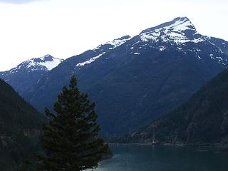 IMG_5517 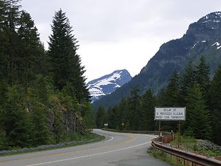 IMG_5497
|
| Back to top |
|
|
Layback
Cascades Expatriate
Joined: 16 Mar 2007
Posts: 5712 | TRs | Pics
Location: Back East |
|
Layback
Cascades Expatriate
|
Mon Sep 14, 2009 9:37 pm |
|
|
Nice. I knew it had to be something I've thought would look fun. Thanks Justus.
|
| Back to top |
|
|
seawallrunner
dilettante

Joined: 27 Apr 2005
Posts: 3307 | TRs | Pics
Location: Lotusland |
So the trailhead to the peak starts from the Gorge Creek parking area near the bridge over Gorge Creek? I can't picture where the trail begins, across the street. Is it somewhere near that bridge, or further down the road?
|
| Back to top |
|
|
|
|


