| Previous :: Next Topic |
| Author |
Message |
iron
Member


Joined: 10 Aug 2008
Posts: 6392 | TRs | Pics
Location: southeast kootenays |
|
iron
Member
|
 Tue Sep 15, 2009 11:07 pm |
|
|
the feel of vegetation brushing against my exposed legs always reminds me how alive i feel in the mountains (exceptions include devils club, stinging nettles, and most of the white river trail). i think i first noticed it upon my first hike, sans crutches, following my bike accident. for the most part, we sit in offices, houses, and other manmade safe places where our bodies are protected. mountains offer us the opportunity, that wonderful opportunity, to shed that protection and be part of nature.
glacier peak and its surrounding mountains have always captured my heart since moving to seattle in 2004 and going on my first backpacking trip in 2005. at that time, my roommate and i attempted to do the indian creek to white river trail loop. it was memorial day weekend with temperatures well into the 80s. everything felt new and unexplored. simply driving up trailhead roads was magical then. we didnt complete the loop that weekend, not because we didnt try, but because we convinced ourselves the map we had was wrong. see, we intended to start on the white river side of the trailhead, while we actually started on the indian creek side. needless to say, arriving at the junction of the pct didnt make sense when we needed to go downhill, but clearly wed be going up. my first in-person hiking lesson. still, seeing the glacier peak wilderness and the sunset that first night was all it took for me to fall in love right then and there.
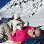
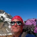
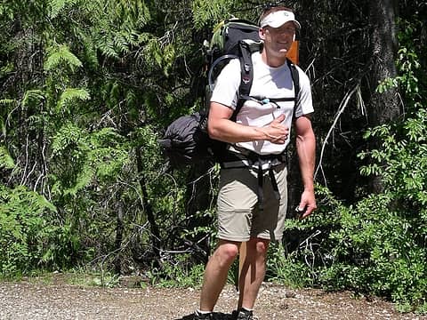 2005 Indian Creek 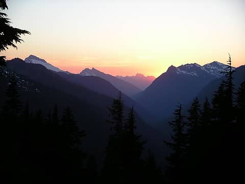 2005 Indian Creek 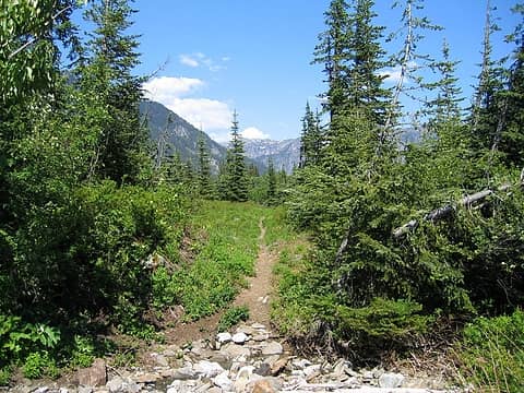 2005 Indian Creek 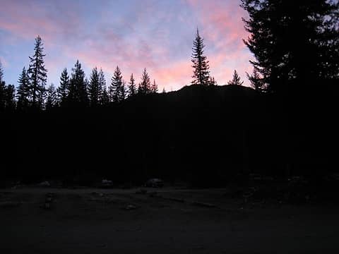 the start of the trip - virtually the only clouds i'd see 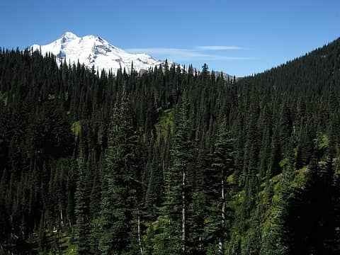 glacier emerges 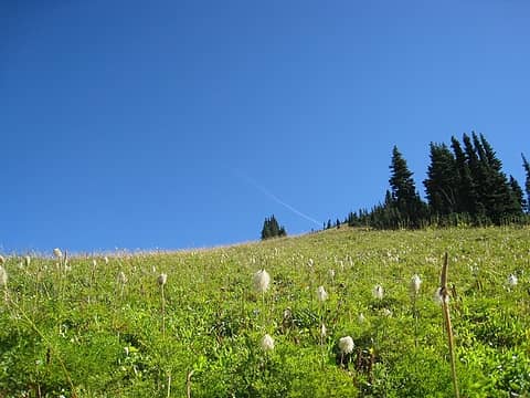 mouse on a stick 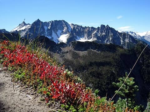 views continue to emerge 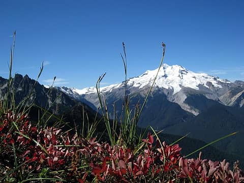 glacier in full display 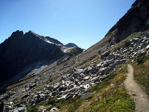 almost at high pass 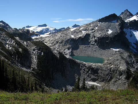 clark and triad lake 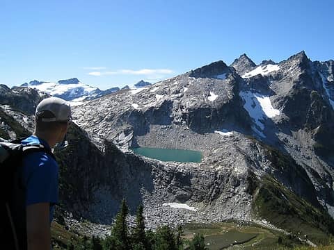 wow 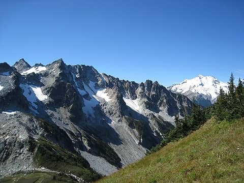 i love that mountain! 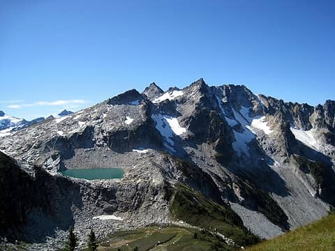 who wants to swim? 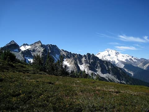 whispy clouds 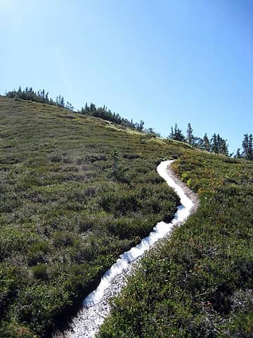 glad i brought the ice axe for this 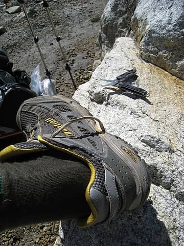 wwjld? 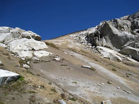 interesting erosion from high above 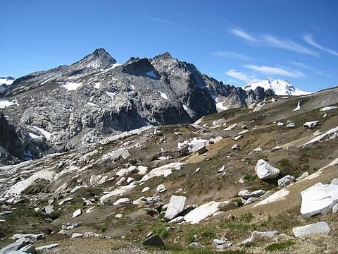 descending high pass warranted many waahoos! 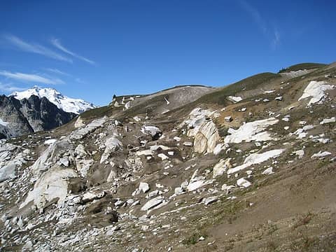 various boulders dispersed about 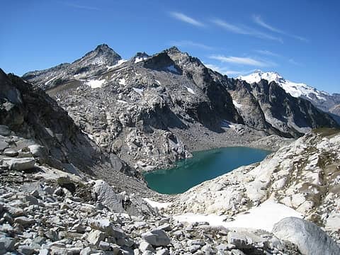 triad lake 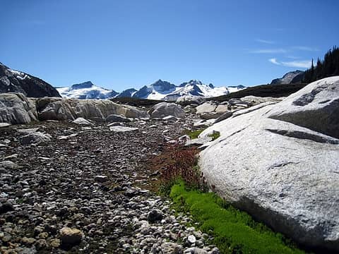 pockets of moss in an otherwise barren plateau 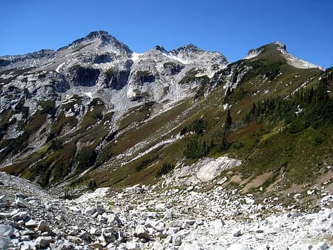 colorful hillsides begin 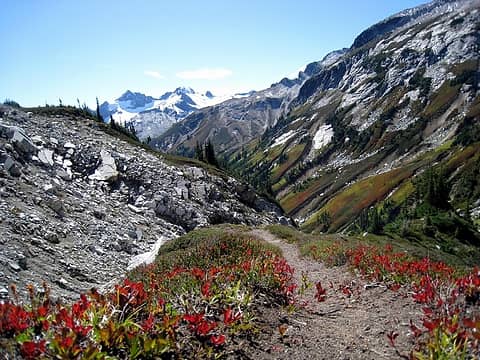 heart rate racing with excitement 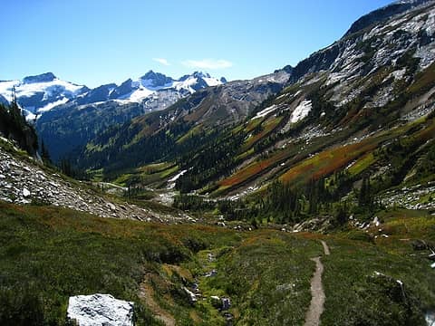 why? why aren't there any bears here? 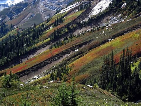 i could spend weeks here 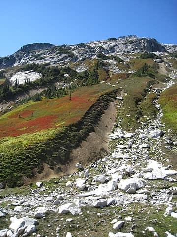 bright white boulders 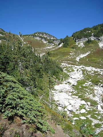 looking back towards high pass 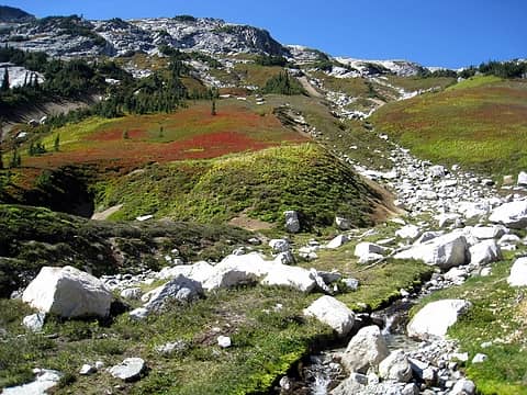 wonderful little creek which later turns into a waterfall 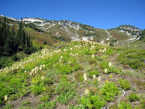 more mouse on a stick 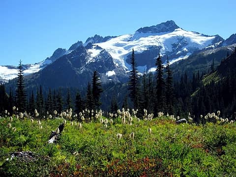 perfect 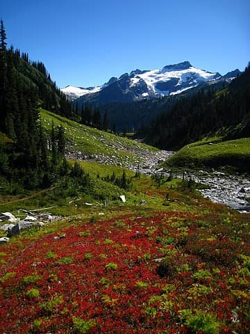 richness defined 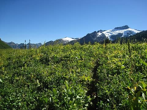 where'd the color go? 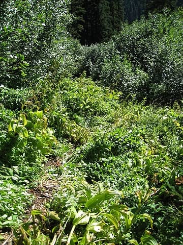 which way to go? 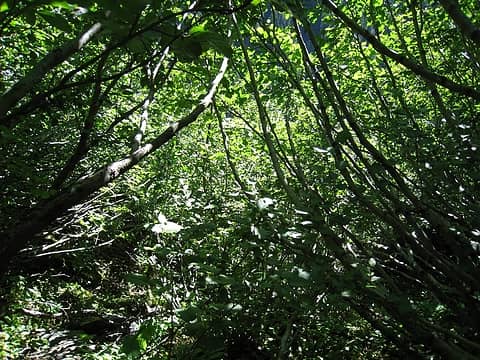 dang, not this way! 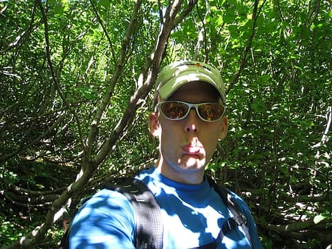 sad face 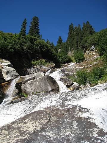 emerging from the slide alder to find the falls 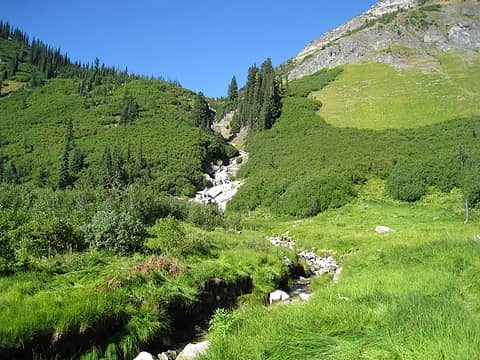 do not go skier's left! 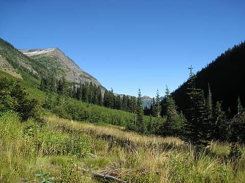 napeequa valley 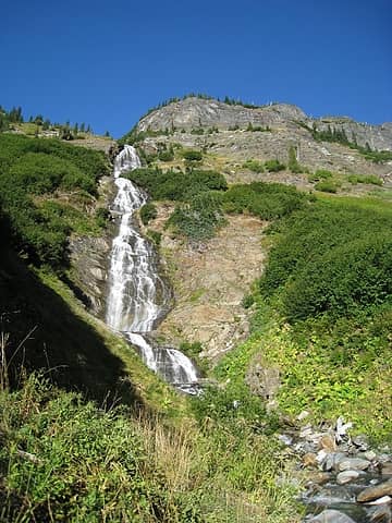 louis creek 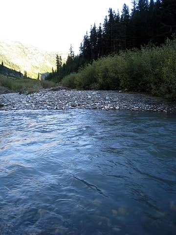 napeequa ford 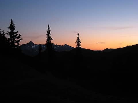 evening light on day 1 from boulder pass 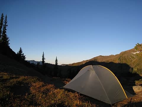 morning light on tent atop boulder pass 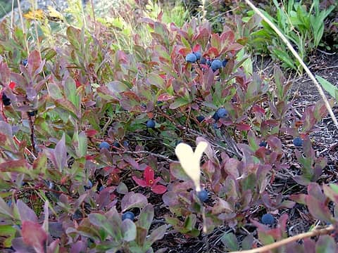 some of the best berries were found descending boulder pass 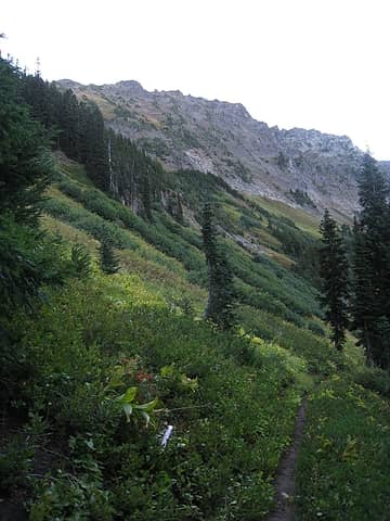 lots of green coming down from boulder pass 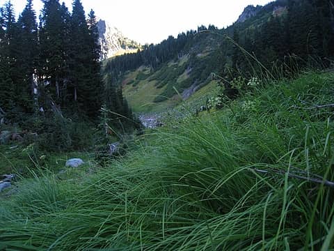 grassy views looking back to boulder pass 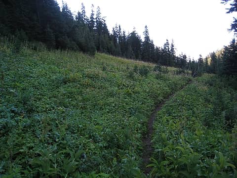 time for some wet legs 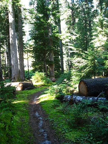 rich greens approaching the white river trail junction 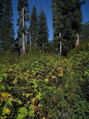 white river "trail" 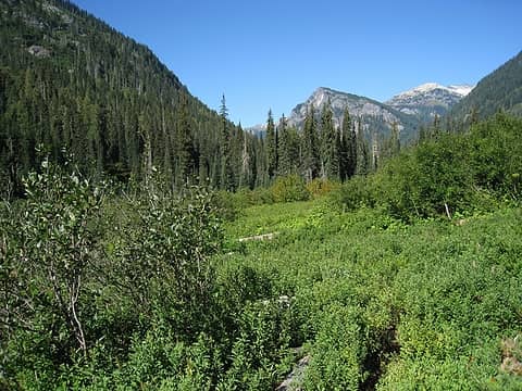 looking up the white river valley, while on trail 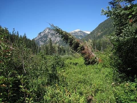 still on trail 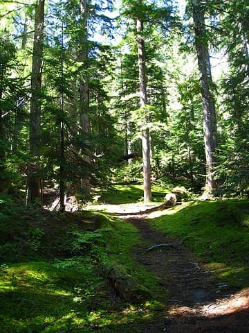 the occassional crossing of forests provided welcome reprieves from the rest of the white river trail 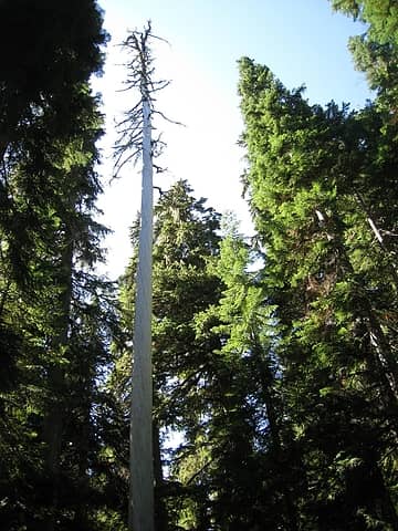 one tall, bare tree 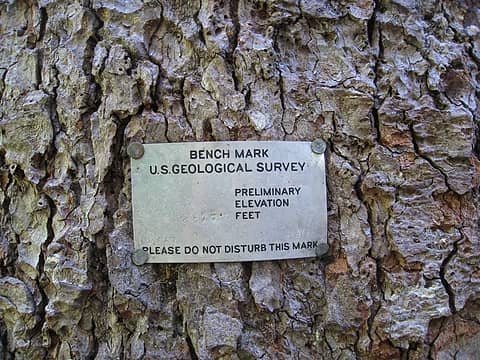 1945 is also the last time the trail saw maintenance 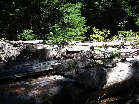 baby trees growing between fallen trees 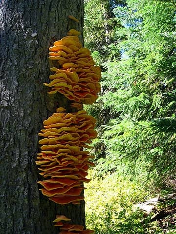 tree fungus 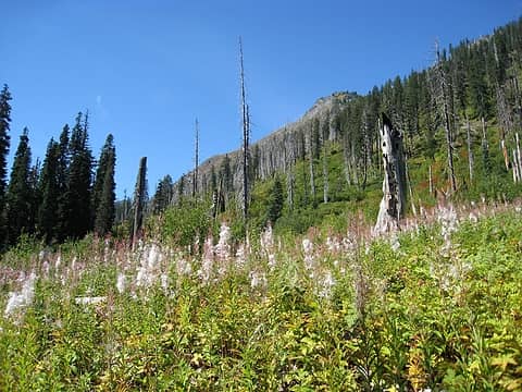 this cottony stuff was fun to inhale 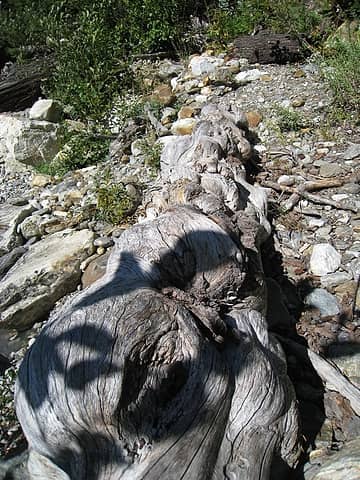 this log's been worked over 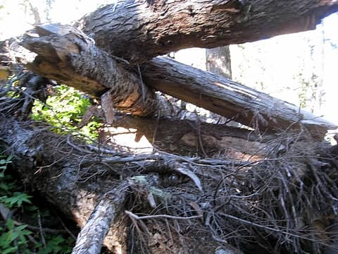 sure, let's climb up this stuff 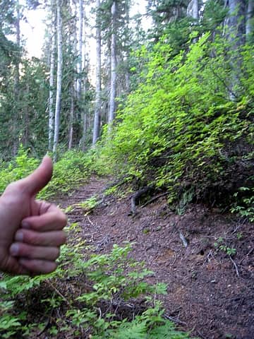 after following the ridge, i finally re-found the trail 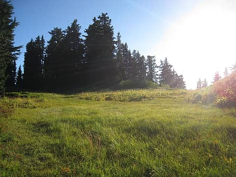 ...things are starting to look familiar 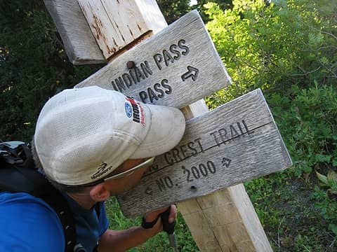 it's not the only thing that's about to get kissed 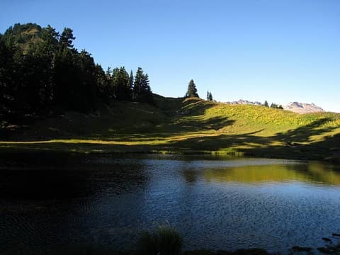 reflection pond, not so reflecting 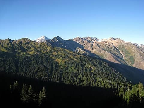 a new view of glacier peak emerges 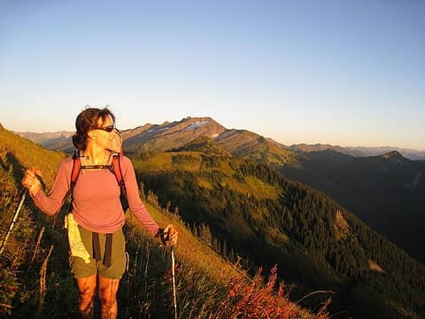 hotpantz arrives!!! 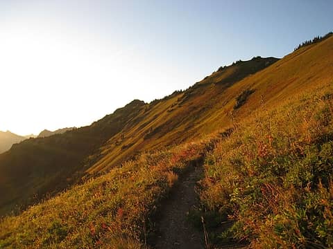 evening light sets in 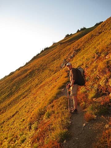 hiking towards red pass with warm evening sun 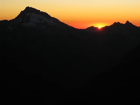 goodnight sun - day 2 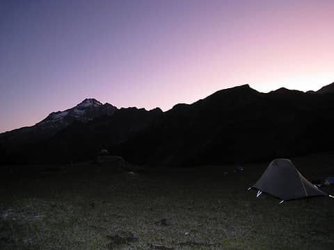 campsite just below red pass 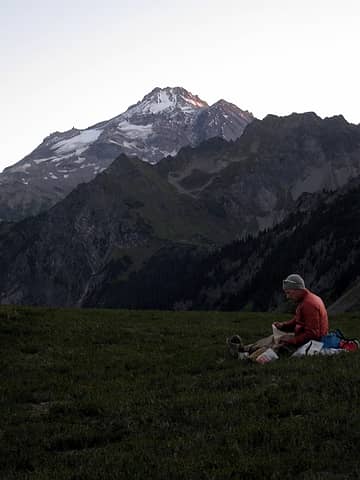 making breakfast (i.e. boiling water) 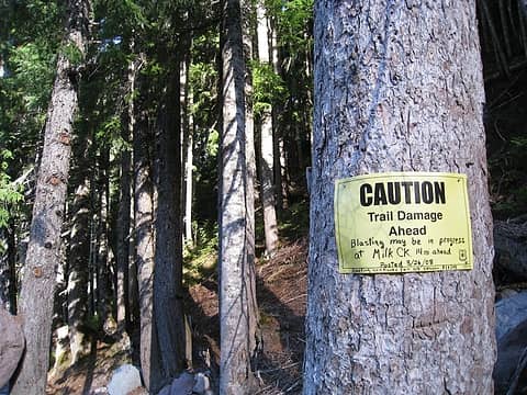 no blasting heard, but there was plenty of trail damage 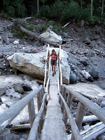 hotpantz crossing the V-bridge over kennedy creek 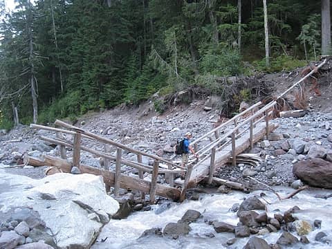 good traction makes a happy iron 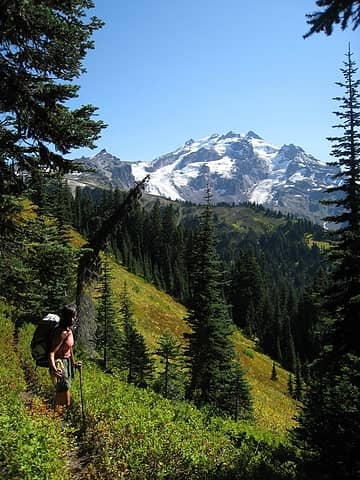 constantly stunned by glacier's beauty 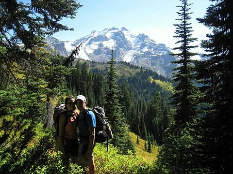 back together again in the mountains! 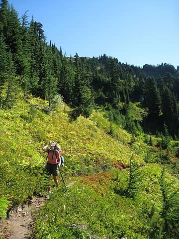 downing the blueberries! 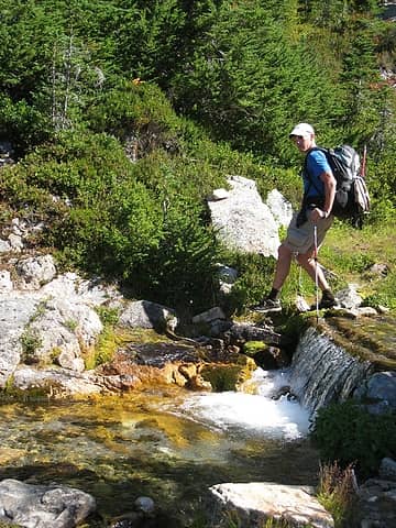 about to step into where? 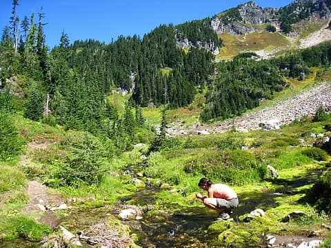 one of the most beautiful creeks i've ever seen near glacier ridge (picture in no way does it justice) 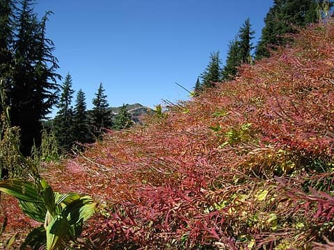 fall is here 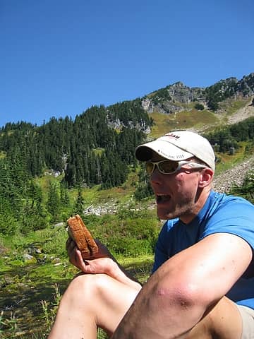 this pb&j is going DOWN 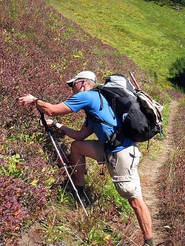 it's tough to hike when there are so many berries 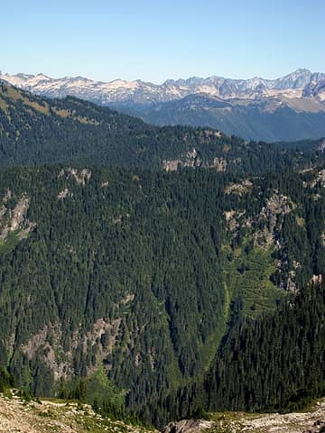 the route up after milk creek 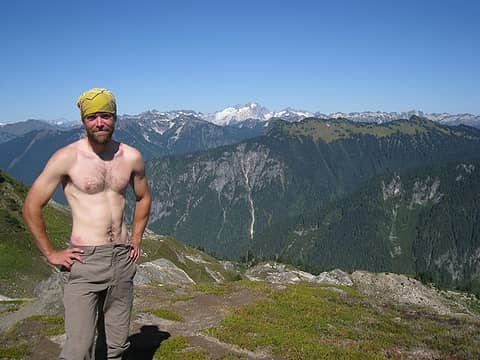 atlas, a thru hiker originally from seattle, nearing the end of his journey 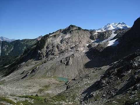 hey, let's go swim in that tarn coming off the unnamed glacier near fire creek pass 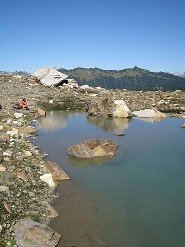 PG13 only 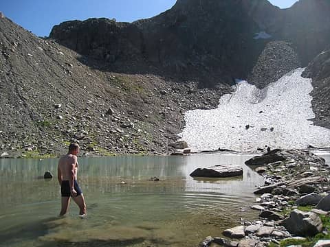 again, PG13. left leg still has a way to grow to catch back up to the right one 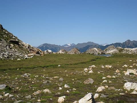 eldorado, some bumps, and a tiny tarn near fire creek pass 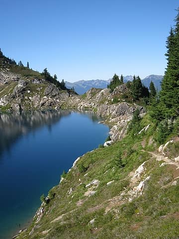 the sublime, and cold looking, mica lake 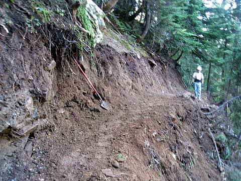 trail work heading down to milk creek 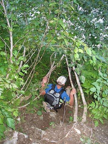 heading down to milk creek via the old trail 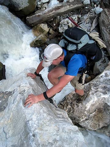 boulder hopping across milk creek 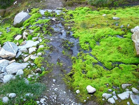 bright green moss near vista creek 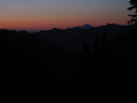 night falls on day 3 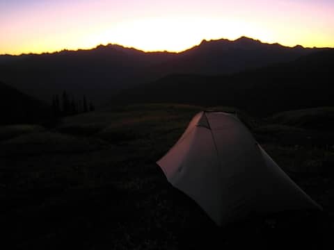 the sky's on fire to start day 4 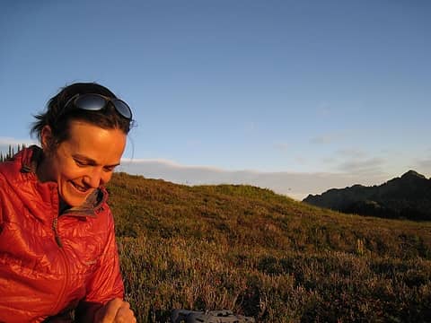 hotpantz smiling about oatmeal (or the 30 mile day ahead) 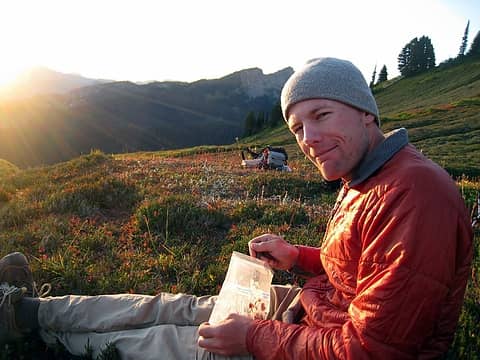 oatmeal on day 4 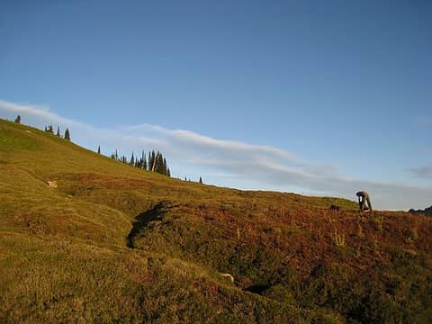 packing up 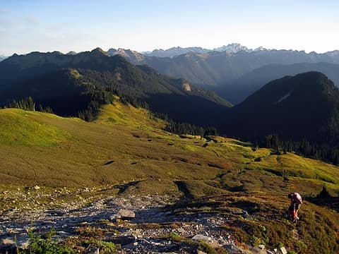 getting set to find the high route 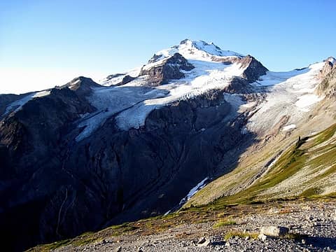 the stopping point for our quest of the high route. shucks. 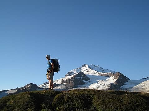 thinking: damn, this doesn't look good 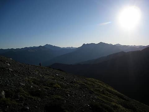 big sun 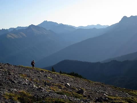 hotpantz is my ray of light 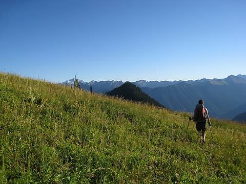 heading back to the pct, tails tucked between our legs 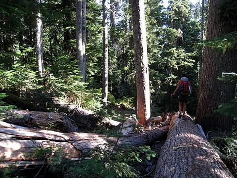 playing on the downed old growth 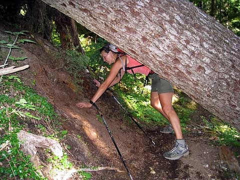 practicing yoga poses again 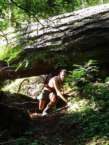 look at that lunge! 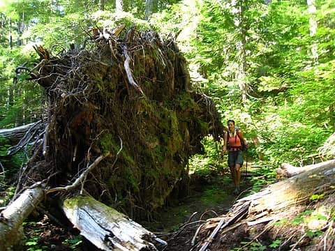 gnarly rootballs 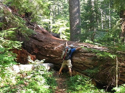 there's no easy way! 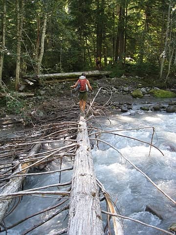 crossing vista creek after the 408 blowdowns 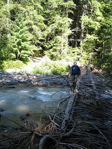 a little narrower log, but those branches should catch me, right? 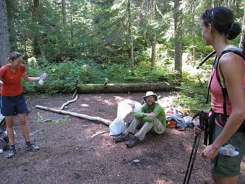 jenny, veggiemite, and hotpantz 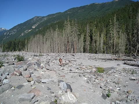 the destruction near the suiattle river. what happened to the trees in the background? 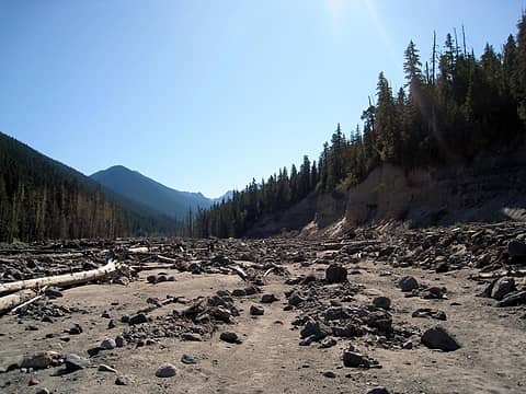 o-bliterated 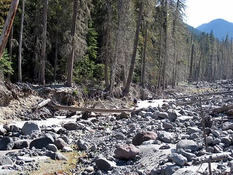 thinking: hmm, if i fall, goodbye 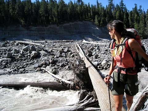 hotpantz simply walked across this one ... over the raging suiattle 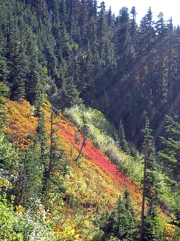 heading up to flower dome's saddle 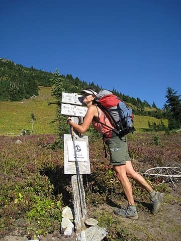 happy to be here. now, only 10 miles back  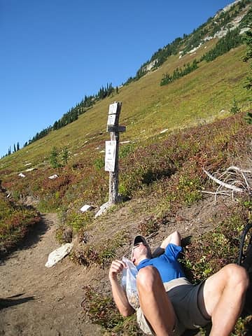 are we done yet? 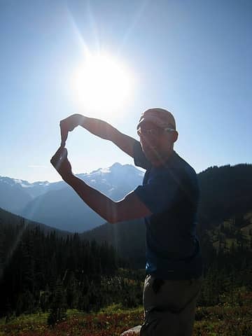 all the way around! 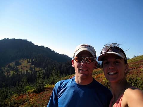 trip nearly complete 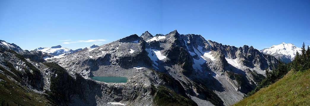 clark, triad lake, and glacier peak
|
| Back to top |
  
|
|
Obi Tony Kenobi
Waterfall Crazy!

Joined: 25 Jun 2007
Posts: 1899 | TRs | Pics
Location: Marysville, WA |
Great trip report and pictures!! Great to see you out again!
|
| Back to top |
|
|
Magellan
Brutally Handsome

Joined: 26 Jul 2006
Posts: 13116 | TRs | Pics
Location: Inexorable descent |
|
Magellan
Brutally Handsome
|
Tue Sep 15, 2009 11:37 pm |
|
|
Epic! A trip many will dream about, but few will complete.
Your dead trees probably drowned in a high river. The channel may have shifted, keeping them underwater for an extended period.
|
| Back to top |
|
|
Hulksmash
Cleaning up.

Joined: 20 Apr 2008
Posts: 7113 | TRs | Pics
Location: Arlington |
|
Hulksmash
Cleaning up.
|
Tue Sep 15, 2009 11:55 pm |
|
|
Dude....you just did some thing that the majority of the human population could not physically do with in there life time....how many weeks after getting messed up from getting hit by a car? Some of us can only dream...thanks for shearing 
"Bears couldn't care less about us....we smell bad and don't taste too good. Bugs on the other hand see us as vending machines." - WetDog
Albuterol! it's the 11th essential
"Bears couldn't care less about us....we smell bad and don't taste too good. Bugs on the other hand see us as vending machines." - WetDog
Albuterol! it's the 11th essential
|
| Back to top |
|
|
Jason Hummel
Member

Joined: 31 Aug 2006
Posts: 1209 | TRs | Pics
Location: Tacoma Washington |
Holly shizel, way to go round the beast....this was a goal of mine this year and I didn't do it...watson to blum instead, but nevertheless, I'm jealous. You were really moving. Nice work. Makes me want to go do this next week, seriously. Thanks a ton for the story!!!
|
| Back to top |
|
|
Hulksmash
Cleaning up.
Joined: 20 Apr 2008
Posts: 7113 | TRs | Pics
Location: Arlington |
|
Hulksmash
Cleaning up.
|
Wed Sep 16, 2009 12:10 am |
|
|
Sure....just rub everyone's nose in it. 
"Bears couldn't care less about us....we smell bad and don't taste too good. Bugs on the other hand see us as vending machines." - WetDog
Albuterol! it's the 11th essential
"Bears couldn't care less about us....we smell bad and don't taste too good. Bugs on the other hand see us as vending machines." - WetDog
Albuterol! it's the 11th essential
|
| Back to top |
|
|
goats gone wild
Mr. Goat

Joined: 19 Aug 2007
Posts: 2524 | TRs | Pics
Location: Vampireville |
.....leaving me wanting to return over and over in what ever capacity that may be, even if one day my knees are too old and I can only see the mountains from my porch.
Jason Hummel
|
| Back to top |
|
|
Ingunn
Hiking Viking
Joined: 01 Feb 2008
Posts: 1751 | TRs | Pics
Location: Redmond |
|
Ingunn
Hiking Viking
|
Wed Sep 16, 2009 12:16 am |
|
|
Holy crap. Sounds like you're already more than ready for the PCT!
What an amazing trip, it should (almost) make up for your downtime this summer. It certainly sounds like you've found your female counterpart in Hotpantz. 
|
| Back to top |
|
|
iron
Member
Joined: 10 Aug 2008
Posts: 6392 | TRs | Pics
Location: southeast kootenays |
|
iron
Member
|
Wed Sep 16, 2009 6:54 am |
|
|
|
| Back to top |
|
|
cartman
Member
Joined: 20 Feb 2007
Posts: 2800 | TRs | Pics
Location: Fremont |
|
cartman
Member
|
Wed Sep 16, 2009 7:15 am |
|
|
Terrific trip and report, sounds like you are completely recovered, that's great. Yumi and I were up there right behind you, those views of Glacier are amazing. The trail up to Buck Creek Pass is completely clear of downed trees now, the Forest Service did a great job.
If you have time, a post with your specific gear list would be very informative. Those packs you two are carrying look very light!
|
| Back to top |
|
|
David¹
Token Canadian

Joined: 25 Jul 2002
Posts: 3040 | TRs | Pics
Location: The Great White North |
|
David¹
Token Canadian
|
Wed Sep 16, 2009 7:28 am |
|
|
|
| Back to top |
|
|
Trevor
Member
Joined: 31 Jan 2004
Posts: 1562 | TRs | Pics
Location: Edmonds, WA |
|
Trevor
Member
|
Wed Sep 16, 2009 7:31 am |
|
|
I appreciate the post and congrats for the accomplishment, especially given the trauma you were subjected to in the bike accident.
|
| Back to top |
|
|
BirdDog
Member
Joined: 09 Jan 2007
Posts: 1067 | TRs | Pics
Location: Seattle |
|
BirdDog
Member
|
Wed Sep 16, 2009 8:02 am |
|
|
iron;
I had to read the title three times to make sure this TR was from this year. Unbelievable. It wasn't that long ago I sent you an e-mail encouraging you to hang in there, and telling you that you would eventually recover from your accident. I knew you were in great shape before the wreck but I had no idea you could recover this quickly. A testament to both your physical and mental toughness. Utterly amazing!
Nice TR & pics too. Congrats!
"There can be no greater issue than that of conservation in this country."
Teddy Roosevelt August 6, 1912
"There can be no greater issue than that of conservation in this country."
Teddy Roosevelt August 6, 1912
|
| Back to top |
|
|
BeyondLost
Crazy Bob
Joined: 07 Jul 2007
Posts: 3601 | TRs | Pics
Location: Whidbey Island, WA |
Wow! What a trip and great photos.
I treated a lot of femur fractures (including professional athletes) but I never saw anyone 11 weeks post injury do what you just did.
Iron indeed!!!
|
| Back to top |
|
|
Opus
Wannabe

Joined: 04 Mar 2006
Posts: 3700 | TRs | Pics
Location: The big rock candy mountain |
|
Opus
Wannabe
|
Wed Sep 16, 2009 8:15 am |
|
|
I agree: epic. What a trip!
I met Jenny and Vegemite last week as they came over Trap Pass near Stevens! If I'm thinking of the right person, Jenny had just come through a rain storm where her tent failed. Glad to see they're still moving along.
|
| Back to top |
|
|
|
|
You cannot post new topics in this forum
You cannot reply to topics in this forum
You cannot edit your posts in this forum
You cannot delete your posts in this forum
You cannot vote in polls in this forum
|
Disclosure: As an Amazon Associate NWHikers.net earns from qualifying purchases when you use our link(s). |


 My favorite pictures are: 'there's no easy way'
  and 'all the way around'