| Previous :: Next Topic |
| Author |
Message |
BeyondLost
Crazy Bob


Joined: 07 Jul 2007
Posts: 3601 | TRs | Pics
Location: Whidbey Island, WA |
The forecast was for 91 in Mazama so it seemed smart to head up for cool. But, where? I've been to Windy Pass before but on a foggy, viewless, cold day This was my chance to see the Pasayten on the other side of Tamarack Peak.
I left home about 9:15 AM and enjoyed a solitary drive up Hart's Pass Road. Several campers were cooking breakfast at Hart's Pass and lots of packers were organizing in the meadow above Hart's Pass with horses and mules wandering about on the road. I parked at the first switchback about 10:00 AM where I talked to a woman out walking her dog and we watched a "loose llama" on the next switchback watching us. It had been wandering and eluding capture for a few days according to a sign at the trailhead.
The PCT heads NW below Slate Peak entering wilderness at Windy Pass. If you continue in another 1.4 miles you reach a ridge line extending NE from Tmarack Peak which was my goal (initially).
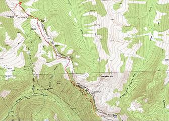 1 Windy Pass & Tamarack Peak.jpg 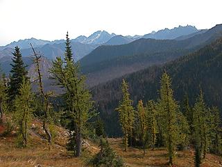 2 Gardners, Silverstar & Needles.JPG 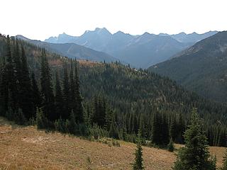 6 Azurite Pk over Tatie Pk.JPG 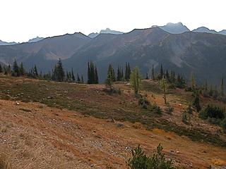 7 Tatie Pk-Golden Horn, Azurite, Ballard.JPG 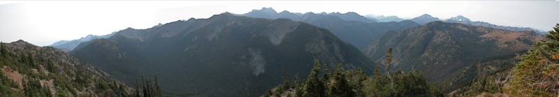 Pano_2.jpg 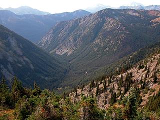 4 Slate Creek.JPG 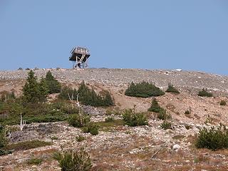 5 Slate Pk tower.JPG 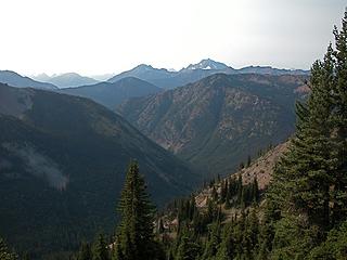 8 Majestic, Crater & Jack.JPG 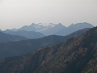 10 Neve Glacier & Snowfield Pk, Colonial Peak, Pyramid Pk Ruby Mtn on right.JPG 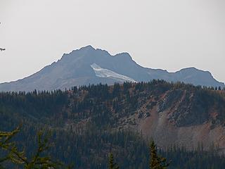 9 Crater Mtn.JPG 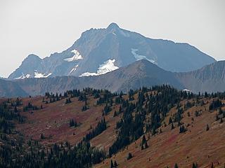 11 Jack Mtn.JPG 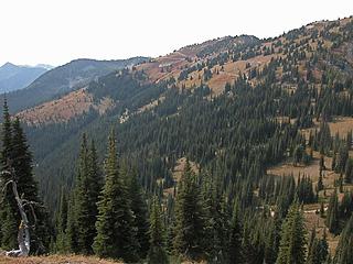 13 Roads & Mines.JPG 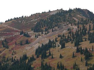 14 Mine tailings.JPG 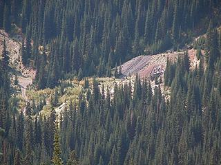 11 Mine Entrance.JPG 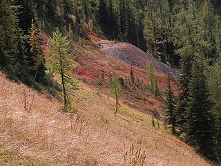 12 Mine tailings beneath trail.JPG 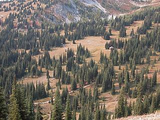 15 Yurt in Indiana Basin.JPG 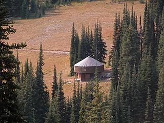 16 Yurt.JPG 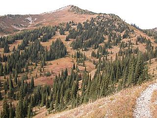 17 Tamarack Pk from SE.JPG 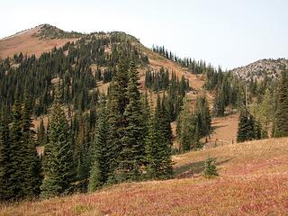 17A Into Windy Pass.JPG 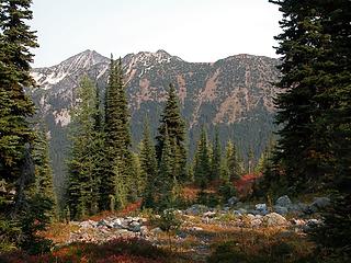 18 Pasayten Pk from Windy Pass.JPG 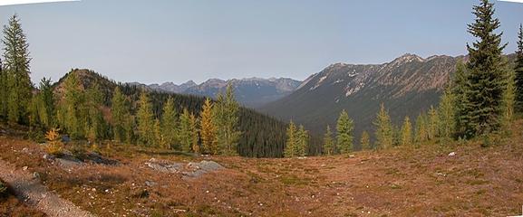 Pasayten 4_2.jpg 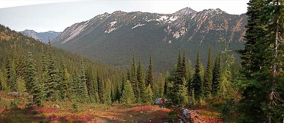 Pasayten Pk & Gold Ridge_2.jpg 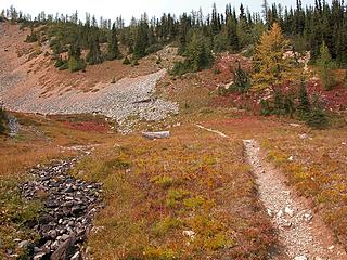 21 Basin below NE Tamarack.JPG 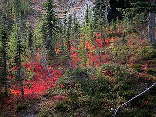 22 Red & Green.JPG 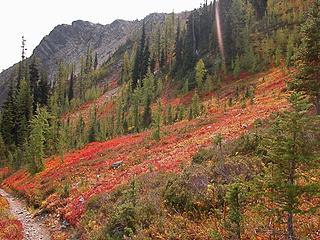 23 Red Abounds.JPG 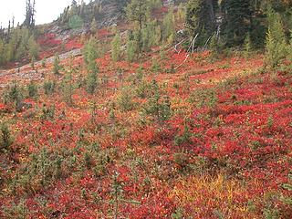 24 Red Profusion.JPG 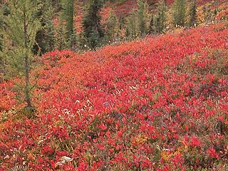 25 Red Red Red.JPG 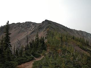 26 Tamarack Pk.JPG 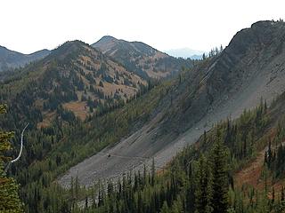 27 Slate Peak over Windy Pass.JPG 
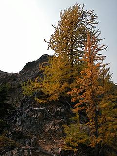 28 Tamarack larches.JPG 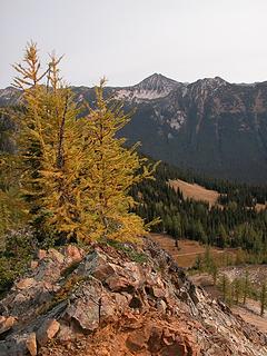 29 Pasayten Pk over Tamarack larch.JPG 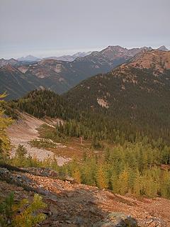 31 Center and Shull Mtns over Foggy Pass.JPG 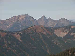 32 Jackita Ridge over Center Mtn.JPG 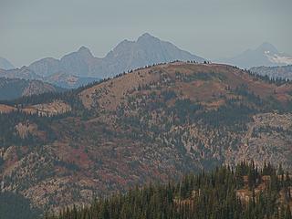 33 Joker Mtn & Castle Peak over Center Mtn.JPG 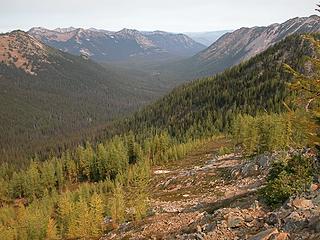 34 Jim Pk & Devil's Backbone-Holman Pk behind, three mile point on right.JPG 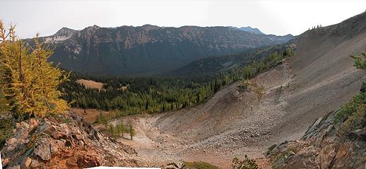 Pasayten 2_2.jpg 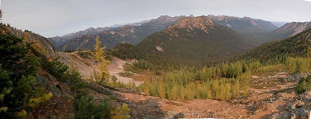 Pasayten 1 A_2.jpg
|
| Back to top |
  
|
|
Magellan
Brutally Handsome

Joined: 26 Jul 2006
Posts: 13116 | TRs | Pics
Location: Inexorable descent |
|
Magellan
Brutally Handsome
|
 Sun Sep 27, 2009 9:13 am |
|
|
Way to capture an area.  I have only been as far as just above Windy pass on this trail. I was a bit discouraged by the intrusion of mining. Perhaps I will go farther next time.
|
| Back to top |
|
|
Hans
Member

Joined: 11 Sep 2007
Posts: 51 | TRs | Pics
|
|
Hans
Member
|
Sun Sep 27, 2009 5:57 pm missed you by one day
|
|
|
I was up at Slate peak on Thurs. and Fri. with my dog Schatzie. We hiked out to Haystack on Thurs. and Tamarack on Fri. The larch were good but about a week from being at peak I thought. Still a great place to be with the great weather. I was not sure where there might be a trail up Tamarack would be so Schatzie and I went up the scree slope where the trail goes through in photo 27. A good route but it looks like I should have gone a bit more along the PCT to find the trail you took. What do you think the wood and and red strips sticking out of the summit carin were? Glad you had a good time.
|
| Back to top |
|
|
BeyondLost
Crazy Bob
Joined: 07 Jul 2007
Posts: 3601 | TRs | Pics
Location: Whidbey Island, WA |
Yes the larch are just starting to turn but best at 7000 feet right now. We hiked along the West Fork Methow today and aspen that were green 5 days ago were bright yellow today. Temps will be down near freezing all week and the colors ought to be prime in the next 5 days.
I have no idea what the wood and red strips were about.
|
| Back to top |
|
|
|
|
You cannot post new topics in this forum
You cannot reply to topics in this forum
You cannot edit your posts in this forum
You cannot delete your posts in this forum
You cannot vote in polls in this forum
|
Disclosure: As an Amazon Associate NWHikers.net earns from qualifying purchases when you use our link(s). |


