| Previous :: Next Topic |
| Author |
Message |
Sultan Guy
Member


Joined: 22 Jul 2008
Posts: 353 | TRs | Pics
Location: Now reinforced with Concrete |
Like many other hikers here I often get ideas for future trips from other hikes. Gazing at some far off peak, lake, or ridge can lead to a place on my mental to do list. Such was the case one time last year when I was on the PCT a bit north of Kodak Peak when I sat and studied the dramatic sweeping ridge from Longfellow Mtn. to Mount Jonathan with Whittier Peak dominating the middle section. As soon as I returned home I researched this ridge and found only a few TRs to Whittier. Not very technical but seldom done because of the long distance and physical effort required. Perfect! My kind of trip!
I set aside a weekend hoping for decent weather and planned to drive to the Little Wenatchee TH Friday evening and camp so as to make an early start easy. The weather forecast called for rain on Saturday but I hoped that being east of the crest would break things up some. My vague plan was to go for one night and either traverse from Longfellow to Mt. David if possible, or just to Whittier and then return, or possibly down to Indian Creek. The only beta on the route from Whittier to Jonathan I had was the typical Beckey First keep on the ridge to the saddle then on to the S to avoid a cliff. I had one friend bail out on me so I opted to go solo (I need to recruit more fellow NWHikers). Going on a solo hike to the Poet Range sounds like a soul searching experience and I made sure to listen to some appropriate tunes on the drive over. The Into the Wild soundtrack by Eddie Vedder is great for a mountain drive. Say what you want about Chris McCandless, that guy lived life to the fullest and paid the ultimate price. The lyrics to End of the Road are awesome.
Wont be the last
Wont be the first
Find a way to where
The sky meets the earth
We come and go
Its alright
And all wrong
For me it begins
At the End of the Road
I rolled into the end of Little Wenatchee Rd. at 8 PM, and set up my tent in the woods with bright stars overhead. I was awoken by a light rain and/or a large diesel truck around 5:30 AM and was on the trail by 7.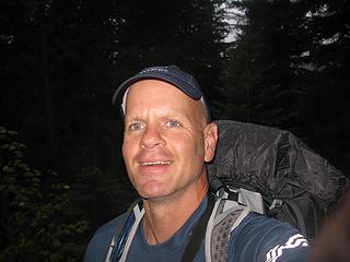 full of piss and vinegar  I rounded a bend in the trail and found a dead grouse at my feet. A hunter was off the side of the trail searching for his kill. I alerted him to where it was and we chatted for a bit. He came in from Irving Pass. I wish I could say that the views from Poe to Longfellow were outstanding but the visibility was poor. I rounded a bend in the trail and found a dead grouse at my feet. A hunter was off the side of the trail searching for his kill. I alerted him to where it was and we chatted for a bit. He came in from Irving Pass. I wish I could say that the views from Poe to Longfellow were outstanding but the visibility was poor.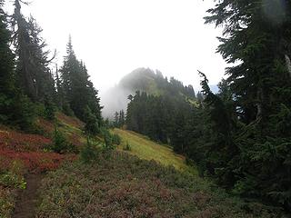 ridge from Poe to Longfellow  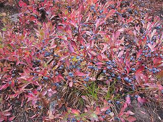 where are the bears? 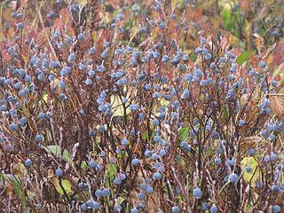 Come and pick me 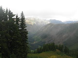 Papoose Creek valley 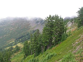 Ridge to Whittier slowly being revealed 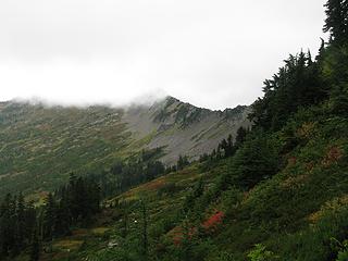 but where is the summit? 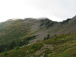 still no summit 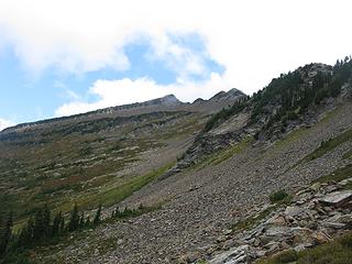 Finally the clouds parted 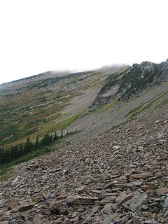 Sidehill Olympics 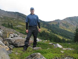 SG enroute 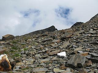 Summit getting closer 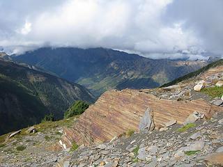 towards White River valley 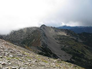 Longfellow from Whittier 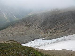 Looking down the north face  located summit register 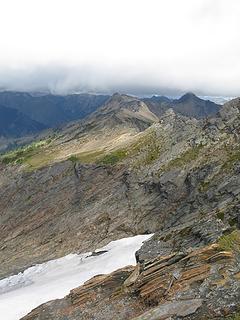 Looking towards Mt. David 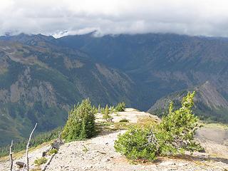 windblown Northwest Ridge  Not wanting to make the 11 oclock news I searched for other options. On the north face directly beneath an icefield I saw some benches of moraine and grass. It was now almost 3:30 and the clouds were gathering once again so I scurried to find a route down. While descending the ridge I almost stepped on a golden eagle that had his back turned to me. I am not sure who was scared more! Not wanting to make the 11 oclock news I searched for other options. On the north face directly beneath an icefield I saw some benches of moraine and grass. It was now almost 3:30 and the clouds were gathering once again so I scurried to find a route down. While descending the ridge I almost stepped on a golden eagle that had his back turned to me. I am not sure who was scared more!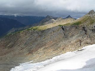 Icefield on north face 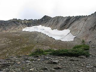 Below the icefield 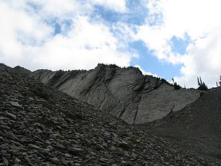 I descended ridge on right corner of picture 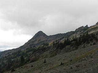 Mt. Jonathan 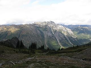 Mt. Saul 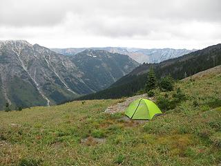 My camp at 6,400 feet on north side of Whittier 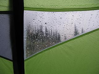 View from tent in storm 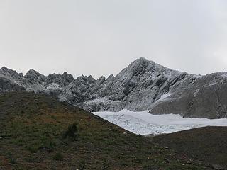 Fresh morning snow on Whittier Peak 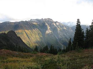 Starting descent into Indian Creek  Any thoughts of regaining the ridge to Mount Jonathan were squashed by the fresh snow. Unknown route with snow and solo. Ummmm no. Any thoughts of regaining the ridge to Mount Jonathan were squashed by the fresh snow. Unknown route with snow and solo. Ummmm no.  Time to enact plan B. I studied the route down to Indian Creek from camp and on the map. Not too steep, only 3,000 feet.
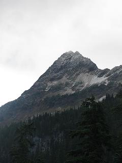 Mt. Jonathan-north face 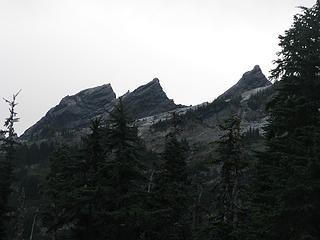 Unnamed peaks on Whittier/Jonathan divide 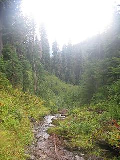 Upper stream valley 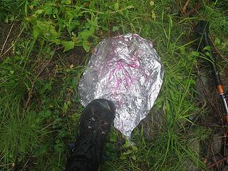 Balloon #1  Balloon #2  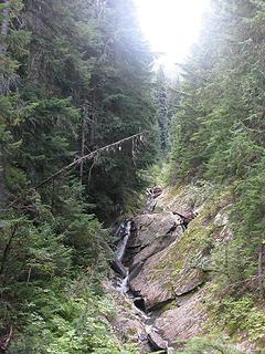 Stream valley I descended  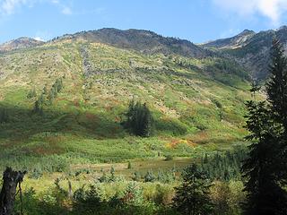 Indian Creek valley looking sunny and warm 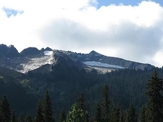 Whittier from Indian Creek-4,000 feet up  This trail although scenic is a bit boring. I stopped a few times to lounge in the sun and once to make some coffee but still reached the White River TH at 3 PM. This trail although scenic is a bit boring. I stopped a few times to lounge in the sun and once to make some coffee but still reached the White River TH at 3 PM.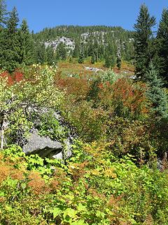 Fine fall color 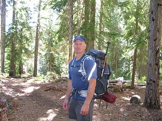 Do I look tired yet?  Standard White River tourist picture
Any worthwhile expedition can be planned on the back of an envelope- H. W. Tilman
Any worthwhile expedition can be planned on the back of an envelope- H. W. Tilman
|
| Back to top |
  
|
|
RichP
Member

Joined: 13 Jul 2006
Posts: 5634 | TRs | Pics
Location: here |
|
RichP
Member
|
 Tue Sep 22, 2009 9:04 pm |
|
|
Love it! That's one of those often seen and seldom done summits. Perfect camp spot too.
|
| Back to top |
|
|
Magellan
Brutally Handsome

Joined: 26 Jul 2006
Posts: 13116 | TRs | Pics
Location: Inexorable descent |
|
Magellan
Brutally Handsome
|
Tue Sep 22, 2009 9:11 pm |
|
|
Great TR! Nice pictures, and quite an adventure.
|
| Back to top |
|
|
tomastaylor
Member

Joined: 11 May 2007
Posts: 90 | TRs | Pics
|
Great report! How did you get from White River TH all the back around to the Little Wenatchee TH to your car?
|
| Back to top |
|
|
Sultan Guy
Member
Joined: 22 Jul 2008
Posts: 353 | TRs | Pics
Location: Now reinforced with Concrete |
| tomastaylor wrote: | | Great report! How did you get from White River TH all the back around to the Little Wenatchee TH to your car? |
Found some mushroom hunters who needed some more roads to go explore.
Any worthwhile expedition can be planned on the back of an envelope- H. W. Tilman
Any worthwhile expedition can be planned on the back of an envelope- H. W. Tilman
|
| Back to top |
|
|
Get Out and Go
Member

Joined: 13 Nov 2004
Posts: 2128 | TRs | Pics
Location: Leavenworth |
"These are the places you will find me hiding'...These are the places I will always go."
(Down in the Valley by The Head and The Heart)
"Sometimes you're happy. Sometimes you cry.
Half of me is ocean. Half of me is sky."
(Thanks, Tom Petty)
|
| Back to top |
|
|
Movenhike
\m/..mmmmetal\m/
Joined: 16 Apr 2007
Posts: 642 | TRs | Pics
Location: Leavenworth, WA |
|
Movenhike
\m/..mmmmetal\m/
|
Sat Sep 26, 2009 6:11 pm |
|
|
"Make it your Friend" -John Bull
|
| Back to top |
|
|
bgs8379
Member
Joined: 24 Sep 2007
Posts: 49 | TRs | Pics
|
|
bgs8379
Member
|
Tue Aug 18, 2020 7:59 am |
|
|
When you dropped down to Indian cr. Did you ever come across parts of the old Papoose trail?
|
| Back to top |
|
|
|
|


 Yikes, leap-of-faith brush bash to drop down to Indian Creek. Didn't the crowds of people up there annoy you?
  Great work...