| Previous :: Next Topic |
| Author |
Message |
Bloated Chipmunk
Cock Rock Searcher


Joined: 29 Jan 2007
Posts: 2993 | TRs | Pics
Location: Margaritaville |
Yesterday MM & I tackled another peak on our list - Mt. Baring. The steepness of the trail is legendary, so I just had to find out for myself how bad it was, plus it sounded like the views from the top were pretty good.  We set out early from Issy & made our way up to hwy. 2 & then over to the "town" of Baring, where we turned onto FR 6024. We took it to its end @ the TH for Barclay Lk., where 2 other cars were parked. The trail to Barclay Lk. is flat & easy. The trail to Baring is not.
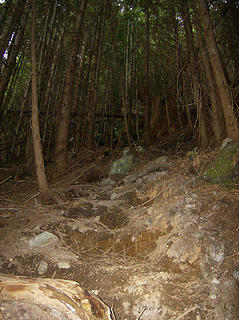
  From the parking area, 2 trails take off in an easterly direction - the higher one on the right is for Baring. We took the higher trail past a box toilet, over some blowdowns, & then turned right uphill at a small steep rock gully. Our flat trail was now over. There is a trail paralleling the creek on the right, & it crosses to the left side in short order.
 Steep  & I realized it must've been pretty bad so I came back down the trail to him. He had a nasty gouge in his left shin that looked deep enough to warrant stitches. & I realized it must've been pretty bad so I came back down the trail to him. He had a nasty gouge in his left shin that looked deep enough to warrant stitches.   We sat down & applied some 1st aid & discussed whether we should continue w/the hike or go to a doctor. We sat down & applied some 1st aid & discussed whether we should continue w/the hike or go to a doctor.  After a few minutes the bleeding was under control & MM said it didn't hurt nearly as bad, & told me he was fine w/continuing up. He kept an eye on it & changed the bandage a few times as necessary.
The trail continues up relentlessly, aided by ribbons tied to the trees. We stopped about halfway up for a quick snack, meanwhile a solo hiker made his way up. We chatted for a bit - he was coming back to finish off the summit after he had taken people from Wisconsin After a few minutes the bleeding was under control & MM said it didn't hurt nearly as bad, & told me he was fine w/continuing up. He kept an eye on it & changed the bandage a few times as necessary.
The trail continues up relentlessly, aided by ribbons tied to the trees. We stopped about halfway up for a quick snack, meanwhile a solo hiker made his way up. We chatted for a bit - he was coming back to finish off the summit after he had taken people from Wisconsin  up the trail last Saturday in the rain & the summit was too socked in to make it worth completing. Baring didn't seem like the best trail to take people on from the flatlands of Wisconsin, but hey who am I to judge. up the trail last Saturday in the rain & the summit was too socked in to make it worth completing. Baring didn't seem like the best trail to take people on from the flatlands of Wisconsin, but hey who am I to judge.  The solo hiker continued on up while we finished our snack; we would not see him again until the rock gully. The solo hiker continued on up while we finished our snack; we would not see him again until the rock gully.
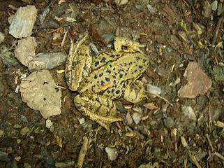 Frog 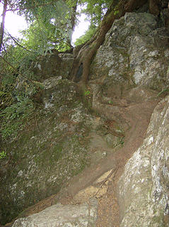 A little scrambling  we finally reached the ridge. we finally reached the ridge.  The look on MM's face said it all: The look on MM's face said it all:
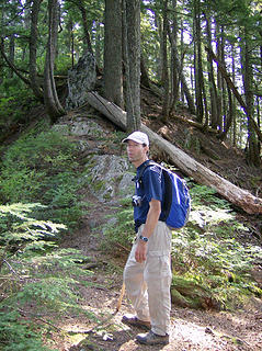 MM on the ridge, not looking too thrilled after the strenuous climb. 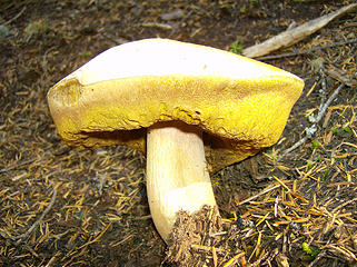 'shroom 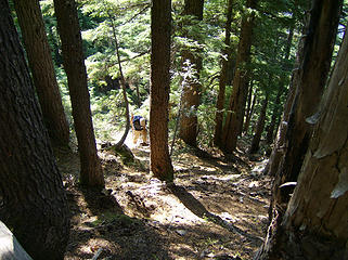 Coming up the 2nd steep forested section 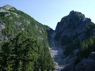 2 labels The gully. Easier than it looks. 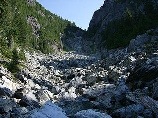 Starting up the gully. 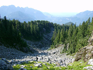 Looking back down the gully. 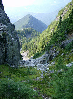 Looking down the gully from the saddle. 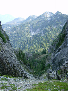 Looking down the gully on the other (east) side.  The views were great in all directions, though a bit hazy on this day. The peaks we could see are too long to list, & when we stood @ the edge of the lower north end of the summit, we could peer directly down to Barclay Lk. ~ 3,700' below.
  I got my boot shot from the summit, MM got his from the north end over the lake. I got close enough to see the lk. but wasn't going to sit on the rock @ the very edge of the cliff! I got my boot shot from the summit, MM got his from the north end over the lake. I got close enough to see the lk. but wasn't going to sit on the rock @ the very edge of the cliff!  
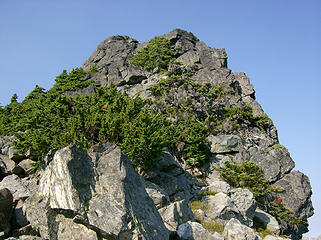 Summit is up there somewhere. 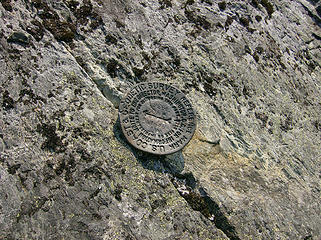 Summit marker - slightly below the summit 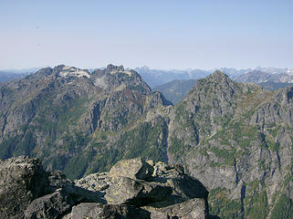 Views from the summit. 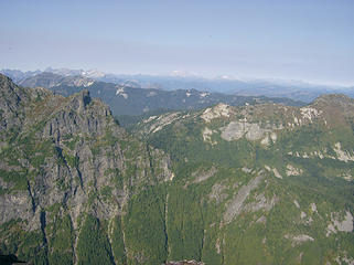 Views from the summit. 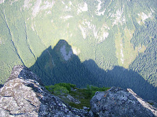 Baring's shadow. We're too small to show up. 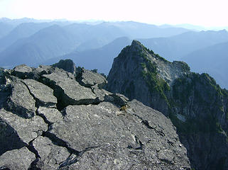 Looking across to Baring's lower south summit 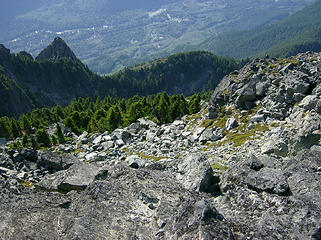 Looking down to the west 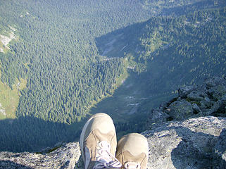 Boot shot from the summit. 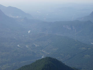 Looking back toward town - lotsa haze. 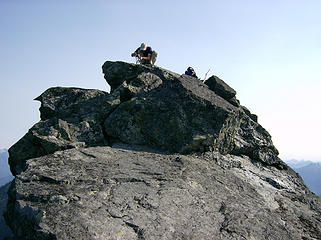 MM on the summit getting the camera ready. 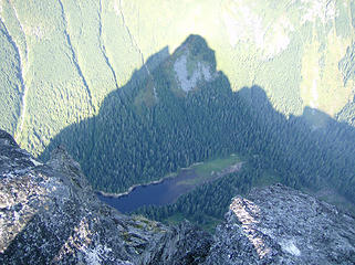 Baring shadows Barclay Lk. 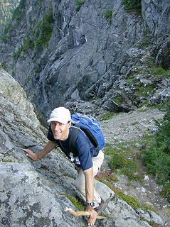 MM going down one of the scrambly sections. 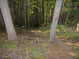 Heading down the steep-ass trail 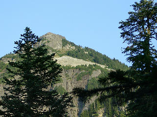 Last look @ Baring  
Home is where the hiking is.
"Peaks that have come and gone four times should halt a man in his steps." -- William O. Douglas
A balanced diet is a margarita in each hand.
Home is where the hiking is.
"Peaks that have come and gone four times should halt a man in his steps." -- William O. Douglas
A balanced diet is a margarita in each hand.
|
| Back to top |
  
|
|
GeoTom
Member
Joined: 19 May 2005
Posts: 3215 | TRs | Pics
Location: Earth |
|
GeoTom
Member
|
 Thu Sep 24, 2009 12:15 pm |
|
|
This is nice and all, but I must have missed the photos of the busted ass.  Thanks for reminding me how steep that trail was. Ugh.
|
| Back to top |
|
|
Ingunn
Hiking Viking
Joined: 01 Feb 2008
Posts: 1751 | TRs | Pics
Location: Redmond |
|
Ingunn
Hiking Viking
|
Thu Sep 24, 2009 12:18 pm |
|
|
The more reports I read on Baring, the less I want to do it.  Good job, I hope your various injuries are healing!
|
| Back to top |
|
|
Tazz
Member

Joined: 27 Apr 2005
Posts: 7902 | TRs | Pics
|
|
Tazz
Member
|
Thu Sep 24, 2009 12:35 pm |
|
|
oh the knee cruncher!! i gotta get back up there when that darn head wall of snow is gone too.
good stuff
|
| Back to top |
|
|
MountainMan
Member

Joined: 15 Jul 2008
Posts: 365 | TRs | Pics
Location: San Diego |
My Baring pics: 
 Haze shrouded sunrise. 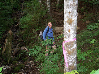 About to start up the first gully. 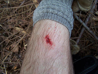 How I started out the hike. 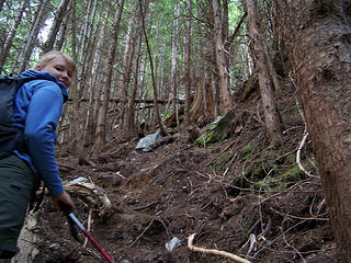 BC on the way up the steep "trail" to the west ridge. 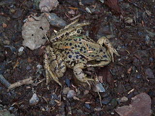 Frog on the trail. 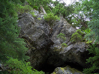 Class 5 route... 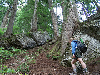 Trees growing out of the rocks. 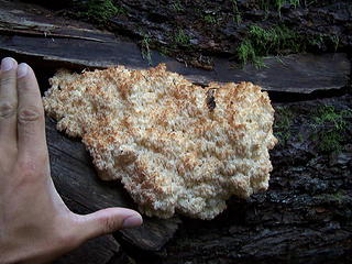 Fungus 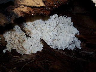 Another fungus under log. 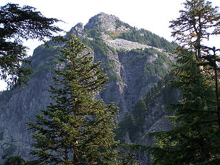 Baring from west ridge. 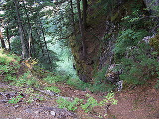 Optional way down 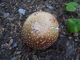 Mushroom 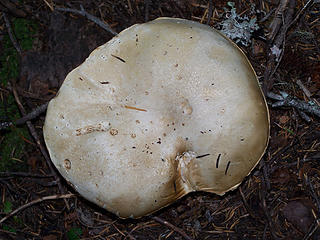 Looks like a pancake... 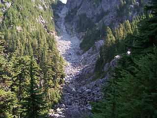 Gully and basin 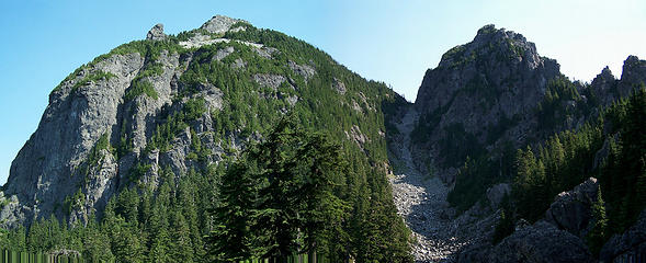 Baring and south peak 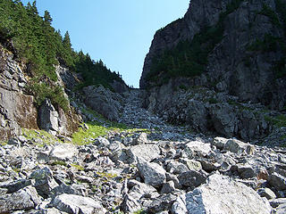 Looking up towards the saddle from about the midway point. 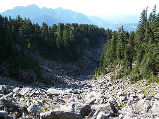 Looking down at the basin from midway up. 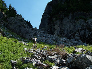 Heading up the last part of the gully to the saddle. 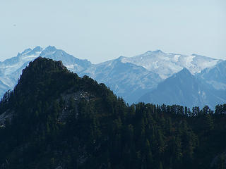 Daniel and Hinman 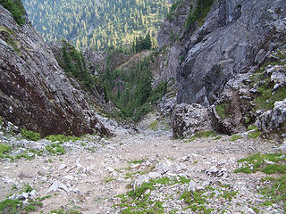 Looking down the east side from the saddle. 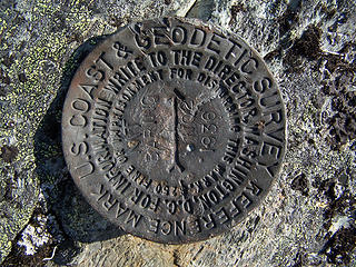 Baring survey marker.  Reaching the summit. 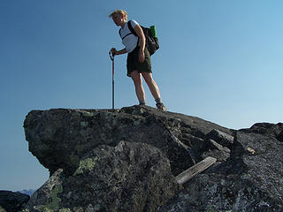 Looking down 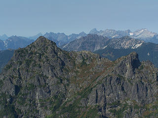 Merchant Peak from Baring 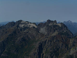 Gunn Peak 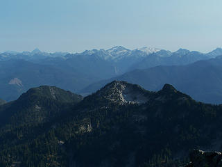 Views 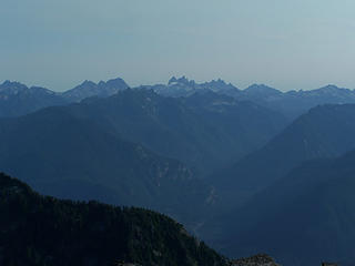 Views  View north from Baring. 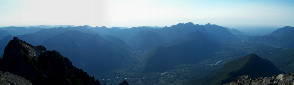 Hazy views south and west from Baring. 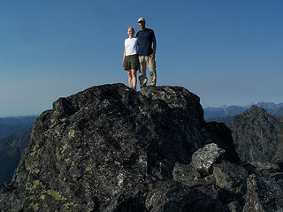 Us on Baring 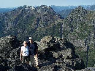 Us with Gunn and Merchant behind 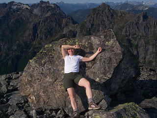 BC on Baring 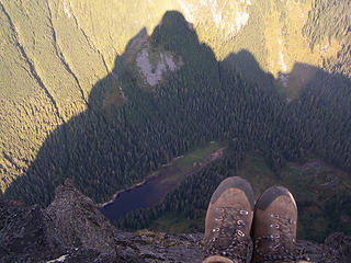 Baring boot shot over Barclay. 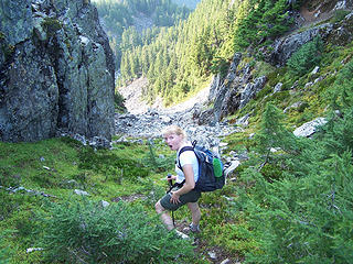 My knees hurt already! 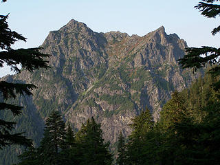 Merchant Peak form basin 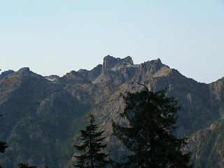 Gunn Peak from basin 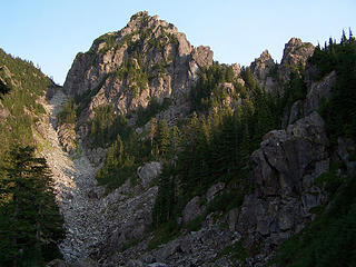 Baring's south peak
Slow down, take notice, savor the moment, appreciate the world around you and everything that you have.
Slow down, take notice, savor the moment, appreciate the world around you and everything that you have.
|
| Back to top |
|
|
sky_pilot
Member
Joined: 29 Apr 2009
Posts: 55 | TRs | Pics
Location: Seattle |
Fun trip on a hot day. You folks sure get out a lot. It's fun to look at your trips and pics.
I think the "rocky things" in the Views From the Summit photo are Chimney Rock, Overcoat and the Lemah Group. I labeled these formations in the View Southish photo.
edited to add Overcoat
|
| Back to top |
|
|
polarbear
Member

Joined: 16 Dec 2001
Posts: 3680 | TRs | Pics
Location: Snow Lake hide-away |
|
| Back to top |
|
|
Nisquaww
Hot balls

Joined: 09 Jan 2006
Posts: 1239 | TRs | Pics
Location: Red of Mond |
|
Nisquaww
Hot balls
|
Thu Sep 24, 2009 5:09 pm |
|
|
rockin!
"Why do you have a beard?"
"I don't have a beard. It's just the light; it plays funny tricks." ~ Shel Silverstein
"Why do you have a beard?"
"I don't have a beard. It's just the light; it plays funny tricks." ~ Shel Silverstein
|
| Back to top |
|
|
Magellan
Brutally Handsome

Joined: 26 Jul 2006
Posts: 13116 | TRs | Pics
Location: Inexorable descent |
|
Magellan
Brutally Handsome
|
Thu Sep 24, 2009 5:31 pm |
|
|
|
| Back to top |
|
|
tmatlack
Member
Joined: 21 Aug 2007
Posts: 2854 | TRs | Pics
|
|
tmatlack
Member
|
Thu Sep 24, 2009 6:06 pm |
|
|
Bloat,
Great trip on one of the most recognizable peaks in the WA Cascades!
Tom
|
| Back to top |
|
|
Mtn Dog
Technohiker

Joined: 01 Aug 2004
Posts: 3336 | TRs | Pics
Location: Bellevue, WA |
|
Mtn Dog
Technohiker
|
Thu Sep 24, 2009 7:05 pm |
|
|
You know, this is one of many peaks that has only a reference marker left on the summit and no benchmark. Vesper Peak was another. I like how you both take great photos but with completely different perspectives. It's nice to see your trip report from two sets of eyes rather than just one!
Footprints on the sands of time will never be made sitting down.
Footprints on the sands of time will never be made sitting down.
|
| Back to top |
|
|
Yana
Hater

Joined: 04 Jun 2004
Posts: 4212 | TRs | Pics
Location: Out Hating |
|
Yana
Hater
|
Thu Sep 24, 2009 10:10 pm |
|
|
PLAY SAFE! SKI ONLY IN CLOCKWISE DIRECTION! LET'S ALL HAVE FUN TOGETHER!
|
| Back to top |
|
|
tigermn
Member

Joined: 10 Jul 2007
Posts: 9242 | TRs | Pics
Location: There... |
|
tigermn
Member
|
Thu Sep 24, 2009 10:19 pm |
|
|
| Bloated Chipmunk wrote: | | After gaining ~ 1,700' in 0.4 mi., we finally reached the ridge. |
That be one steep boot path gaining at the rate of 4250ft/mile!
|
| Back to top |
|
|
MountainMan
Member
Joined: 15 Jul 2008
Posts: 365 | TRs | Pics
Location: San Diego |
My GPS had poor reception and was wandering a lot in that area, so I don't have an accurate GPS route. The one below is redrawn. The distance stated is straight line distance. Sorry for the confusion. The trail twists and turns, but mostly it heads straight up, so maybe it's not that much longer. Does anyone know how long that part of the trail is? Here is a topo and a close up of the section in question.
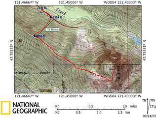 Baring route 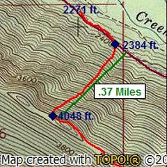 Close up of climb to west ridge
Slow down, take notice, savor the moment, appreciate the world around you and everything that you have.
Slow down, take notice, savor the moment, appreciate the world around you and everything that you have.
|
| Back to top |
|
|
pimaCanyon
Member

Joined: 13 Jul 2007
Posts: 1304 | TRs | Pics
Location: at the bottom of the map |
| Yana wrote: | | Bloated Chipmunk wrote: | | After gaining ~ 1,700' in 0.4 mi., we finally reached the ridge. |
Uh... That would be over an 80% grade, which would make it steep 5th class dirt. |
OK, I'm confused. I thought "grade" was measured relative to 100 percent which is gaining one mile vertically for every one mile in the horizontal direction. So 100 percent grade is a 45 degree slope. 80 percent grade would be what, 36 or 38 degrees or so? Definitely steep (most folks see a 45 degree slope and it looks near vertical to them), but I don't believe a slope of 38 degrees would actually be 5th class, just a steep ass slope.
It's never too late to have a happy childhood
It's never too late to have a happy childhood
|
| Back to top |
|
|
|
|


