| Previous :: Next Topic |
| Author |
Message |
Middle E
no more moustache


Joined: 10 Feb 2008
Posts: 432 | TRs | Pics
Location: Seattle, WA |
|
Middle E
no more moustache
|
 Mon Sep 28, 2009 11:55 am |
|
|
I've hiked many areas in Washington, but never have ventured into the elusive and magical Enchantment Lakes area. Many months ago, David (Opus) won the lucky lottery and secured a permit for 4 people for 5 days in late September, graciously inviting Yumi (BPLama), Suzanne (Sadie's Driver), and me to accompany him. Everyone else had been there at least once, but this was my first trip.
After months of anticipation, we watched the long range forecast gradually encompass our planned dates with an amazing forecast of continuous sun and warmth. Not wanting to risk any chance of losing the precious permits, we rolled out of Seattle at 6am on Wednesday in order to reach the Leavenworth Ranger Station by 9am.
In fact, we arrived not long after 8am. David listened to the mechanical spiel of instruction from one Forest Service employee while I posed an important question to the other: "Why are all the Forest Service rigs switching from green to white?" Answer: "Because it saves $1500 per rig for a stock color rather than the special green." I guess that's a good reason, but I miss the green.
Day 1 - in via Colchuck Lake and Aasgard Pass
Shortly after 9am we saddled up and headed toward Colchuck Lake and Aasgard Pass, the others having vowed never to go via Snow Lakes again. The hike in along Mountaineer Creek was pleasantly cool and we made good time to Colchuck Lake. The view south toward Colchuck Pk. and Aasgard Pass is spectacular. The view in the other direction is relatively mundane. The water level in the lake was lower than usual after the hot and dry summer.
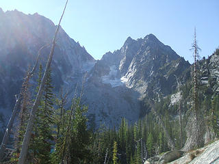 Colchuck Pk. 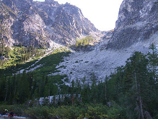 Aasgard Pass ahead 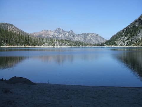 Cashmere Mtn. from Colchuck Lk. 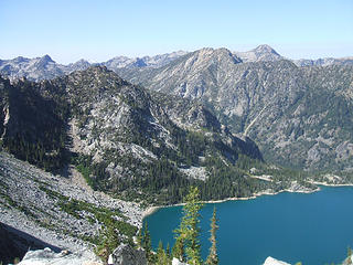 Colchuck Lk. with Eightmile Mtn. behind 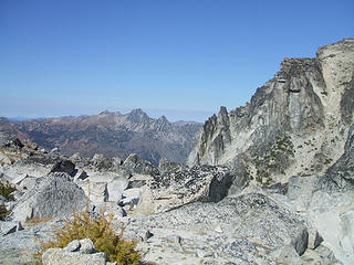 Cashmere Mtn. from Aasgard Pass 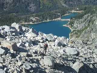 Colchuck Lk. from Aasgard Pass 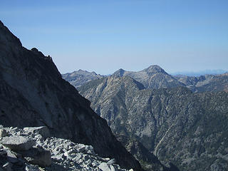 Eightmile Mtn. from Aasgard Pass 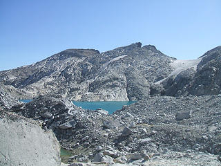 First view of an Enchantment lake (Isolation) 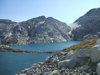 Isolation Lk. 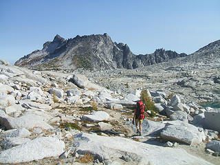 Enchantment Basin 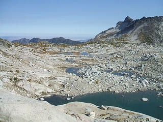 Tarns ahead (and camp) 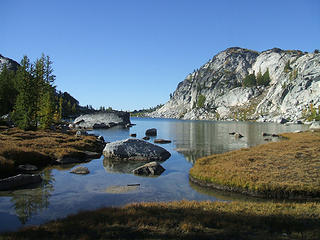 Perfection Lk. 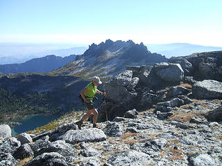 Suzanne reaches Druid Plateau 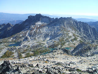 McClellan Pk. from Cannon Mtn. 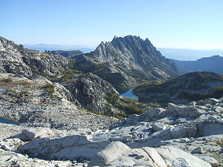 Prusik Pk. and The Temple as seen heading up Little Annapurna 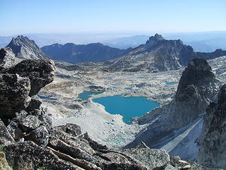 Enchantment Basin from Dragontail Pk. 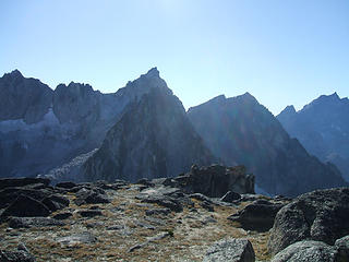 Colchuck Pk. from plateau 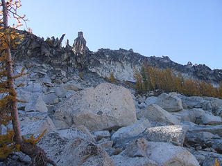 Route to the Prong and McClellan Pk.  Enchantment Basin from McClellan Pk. 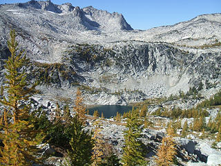 Crystal Lk. and Enchantment Basin above 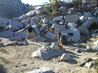 Stretching 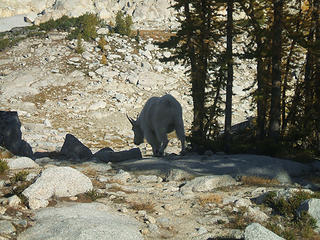 Goat in camp
pithy yet insightful signature
pithy yet insightful signature
|
| Back to top |
  
|
|
HitTheTrail
Member

Joined: 30 Oct 2007
Posts: 5460 | TRs | Pics
Location: 509 |
Great TR on one of my favorite places on earth!!
I think the Colchuck Lake level is low because they actually spill water down to the Leavenworth Fish Hatchery so the fish can have cool water. Several other lakes in the area get the same treatment.
|
| Back to top |
|
|
Sadie's Driver
Sadie's Driver

Joined: 24 Apr 2006
Posts: 1763 | TRs | Pics
Location: Welcome Pass |
| Middle E wrote: | | Day 2 [Suzanne] - Isolation and Perfection Lakes, Cannon Mtn, Enchantment Pk. |
Splendid, indeed! What a trip - there were AT LEAST 101 enchanting hours! Jim K, Happy Marmot (Kelly), Rick and I were up in the basin in 2005 and we had some beautiful weather, too - but not nearly as "balmy" as it was this trip (well, with the exception of the wind on Friday night and all day Saturday). I think most of the rocks are still in the same place they were then!  I do remember Aaskick Pass and heavy packs before, but we did a little "weigh-in" at the beginning of our trip
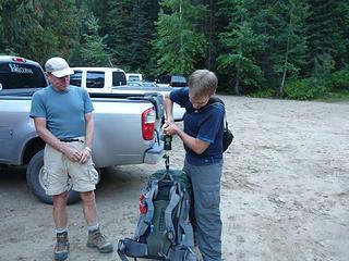 David weighing in at 44 lbs.  Geez. Anyway, a gourmet meal and nearly 11 hours in the tent and we were ready for:
Day Two Adventure
It had been a warm - and dead calm wind - evening. Almost too warm - but we were eager to get started. Our merry band started out about 9:00 a.m. in short sleeves and shorts (well, most of us) heading off down past Inspiration and Perfection Lakes (and the camp site of the hikers whom Yumi had had a foot race with on our way in) and on to Prusik Pass. Geez. Anyway, a gourmet meal and nearly 11 hours in the tent and we were ready for:
Day Two Adventure
It had been a warm - and dead calm wind - evening. Almost too warm - but we were eager to get started. Our merry band started out about 9:00 a.m. in short sleeves and shorts (well, most of us) heading off down past Inspiration and Perfection Lakes (and the camp site of the hikers whom Yumi had had a foot race with on our way in) and on to Prusik Pass.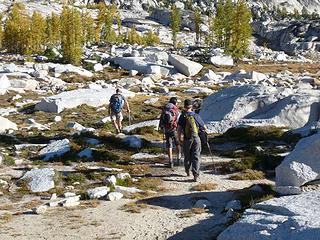 The fearless foursome head out on Thursday (09/24) morning to Cannon and Enchantment peaks 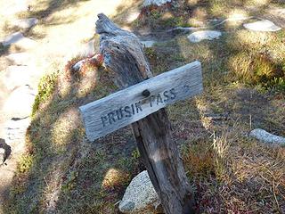 Off we go . . . 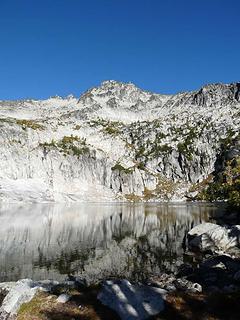 Pretty 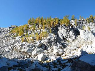 The scramble ahead of us to get to Druid Plateau 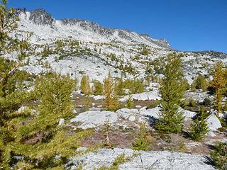 No easy route! 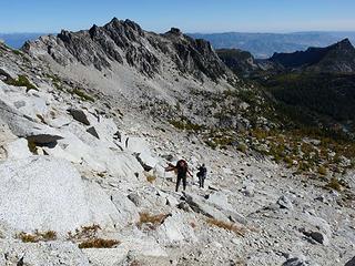 Heading up towards the Plateau 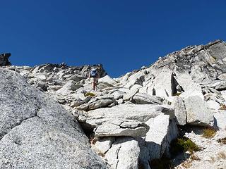 Barry reaching the last part of steep gully to Druid Plateau 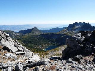 View east from Druid Plateau across Shield Lake below 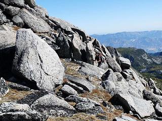 Yumi almost to Druid Plateau 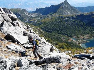 David on last part of steep gully up to Druid Plateau 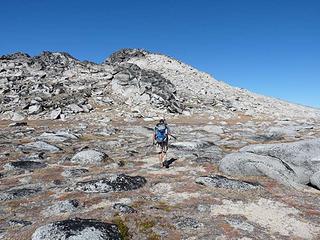 Barry heading across the Plateau towards Cannon 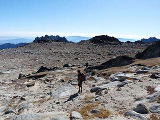 Druid Plateau 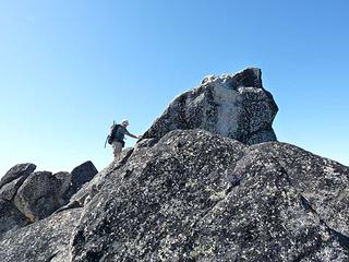 Climbing the summit block of Cannon 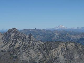 Glacier Peak to the North 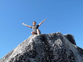 Victorious! 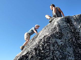 Barry and Yumi at the top of Cannon 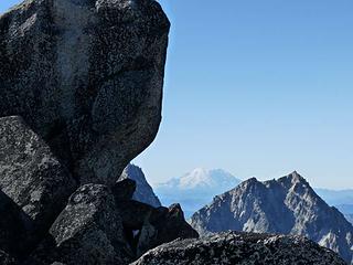 Rainier from Cannon 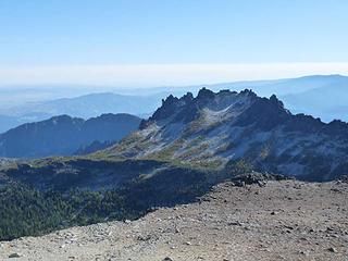 McClellan from Cannon - lots of smoke to the southeast 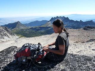 Lunch break on Cannon 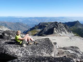 The driver sunning on Cannon 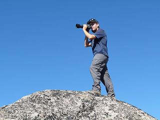 Opus striking "the pose" from top of Cannon 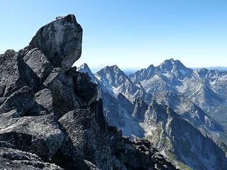 1 label Colchuck - with Mt. Stuart behind - from the top of Cannon 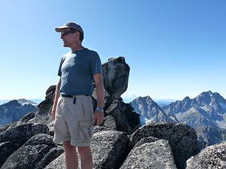 Barry on top of Cannon 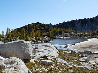 Looking east from tarns above Shield Lake 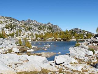 Cannon off in the distance from tarns above Shield Lake 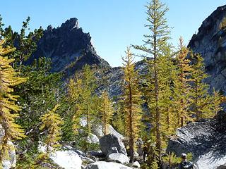 View to Prusik Peak (from the north side) 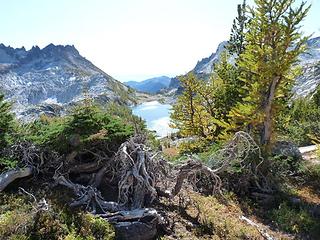 View on the way up Enchantment looking toward Perfection Lake 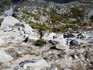 Yumi coming up the south flank of Enchantment 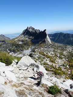 A rather barren looking landscape 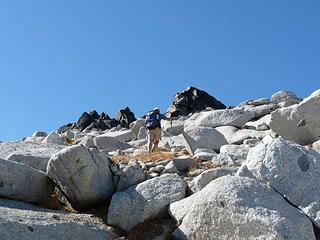 Heading to the summit block 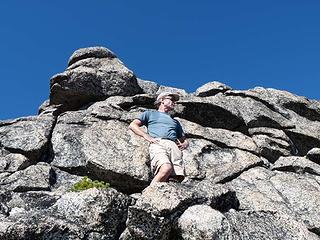 Almost to the top 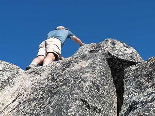 Barry touching the top of Enchantment 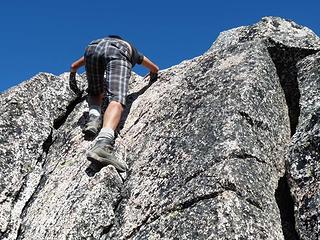 Yumi climbing up Enchantment 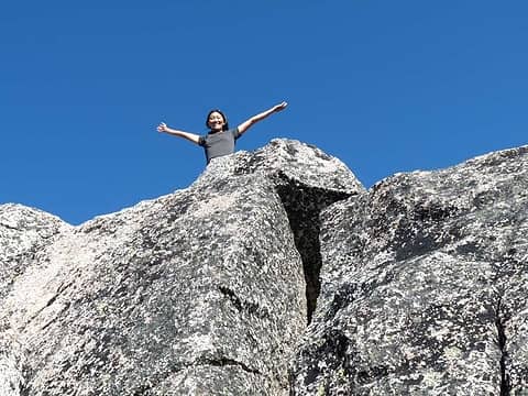 Yumi on top of Enchantment Peak 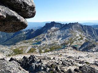 Looking toward Saturday's destination - McClellan from Enchantment 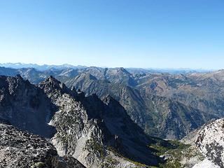 View from atop of Enchantment 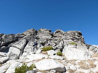 Heading off of Enchantment 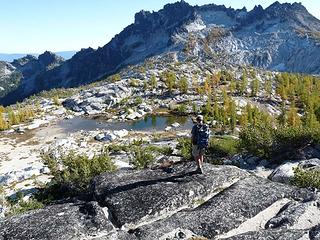 Heading to Gnome Tarn 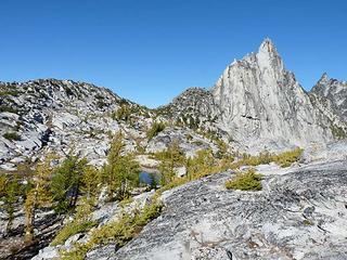 Looking back to Prusik Peak and Prusik Pass 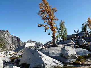 Bear pinatas  ) Avocado, tomato, chiles, (fake and real) chicken (for the vegetarians in the group), black beans and cheese! Accompanied by Spanish Rice, a fine wine, lots of chocolate . . . . need I say more? ) Avocado, tomato, chiles, (fake and real) chicken (for the vegetarians in the group), black beans and cheese! Accompanied by Spanish Rice, a fine wine, lots of chocolate . . . . need I say more? Kitchen crew prepares for another exquisite dinner. 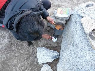 Chef's assistant, preparing the Spanish Rice! 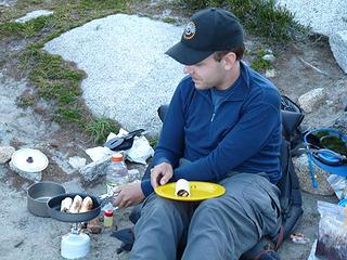 Gourmet chef in action! Mmmmmm
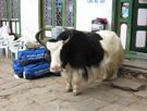
burritos! 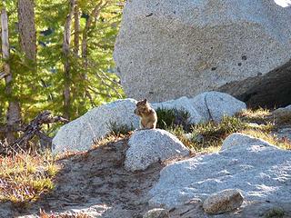 Look who's coming for dinner! 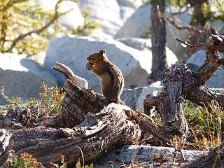 Fran, is that you?
Four-paw buddy lets me tag along!
Four-paw buddy lets me tag along!
|
| Back to top |
|
|
Middle E
no more moustache
Joined: 10 Feb 2008
Posts: 432 | TRs | Pics
Location: Seattle, WA |
|
Middle E
no more moustache
|
Mon Sep 28, 2009 4:48 pm |
|
|
| HitTheTrail wrote: | | I think the Colchuck Lake level is low because they actually spill water down to the Leavenworth Fish Hatchery so the fish can have cool water. Several other lakes in the area get the same treatment. |
That's true of Snow Lake, but I haven't heard that of Colchuck Lake. Almost all of the Enchantment lakes were below the apparent high water level -- I don't really know whether this is normal for the season, or whether this year was unusual.
pithy yet insightful signature
pithy yet insightful signature
|
| Back to top |
|
|
HitTheTrail
Member
Joined: 30 Oct 2007
Posts: 5460 | TRs | Pics
Location: 509 |
| Middle E wrote: | | HitTheTrail wrote: | | I think the Colchuck Lake level is low because they actually spill water down to the Leavenworth Fish Hatchery so the fish can have cool water. Several other lakes in the area get the same treatment. |
That's true of Snow Lake, but I haven't heard that of Colchuck Lake. Almost all of the Enchantment lakes were below the apparent high water level -- I don't really know whether this is normal for the season, or whether this year was unusual. |
I have just been told by my brother (who worked with fisheries via the Chelan Co. PUD for 30 + years) that the following lakes have all been dammed and raised about 20'; Colchuck, Eight Mile, Square, Klonaqua. So, according to him, the lake level you are seeing is close to the natural level.
|
| Back to top |
|
|
GeoTom
Member
Joined: 19 May 2005
Posts: 3215 | TRs | Pics
Location: Earth |
|
GeoTom
Member
|
Mon Sep 28, 2009 5:46 pm |
|
|
Very nice, as usual. 
|
| Back to top |
|
|
Layback
Cascades Expatriate

Joined: 16 Mar 2007
Posts: 5712 | TRs | Pics
Location: Back East |
|
Layback
Cascades Expatriate
|
Mon Sep 28, 2009 6:31 pm |
|
|
Nice you guys. I had permits the same weekend last year as you did this year. This year I've got them for this coming weekend. It always seems that the larch aren't quite yet at peak the last weekend of September but the first weekend of October seems to be a risk for snow. Two years ago my plans got totally hosed when Asgard Pass got three feet of snow the first weekend of Oct.
You guys really took advantage of the nice weather window to tick off a ton of summits.
|
| Back to top |
|
|
Sadie's Driver
Sadie's Driver
Joined: 24 Apr 2006
Posts: 1763 | TRs | Pics
Location: Welcome Pass |
Four-paw buddy lets me tag along!
|
| Back to top |
|
|
Magellan
Brutally Handsome

Joined: 26 Jul 2006
Posts: 13116 | TRs | Pics
Location: Inexorable descent |
|
Magellan
Brutally Handsome
|
Mon Sep 28, 2009 8:41 pm |
|
|
Awesome! Looking forward to more, more, more!
|
| Back to top |
|
|
Matt
Tea, Earl Grey, Hot

Joined: 30 Jan 2007
Posts: 4307 | TRs | Pics
Location: Shoreline |
|
Matt
Tea, Earl Grey, Hot
|
Mon Sep 28, 2009 10:40 pm |
|
|
Nice going. Looks like you made the most of the area.
As beacons mountains burned at evening. J.R.R. Tolkien
As beacons mountains burned at evening. J.R.R. Tolkien
|
| Back to top |
|
|
twodogdad
Member

Joined: 21 Nov 2006
Posts: 846 | TRs | Pics
Location: seattle |
| Sadie's Driver wrote: | | I was the overall winner with 52 lbs.
A gourmet meal and nearly 11 hours in the tent and we were ready for
evening TWO of our gourmet meals! The menu included Avocado, tomato, chiles, (fake and real) chicken (for the vegetarians in the group), black beans and cheese! Accompanied by Spanish Rice, a fine wine, lots of chocolate . . . . need I say more? |
Take me with you next time, pleeeease. tdd
|
| Back to top |
|
|
Opus
Wannabe

Joined: 04 Mar 2006
Posts: 3700 | TRs | Pics
Location: The big rock candy mountain |
|
Opus
Wannabe
|
Tue Sep 29, 2009 4:05 pm |
|
|
| Sadie's Driver wrote: | | Day Three - David's Version of What Really Happened |
Once again I'd had my fill of sleep from the early tuck in the night before and I found myself out of the tent by 6 am to enjoy another sunrise. While the others slept in I packed up my camera gear and wandered out to the knoll overlooking Perfection Lake and Prusik Peak. Another glorious sunrise full of color due to the fire smoke in the valley!
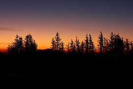 Sunrise  Breakfast company  Goats arrive  Little Annapurna summit  Mt Adams with wildfire  Helicopter landing 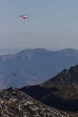 Flying out full toilets  Yumi on Dragontail peak  Upper Enchantments  Find my tiny red tent 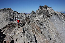 Ridge walk  Blue water  Camp from above  Tired feet  Tired feet
|
| Back to top |
|
|
BPLlama
Member

Joined: 07 Sep 2006
Posts: 69 | TRs | Pics
Location: シアトル |
|
BPLlama
Member
|
Tue Sep 29, 2009 5:26 pm |
|
|
| Middle E wrote: | | Day 4 [Yumi] - McClellan Pk, Crystal Lk, (windy!) |
Ok, Barry is not full of sh*t  (though the loo was till the crappers got lifted away (though the loo was till the crappers got lifted away  ) it sure turned frigging windy on Day4!
Barry and I kept looking at the McClellan peak from our campsite, trying to analyze the best route up. ) it sure turned frigging windy on Day4!
Barry and I kept looking at the McClellan peak from our campsite, trying to analyze the best route up.Route to the Prong and McClellan Pk.  Popping up on Ridge (by Suzanne) Real summit behind (by Suzanne) The way to McClellan Summit (by Suzanne) Happy faces reaching summit (by Suzanne) 
Enchantment Basin from McClellan Pk.  . Suzanne summed it up pretty well singing a little diddi by Carole King (i feel the earth move under my feet). . Suzanne summed it up pretty well singing a little diddi by Carole King (i feel the earth move under my feet).Going down slippery gully (by Suzanne) Crystal Lk. and Enchantment Basin above Crystal Lake and Mini-Annapurna (by Suzanne) Freezed dried ain't so bad on day4 (by Suzanne)  . Day1 was community dinner provided by Chef Suzanne: Jambalaya! Delish! . Day1 was community dinner provided by Chef Suzanne: Jambalaya! Delish! Day2 was provided by Chef David: Burrito! Yummilicous! Day2 was provided by Chef David: Burrito! Yummilicous!  Thanks for a superb time ya'll~! Thanks for a superb time ya'll~!
|
| Back to top |
|
|
Bloated Chipmunk
Cock Rock Searcher

Joined: 29 Jan 2007
Posts: 2993 | TRs | Pics
Location: Margaritaville |
| BPLlama wrote: | Freezed dried ain't so bad on day4 (by Suzanne) |
Nice to see that David has ditched those bright orange crocs. 
Home is where the hiking is.
"Peaks that have come and gone four times should halt a man in his steps." -- William O. Douglas
A balanced diet is a margarita in each hand.
Home is where the hiking is.
"Peaks that have come and gone four times should halt a man in his steps." -- William O. Douglas
A balanced diet is a margarita in each hand.
|
| Back to top |
|
|
Opus
Wannabe
Joined: 04 Mar 2006
Posts: 3700 | TRs | Pics
Location: The big rock candy mountain |
|
Opus
Wannabe
|
Tue Sep 29, 2009 5:51 pm |
|
|
|
| Back to top |
|
|
|
|
You cannot post new topics in this forum
You cannot reply to topics in this forum
You cannot edit your posts in this forum
You cannot delete your posts in this forum
You cannot vote in polls in this forum
|
Disclosure: As an Amazon Associate NWHikers.net earns from qualifying purchases when you use our link(s). |


 Got more Top 100s in 3 days than I have (almost) in a lifetime!!!


